| Locality | Latitude | Longitude | Distance | Bearing |
|---|
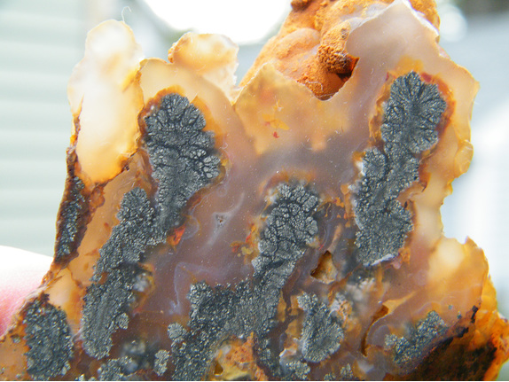
| Nipomo, San Luis Obispo County, California, USA | 35° 2' 34" N | 120° 28' 29" W | 0.1km (0.1 miles) | |
| Santa Maria Rock Company Mine, Nipomo, San Luis Obispo County, California, USA | 35° 2' 30" N | 120° 26' 25" W | 3.3km (2.0 miles) | |
| Moore Quarry, Los Berros, Santa Lucia Mts (Santa Lucia Range), San Luis Obispo County, California, USA | 35° 4' 35" N | 120° 29' 49" W | 4.2km (2.6 miles) | |
| Los Berros Canyon (Campedonico Ranch), Los Berros, Santa Lucia Mts (Santa Lucia Range), San Luis Obispo County, California, USA | 35° 5' 49" N | 120° 29' 39" W | 6.3km (3.9 miles) | |
| Unnamed Baryte deposit [1], Huasna, Santa Lucia Mts (Santa Lucia Range), San Luis Obispo County, California, USA | 35° 3' 24" N | 120° 24' 29" W | 6.4km (4.0 miles) | |
| Kolrich pit (Lompoc Quarry), Nipomo, San Luis Obispo County, California, USA | 34° 59' 38" N | 120° 26' 20" W | 6.4km (4.0 miles) | |
| Colson Canyon pit No. 2, Santa Maria, Santa Barbara County, California, USA | 34° 59' 0" N | 120° 27' 6" W | 6.9km (4.3 miles) | |
| Los Berros, Santa Lucia Mts (Santa Lucia Range), San Luis Obispo County, California, USA | 35° 4' 44" N | 120° 32' 34" W | 7.3km (4.5 miles) | |
| Morgan Limestone deposit, Huasna, Santa Lucia Mts (Santa Lucia Range), San Luis Obispo County, California, USA | 35° 5' 49" N | 120° 25' 29" W | 7.6km (4.7 miles) | |
| Santa Maria, Santa Barbara County, California, USA | 34° 57' 11" N | 120° 26' 4" W | 10.7km (6.6 miles) | |
| Newsome Marl deposit, Arroyo Grande, Santa Lucia Mts (Santa Lucia Range), San Luis Obispo County, California, USA | 35° 7' 19" N | 120° 32' 35" W | 10.7km (6.7 miles) | |
| Caen Quarry (Houghton Quarry), Arroyo Grande, Santa Lucia Mts (Santa Lucia Range), San Luis Obispo County, California, USA | 35° 7' 48" N | 120° 31' 45" W | 10.9km (6.7 miles) | |
| Tepusquet Quarry Number One, Santa Maria, Santa Barbara County, California, USA | 34° 56' 57" N | 120° 25' 27" W | 11.4km (7.1 miles) | |
| Steele Ranch Magnesite deposit, Arroyo Grande, Santa Lucia Mts (Santa Lucia Range), San Luis Obispo County, California, USA | 35° 8' 44" N | 120° 28' 20" W | 11.4km (7.1 miles) | |
| Steele Ranch deposit (Rancho Santa Manuela), Huasna, Santa Lucia Mts (Santa Lucia Range), San Luis Obispo County, California, USA | 35° 8' 49" N | 120° 28' 19" W | 11.6km (7.2 miles) | |
| Huasna, Santa Lucia Mts (Santa Lucia Range), San Luis Obispo County, California, USA | 35° 7' 22" N | 120° 23' 36" W | 11.6km (7.2 miles) | |
| Guadalupe, Santa Barbara County, California, USA | 34° 58' 18" N | 120° 34' 18" W | 11.8km (7.3 miles) | |
| Arroyo Grande Creek deposit, Arroyo Grande, Santa Lucia Mts (Santa Lucia Range), San Luis Obispo County, California, USA | 35° 7' 54" N | 120° 33' 50" W | 12.7km (7.9 miles) | |
| Arroyo Grande, Santa Lucia Mts (Santa Lucia Range), San Luis Obispo County, California, USA | 35° 7' 6" N | 120° 35' 22" W | 13.4km (8.3 miles) | |
| Unnamed diatomite deposit [2], Arroyo Grande, Santa Lucia Mts (Santa Lucia Range), San Luis Obispo County, California, USA | 35° 7' 59" N | 120° 34' 49" W | 13.8km (8.6 miles) | |
| Unnamed limestone deposit [1], Arroyo Grande, Santa Lucia Mts (Santa Lucia Range), San Luis Obispo County, California, USA | 35° 8' 39" N | 120° 33' 50" W | 13.8km (8.6 miles) | |
| Oceano, San Luis Obispo County, California, USA | 35° 5' 56" N | 120° 36' 44" W | 13.9km (8.6 miles) | |
| Lowe; Porter; et al Limestone deposit, Huasna, Santa Lucia Mts (Santa Lucia Range), San Luis Obispo County, California, USA | 35° 7' 59" N | 120° 22' 5" W | 14.1km (8.7 miles) | |
| Oceano Sand pit, Oceano, San Luis Obispo County, California, USA | 35° 5' 48" N | 120° 37' 14" W | 14.5km (9.0 miles) | |
| Ezra Carpenter deposit, Huasna, Santa Lucia Mts (Santa Lucia Range), San Luis Obispo County, California, USA | 35° 9' 10" N | 120° 22' 9" W | 15.6km (9.7 miles) | |
| Santa Maria River, Guadalupe, Santa Barbara County, California, USA | 34° 58' 14" N | 120° 39' 1" W | 17.8km (11.0 miles) | |
| Grieb Ranch Quarry, Arroyo Grande, Santa Lucia Mts (Santa Lucia Range), San Luis Obispo County, California, USA | 35° 12' 14" N | 120° 30' 36" W | 18.2km (11.3 miles) | |
| Deer Trail Mine, Huasna, Santa Lucia Mts (Santa Lucia Range), San Luis Obispo County, California, USA | 35° 6' 1" N | 120° 17' 12" W | 18.4km (11.4 miles) | |
| Unnamed Pumice occurrence [1], Pismo Beach, San Luis Obispo County, California, USA | 35° 9' 14" N | 120° 37' 40" W | 18.5km (11.5 miles) | |
| Southview prospect, Stanley Mountain Roadless Area Review & Evaluation Area (RARE II), San Rafael Mountains, San Luis Obispo County, California, USA | 35° 5' 54" N | 120° 16' 55" W | 18.7km (11.6 miles) | |
Minerals recorded nearby (within 18.7 km)
Rock types recorded nearby (within 18.7 km)
Entries shown in red are rocks recorded for this region.


Nipomo, San Luis Obispo County, California, USA