Monteagudo, Simoca Department, Tucumán Province, Argentinai
| Regional Level Types | |
|---|---|
| Monteagudo | Municipality |
| Simoca Department | Department |
| Tucumán Province | Province |
| Argentina | Country |
This page is currently not sponsored. Click here to sponsor this page.


Neighbouring regions:
Locality type:
Other Languages:
Spanish:
Monteagudo, Departamento Simoca, Provincia de Tucumán, Argentina
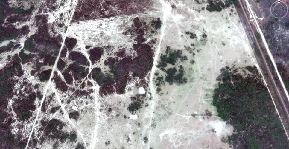
Area of clay and saline soils, carriers of alkali sulfates such as Mirabilite and Thenardite which appear as efflorescence on them. This area has a surface of approximately 1.5 x 2.5 km (3.75 km²) located about 3.7 kilometers NW (350°) of the town of Monteagudo, at an elevation of 305 m. a. s. l.
Scattered fragments of meteoritic iron were found in the area.
Corundum deposits are found in the sands of the Chico River, 1,050 meters SE (156°) of the town of Monteagudo.
Monteagudo is an Argentine town located in the Simoca Department of the Province of Tucumán. It is located on National Route 157, 500 m from the Medina River.
The town was born in 1870, with the laying of the railway. It was originally called Villa Télfener, in honour of José Télfener, builder of the line. Later the name was adopted in reference to Bernardo de Monteagudo, Tucumán and intellectual of the May Revolution. The town has been growing in population at the expense of many people in the area who lose their homes due to the flooding of the Medina, Chico and Gastona rivers.
Select Mineral List Type
Standard Detailed Gallery Strunz Chemical ElementsMineral List
Mineral list contains entries from the region specified including sub-localities3 valid minerals.
Detailed Mineral List:
| ⓘ Corundum Formula: Al2O3 Localities: Reference: Raúl Jorge Tauber Larry´s collection. |
| ⓘ 'Meteoritic Iron' Reference: Raúl J. Tauber Larry (2013). |
| ⓘ Mirabilite Formula: Na2SO4 · 10H2O Reference: Raúl J. Tauber Larry (2013). |
| ⓘ Thénardite Formula: Na2SO4 Reference: Raúl J. Tauber Larry (2013). |

List of minerals arranged by Strunz 10th Edition classification
| Group 4 - Oxides and Hydroxides | |||
|---|---|---|---|
| ⓘ | Corundum | 4.CB.05 | Al2O3 |
| Group 7 - Sulphates, Chromates, Molybdates and Tungstates | |||
| ⓘ | Mirabilite | 7.CD.10 | Na2SO4 · 10H2O |
| ⓘ | Thénardite | 7.AD.25 | Na2SO4 |
| Unclassified Minerals, Rocks, etc. | |||
| ⓘ | 'Meteoritic Iron' | - | |
List of minerals for each chemical element
| H | Hydrogen | |
|---|---|---|
| H | ⓘ Mirabilite | Na2SO4 · 10H2O |
| O | Oxygen | |
| O | ⓘ Corundum | Al2O3 |
| O | ⓘ Mirabilite | Na2SO4 · 10H2O |
| O | ⓘ Thénardite | Na2SO4 |
| Na | Sodium | |
| Na | ⓘ Mirabilite | Na2SO4 · 10H2O |
| Na | ⓘ Thénardite | Na2SO4 |
| Al | Aluminium | |
| Al | ⓘ Corundum | Al2O3 |
| S | Sulfur | |
| S | ⓘ Mirabilite | Na2SO4 · 10H2O |
| S | ⓘ Thénardite | Na2SO4 |
Fossils
This region is too big to display the fossil list, try looking at smaller subregions.References
Sort by
Year (asc) Year (desc) Author (A-Z) Author (Z-A)Díaz, Carlos (1920) Yacimientos mineros de la Provincia de Tucumán. Informe del departamento de investigaciones industriales de la Universidad Nacional de Tucumán.
Peña, Hugo A. (1970) Minerales y rocas de aplicación de la Provincia de Tucumán. Dirección Provincial de Minas. Tucumán. República Argentina.
Tauber Larry, Raúl J. (2013).
Other Databases
| Wikipedia: | https://es.wikipedia.org/wiki/Monteagudo_(Tucum%C3%A1n) |
|---|---|
| Wikidata ID: | Q6022574 |
Localities in this Region
- Tucumán Province
- Simoca Department
- Monteagudo
- Simoca Department
Other Regions, Features and Areas that Intersect
South America PlateTectonic Plate
This page contains all mineral locality references listed on mindat.org. This does not claim to be a complete list. If you know of more minerals from this site, please register so you can add to our database. This locality information is for reference purposes only. You should never attempt to
visit any sites listed in mindat.org without first ensuring that you have the permission of the land and/or mineral rights holders
for access and that you are aware of all safety precautions necessary.


Monteagudo, Simoca Department, Tucumán Province, Argentina