 | | Report (issue) | | Pennsylvanian and Permian Rocks, San Juan Basin and Adjacent Areas, Utah, Colorado, Arizona, and New Mexico...Pennsylvanian and Permian Rocks, San Juan Basin and Adjacent Areas, Utah, Colorado, Arizona, and New Mexico...BULLETIN 1808 EVOLUTION OF SEDIMENTARY BASINS SAN JUAN BASIN U.S. DEPARTMENT OF THE INTERIOR BRUCE...Pennsylvanian and Permian rocks, San Juan Basin and adjacent areas, Utah, Colorado, Arizona, and New Mexico...bulletin ; 1808) (Evolution of sedimentary basins San Juan Basin) Includes bibliographical references. Supt |  | | Report (issue) | | through 1989. These publications are indexed by county, technical content, geohydrologic unit, and selected...are referenced in indented sub-indexes under county, descriptor, and geohydrologic-unit entries in...Junction area). U.S. Bureau of Land Management, San Juan Resource Area Office Federal Building 701 Camino...sedimentation of the Juniper Mountain area, Moffat County, Colorado: Boulder, University of Colorado, Master's...and Brooks, T.D., 1985, Ground-water data from the San Miguel River basin, southwestern Colorado: U.S. Geological |  | | Report (issue) | | Mountain outcrops and those to the north in the San Juan Mountains area. A detailed sedimentologic interpretation...1899-1900, p. 48) first applied the name Hermosa Formation to these rocks. Although no type section was designated...Hermosa Formation to Group status that included, in assending order, the Pinkerton Trial Formation, the...the Paradox Formation, and the Honaker Trail Formation. The exposure of the Hermosa Group at Hermosa Mountain...subsurface and crop out again in the canyons of the San Juan River, about 100 mi (160 km) west of Hermosa Mountain |  | | Book | | Published by Utah Geological Association and Bryce Canyon Natural History Association Utah Geological Association...Canyon National Park Bryce Canyon, Utah 84717 v,rww.nps.gov / brca Utah Geological Association P.O. Box...Salt Lake City, Utah 84152-0100 wvvv.r.utahgeology.org Copyright© 2003 by the Utah Geological Association...1d..'y Oarke, Graphic Designer, Salt Lake City, Utah Printed in Hong Kong by Regal Printing Limited through...photograph: Goblin Valley State Park Courtesy of Utah Di ision of Parks and Recreation (unknown photographer) |  | | Book | | White Spruce / 8 5 II Monument Valley / 12 San Juan River / 117 Geology in the Grand Canyon / 129...marked by Mount Taylor, or Tsoodzil. To the west, the San Francisco Peaks, Dook ' o' oosliid, near Flagstaff...the La Plata Range, called Dibe Nitsaa, and the San Juan River distinguish Dine Bikeyah from Ute territory...Shiprock on the west, along a strip south of the San Juan River, through where Farmington arid Aztec are...of 1952 after graduating from the University of Utah. I was beginning my professional career as a petroleum |  | | Book | | The American Alps— 9 10 Part Turee 94 The San Juan Mountains, Colorado 131 LANDSCAPES Forests...Glen Canyon National Recreation Area, southern Utah. Canyon walls of Pennsyl- vanian and Permian age...millions of years that have passed during the formation of the earth as we know it. The need to subdivide...example of determining the environment of the formation of stromatolites has already been cited. The formal...Canyon Super Group 1,700—4,500 + Fm.= Sh. = Formation Shale Vischnu Schist Ss. Ls. = Sandstone |  | | Report (issue) | | Hopi Indian Reservations, Arizona, New Mexico, and Utah GEOLOGICAL SURVEY Prepared in cooperation with...Hopi Indian Reservations, Arizona, New Mexico, and Utah By]. H. IRWIN, P.R. STEVENS, and M. E. COOLEY HYDROGEOLOGY...HOPI INDIAN RESERVATIONS, ARIZONA, NE\V MEXICO, AND UTAH GEOLOGICAL SURVEY PROFESSIONAL PAPER 521-C...---------------------------------------Supai Formation and Hermit Shale________________________ Coconino...-------------------------------------------------Toroweap Formation -----------------------------------------------Kaibab |  | | Report (issue) | | Area west of the Green and Colorado Rivers. .... San Rafael Swell. .....................................Gravity anomaly map of the central Colorado Plateau, Utah, Colorado, Arizona, and New Mexico........In pocket..... In pocket 1. Index map of parts of Colorado, Utah, Arizona, and New Mexico, showing region covered...square miles in the central Colorado Plateau in Utah, Colorado, Arizona, and New Mexico were conducted...shale, and, in the Paradox Member of the Hermosa Formation, evaporites. Permian rocks include sandstone, |  | | Book | | of erosion, Balanced Rock, Arches National Park, Utah Library of Congress Cataloging-in-Publication Data... North Wilson Trail in Oak Creek Canyon: A Tale of Two Canyons 52 CHAPTER 2. THE SAN FRANCISCO VOLCANIC...VOLCANIC FIELD 57 Hike 3. Inner Basin: San Francisco Mountain’s Glaciated Caldera 60 Hike 4. Bonito Lava...SLICKROCK COUNTRY 118 Hike 16. Honaker Trail: Entrenched Meanders of the San Juan River Hike 17. 123 Twin... Gunnison @ River a San J 8 Mounegat ts IS Durango OF = 1 ©. Juan Basin oe & os 7 Grand |  | | Book | | "'"^ WEATHERED. TOWERS IN WINTER, NEAR MOAB, UTAH .'Si* >*,-% \r» t- I '': riff .Mr -r i ['...a winter morning's mist in the canyon country of Utah. Weathering and the gradual effects of gravity cause...River Sacred Mountain The 6/ the Rainbow Bridge Trail 104 Bibh'ography I80 Acknowledgments and Credits...in blue], only the Colorado, the Green and the San Juan usually flow year round. Lesser streams tend to...approach the canyon and mesa country of southeastern Utah but few to enter it. This is the heart of a tough |  | | Report (issue) | | Basin Region, Northwestern Colorado and Northeastern Utah U.S. GEOLOGICAL SURVEY BULLETIN 1 787-CC AVAILABILITY...1C402, 12201 Sunrise Valley Dr. SALT LAKE CITY, Utah-Federal Bldg., Rm. 8105, 125 South State St. SPOKANE...Basin Region, Northwestern Colorado and Northeastern Utah By SAMUEL Y. JOHNSON, MARJORIE A. CHAN, and EDITH...Basin region, northwestern Colorado and northeastern Utah / by Samuel Y. Johnson, Marjorie A. Chan, and Edith...bibliographical references. 1. Paleogeography Uinta Basin (Utah and Colo.) 2. Paleogeography Colorado Piceance Creek |  | | Report (issue) | | northeast region of Arizona and adjacent portion of Utah, showing location of oil and gas pools ...........Arizona - SW Utah ................ Structure contour map on top of the Permian Kaibab Formation (unpub. work)............ Cross section across Black Mesa and San Juan basins . Generalized tectonic map of Four Corners...shelf ...... Isopach map of upper part of Supai Formation in east-central Arizona ........................production occurs in the northeast corner of Apache County where the first oil field was discovered in 1954 |  | | Report (volume) | | the Paradox Formation of the Hermosa Group of Pennsylvanian Age in the Paradox Basin, Utah and Colorado...Cisco and Moab, Utah. Fisher Towers in center are composed of Permian Cutler Formation and capped by Triassic...Triassic Moenkopi Formation. Prominent mesa at left center is capped by Jurassic Kayenta Formation and Wingate...the Paradox Formation of the Hermosa Group of Pennsylvanian Age in the Paradox Basin, Utah and Colorado...the Paradox Formation of the Hermosa Group of Pennsylvanian age in the Paradox Basin, Utah and Colorado |  | | Journal (article/letter/editorial) | | Copyright 0 1994 ElsevierScienceLtd Printedin the USA. Allrights reserved 0016-7037/94$6.00 +.OO Pergamon...blocks in Colorado to platform sediment in Kansas, USA ROBERTL. CULLERS Department of Geology, Kansas State...State University, Manhattan, KS 66506-3201, USA (Received September 24, 1993; accepted in revisedjorm...siltstones, most likely due to more plagioclase and quartz and less clay minerals in the sandstones than in...and siltstones, so dilution of other minerals by quartz and calcite is not the main reason for the lower |  | | Report (issue) | | the Gibson Dome No. 1 drill core, Paradox Basin, Utah By Marc W. Bodine, Jr. and Bruce F. Rueger 1 Open-File...glycol-saturated "corrensites" in the Hermosa Formation from Gibson Dome No. 1 drill core 10 4. Structural...corrensite from the Paradox Member of the Hermosa Formation 12 Progress report on clay-mineral assemblages...the Gibson Dome No. 1 drill core Paradox Basin, Utah By Marc W. Bodine, Jr. and Bruce F. Rueger U.S....from the Gibson Dome No. 1 drill hole, San Juan County, Utah, yield kaolinite, illite, mixed-layer illitedioctahedral |  | | Report (issue) | | study of the Paradox Basin, located in southeastern Utah and southwestern Colorado, is being conducted from...the measured section of the Pennsylvanian Molas Formation and Hermosa Group at Ouray, Colorado (fig. 1)...Pennsylvanian Molas Formation and Hermosa Group. The Triassic Dolores Formation unconformabry overlies...located on the Ouray 7.5 minute quadrangle map (Ouray County, Colorado), is comprised of two segments (fig....separates the Hermosa Group from the Triassic Dolores Formation. This unconformity rises stratigraphically to |  | | Report (volume) | | Member of the Permian Cutler Formation, Canyonlands National Park, Utah By Brenda A. Steele Interpretation...member of the Permian Cutler formation, Canyonlands National Park, Utah. (U.S. Geological Survey bulletin;...Bibliography: p. Supt. of Docs no.: I 19.3:1592 1. Sandstone-Utah-Canyonlands National Park. 2. Geology, Stratigraphic-Permian...Member of the Permian Cutler Formation, , Canyonlands National Park, Utah By Brenda A. Steele Abstract...of the Permian Cutler Formation in Canyonlands National Park, southeastern Utah, was deposited in a coastal |  | | Report (issue) | | Geophysical Investigations of the Moab-Needles Area, Utah GEOLOGICAL SURVEY PROFESSIONAL PAPER 516-C Prepared...INVESTIGATIONS MOAB-NEEDLES AREA, UTAH Aerial view of Upheaval Dome, San Juan County, Utah. Regional Geophysical...Geophysical Investigations of the Moab-Needles Area, Utah By H. R. JOESTING, ]. E. CASE, and DONALD PLOUFF GEOPHYSICAL...GEOPHYSICAL INVESTIGATIONS OF THE MOAB-NEEDLES AREA, UTAH By H. R. JoESTING, 1 J. E. CAsE, and DoNALD PLOUFF...about 1,450 square miles in the Moab-Needles area of Utah, in the northcentral parot of ·the Colorado Plateau |  | | Report (volume) | | the Mancos Mesa Wilderness Study Area, San Juan County, Utah U.S. GEOLOGICAL SURVEY BULLETIN 1755-A...the Mancos Mesa Wilderness Study Area, San Juan County, Utah By FORREST G. POOLE, GEORGE A. DESBOROUGH...WILDERNESS STUDY AREAS: RED HOUSE CLIFFS REGION, UTAH DEPARTMENT OF THE INTERIOR MANUEL LUJAN, JR.,...the Mancos Mesa Wilderness Study Area, San Juan County, Utah / by Forrest G. Poole ... [et al.]. p. cm...wilderness study areas-Red House Cliffs region, Utah : ch. A) (U.S. Geological Survey bulletin ; 1755-A) |  | | Journal (article/letter/editorial) | | deposits formed adjacent to the Toroweap-Kaibab sea in Utah and Arizona (Coconino and White Rim Sandstones)...deposits include major erg deposits in the Jelm Formation of central Colorado-Wyoming and smaller eolian...Member of the Wingate Sandstone and upper Dolores Formation, both of the Four Corners region. None of these...Sundance Formation, and coeval deposits. Less extensive eolian deposits occur in the Carmel Formation, Temple...Sandstone Member and Recapture Member of the Morrison Formation and Junction Creek Sandstone, all of the Four |  | | Book | | r(5a3side EOLOGY of UTAH HALKA CHRONIC Digitized by the Internet Archive in 2014 https://archive...org/details/roadsidegeologyoOOchro_0 roadside VJeology of Utah Halka Chronic MOUNTAIN PRESS PUBLISHING COMPANY...ation Data Chronic, Halka. Roadside geology of Utah / Halka Chronic. cm. (Roadside geology series) p... — Utah—Guide-books. ravel— 1981— Guide-books. QE169.C48 1989 557.92— dc20 dc20 t I. 2. Utah Title...visible on the surface. A more detailed, full-color Utah Geological Highway Map is available from bookstores |  | | Report (issue) | | and Butler Wash Wilderness Study Areas, San Juan County, Utah U.S. GEOLOGICAL SURVEY BULLETIN 1754-A...and Butler Wash Wilderness Study .Areas, San Juan County, Utah By CHARLES G. PATTERSON, MARGO I. TOTH,...WILDERNESS STUDY AREAS UPPER COLORADO RIVER REGION, UTAH DEPARTMENT OF THE INTERIOR DONALD PAUL MODEL,...and Butler Wash Wilderness study areas, San Juan County, Utah. (Mineral resources of wilderness study...study areas upper Colorado River region, Utah ; ch. A) (U.S. Geological Survey bulletin ; 1754-A) Bibliography: |  | | Report (issue) | | ........................................ 45 San Juan Basin province (088) A. Curtis Huffman, Jr........................... 49 Albuquerque-Santa Fe-San Luis Rift Basins province (089) Cornelius M. Molenaar..................................... 66 Wyoming-Utah-Idaho Thrust Belt province (090) Richard B. Powers..... 48 23. Generalized stratigraphic column, San Juan Basin province..................................Generalized stratigraphic column, Albuquerque-Santa Fe-San Luis Rift Basins province....................... |  | | Report (issue) | | known. For simplification by AGI the Sections on County Index and Rock Unit Index were merged into a broader...bibliography can be searched by location, i.e. the county or by the subject material or the rock unit name...Bulletin of the South Texas Geological Society. San Antonio, TX: South Texas Geological Society. ISSN:...ISSN: 03756157, CODEN: CGBLB3. California Geology. San Francisco, CA: California Division of Mines and Geology...CODEN: CJESAP. Bulletin- Utah Geological and Mineral Survey. Salt Lake City, UT: Utah Geological and Mineral |  | | Report (issue) | | Arizona, Colorado, New Mexico, Utah, and Wyoming^ Excluding the San Juan Basin Regional Aquifer-System...Aquifer-System Analysis Professional Paper 1411-A UTAH r \ * -L.J uses science tor a changing world ^M Geology...Arizona, Colorado, New Mexico, Utah, and Wyoming, Excluding the San Juan Basin By ARTHUR L. GELDON REGIONAL...ANALYSISUPPER COLORADO RIVER BASIN, EXCLUDING SAN JUAN BASIN U.S. GEOLOGICAL SURVEY PROFESSIONAL PAPER...Arizona, Colorado, New Mexico, Utah, and Wyoming, Excluding the San Juan Basin / by Arthur L.Geldon. p |
|


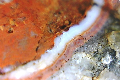


Honaker Trail Formation, Mexican Hat, San Juan County, Utah, USA