| Classification |
|---|
|
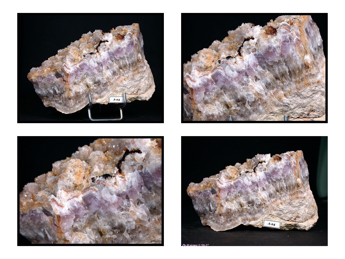
| Species: | Quartz var: Amethyst |
| Formula: | SiO2 |
| Confirmation |
|---|
|
| Validity: | Believed Valid |
| Associated Minerals Based on Photo Data: |
|---|
|
| Quartz | ⓘ1 photo of Amethyst associated with Quartz at this locality. |
| Data |
|---|
|
| Mineral Data: | Click here to view Amethyst data |
| Locality Data: | Click here to view Baerenbach, Sewen, Thann-Guebwiller, Haut-Rhin, Grand Est, France |
| Data Identifiers |
|---|
|
| Mindat Occurrence Record ID: | 74741 |
| Long-form Identifier: | 1:3:74741:1 |
| GUID (UUID V4): | fc690e22-89fe-43b3-8326-a3c5d829cec0 |
| Nearest other occurrences of Amethyst |
|---|
|
|
| 1.1km (0.7 miles) | ⓘAlfeld Lake, Sewen, Thann-Guebwiller, Haut-Rhin, Grand Est, France |
| 6.1km (3.8 miles) | ⓘBrandeskopf Mountain, Wegscheid, Thann-Guebwiller, Haut-Rhin, Grand Est, France |
| 19.2km (11.9 miles) | ⓘCorbeaux Lake, La Bresse, Épinal, Vosges, Grand Est, France |
| 20.7km (12.9 miles) | ⓘBramont pass, La Bresse, Épinal, Vosges, Grand Est, France |
| 21.3km (13.2 miles) | ⓘOspenkopf Mt. - Wolfsgrube pass area, Lautenbach, Thann-Guebwiller, Haut-Rhin, Grand Est, France |
| 22.6km (14.1 miles) | ⓘLes Meix, Rupt-sur-Moselle, Épinal, Vosges, Grand Est, France |
| 23.5km (14.6 miles) | ⓘMaxonchamp, Rupt-sur-Moselle, Épinal, Vosges, Grand Est, France |
| 31.0km (19.3 miles) | ⓘCopper deposit, Osenbach, Thann-Guebwiller, Haut-Rhin, Grand Est, France |
| 54.8km (34.1 miles) | ⓘSchlusselstein, Bergheim, Colmar-Ribeauvillé, Haut-Rhin, Grand Est, France |
| 56.4km (35.1 miles) | ⓘSéprais, Boécourt, Delémont, Jura, Switzerland |
| References |
|---|
|
|


Baerenbach, Sewen, Thann-Guebwiller, Haut-Rhin, Grand Est, France