| Locality | Latitude | Longitude | Distance | Bearing |
|---|
| Section 17 Mine (U S Steel Corp), St. Louis County, Minnesota, USA | 47° 30' 20" N | 92° 46' 48" W | 0.0km (0.0 miles) | |
| Thorne Mine (Hanna Mining Company Agt; Hanna Ore Mining Company), St. Louis County, Minnesota, USA | 47° 30' 29" N | 92° 47' 5" W | 0.5km (0.3 miles) | |
| Wabigon No. 2 Mine, St. Louis County, Minnesota, USA | 47° 30' 30" N | 92° 46' 27" W | 0.5km (0.3 miles) | |
| Wabigon Mine, St. Louis County, Minnesota, USA | 47° 30' 3" N | 92° 46' 28" W | 0.7km (0.4 miles) | |
| Sharon Mine, St. Louis County, Minnesota, USA | 47° 29' 58" N | 92° 47' 0" W | 0.7km (0.5 miles) | |
| Culver Mine (Rhude & Fryberger Inc), St. Louis County, Minnesota, USA | 47° 29' 57" N | 92° 46' 36" W | 0.7km (0.5 miles) | |
| Iron Chief Mine (U S Steel Corp), St. Louis County, Minnesota, USA | 47° 30' 5" N | 92° 47' 20" W | 0.8km (0.5 miles) | |
| Frantz Mine (State of Minnesota), St. Louis County, Minnesota, USA | 47° 29' 57" N | 92° 46' 13" W | 1.0km (0.6 miles) | |
| North Shiras Mine (State of Minnesota), St. Louis County, Minnesota, USA | 47° 30' 19" N | 92° 45' 59" W | 1.0km (0.6 miles) | |
| Woodbridge Mine (Snyder Mining Company), St. Louis County, Minnesota, USA | 47° 30' 35" N | 92° 46' 0" W | 1.1km (0.7 miles) | |
| Shiras Mine (State of Minnesota), St. Louis County, Minnesota, USA | 47° 30' 7" N | 92° 45' 56" W | 1.2km (0.7 miles) | |
| Grant Mine (State of Minnesota), St. Louis County, Minnesota, USA | 47° 29' 49" N | 92° 47' 20" W | 1.2km (0.7 miles) | |
| Budd Reserve H-56 Prospect (Hanna Mining Company Agt; Hanna Ore Mining Company), St. Louis County, Minnesota, USA | 47° 29' 51" N | 92° 45' 51" W | 1.5km (0.9 miles) | |
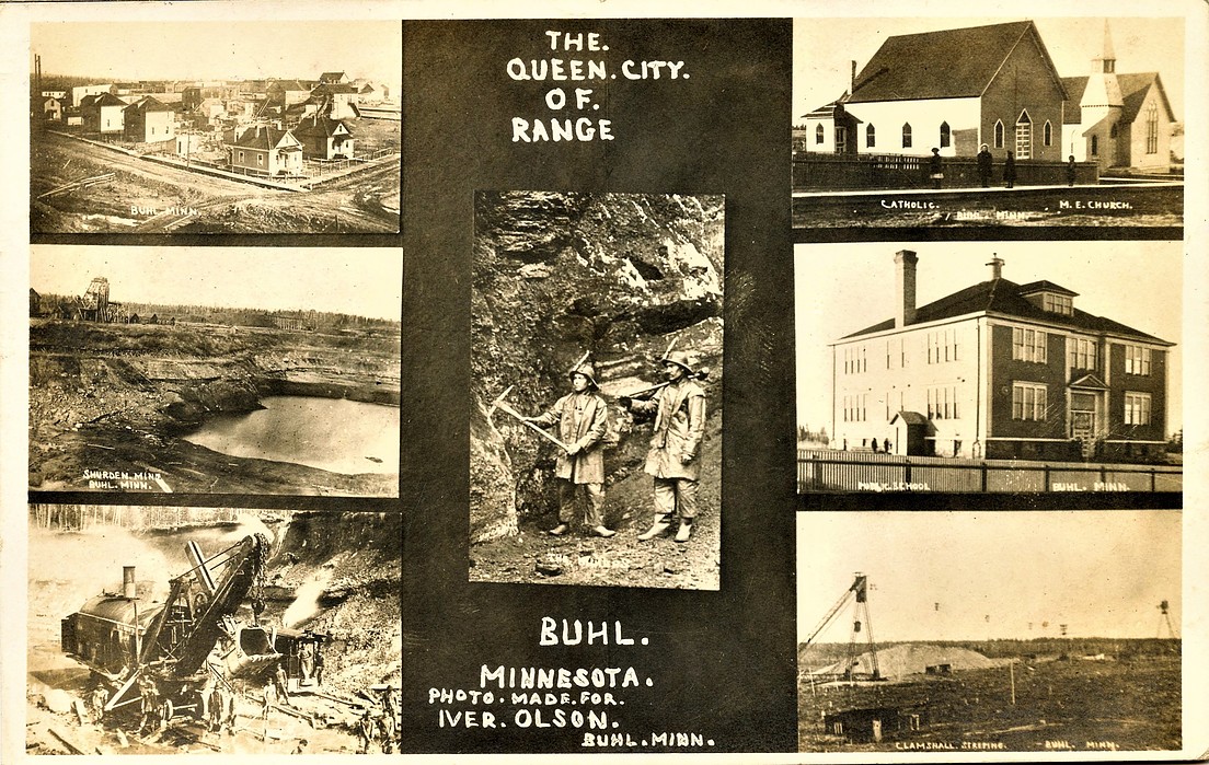
| Shurden Mine, St. Louis County, Minnesota, USA | 47° 29' 29" N | 92° 47' 8" W | 1.6km (1.0 miles) | |
| Margaret Mine (State of Minnesota), St. Louis County, Minnesota, USA | 47° 30' 12" N | 92° 45' 26" W | 1.7km (1.1 miles) | |
| Stubler Mine, St. Louis County, Minnesota, USA | 47° 29' 29" N | 92° 47' 34" W | 1.9km (1.2 miles) | |
| Forster-Burt Mine (U.S.Steel Reserve O-61), St. Louis County, Minnesota, USA | 47° 29' 51" N | 92° 48' 15" W | 2.1km (1.3 miles) | |
| Drew Mine (First Amer Nat Bk Duluth Tr et al), St. Louis County, Minnesota, USA | 47° 30' 11" N | 92° 48' 29" W | 2.1km (1.3 miles) | |
| Wanless Mine (Snyder Mining Company; Snyder Mining Company), St. Louis County, Minnesota, USA | 47° 30' 38" N | 92° 45' 3" W | 2.2km (1.4 miles) | |
| Judson Mine (State of Minnesota), St. Louis County, Minnesota, USA | 47° 29' 8" N | 92° 47' 12" W | 2.3km (1.4 miles) | |
| East Burt Mine (U S Steel Corp), St. Louis County, Minnesota, USA | 47° 29' 44" N | 92° 48' 27" W | 2.3km (1.5 miles) | |
| Eaton Mine (P-M & Company Agt; Ontario Iron Company), St. Louis County, Minnesota, USA | 47° 31' 2" N | 92° 45' 14" W | 2.4km (1.5 miles) | |
| Michael Reserve St-10 Prospect (State of Minnesota), St. Louis County, Minnesota, USA | 47° 29' 2" N | 92° 46' 41" W | 2.4km (1.5 miles) | |
| Kosmerl Mine (Snyder Mining Company; Shenango Furnace Company), St. Louis County, Minnesota, USA | 47° 30' 16" N | 92° 44' 51" W | 2.4km (1.5 miles) | |
| Whiteside Mine (Snyder Mining Company), St. Louis County, Minnesota, USA | 47° 30' 33" N | 92° 44' 38" W | 2.7km (1.7 miles) | |
| Midway No. 2 Mine, St. Louis County, Minnesota, USA | 47° 30' 55" N | 92° 44' 43" W | 2.8km (1.7 miles) | |
| Itasca Mine (Inland Steel Company), St. Louis County, Minnesota, USA | 47° 30' 16" N | 92° 44' 30" W | 2.9km (1.8 miles) | |
| McGrath Reserve G-12 (G N I O P et al), St. Louis County, Minnesota, USA | 47° 30' 48" N | 92° 44' 31" W | 3.0km (1.8 miles) | |
| Croxton-Syme Mine (Syme Mine; U S Steel Corp), St. Louis County, Minnesota, USA | 47° 29' 57" N | 92° 49' 8" W | 3.0km (1.9 miles) | |
| Rhude & Fryberger Inc (Rana Mine), St. Louis County, Minnesota, USA | 47° 31' 5" N | 92° 44' 38" W | 3.0km (1.9 miles) | |
Minerals recorded nearby (within 3.0 km)
Rock types recorded nearby (within 3.0 km)
Entries shown in red are rocks recorded for this region.


Shurden Mine, St. Louis County, Minnesota, USA