Lennox Mine, Buena Vista Mining District, King County, Washington, USAi
| Regional Level Types | |
|---|---|
| Lennox Mine | Mine (Abandoned) |
| Buena Vista Mining District | Mining District |
| King County | County (Historical) |
| Washington | State |
| USA | Country |
This page is currently not sponsored. Click here to sponsor this page.


Latitude & Longitude (WGS84):
47° 39' 12'' North , 121° 34' 18'' West
Latitude & Longitude (decimal):
Type:
Mine (Abandoned) - last checked 2021
Köppen climate type:
Nearest Settlements:
| Place | Population | Distance |
|---|---|---|
| Baring | 220 (2011) | 14.8km |
| Skykomish | 207 (2017) | 17.0km |
| Index | 194 (2017) | 18.6km |
| May Creek | 818 (2011) | 23.4km |
| Snoqualmie | 13,169 (2017) | 23.5km |
Nearest Clubs:
Local clubs are the best way to get access to collecting localities
Local clubs are the best way to get access to collecting localities
| Club | Location | Distance |
|---|---|---|
| Bellevue Rock Club, Inc. | Bellevue, Washington | 47km |
| East KingCo Rock Club | Kirkland, Washington | 48km |
Mindat Locality ID:
406426
Long-form identifier:
mindat:1:2:406426:1
GUID (UUID V4):
29017f5c-0870-44b1-8614-db3dc926498f
Other/historical names associated with this locality:
Silver Bowl Mine
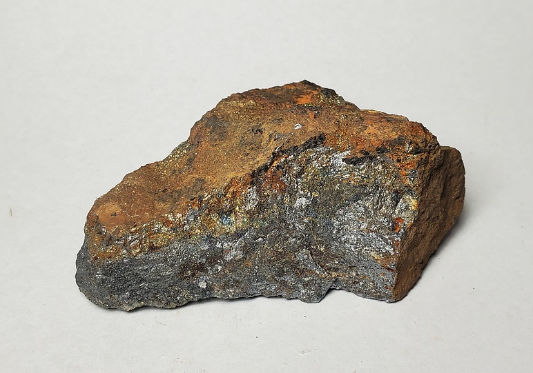
The Lennox was a small unproductive mine on the south side of Lennox Creek. Total production is 1 ton in 1938. There were 11 adits, the longest being around 600'.
Select Mineral List Type
Standard Detailed Gallery Strunz Chemical ElementsDetailed Mineral List:
| ⓘ Arsenopyrite Formula: FeAsS |
| ⓘ Chalcopyrite Formula: CuFeS2 |
| ⓘ Galena Formula: PbS |
| ⓘ Pyrite Formula: FeS2 |
| ⓘ Pyrrhotite Formula: Fe1-xS |
| ⓘ Sphalerite Formula: ZnS |
Gallery:
List of minerals arranged by Strunz 10th Edition classification
| Group 2 - Sulphides and Sulfosalts | |||
|---|---|---|---|
| ⓘ | Sphalerite | 2.CB.05a | ZnS |
| ⓘ | Chalcopyrite | 2.CB.10a | CuFeS2 |
| ⓘ | Pyrrhotite | 2.CC.10 | Fe1-xS |
| ⓘ | Galena | 2.CD.10 | PbS |
| ⓘ | Pyrite | 2.EB.05a | FeS2 |
| ⓘ | Arsenopyrite | 2.EB.20 | FeAsS |
List of minerals for each chemical element
| S | Sulfur | |
|---|---|---|
| S | ⓘ Arsenopyrite | FeAsS |
| S | ⓘ Chalcopyrite | CuFeS2 |
| S | ⓘ Galena | PbS |
| S | ⓘ Pyrite | FeS2 |
| S | ⓘ Pyrrhotite | Fe1-xS |
| S | ⓘ Sphalerite | ZnS |
| Fe | Iron | |
| Fe | ⓘ Arsenopyrite | FeAsS |
| Fe | ⓘ Chalcopyrite | CuFeS2 |
| Fe | ⓘ Pyrite | FeS2 |
| Fe | ⓘ Pyrrhotite | Fe1-xS |
| Cu | Copper | |
| Cu | ⓘ Chalcopyrite | CuFeS2 |
| Zn | Zinc | |
| Zn | ⓘ Sphalerite | ZnS |
| As | Arsenic | |
| As | ⓘ Arsenopyrite | FeAsS |
| Pb | Lead | |
| Pb | ⓘ Galena | PbS |
Other Regions, Features and Areas containing this locality
This page contains all mineral locality references listed on mindat.org. This does not claim to be a complete list. If you know of more minerals from this site, please register so you can add to our database. This locality information is for reference purposes only. You should never attempt to
visit any sites listed in mindat.org without first ensuring that you have the permission of the land and/or mineral rights holders
for access and that you are aware of all safety precautions necessary.
References


Lennox Mine, Buena Vista Mining District, King County, Washington, USA