Burley Mine, Bigstone Bay Area, Kenora District, Ontario, Canadai
| Regional Level Types | |
|---|---|
| Burley Mine | Mine (Inactive) |
| Bigstone Bay Area | Area |
| Kenora District | District |
| Ontario | Province |
| Canada | Country |
This page is currently not sponsored. Click here to sponsor this page.
Latitude & Longitude (WGS84):
49° 42' 30'' North , 94° 24' 12'' West
Latitude & Longitude (decimal):
Type:
Mine (Inactive)
Deposit first discovered:
Before 1899
Köppen climate type:
Nearest Settlements:
| Place | Population | Distance |
|---|---|---|
| Kenora | 15,096 (2018) | 9.0km |
Mindat Locality ID:
406899
Long-form identifier:
mindat:1:2:406899:3
GUID (UUID V4):
b5c9e460-a7ef-4587-9cde-65bded46d18b
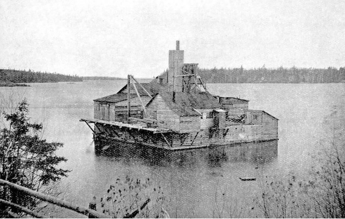
1896-1897: J. Burley Smith drilled 3 holes through the ice in an
attempt to intersect the Crown Reef Vein.
1897-1899: Burley Gold Mining Co. of Ottawa, Ltd. built a caisson
consisting of an outer wall of timbers 18 m square, and an inner wall
of timbers 12 m square. The caisson was towed from Queen Bee Island
and sunk into clays. A concrete collar was constructed and a shaft
was sunk from a platform built on top of the caisson. The shaft
reached a depth of 61.6 m. About 17 m of crosscutting was completed
on the 32.6 m level and 24.7 m of drifting was done on the 45.7 m
level.
Select Mineral List Type
Standard Detailed Gallery Strunz Chemical ElementsGallery:
List of minerals arranged by Strunz 10th Edition classification
| Group 1 - Elements | |||
|---|---|---|---|
| ⓘ | Gold | 1.AA.05 | Au |
| Group 4 - Oxides and Hydroxides | |||
| ⓘ | Quartz | 4.DA.05 | SiO2 |
List of minerals for each chemical element
| O | Oxygen | |
|---|---|---|
| O | ⓘ Quartz | SiO2 |
| Si | Silicon | |
| Si | ⓘ Quartz | SiO2 |
| Au | Gold | |
| Au | ⓘ Gold | Au |
This page contains all mineral locality references listed on mindat.org. This does not claim to be a complete list. If you know of more minerals from this site, please register so you can add to our database. This locality information is for reference purposes only. You should never attempt to
visit any sites listed in mindat.org without first ensuring that you have the permission of the land and/or mineral rights holders
for access and that you are aware of all safety precautions necessary.
References


Burley Mine, Bigstone Bay Area, Kenora District, Ontario, Canada