 | | Report (volume) | | KOTSINA-KUSKULANA DISTRICT ALASKA BY RALPH E. VAN ALSTINE AND ROBERT F. BLACK WITH AN INTRODUCTION BY...--_-----------------__---------.------ In pocket 31. No.'ladit, Clear Creek..___ . .. - In pocket 32...showing the location of the KotsinaKuskulana .district. _______-__________--_-_--______--_- 124 21...Copper Creek_________________________ 127 22. No. 2 adit, Clear Creek._________________________________...River. , At Chitina it is necessary to use a boat or an aerial tram to cross the Copper River, for the railroad | 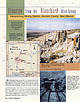 | | Journal (article/letter/editorial) | | Albuquerque New Mexico 87109 Blue Fluorite Crystals 1) + Figure 4.; 1936 Rocks & ' Mherals ad for fluorite...activity,for 1ead.hasexisted inthe Hansonburg &ng district, which includes the Blanchard mine, . since 1872...eariiest reference to fluor& in the area seems to be in an 1892 issue of a mininggazette published in El Paso...comprehensive look at fluorite in New Mexico is reported in an early New Mexico Bureau of Mines bulletin (Johnston...is now known as the Portales adit (not to be confused with the Sunshine No. 6 mine, which has been called |  | | Report (issue) | | Lewis and Cl ark Counties, Montana. 1963. (Card 2) 1 1. 'Geology-Montana-.Jefferson City quadrangle. 2...Comparison with adjacent areas _____________________ _ 1 2 4 4 4 5 6 6 8 8 15 15 16 16 17 17 17 17 18 18 19...districts and mines ______________________ _ Rimini district ____________________________ _ Lee ·Mountain-V~lley...mines-Continued Rimini district-Continued Mines in the southern area ______________ _ Florsefiy adit __________________________..._ Other mines _______________________ _ Clancy district ____________________________ _ King Solomon mine |  | | Report (volume) | | Monument___________________ Tract No. !_______________________________ Tract No. 2__________._._________________...__________ Lena No. 1 and Genie No. 1 claims----_----_----_------_-__Sure Fire No. 1 claim-_______-_...claim-_______-___________-_---__--_____-__Van Hill No. 5 claim___________________________ Van Hill Nos. 7 and 8 cla..._____________________________________________ Honey Bee No. 4 claim.__________________________________ Shorty...___---_-_-_-_____-_______ Wooley No. 1 claim______________________._________________ in Page A-1 1 3334 7 7 7 12 12 |  | | Report (issue) | | Minister Xiniste? HON.R. C. MACDONALD, BULLETIN NO. 27 GEOLOGY AND MINERALDEPOSITS OF 'SNE ZEBALLOS...left ...Frontispiece 11. Narrow shrinkage stope on No. 2 vein, 1100 level, Privateer mine, looking up from.... ~~~~ .......... ......... ~~~~~ 38 IX. No. 1 vein, 1100 level, Privateer mine, showing vein in...Valley mine camp-portal of No. 7 level a t dump, lower right; portal of No. 4 level at top of dump, upper... ZEBALLOS MINING CAMP, BRITISH COLUMBIA. CHAPTER 1.-INTRODUCTION. GENERALSTATEMENT. This bulletin presents |  | | Report (issue) | | ARIZONA BUREAU OF MINES, GEOLOGICAL SERIES No. 18, BULLETIN NO. -156 PUBLISHED BY linhttrsitg of Ari!ona...TUCSON, ARIZONA April, 1950 Vol. XXI, No.2 ){ninf,faiil1 of 1\rtlona I ~ul1rtin -' BOARD OF REGENTS'...following have proved especially important and valuable: 1. The preparation and publication of bulletins and...originate within the state of Arizona; a charge of $1 per specimen is made for samples submitted from outside...authorized June 29, 1921. April, 1950 Vol. XXI, No.2 1ltuitttrntty uf ArilUUU ~ullrttu ARIZONA BUREAU |  | | Report (volume) | | Geological Survey. Bulletin 1129) Bibliography : p. 76. 1. Geology-Alaska-Lost River valley. 2. Mines and mineral...Superintendent of Documents, U.S. Government Prlntin!1 Office Washln!lton, D.C., 20402 CONTENTS Page ...area___________________________________________ m 1 2 5 5 5 6 6 6 7 8 9 9 9 10 10 11 12 12 13 15 15 15...ILLUSTRATIONS [Plates are in separate volume] PLATE 1. General geologic map of the Lost River valley and...Nos. 1 and 2 and of sublevels above No. 3 adit, Lost River mine, Alaska. 5. Geologic map of No. 3 adit |  | | Report (issue) | | MINES AND PROSPECTS, LAWSON-DUMONT-FALL RIVER DISTRICT, CLEAR CREEK COUNTY, COLORADO By C. C. Hawley...England and Sunburst(?) mines United tunnel Unknown No. C4-3 Other mines or prospects tabular summary Lawson...Murry veinNabob mine Princess of India group II 1 6 7 9 10 10 lOa 13 15 16 17 19 20 20 20 20 21 21 22.... . Wolverine mine . . . . - .. Unknown No. C6-45 Unknown No. G643 Mines between Mill Creek and Spring...mineFiremen and Conductors tunnel Torrey tunnel « Unknown No. G454 III 56 56 57 58 58 59 59 61 61 62 64 54 64 |  | | Report (issue) | | ECONOMIC GEOLOGY REPORT No. 20 MOLYBDENUM DEPOSITS OF CANADA F. M. Vokes $4.50 1963 MOLYBDENUM... MOLYBDENUM DEPOSITS OF CANADA 2,500-1962-1992 56160-5-1 Plate I. Headframe, concentrator and waste dump at... GEOLOGICAL SURVEY OF CANADA ECONOMIC GEOLOGY REPORT No. 20 MOLYBDENUM DEPOSITS OF CANADA By F. M. Vokes...CONTROLLER OF STATIONERY OTTAWA, 1963 Price $4.50 Cat. No. M43-2062 A French translation of this report is...properties based partly or entirely on earlier reports. An introductory section on production, consumption, |  | | Report (volume) | | colored, part in pocket. Bibliography: p. 132- 133. 1. Ore-deposits-Alaska-Kasaan P·e ninsula. 2. Iron mines...___________________________________________ __ ____ __ _ 1 3 3 3 (}eologY ------ - --------------~- - ---------...____ ___ ________ _____ _______ _ (}eol~/e~~~t~~~ ~~1-d ~~~t;i~t~d -r-o-ck~~~~~~~~~~~~~~~~~~~~~~~~~~ Igneous..._________________________________________ Iron King No. 1 copper prospect, by L. A. Warner and Matt S. W alton...__ __ _ _ _ __ _ _ Venus prospect, by R. G. RaY---1----- _________________________ Haida mine, by L.A |  | | Report (issue) | | REPORT 19i6 Nines and Prospects, Idaho Springs District Clear Creek and Gilpin Counties, Colorado Descriptions...Commission Introduction The Idoiho Springs mining district forms an important segment of tae Front Range mineral...west, and southwest. The adjacent Central City district, which produced ores valued at more than $100...clearly the most important district in the mineral belt The Idaho Springs district from 1860 to 1959 produced...prospects, their coordinate location on the district map (fig. 1), the page of this report on which their |  | | Report (volume) | | Economic Geology of the Idaho Springs District Clear Creek and Gilpin Counties, Colorado GEOLOGICAL (=)...1208 * Economic Geology of the Idaho Springs District Clear Creek and -i ;i ?i Gilpin Counties, Colorado...Pecora, Director Library of Congress catalog-card No. GS 65-368 For sale by the Superintendent of Documents...____ Mines and prospects in the Idaho Springs district ________________ Previous studies.___________...____-Acknowledgments. _________________-_--__-_______-_-_-_--__--- 1 3 6 6 7 13 13 14 History, production, and future |  | | Report (issue) | | Geology and Ore Deposits of the Globe-Miami District, Arizona GEOLOGICAL SURVEY PROFESSIONAL PAPER...Globe-Miami District, Arizona By N. P. PETERSON GEOLOGICAL SURVEY PROFESSIONAL Within the district of known...1898Geology and ore deposits of the Globe-Miami district, Arizona. Washington, U.S. Govt. Print. Off.,...146-147. 1. Geology-Arizona-Globe-MJami district. 2. Ore-deposits-Arizona-Globe-Miami district. 3. Copper...mining-Arizona. I. Title. II. Title: Globe-Miami district, Arizona. (Series) For sale by the Superintendent |  | Kovalenker, V.A., Plotinskaya, O.Y., Prokofiev, V.Y., Gertman, Y.L., Koneev, R.I., Pomortsev, V.V. (2003) Mineralogy, geochemistry, and genesis of gold-sulfide-selenide-telluride ores from the Kairagach deposit (Uzbekistan) Geology of Ore Deposits, 45 (3) 171-200 | Journal (article/letter/editorial) | | Vol. 45, No. 3, 2003, pp. 171–200. Translated from Geologiya Rudnykh Mestorozhdenii, Vol. 45, No. 3, 2003...Kairagach Deposit (Uzbekistan) V. A. Kovalenker*, 1, O. Yu. Plotinskaya*, V. Yu. Prokof’ev*, Yu. L. Gertman**...and 171 172 KOVALENKER et al. 70° E 1 2 N 41° Angren 1 3 2 4 5 3 6 7 8 9 4 10 11 12 Fergana...10 20 km Fig. 1. Schematic geological map of the central part of the Kuramin Ridge. (1) Mesozoic–Cenozoic...the Karatash (Kochbulak) caldera; (12) deposits: (1) Kairagach, (2) Kochbulak, (3) Lashkerek, (4) Almalyk |  | | Report (volume) | | Pruneda adit.................................... Calvache shaft.................................. No. 2 adit...adit...................................... No. 3 adit...................................... Breccia area...39. 40. 41. 42. 43. Page Index map, Siguanea district, Isla de Pinos, Cuba........................................ 180 Geologic map of the Siguanea district, Isla de Pinos, Cuba........................ In...Detailed map of porphyry dikes north of the - No. 2 adit on the Lela claim, Isla de Pinos, Cuba...... |  | | Report (volume) | | SURVEY BULLETIN 1151 A descriptive report of an area along the west margin of the Boulder batholith...S. Govt. Print. Off., 1963. 121 p. illus., maps (1 col.) diagrs., tables. 24 cm. Survey. Bulletin 1151)...matter folded in pocket. Bibliography: p. 119-121. 1. Geology Montana Basin quadrangle. 2. Mines and mineral...Intrusive rocks.___________________________________ in 1 2 2 3 4 4 5 6 8 8 8 9 9 10 14 14 17 18 19 20 20 21...101 ILLUSTRATIONS [Plates are in pocket] PLATE 1. Geologic map and sections of the Basin quadrangle |  | | Report (issue) | | indicates, the papers included are of two classes (1) short papers giving comparatively detailed descriptions...subjects treated, and each group has been issued as an advance chapter as soon as it was ready. By means...1909, the writer spent 10 days in the Carrville district, Trinity County, Cal., and, incidental to other...written. In November, 1910, another visit to the district was made, but inclement weather handicapped the...The growing economic importance of this min ing district merits notice, and it is hoped that this brief |  | | Report (issue) | | Deposits of the Sacramento (High Rolls) Mining District, Otero County, New Mexico By S. K JEROME, DOUGLAS................................................... 1 INTRODUCTION .......................................are in the pocket) 1. Location of the Sacramento (High Rolls) mining district 2. Index map to plates... Abstract In the Sacramento (High Rolls) mining district, Otero County, New Mexico, the Permian Abo Formation...throw. The few intrusives in the district are sills of andesite with no associated mineralization or alteration |  | | Book (volume) | | library book that was digitized by Google as part of an ongoing effort to preserve the information in books....c .2 423 Oxford Street, London w .1 P .O . Box 569, London s. .1 13a Castle Street, Edinburgh 2 109...39 King Street, Manchester 2 Tower Lane, Bristol 1 2 Edmund Street, Birmingham 3 80 Chichester Street...CORNWALL, DEVON AND WEST SOMERSET 8. St. Austell district in .. .. .. .. ... Lanivet (p . 511); Belowda...Stephen (p . 539) ; Par (p . 552). 9. Wadebridge district .. .. . . 571 .. .. ' .. ' West of Wadebridge |  | Ondruš, P., Veselovský, F., Gabašová, A., Hloušek, J., Šrein, V., Vavřín, I., Skála, R., Sejkora, J., Drábek, M. (2003) Primary minerals of the Jáchymov ore district. Journal of the Czech Geological Society, 48 (3-4) 19-147 | Journal (article/letter/editorial) | | Jáchymov ore district Primární minerály jáchymovského rudního revíru (237 figs, 160 tabs) PETR ONDRU1 FRANTIEK...FRANTIEK VESELOVSKÝ1 ANANDA GABAOVÁ 1 JAN HLOUEK2 VLADIMÍR REIN3 IVAN VAVØÍN1 ROMAN SKÁLA1...Czech Geological Survey, Klárov 3, CZ-118 21 Prague 1 U Roháèových kasáren 24, CZ-100 00 Prague 10 3 Institute...Museum, Václavské námìstí 68, CZ-115 79, Prague 1 1 2 One hundred and seventeen primary mineral species...Approximately seventy primary minerals were known from the district before the present study. All known reliable data |  | | Report (issue) | | crops out on the far western Inian Island, about 1/2 mile southwest of the iron occurrence (Rossman,...None Site Status: Inactive Workings/exploration: No workings were reported. Production notes: Reserves:...site is Tongass National Forest; it appears to be in an area open for mineral location. References: Rossman...(Rossman, 1959, plate 12; Loney and others, 1975, plates 1 and 2). The eastern part of the gabbro body on northern...the mainland of the island; much of the body is on an offshore island complex. Nickel-bearing norite gabbro |  | | Report (issue) | | Idaho by Rick Johnson , Terry Close2, and Ed McHugh3 1 Open-File Report 98-478 This report is preliminary...does not imply endorsement by the U.S. Government. 1 2 3 U.S. Forest Service, Salmon-Challis National...Service. The U.S. Bureau of Mines was abolished by an act of Congress in 1996. This report is based upon...Mining District Indian Creek Mining District Mineral Hill Mining District Mackinaw Mining District Blackbird...Blackbird Mining District Wilson Creek Mining District Yellowjacket Mining District Gravel Range Mining District |  | | Book (volume) | | ........................ 509 8. St. Austell district . . . . . . . . . . . . . . . . . . . . . . ....St. Stephen (p. 539); (p. 552). 9. Wade bridge district ........................................... West...574); Bodmin Moor (p.578). 571 10. Liskeard district . . . . . . . . . . . . . . . . . . . . . . ....Menheniot (p. 615). 11. Callington and Tavistock district . . . . . . . . . . . . . . . . . . . . . . ....(p. 712). INDEX 12. Dartmoor and Teign Valley district ............................... Central Dartmoor |  | | Report (issue) | | Dean Farris from mine dump waste in the Gold Hill district. The actual diameter of the button in the lower..... . . . . . . . . .. . . . . . . . . . . . . . 1 Historical background . . . . . . . . . . . . ..... . . . . . . . . . . . . . . . . . . . Kirwin district . . . . . . , . . . . . . . . . . . . . . . ....City) district .. . . . . . . . . . . . . . . . . . . . . . . . . 13 16 Stinkingwater district . . ... .. .. . ... . . . . . . . . . . . . Sunlight district . ... . . . . . . . . . . . . . . . . . . . . |  | | Book (volume) | | Metalliferous Mining Region of South-West England 0 iz 0 1-rj VOLUME II Assistant Director's Copy LIBRARY...Street, Bristol BSl 3DE 258 Broad Street, Birmingham 1 7 Linenhall Street, Belfast BT2 8AY or through any... DEVON AND WEST SOMERSET 509 8. St. Austell district 510 Lanivet (p. 511); Belowda (p. 521); Luxulian...Stephen (p. 539); Par (p. 552). 9. Wadebridge district . . 571 West of_ Wadebridge (p. 572); East of...(p. 574); Bodmin Moor (p. 578). I 0. Liskeard . district . 582 North Hill (p. 582); Caradon and Phoenix |
|


No. 1 adit, Äußere Wimitz, Frauenstein, Sankt Veit an der Glan District, Carinthia, Austria