| Locality | Latitude | Longitude | Distance | Bearing |
|---|
| Thompson Property, Goshen Area, Cherokee County, Alabama, USA | 33° 58' 54" N | 85° 37' 3" W | 0.0km (0.0 miles) | |
| Harbour and Thompson Prospects, Goshen Valley Area, Cherokee County, Alabama, USA | 33° 58' 59" N | 85° 37' 0" W | 0.2km (0.1 miles) | |
| Goshen, Cherokee County, Alabama, USA | 33° 58' 49" N | 85° 36' 59" W | 0.2km (0.1 miles) | |
| E. A. Jones Prospect, Rock Run, Cherokee County, Alabama, USA | 33° 58' 33" N | 85° 37' 13" W | 0.7km (0.4 miles) | |
| Unnamed Manganese - Cobalt Prospect (MRDS - 10067536), Goshen Valley Area, Cherokee County, Alabama, USA | 33° 58' 0" N | 85° 37' 0" W | 1.7km (1.1 miles) | |
| Davis Property, Cherokee County, Alabama, USA | 33° 57' 48" N | 85° 37' 0" W | 2.0km (1.3 miles) | |
| Toll Property; Goshen Valley, Goshen Area, Cherokee County, Alabama, USA | 33° 57' 42" N | 85° 37' 15" W | 2.2km (1.4 miles) | |
| Goshen Valley Manganese Prospect, Cherokee County, Alabama, USA | 33° 57' 43" N | 85° 37' 23" W | 2.3km (1.4 miles) | |
| Howell Prospect, Cherokee County, Alabama, USA | 33° 57' 38" N | 85° 36' 23" W | 2.6km (1.6 miles) | |
| Lewis Prospect, Cherokee County, Alabama, USA | 33° 59' 38" N | 85° 38' 34" W | 2.7km (1.7 miles) | |
| Neddie Parker Property, Cherokee County, Alabama, USA | 33° 58' 54" N | 85° 38' 48" W | 2.7km (1.7 miles) | |
| Snyder Mine (New Goshen Mine; Dupont), Cherokee County, Alabama, USA | 34° 0' 34" N | 85° 37' 37" W | 3.2km (2.0 miles) | |
| Johnson Prospect, Cherokee County, Alabama, USA | 34° 0' 37" N | 85° 37' 45" W | 3.3km (2.1 miles) | |
| Wallace Prospect, Cherokee County, Alabama, USA | 33° 58' 46" N | 85° 39' 21" W | 3.6km (2.2 miles) | |
| Stewart Mine, Calhoun County, Alabama, USA | 33° 57' 3" N | 85° 36' 11" W | 3.7km (2.3 miles) | |
| Mundy Prospect, Cherokee County, Alabama, USA | 33° 57' 51" N | 85° 39' 23" W | 4.1km (2.5 miles) | |
| Unnamed Iron Prospect (MRDS - 10160108), Calhoun County, Alabama, USA | 33° 56' 40" N | 85° 37' 31" W | 4.2km (2.6 miles) | |
| Old and New Stewart Prospects, Cherokee County, Alabama, USA | 34° 1' 10" N | 85° 36' 52" W | 4.2km (2.6 miles) | |
| Rumsey Old Houses, Cherokee County, Alabama, USA | 33° 59' 20" N | 85° 39' 47" W | 4.3km (2.7 miles) | |
| Unnamed Iron Prospect (MRDS - 10083359), Calhoun County, Alabama, USA | 33° 57' 29" N | 85° 39' 29" W | 4.6km (2.9 miles) | |
| Mundy Brown Iron Deposit, Calhoun County, Alabama, USA | 33° 57' 47" N | 85° 39' 43" W | 4.6km (2.9 miles) | |
| Rumsey and Lee Prospects 1 and 2, Cherokee County, Alabama, USA | 33° 59' 3" N | 85° 40' 5" W | 4.7km (2.9 miles) | |
| Unnamed Iron (MRDS - 10232854), Cherokee County, Alabama, USA | 34° 0' 3" N | 85° 34' 0" W | 5.1km (3.2 miles) | |
| Frog Mountain, Cherokee County, Alabama, USA | 34° 0' 35" N | 85° 34' 8" W | 5.5km (3.4 miles) | |
| Garvin Prospect, Cherokee County, Alabama, USA | 34° 1' 44" N | 85° 35' 5" W | 6.0km (3.7 miles) | |
| Wright Prospect, Cherokee County, Alabama, USA | 33° 58' 0" N | 85° 40' 49" W | 6.0km (3.7 miles) | |
| Unnamed Iron (MRDS - 10160717), Cherokee County, Alabama, USA | 34° 0' 42" N | 85° 33' 21" W | 6.6km (4.1 miles) | |
| Unnamed; Craig Mt & Frog Mt. (MRDS - 10083987), Cherokee County, Alabama, USA | 34° 1' 19" N | 85° 33' 55" W | 6.6km (4.1 miles) | |
| Cunliff Prospect, Cherokee County, Alabama, USA | 34° 0' 24" N | 85° 40' 58" W | 6.6km (4.1 miles) | |
| Griffin Prospect, Eagle Creek Mining District, Tallapoosa County, Alabama, USA | 33° 58' 0" N | 85° 41' 15" W | 6.7km (4.1 miles) | |
Minerals recorded nearby (within 6.7 km)
Rock types recorded nearby (within 6.7 km)
Entries shown in red are rocks recorded for this region.
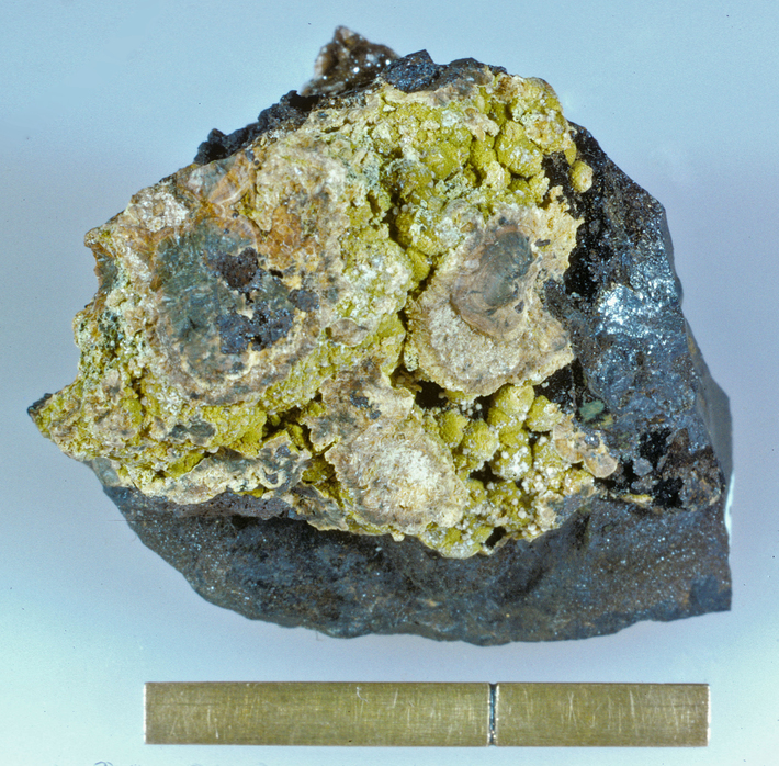


Rock Run, Goshen, Cherokee County, Alabama, USA