| Locality | Latitude | Longitude | Distance | Bearing |
|---|
| Gatteville-le-Phare, Saint-Pierre-Église, Cherbourg, Manche, Normandy, France | 49° 41' 43" N | 1° 16' 50" W | 0.0km (0.0 miles) | |
| Landemer Cliffs, Montfarville, Cherbourg, Manche, Normandy, France | 49° 39' 0" N | 1° 14' 22" W | 5.8km (3.6 miles) | |
| La Pernelle baryte mine, La Pernelle, Cherbourg, Manche, Lower Normandy, France | 49° 37' 13" N | 1° 18' 2" W | 8.5km (5.3 miles) | |
| Le Bourg de Lestre quarries, Quinéville, Cherbourg, Manche, Normandy, France | 49° 30' 33" N | 1° 19' 35" W | 20.9km (13.0 miles) | |
| La Glacerie sandstones, Cherbourg-en-Cotentin, Cherbourg, Manche, Normandy, France | 49° 36' 3" N | 1° 33' 34" W | 22.7km (14.1 miles) | |
| Mont-Rogneux quarry, Montebourg, Cherbourg, Manche, Normandy, France | 49° 30' 13" N | 1° 23' 45" W | 22.9km (14.2 miles) | |
| Éroudeville sand pits, Écausseville, Cherbourg, Manche, Normandy, France | 49° 28' 23" N | 1° 23' 4" W | 25.8km (16.0 miles) | |
| Siouville-Hague quarry, Tréauville, Cherbourg, Manche, Normandy, France | 49° 33' 14" N | 1° 51' 19" W | 44.3km (27.5 miles) | |
| Fritot alluvium deposits, Le Rozel, Cherbourg, Manche, Normandy, France | 49° 29' 17" N | 1° 48' 41" W | 44.6km (27.7 miles) | |
| Diélette iron mines, Flamanville, Cherbourg, Manche, Normandy, France | 49° 32' 52" N | 1° 52' 3" W | 45.4km (28.2 miles) | |
| Sainte-Honorine-des-Pertes cliffs, Aure sur Mer, Bayeux, Calvados, Normandy, France | 49° 21' 12" N | 0° 47' 31" W | 51.8km (32.2 miles) | |
| Le Molay-Littry coal mine, Le Molay-Littry, Bayeux, Calvados, Normandy, France | 49° 14' 32" N | 0° 52' 43" W | 58.1km (36.1 miles) | |
| Mannez Quarry, Alderney, Bailiwick of Guernsey | 49° 43' 38" N | 2° 10' 2" W | 63.9km (39.7 miles) | |
| Berry Quarry, Alderney, Bailiwick of Guernsey | 49° 43' 34" N | 2° 10' 19" W | 64.2km (39.9 miles) | |
| Le Côtil Point, St John, Jersey | 49° 15' 12" N | 2° 8' 4" W | 78.9km (49.0 miles) | |
| La Saline/Mont Mado Quarry, St John, Jersey | 49° 15' 5" N | 2° 8' 4" W | 79.0km (49.1 miles) | |
| La Saline Quarry, St John, Jersey | 49° 15' 5" N | 2° 8' 13" W | 79.2km (49.2 miles) | |
| Ronez quarry, St John, Jersey | 49° 15' 31" N | 2° 9' 13" W | 79.6km (49.5 miles) | |
| Sorel Point, St John, Jersey | 49° 15' 32" N | 2° 9' 32" W | 79.9km (49.6 miles) | |
| Devil's Hole, St Mary, Jersey | 49° 15' 5" N | 2° 10' 24" W | 81.2km (50.5 miles) | |
| Le Hocq, St Clement, Jersey | 49° 10' 0" N | 2° 3' 42" W | 81.5km (50.6 miles) | |
| Jersey minette outcrops, St Helier, Jersey | 49° 12' 0" N | 2° 7' 0" W | 81.8km (50.8 miles) | |
| Le Nez Point, Le Hocq, St Clement, Jersey | 49° 10' 0" N | 2° 4' 0" W | 81.8km (50.8 miles) | |
| Waterworks Valley, St Lawrence, Jersey | 49° 12' 27" N | 2° 8' 3" W | 82.2km (51.0 miles) | |
| Unnamed quarry, Waterworks Valley, St Lawrence, Jersey | 49° 12' 30" N | 2° 8' 9" W | 82.2km (51.1 miles) | |
| La Gigoulande Quarry, St Peter, Jersey | 49° 13' 29" N | 2° 10' 14" W | 82.9km (51.5 miles) | |
| Port du Moulin, Greater Sark, Sark, Bailiwick of Guernsey | 49° 26' 18" N | 2° 22' 8" W | 83.5km (51.9 miles) | |
| Greater Sark, Sark, Bailiwick of Guernsey | 49° 25' 48" N | 2° 21' 59" W | 83.7km (52.0 miles) | |
| Port-ès-Sées, Greater Sark, Sark, Bailiwick of Guernsey | 49° 25' 35" N | 2° 22' 10" W | 84.0km (52.2 miles) | |
| Hermitage, St Helier, Jersey | 49° 10' 23" N | 2° 7' 31" W | 84.3km (52.4 miles) | |

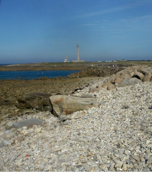


Gatteville-le-Phare, Saint-Pierre-Église, Cherbourg, Manche, Normandy, France