Home PageAbout MindatThe Mindat ManualHistory of MindatCopyright StatusWho We AreContact UsAdvertise on Mindat
Donate to MindatCorporate SponsorshipSponsor a PageSponsored PagesMindat AdvertisersAdvertise on Mindat
Learning CenterWhat is a mineral?The most common minerals on earthInformation for EducatorsMindat ArticlesThe ElementsThe Rock H. Currier Digital LibraryGeologic Time
Minerals by PropertiesMinerals by ChemistryAdvanced Locality SearchRandom MineralRandom LocalitySearch by minIDLocalities Near MeSearch ArticlesSearch GlossaryMore Search Options
The Mindat ManualAdd a New PhotoRate PhotosLocality Edit ReportCoordinate Completion ReportAdd Glossary Item
Mining CompaniesStatisticsUsersMineral MuseumsClubs & OrganizationsMineral Shows & EventsThe Mindat DirectoryDevice SettingsThe Mineral Quiz
Photo SearchPhoto GalleriesSearch by ColorNew Photos TodayNew Photos YesterdayMembers' Photo GalleriesPast Photo of the Day GalleryPhotography
╳Discussions
💬 Home🔎 Search📅 LatestGroups
EducationOpen discussion area.Fakes & FraudsOpen discussion area.Field CollectingOpen discussion area.FossilsOpen discussion area.Gems and GemologyOpen discussion area.GeneralOpen discussion area.How to ContributeOpen discussion area.Identity HelpOpen discussion area.Improving Mindat.orgOpen discussion area.LocalitiesOpen discussion area.Lost and Stolen SpecimensOpen discussion area.MarketplaceOpen discussion area.MeteoritesOpen discussion area.Mindat ProductsOpen discussion area.Mineral ExchangesOpen discussion area.Mineral PhotographyOpen discussion area.Mineral ShowsOpen discussion area.Mineralogical ClassificationOpen discussion area.Mineralogy CourseOpen discussion area.MineralsOpen discussion area.Minerals and MuseumsOpen discussion area.PhotosOpen discussion area.Techniques for CollectorsOpen discussion area.The Rock H. Currier Digital LibraryOpen discussion area.UV MineralsOpen discussion area.Recent Images in Discussions


GeneralAnother geological puzzle.

3rd Nov 2018 00:19 UTCReiner Mielke Expert


3rd Nov 2018 00:54 UTCPaul Brandes 🌟 Manager
Or, what formation is the rock from?

3rd Nov 2018 02:39 UTCLarry Maltby Expert
The only thing that I can think of is that perhaps the rocks were carried by an iceberg and dropped on the sea floor. In that way the sedimentation on the sea floor would not be disrupted and would continue to cover the cobbles and eventually form the limestone. In Glacier Bay I did see rocks being carried by icebergs.
3rd Nov 2018 03:17 UTCBart Cannon
3rd Nov 2018 06:00 UTCBen Grguric Expert
3rd Nov 2018 09:32 UTCWayne Corwin
3rd Nov 2018 09:35 UTCSusan Robinson
3rd Nov 2018 11:24 UTCReiner Mielke Expert
3rd Nov 2018 11:28 UTCReiner Mielke Expert
3rd Nov 2018 11:36 UTCReiner Mielke Expert
3rd Nov 2018 11:44 UTCReiner Mielke Expert
3rd Nov 2018 11:47 UTCReiner Mielke Expert
3rd Nov 2018 12:01 UTCDavid K. Joyce Expert
David K Joyce
3rd Nov 2018 12:12 UTCReiner Mielke Expert
I've seen that but that is much older precambrian rock. The unusual thing with this is that it is in fossiliferous limestone not something that is usually associated with glaciers.
3rd Nov 2018 12:24 UTCPaul Brandes 🌟 Manager
3rd Nov 2018 12:29 UTCKeith Wood
All I can think of is a large ice sheet like the Antarctic ice sheet that got blanketed with a layer of lithic fragments from a volcanic eruption. Such icebergs are larger, with less surface area, so they melt more slowly. With the lithic ejecta on top of the ice rather than within the ice, the fines could be washed away by rain and melt water. As the iceberg thinned it would break apart, dropping rocks in a local area. This scenario would account for the travel distance of an iceberg source, and the clean horizon.
A lot depends on the speed of currents at the time. Does anyone know if high thermal gradients drive faster ocean currents? If so, times of glaciation events might also have faster currents and be able to deliver icebergs farther than today.
I believe there was a glaciation event in the Ordovician.
I would wager this is a fairly localized occurrence.
Knowing more about the depositional environment of the limestone would help. It is light colored and massive, suggesting a lagoonal facies. If this is the case, perhaps such an iceberg as I described got grounded there and dropped all its stones in that area. Or a strong current delivered several such icebergs in a short while which shed stones while passing through.
Just speculation to open up the discussion. My thinking may be flawed in one or another way. I look forward to the discussion.
3rd Nov 2018 13:07 UTCReiner Mielke Expert
3rd Nov 2018 13:55 UTCKeith Wood
Interstitial water in carbonates is almost constantly saturated in CaCO3, leading to relatively rapid lithification, as compared with siliciclastics, but commonly still on the order of hundreds to thousands of years or more. In the lagoonal facies, original bedding is usually poorly preserved, owing to bioturbation. This lends a massive character to the limestone as new beds are mixed with older material and the distinctiveness is lost. The light color is indicative of fully oxygenated conditions unfavorable to the preservation of organic matter.
3rd Nov 2018 14:00 UTCKeith Wood
3rd Nov 2018 14:17 UTCKeith Wood
Or there is yet another explanation entirely.
3rd Nov 2018 14:25 UTCReiner Mielke Expert
3rd Nov 2018 14:31 UTCKeith Wood
Have you ever examined a lithic blanket from an eruption? It is surprising the range of shapes found within. There are fewer angular fragments than you would imagine. Also, in the phreatic environment, stones can be milled prior to eruption. But I'll admit there seems to be a shortage here.
3rd Nov 2018 14:42 UTCReiner Mielke Expert
3rd Nov 2018 15:13 UTCKeith Wood
The volcano need not have been present "in the area." That is the point. The iceberg could have travelled thousands of miles on a swift current with favorable winds even at 10-15 miles per hour. The Gulf Stream flows at 5.6 miles per hour and is not the fastest current in the ocean even now. There is an African current twice as fast. In a period of glaciation it is possible that high thermal gradients could drive even faster currents. A huge iceberg from an ice sheet would not melt away in 300 hours if it remained in a cool current. The iceberg could travel 4500 miles in two weeks under the right conditions.
I am suggesting a sequence of uncommon events. But they are possible events that account for much of what is observed. I'm open to other explanations but they need to be encompassing in scope.
What's your explanation?

3rd Nov 2018 15:34 UTCKevin Hean
3rd Nov 2018 16:32 UTCReiner Mielke Expert
3rd Nov 2018 16:39 UTCRobert Elliott
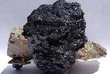
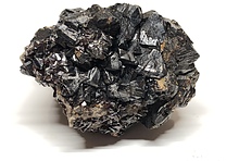
I have seen storm/wave deposits in the limestones of Derbyshire (UK), albeit with clasts of limestone. Could these clasts be from the local area and be related to a high energy event in the Ordovician, which scoured a nearby beach deposit, perhaps a storm? Also if they are dropstones I would expect to see some evidence of impact, which is not apparent in the photographs although I accept that the limestones have been somewhat altered. It is a very interesting geological puzzle!!!!
3rd Nov 2018 16:57 UTCReiner Mielke Expert
3rd Nov 2018 17:08 UTCKeith Wood
In your initial post you were skeptical about the glacial theory. Have you reversed yourself? If so, please explain your newfound belief.
My volcano explanation was to account for a large ice sheet type iceberg, which has different properties in the ocean and a higher likelihood of traveling farther. It was in answer to your concern about getting an iceberg to warmer waters.
I am looking at the pictures in detail using the enlarged views you get when you click on them, and there are many subangular corners to the clasts. Some are rounded, to be sure, but not nearly all.
Bioturbation is likely in a shallow water, poorly bedded, light colored limestone, and may occur around and under dropped clasts. Impact evidence may not be preserved. Notably there is fossil coral in one of the pictures, so bioturbation is a virtual certainty.
3rd Nov 2018 17:12 UTCDoug Schonewald
Another theory might be a tsunami situation that drew beach cobble far enough out to sea to drop them onto the ocean floor sediments.
Just jabbering here.
3rd Nov 2018 17:17 UTCKeith Wood

3rd Nov 2018 17:31 UTCUwe Kolitsch Manager
https://en.wikipedia.org/wiki/Huronian_glaciation
"The Huronian glaciation (or Makganyene glaciation)[1] was a glaciation that extended from 2.4 billion years ago (Gya) to 2.1 Gya, during the Siderian and Rhyacian periods of the Paleoproterozoic era. The Huronian glaciation followed the Great Oxygenation Event (GOE), a time when increased atmospheric oxygen decreased atmospheric methane. The oxygen combined with the methane to form carbon dioxide and water, which do not retain heat as well as methane does"
3rd Nov 2018 17:41 UTCKeith Wood
3rd Nov 2018 17:48 UTCUwe Kolitsch Manager
3rd Nov 2018 18:12 UTCReiner Mielke Expert
3rd Nov 2018 18:15 UTCReiner Mielke Expert
I am skeptical of a glacial origin but I really can't see any other way of explaining it so I am going with what is the simplest and most plausable explanation, unless something better comes along. It really needs some detailed study.
3rd Nov 2018 18:23 UTCUwe Kolitsch Manager
EDIT: Typo.
3rd Nov 2018 18:37 UTCReiner Mielke Expert

3rd Nov 2018 19:03 UTCDon Saathoff Expert
3rd Nov 2018 19:27 UTCPaul Brandes 🌟 Manager
Also something no one has mentioned yet, where were the continents during this period? From what I have seen, the area around Cobalt was the edge of an equatorial ocean during the Middle Ordovician, so all the normal nearshore sedimentary facies should apply here. It also nixes the iceberg/glacial hypothesis.
Edit: Sheesh Don, I think you were looking over my shoulder when I posted...... ;-)
3rd Nov 2018 19:33 UTCReiner Mielke Expert
There was an ice age at the end of the Ordovician and as far as I know North America was still near the equator. So one would have to assume an earlier middle Ordovician ice age with icebergs drifting north from Gondwana towards the equator.
3rd Nov 2018 19:35 UTCReiner Mielke Expert
Say we nix those two, what does that leave us?
3rd Nov 2018 20:51 UTCDon Saathoff Expert
3rd Nov 2018 21:32 UTCKeith Wood
Surely this occurrence has been studied by someone by now. Some library research my end the speculation.
3rd Nov 2018 21:33 UTCPaul Brandes 🌟 Manager
Nathalie has been watching this thread as well. She suggested that maybe we're dealing with a tidal flat situation where the constant movement of water created a winnowing situation that removed smaller sediments, leaving the larger cobbles behind. Usually when one thinks of winnowing however, you're looking at wind removing the finer sediments, but any type of current should be able to accomplish this.
3rd Nov 2018 21:38 UTCKeith Wood
Another thought just came to mind. Was there a karst event at this time? There is one at the end of the Ordovician, but I'm not sure about the middle Ordovician. If there was subaerial exposure there could also have been surficial transport from a local high spot, with all but the larger pieces being eroded away upon inundation. Indicators if that would be terra rosa - red oxidized beds within the formation. It doesn't look like that because the rocks appear to be separate within the limestone. They are matrix supported, but that brings us back around to drop stones.
3rd Nov 2018 21:45 UTCPaul Brandes 🌟 Manager
Isn't interpreting geology from a photo fun?? ;-)
3rd Nov 2018 21:50 UTCTom Tucker
4th Nov 2018 04:02 UTCWayne Corwin

4th Nov 2018 04:50 UTCKevin Conroy Manager
4th Nov 2018 04:51 UTCDoug Daniels
4th Nov 2018 08:09 UTCKevin Hean
-------------------------------------------------------
> No, Paul....inquiring minds stumble along
> together.....and sometimes trip & fall....
Brilliant Don !!


Mindat.org is an outreach project of the Hudson Institute of Mineralogy, a 501(c)(3) not-for-profit organization.
Copyright © mindat.org and the Hudson Institute of Mineralogy 1993-2024, except where stated. Most political location boundaries are © OpenStreetMap contributors. Mindat.org relies on the contributions of thousands of members and supporters. Founded in 2000 by Jolyon Ralph.
Privacy Policy - Terms & Conditions - Contact Us / DMCA issues - Report a bug/vulnerability Current server date and time: May 12, 2024 23:14:19