 | | Report (issue) | | Geological Survey of Canada Miscellaneous Report 48 Ottawa to North Bay and Huntsville, Ontario; Gatineau (Hull)...Natural Resources Canada Ressources naturelles Canada Geological Survey of Canada Miscellaneous Report...COLLECTOR: Ottawa to North Bay and Huntsville, Ontario; Gatineau (Hull) to Waltham and Témiscaming, Quebec...Queen in Right of Canada 2007 Catalogue No. M41-8/48E ISBN 0-660-19556-9 Available in Canada from the Geological...Geological Survey of Canada Bookstore (see inside front cover for details) A copy of this publication is | 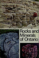 | | Journal (issue) | | Rocks and Minerals of Ontario -- H f ONTARIO DEPARTMENT OF MINES AND NORTHERN AFFAIRS Honourable...and Minerals of Ontario By D. F. HEWITT Chief, Industrial Mineral Section Ontario Department of Mines... (Courtesy The International Nickel Company of Canada, Limited). Centre left: Eurypterus lacustris, an...lagoon about 400 m.y. ago; Welland County. (Courtesy Shell Canada Ltd.). right: left: — — — Centre...are common in Paleozoic limestones throughout Ontario. A large crinoid reef extended along presentday |  | | Report (issue) | | GOVERN YOUR USE OF THIS DOCUMENT Your use of this Ontario Geological Survey document (the “Content”) is governed... copyright is held by the Queen’s Printer for Ontario. It is recommended that reference to the Content... . ; Ontario Geological Survey, ...670-5691 Toll Free: 1-888-415-9845, ext. 5691 (inside Canada, United States) Local: (705) 670-5691 Toll Free:...(inside Canada, United States) Local: (416) 326-2678 Toll Free: 1-800-668-9938 (inside Canada, United |  | | Report (volume) | | 13. British Columbia ores, zoning: Geology in Canada: Hume, G. S., Gunning, H. G., 5. California, southern...United Alaska, evaluation of soil and States and Canada: Levorsen, permafrost conditions: Frost, A. I....Wetmore, hoff, W. S., 3. A., 1. Alberta, plains region: Gravenor, Cuebec, St. Lawrence Lowlands, C. P...quadrangle: Trenton group, Ordovician: Bowen, O. E., Jr. , 5. Clark, T. H., 10. Canada, arctic, physiography...Hagar, L. L., 11. D. J. Rocky Mtn. geosyncline in Canada: Colorado Plateau: Wengerd, Warren; P. S., 4. S |  | | Book | | Scarborough, Ontario Publishing M1P Van Nostrand Reinhold 17 Queen Street 2E7, Canada Australia Pty...sulfides, oxides, and so on. Within each major group the minerals are presented generally according...mineral species or group of species are reported by 1-2 shows the county boundaries and county names. When possible...given in the following notation: Section (Sec.), Township (T.), Range (R.), and Meridian (M.D.M. — Mount...arrangement of sections within a township is illustrated by Figure 1-1. county of occurrence. Map *M. Fleischer’s | | | Book | | Publishing 1410 Birchmount Road Scarborough, Ontario Ml P 2E7, Canada Van Nostrand Reinhold Australia Pty. Ltd...sulfides, oxides, and so on. Within each major group the minerals are presented generally according to...species or group of species are reported by county of occurrence. Map 1-2 shows the county boundaries...boundaries and county names. When possible, locations of mines and other deposits are given in the following notation:...notation: Section (Sec.), Township (T.), Range (R.), and Meridian (M.D.M. Mount Diablo Meridian;S.B.M |  | | Report (volume) | | provinces of Canada are given in Part I.] Anon anonymous papers, placed at the end of Part I Co. county cos....Bureau Can G S Canada, Geological Survey Can :M Br Canada, Mines Branch Can Pari Canada, Parliament Conn...Okla. G S Oklahoma Geological Survey Ont R Com Ontario, Royal Commission. Oreg B :M Oregon Bureau of Geology...Geologic Survey Com-· mission R Ont Nickel Com Royal Ontario Nicker Commission Smiths Inst Smithsonian Institution...folio, S. Dak. (no. 165): Todd, 09 Abitibi region, Ontario: Johuston (J F E), 02; Wilson (W J), 02 Abrasive |  | | Book (edition) | | belongs to a broader group of related minerals, the name adopted for the group is given beneath the formula...editions of this book. Brieny. within each anionic group the minerals arc arranged in order determined by...those of the alkaline earths, etc. Within each group the minerals are tabulated with increasing anion...K(U00As0,.4H�O. Meta-autunite group. M.E. Thompson. B. Ingram. and E.B. G ross ( 1 956) Amer. Min. 4 1 ....p. 579. Abkhazite. syn. of tremolite. Amphibole group. N.E. E fremov ( 1 940 for 1 938) Trans. 111st. |  | | Book (volume) | | (1933) AIME TRANSACTIONS VOLUME AIME TRANSACTIONS MINE PLANT VOLUME 112, MILLING METHODS (1933) (1934)...Utah Hav T. Morris 2: Mountain City Copper Mine, Elko County, Nevada RoBERT R. Coats F. KERR EDWARD...BARNES JOHN G. SIMOS Breccia Structures in the Ontario Mine, Park City District, Utah W. J. GARMOE 54....CHARLES A. ANDERSON Sih. Geology of the Christmas Mine and Vicinity, Banner Mining District, 1163 Ligt...Mining District, Grant County, New Mexico so; The Geology of the Iron King Mine ROBERT M. HERNONT |  | | Report (issue) | | Highlands and the Coastal Plains._______ Central region.................................................._______ . __ _ __ cubic feet per second CGIS ______ ..Canada Geographic Information System cgs _______________.........Continental Off-shore Stratigraphic Test Group cps__._ ____ .............. ____ . ___ .counts per.....___...second SFBRS......_..San Francisco Bay Region Environment and Resources Planning Study SIP.....and Somerset Counties and northeastern Aroostook County, Maine, were investigated by C. C. Cameron (USGS) |  | | Report (volume) | | Highlands and the Coastal Plains._______ Central region.................................................._______ . __ _ __ cubic feet per second CGIS ______ ..Canada Geographic Information System cgs _______________.........Continental Off-shore Stratigraphic Test Group cps__._ ____ .............. ____ . ___ .counts per.....___...second SFBRS......_..San Francisco Bay Region Environment and Resources Planning Study SIP.....and Somerset Counties and northeastern Aroostook County, Maine, were investigated by C. C. Cameron (USGS) |  | | Report (issue) | | RESOURCES OF KERN COUNTY CALIFORNIA CALIFORNIA DIVISION OF MINES AND GEOLOGY COUNTY REPORT 1 i y 1966... Front cover: The exceedingly varied terrain of Kern County is shown by the brown section— from McKittrick...Sierra Nevada and Owens Peak (highest point in the county); on the east (right side) is the sharp descent...Rhodes. MINES AND MINERAL RESOURCES OF KERN COUNTY, CALIFORNIA By BENNIE W. TROXEL, mining geologist...geologist California Division of Mines and Geology County Report f Ferry Building, San Francisco 1962 |  | | Book | | label: Aerial view of the Bingham Canyon copper mine, Kennecott Utah Copper, September 2003. Photo courtesy...Tunnels Au-Ag-Zn-Pb deposit, Montana, United States (mine now exhausted). 1971: Recognized control of ore...high sulfidation epithermal Au-Ag deposit, Chile (mine now exhausted). 1971: First formal recognition...which led to discovery of Perkoa Zn-Pb-Ag deposit (mine under construction). 1990: Recommendation of Cerro...porphyry Cu deposit, Chuquicamata district, Chile (mine under construction). 1978: Recognition of concealed |  | | Book (edition) | | Serpentine Clay Minerals Kaolinite group, Illite group, Smectite group, Vermiculite Prehnite v vii viii...216 224 227 226 244 Framework Silicates Feldspar group Alkali feldspars, Barium feldspars Plagioclase feldspars...Kalsilite, Leucite, Sodalite Group, Cancrinite–Vishnevite, Scapolite Zeolite group Analcime, Natrolite, Phillipsite–...Olivine 4 Zircon 12 Titanite (sphene) 15 Garnet group 18 Vesuvianite (idocrase) 28 Sillimanite 30 Andalusite...36 Staurolite 39 Topaz 44 Chloritoid 47 Epidote group 52 64 Zoisite, Clinozoisite, Epidote, Piemontite |  | | Report (issue) | | COVER PHOTO : Gold nugget from Dukes Creek, White County, weight 5 oz., 12 dwt., approx. 2x. BACK COVER...approx. 1.5x. Lower left - Goethite from Pulaski County, approx. lx. Right - Magnetite crystal face showing...................................... 111 Garnet Group .................................................................................... 118 Axinite Group ......................................................................... 119 iii Page Axinite Group ............................................... |  | | Report (issue) | | commercial borates. Lawsonite, first found in Marin county in 1895, has proved to be of great petrographic...discovered in California came from the gold mining region of the Sierra Nevada, beginning with the nickel...nickel telluride, melonite, found in Calaveras County in 1867. New minerals and new mineral this is being...Garnet is a conspicuous gneiss may be rich in chlorite and mica. constituent of some metamorphic rocks...products. The gem-bearing pegmatites of San Diego County have aroused special masses, interest. Many |  | | Report (volume) | | America-specifically, the United States, the Dominion of Canada and Newfoundland, the Arctic regions north of the...alifornia anada: anadian ' enlmlblatt incinnati county collection colle e lorado congress onue ticut co...occasional papers Okla ... .. . Oklahoma Ont ...... Ontario Oreg ..... Oregon P ......... papers P E I .. ...ewport, Vt. Ariz St Bur M ines, B Arizona Bureau of Mine , Bulletin. Tu on. Ark G S Arkan as, Geological...Report; Bulletin; Brit! h olumb:a Mini ter· o f Mine , Annua l Repot·t. B Sc N at Bulletin de ·c:cnce |  | | Book (edition) | | University > Am Rei [hs ie a LONGMAN LONGMAN GROUP LIMITED London Associated companies, branches and...Lid, Bungay, Suffolk. CONTENTS Part OLIVINE GROUP 1 ORTHO- AND RING SILICATES Olivine, tephroite—knebelite...tephroite—knebelite, monticellite HUMITE GROUP ZIRCON SPHENE GARNET GROUP, VESUVIANITEanyidotrase) SILLIMANITE...Eudialyte; Rosehbuachite ; EPIDOTE GROUP : LAWSONITE, PUMPELLYITE MELILITE GROUP . Rankinite, Tilleyite, Lavenite;...PYROXENE GROUP gite, johannsenite, augite, spodumene, WOLLASTONITE, PYROXMANGITE AMPHIBOLE GROUP 2 CHAIN |  | | Book | | Hydrogenous Quartz Plagioclase Clay minerals Illite Chlorite Kaolinite Smectite SiO2 (Ca,Na)(Al,Si)AlSi2O8...(Table 1). The primary clay minerals are illite, chlorite, kaolinite, and smectite. Relative abundance of...pelagic clay contains 30 – 40% illite, 10– 15% chlorite, 10– 15% quartz, 10 – 15% plagioclase, 10 – 15%...micronodules, is excluded from the factor analysis. A group of elements in Figures 3(a) and (c) is enclosed...area. Silicon is only partly associated with this group due to additional independent input of siliceous |  | | Book | | structure and composition of clay minerals that deter¬ mine properties and, in turn, particular uses. He analyzes...of the same small group of minerals. 1 Applied Clay Mineralogy 2 About 1924 Ross and various colleagues...crystalline particles of one or more members of a small group of minerals that are commonly known as the clay...feinzerteilten Gesteinen, Z. Krist., 60, 55-69 (1924). Ross, C. S., The Mineralogy of Clays, Proc. First Intern... B. Hendricks, Minerals of die Montmorillonite Group: Their Origin and Relation to Soils and Clays, U |  | | Book | | position of 56Fe; and (iv) the abundance peaks in the region past iron at the neutron closed shell positions...mixing caused by the convection, the entire unstable region evolves essentially chemically homogeneously—replenishing...of burning region (central or shell burning) and depleting the fuel elsewhere in that region at the same...burning of this fuel then commences outside that region. Table 1 summarizes the burning stages and their...maximum temperatures that have been reached in each region in the preceding hydrostatic burning stages (Table |
|


