 | | Journal (article/letter/editorial) |
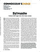
| 23:14 19 October 2014 Vindicator Mine, Cripple Creek, Teller County, Colorado I n terms of sheer volume...years: Kalgoorlie, Western Australia, and Cripple Creek, Colorado. Although on opposite sides of the globe...globe, they have striking similarities in their mining history and mineralogy, but their geology is seemingly...essentially massive gold tellurides associated with coarse native gold. Cripple Creek, on the other hand...is sylvanite. A historically significant Cripple Creek sylvanite specimen has been nominated for this issue’s |
 | | Journal (article/letter/editorial) |
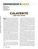
| CALAVERITE Cripple Creek, Colorado W ith the exception of native gold and electrum, the gold telluride calaverite...calaverite may well be the most important gold ore mineral. Its weathering characteristics make identification...Cripple Creek district, essentially subsequent to the development of all other Colorado gold districts...districts. Unlike most gold deposits, weathering of those characterized by relatively abundant telluride minerals...fine-grained and dull, mustard-colored secondary gold that is disbursed as tiny particles as the individual |
 | | Book |
| Bart Cannon 1975 CORD ILLERAN Mercer Island, Washington Lilli liliiiLt' 111? KLi-KlLLLIlrVlIlI Copyright...in 1975 by Cordilleran 18 Holly Hill Drive Mercer Island, Washington 98040 COVER ILLUSTRATION: Amethyst...milky quartz stems. Denny Mountain area of King County. Specimen from the collection of Cary A. Maykut...publications dealing with the various aspects of Washington State's diverse mineral wealth exist, but none..."Minerals of Washington" represents an attempt to begin such a cata logue. "Minerals of Washington" shall |
 | | Journal (article/letter/editorial) |
| specimens, are either inaccessible or are in closed mining districts, or are closed for political reasons...City-D~Lamar Mining Dlstricts / J\. I,' -r-, - L..... ~ rl.. kl \ , 50 I 100 I Miles old mining and...scientific significance. In this index, the better known mining districts that have produced many high-quality...across, on blue thomsonite. Lucky Peak Dam, Ada County; Lanny Ream specimen and photo. Figure 3 (below)...cut near Pinehurst, Adams County; Lanny Ream specimen and photo. Ada County Lucky Peak Dam, on east side |
 | | Report (volume) |
| COMPILED BY SAMUEL SANFORD AND RALPH W. STONE WASHINGTON GOVERNMENT PRINTING OFFICE 1914 USEFUL MINERALS...it helpful to refer to Survey Bulletin 507, "The mining districts of the western United States," and to...abundant, it may have been completely exhausted by mining or quarrying. Deposits of minerals of wide distribution...because they occur in sufficient quantity to warrant mining for their usual products but because they furnish...North Carolina.. .Dr. Joseph Hyde Pratt, Chapel Hill. North Dakota... .Dr. A. G. Leonard, Grand Forks |
 | | Report (volume) |
| AND SAMUEL SANFORD A revision of Bulletin 585 WASHINGTON GOVERNMENT FEINTING OFFICE 1917 CONTENTS........................................... 102 District of Columbia ................................................................................ Washington................................................to refer to Geological Survey Bulletin 507, "The mining districts of the western United States," and to...abundant it may have been completely exhausted by mining or quarrying. Deposits of minerals that are widely |
 | | Report (Issue volume) |
| State of Washington ARTHUR B. LANGLIE, Governor Department of Conservation and Development W. A. GALBRAITH...GLOVER, Supervisor Bulletin No. 37 INVENTORY OF WASHINGTON MINERALS PART II METALLIC MINERALS By MARSHALL...Volume 2 - MAPS STATE PRINTING PLANT. OLYMPIA, WASHINGTON lll!UI For sale by Department of Conservation...volumes-text and maps) $4.50. INVENTORY OF WASHINGTON MINERALS PART II METALLIC MINERALS Volume 1...Bulletin 33, "Nonmetallic Mineral Resources of Washington," published in 1936. Since then the catalogue |
 | | Report (issue) |
| evidence analysis in northeast Washington—4. Mineral industry activity in Washington, 1985-1997. by D.E. Boleneus1...Report 00-014 A Prepared in cooperation with Washington Department of Natural Resources, Division of...1 2 Spokane, Washington Washington Department of Natural Resources, Spokane, Washington Contents Abstract...Appendix II--Table of mineral industry activity in Washington, 1985 to 1997..................................showing location of 339 exploration or mining sites in Washington. ................................... |
| | Report (issue) |
| evidence analysis in northeast Washington—4. Mineral industry activity in Washington, 1985-1997. by D.E. Boleneus1...Report 00-014 A Prepared in cooperation with Washington Department of Natural Resources, Division of...1 2 Spokane, Washington Washington Department of Natural Resources, Spokane, Washington Contents Abstract...Appendix II--Table of mineral industry activity in Washington, 1985 to 1997..................................showing location of 339 exploration or mining sites in Washington. ................................... |
 | | Report (volume) |
| DEPOSITS OF THE MANHATTAN DISTRICT NEVADA BY HENRY G. FERGUSON WASHINGTON GOVERNMENT PRINTING OFFICE...SUPERINTENDENT OF DOCUMENTS GOVERNMENT PRINTING OFFICE WASHINGTON, D. C. AT 50 CENTS PER COPY CONTENTS. J/age...) rocks___________r_________________________ Gold Hill formation______________1 _____________ Ordovician... 98 Arsenical minerals______________________ 99 Gold of the arsenical ores____________'. _________. 105...Tertiary rocks________ _____ __ 114 Ores in the Gold Hill formation_________________ 114 Limestone ores |
 | | Report (issue) |
| Principal Gold-Producing Districts of the United States By A. H. KOSCHMANN and M. H. BERGENDAHL GEOLOGICAL...description of the geology, mining history, and production of the major gold-mining districts in 21 States...States UNITED STATES GOVERNMENT PRINTING OFFICE, WASHINGTON 1968 UNITED STATES DEPARTMENT OF THE INTERIOR...relations ---------------------------History of gold mining and trends in production_ J\labama ---------...--------------Cleburne County ----------~----------------- Tallapoosa County --------------------------Alaska |
 | | Book |
| stumble over a valuable nugget and stake your own mining claim? Indeed it to is, and author book Jay...prospecting, he points out, is in abandoned mining districts, where valuable mineral ores are present...commercial ores and secondary minerals by state, county, township, and geologic range. For easy identification...RANSOM 1875-1948 An to the Eastern '‘Schoolmarm” Mining Camps of the Old West I I a s I \ h K... CONTENTS Preface ix PART I 1 Introduction to Mining and Mineralogy 2 Preparation for Mineral Collecting |
 | | Book (edition) |
| Chapters on the Coeur d'Alene Mining District, the Blackbird Mining District, and the Sawtooth Mountains...Chapters on the Coeur d'Alene Mining District and the Blackbird Mining District, and to Ben Sheppard for reviewing...reviewing the chapter on the Blackbird Mining District. Those who contributed photographs, or specimens...or a vein of massive pyrite and chalcopyrite in a mine, so references such as these were not included....for a particular mineral may be a certain mine, but that mine may now have a new name, or may now be a |
 | | Report (issue) |
| . . . . . . . . . . . . . . . . . 1 Chapter I. Mining Districts of Counties and the State of Utah. .... . . . . . . . . . . . . . . . . . . . . . . 1 County Listings. . . . . . . . . . . . . . . . . . . ... . . . . . . . . . . . . . . . . 1 Chapter II. Mining Districts of Utah . . . . . . . . . . . . . . .... . . . . . . . 4 Mineral Localities Listed by County . . . . . . . . . . . . . . . . . . . . . . . .... . . . . . . . . . . . . . . . . . . 7 Beaver County . . . . . . . . . . . . . . . . . . . . . . . |
 | | Report (issue) |
| WASHINGTON . GEOLOGICAL SURVEY. HENRY LANDES, STA TE GEOLOGIST. VOLUME I. ANNUAL REPORT FOR 1901... . . . . . . . . . . . . . . . . . . . Stevens County..................... ... . . . . . . . . . . ....Northport District. .... . ........ . .. ... . . . .. . . . ............ . Myers Fa.Us District . . . .... . . . . . . . . . . . . . . . . Fla.t C1·eek District . . . . . . . . . . . . . . . . . . . . . . .... . . . . . . . . . . . . . . . . . Colville District . . . . . . . . . . . . . . . . . . . . . . . . |
 | | Book (volume) |
| .........................................411 Washington ...............................................rights, so remember you were told. If in doubt, a county map will tell you who the legal owner is. Good...to the California gold rush of 1849, this portion of Alabama experienced its own gold rush, largely unprofitable...unprofitable, although gold may still be panned in the regional streams. Most of the rest of the state...gemmy qualities for cutting and polishing. AUTAUGA COUNTY PRATTVILLE, N. 6 mi., and just E of the Birmingham |
 | | Book (volume) |
| .........................................413 Washington ...............................................rights, so remember you were told. If in doubt, a county map will tell you who the legal owner is. Good...to the California gold rush of 1849, this portion of Alabama experienced its own gold rush, largely unprofitable...unprofitable, although gold may still be panned in the regional streams. Most of the rest of the state...gemmy qualities for cutting and polishing. AUTAUGA COUNTY PRATTVILLE, N. 6 mi., and just E of the Birmingham |
 | | Report (issue) |
| GEOLOGY AND EARTH RESOURCES DIVISION OLYMPIA, WASHiNGTON 98504 METAL MINES OF WASHINGTONPRELIMINARY REPORT...DERKEY NANCY L. JOSEPH and RAYMOND LASMANIS WASHINGTON DIVISION OF GEOLOGY AND EARTH RESOURCES OPEN...Earth Resources standards and nomenclature. 1, WASHINGTON STATE DEPARTMENT OF Natural Resources Brian...DERKEY NANCY L. JOSEPH and RAYMOND LASMANIS WASHINGTON DIVISION OF GEOLOGY AND EARTH RESOURCES OPEN...CONTENTS Page Page County and site name Kelly Camp Kettle Key East Knob Hill Lancaster Last Chance |
 | | Book (volume) |
| .........................................506 Washington ..............................................................548 Table of Maps Page Alabama County Map ...................................................................................4 Alaska County and Stream Map ..................................Co. Mining Districts ............................................................22 Arizona County Map.........................23 Arizona – Cochise Co. Mining Districts .................................... |
 | | Report (issue) |
| LODE MINING IN THE QUARTZBURG AND GRIMES PASS PORPHYRY BELT, BOISE BASIN, IDAHO. By E. L. JONES, Jr....considered advisable because of the recent important mining developments along this belt and because of frequent...the Boise Basin as a whole. ACKNOWLEDGMENTS. The mining men of the Boise Basin extended many courtesies...Boise Basin are shown by mine symbols and numbers. i Lindgren, Waldemar, The mining districts of the Idaho...LOCATION. The Boise Basin, which lies in Boise County, Idaho, is an intermontane depression near the |
 | | Report (issue) |
| (919) 733-2423. Jeffrey C. Reid Chief Geologist GOLD NORTH CAROLINA IN . by P. Albert Carpenter III...Arrington Mine Carolina Slate 'Belt 25 27 2 Gold Hill Mine 28 Placer ~lXlsits 2 Howie Mine 29 !me...me Del"'sits 2 Reed Mine 31 S<>urces and Prtxluction 5 Silver Hill Mine 31 World Sources and...Production 5 Phoenix Mine 33 United States Sources and Production 5 Hoover Hill Mine 33 Mineralogy and...Gardner Hill Mine 33 Uses 7 Fentress Mine 34 Prices 8 Mining Methc:xis 9 Rudisil Mine 34 OJ:>en-Pit |
 | | Book (volume) |
| Plains state varies from nearly level farmland to hill ridges, increasing steadily in elev. From 1,000’...instance, a single Spodumene crystal from the Etta Mine near Keystone on the east side of the Mount Rushmore...The commercial production of minerals, principally Gold, Silver, Copper, Iron, Lead, Manganese and Zinc...beds, excavations, etc.Selenite roses. BRULE COUNTY AREA: in the Oacoma zone of the Pierre Fm. On Elm...gray Barite rosette up to 5 or 6 inches. CAMPBELL COUNTY MOUND CITY, W to the Missouri R., regional hillsides |
 | | Report (issue) |
| CHARGE UNITED STATES (JOVERNMENT PRINTING OFFICE WASHINGTON : 1934 . . * " «* ;;~ ... "v.:.:.. CONTENTS...designate the papers for advance publication] (A) Some mining districts of eastern Oregon, by James Gilluly,...deposits of the Takilma-Waldo district, Oreg., including the Blue Creek district, by Philip J. Shenon________...ILLUSTRATIONS PLATE 1. Index map showing location of mining districts in eastern Oregon. 8 2. Topographic and...and geologic map of the Mormon Basin mining district, Baker and Malheur Counties, Oreg _ 32 3. Geologic |
 | | Report (issue) |
| Selected Mining Districts of Utah by Carl L. Ege Headframe of Centennial Eureka mine, Tintic mining district...Employment Opportunity Commission, 1801 L. Street, NW, Washington DC 20507. Printed on recycled paper 1/05 CONTENTS... . . . . . . . . . . . . . . .1 What is a mining district? . . . . . . . . . . . . . . . . . . . . .... . . . . . . . . . . . . . . . . . .1 How many mining districts are there in Utah and are they still...mineral resources are mined in Utah’s most productive mining districts . . . . . . . . . . . . . . . . . . |
 | | Journal (article/letter/editorial) |
| to collectors. Many specimens were produced when mining districts were active in the late 1800s through...districts mentioned below, most historically active mining districts in the state have been inactive for decades...exploration activity occurs on an irregular basis. Beaver County MINERAL COLLECTING IN THE STATE of Utah has undergone...article does not give permis- Lincoln district: The Creole mine, located at the south end of the Mineral...and Milford, has BOX ELDER x Lun'n TOOELE x Gold Hill Topaz Mtn. x NAB X Philip Richardson is a |


