 | | Report (issue) |
| MINERAL OCCURRENCES IN THE SOLOMON QUADRANGLE, ALASKA, SUPPLEMENT TO OPEN-FILE REPORT 78-181 PART A ...mineral occurrences in the Solomon quadrangle, Alaska (Gobb, E. H., 1978, Summary of references to mineral...construction materials) in the Solomon quadrangle, Alaska: U.S. Geological Survey Open-file Report 78-181...the report or map. Abbreviations used are: AOF Alaska Division of Geological and Geophysical Surveys...Mines Bulletin G U.S. Geological Survey Circular GC Alaska Division of Geological and Geophysical Surveys |
 | | Report (volume) |
| Placer Deposits of Alaska By EDWARD H. COBB GEOLOGICAL SURVEY BULLETIN 1374 An inventory of the...the placer mines and prospects of Alaska, their history and geologic setting UNITED STATES GOVERNMENT...and method of presentation __ Definitions _-____ Alaska Peninsula region Aleutian Islands region ________...Anchorage district _ Redoubt district ___-_ _ Valdez Creek district __ _ Willow Creek district Yentna district...district _____________ _ ____ __________ _____ Copper River region __ _ _ _ Chistochina district Nelchina |
 | | Journal (article/letter/editorial) |
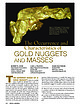
| Figure 1. Gold nugget, 7.67 troy ounces, Fairbanks mining region, Alaska, USA. Donated in 1977 by Arthur...Arthur Sexaur. University of Alaska Museum of the North specimen (No. AK 1271-G- 3), Robert Cook photo...photo. The Occurrence and Characteristics of GOLD NUGGETS AND MASSES ROBERT B. COOK Department of Geosciences...com HE COMMON IMAGE OF A GOLD NUGGET is that of a rounded piece of gold just plucked from a pan or...consistent with even the most generic definitions of gold nugget found in most general reference works and |
 | | Report (issue) |
| IN THE NORTHEASTERN PART OF THE SEWARD PENINSULA ALASKA, 1945-47 and 1951 By H. R. Gault, P. L. Killeen...THE NORTHEASTERN PART OF THE SEWARD PENINSULA, ALASKA, 1945-47 and 1951 By H. R. Gault, P. L. Killeen... CONTENTS Page Page A. --Sweepstakes Creek area, 1945., by H. R. Gault, R. F. Black,and J. B. Lyons... . . . . • • • • . . . . . . . . . • . 3 Placer-gold deposits................. 3 Radioactive mineral...vicinity . . . . . . . . . 7 CHAPTER B. --Candle Creek area, 1945, by H. R. Gault Abstract. ............•.• |
 | | Report (issue) |
| HAKEINGTON. SUMMARY OF MINING OPERATIONS. t A resume of the history of tin mining in Alaska up to 1914 has been...Anikovik River in 1914 for the recovery of both gold and cassiterite but were operated only during that...of the Nome district." Hess mentions 3 that Goldbottom Creek in the Nome district, Fred Gulch, north...Mountain in 1902 and on Lost Eiver the following year. Mining operations have been carried on at both localities...p. 157, 1906. 353 354 MINERAL RESOURCES OF ALASKA, 1917. River assessment work has been done annually |
 | | Report (issue) |
| NOBTHEKN KOYUKUK VALLEY, ALASKA BY ROBERT MARSHALL Mineral resources of Alaska, 1931 (Pages 247-256) ...conducting investigations of the mineral resources of Alaska, about one half of the Territory has been surveyed...observations regarding the physical features of this district and has coordinated them with the facts hitherto...publication. 11011 34 1 247 248 MINERAL KESOUECES OF ALASKA, 1931 INTRODUCTION The Koyukuk River, which is...the country tributary to the Koyukuk embraces an area averaging about 110 miles north and south and about |
 | | Report (volume) |
| D. WALCOTT, DIRECTOR GEOGRAPHIC DICTIONARY OF ALASKA BY MARCUS BAKER SEC03ST3D EIDITIOIT PKEPAHE...established; old mining fields have been developed and new ones discovered and prospected; mining camps of that...PEEFACE. the same as names met at every turn in the mining regions of the West. The first edition of this-...Survey. CHARLES S. SLOANE, Secretary, Bureau of the Census. Maj. WILLIAM D. BEACH, General Staff, War Department...years ago determined to prepare a dictionary of Alaska geographic names and appointed a committee which |
 | | Report (issue) |
| SELECTED CRITICAL AND STRATEGIC MINERAL COMMODITIES IN ALASKA Compiled by Edward H. Cobb and Dennis R. St. Aubin...the series. Abbreviations used are: AOF, State of Alaska Division of Geological and Geophysical Surveys...Clautice, 1978 (BMOF 66-78), p. 9, 11, 14 (loc. 9) [Cr] Gold Bench: Cobb, 1978b (OF 78-94), p. 10-11 [Hg, Sn]...Creek: Idem, p. All [Sn] Goodwin Gulch: Idem, p. All [Sn] Percy Gulch: Idem, p. A16 [Sn] Village Creek:...Cobb, 1981c (OF 81-364A), p. A3-A4 [Sn] Lost River area: Idem, p. A14-A15 [Mn, Sn] Rapid River: Idem, p |
 | | Report (issue) |
| IN THE MOOSE CREEK AREA, ALASKA BY GERALD A. WARING Mineral resources of Alaska, 1932 (Pages 155-166)...ILLUSTRATIONS Page PLATE 6. Map of the Moose Creek area, showing geology, coal mines, and drill holes______...Moose Creek area correlated on'conglomerate beds and with the coal seams of the Premier mine._________...Creek area.___________ FIGURE 6. Map of part of Alaska showing location of the Moose Creek area._._____...COAL IN THE MOOSE CREEK AREA By GERALD A. WARING ABSTRACT The Moose Creek area is in the western part |
 | | Report (issue) |
| Mendenhall, Director Bulletin 857 MINERAL RESOURCES OF ALASKA REPORT ON PROGRESS OF INVESTIGATIONS IN 1932 BY...WASHINGTON : 1934 CONTENTS Page Mineral industry of Alaska in 1932, by P. S. Smith____________ Selected list...Alaska________ Past placer-gold production from Alaska, by P. S. Smith___ The Curry district, by Ralph Tuck_____________________...Tuck_____________________ Notes on the geology of the Alaska Peninsula and Aleutian Islands, by S. R. Capps..._____ Core drilling for coal in the Moose Creek area, by G. A. Waring____ Index_____________ ___ _ __________________ |
 | | Report (issue) |
| RUBY-KUSKOKWIM REGION ALASKA BY J. B. MERTIE, Jr. Mineral resources of Alaska, 1933 (Pages 115-245)...________-___ Ruby district._______-___-____--._-_--.-__---_--__._______ Ruby area.______-_____--_---...__--_-___--__-_-___-_________ 145 Long Creek and Bear Gulch..____________________ Fifth of July and Short...and tributaries.________________________ Poorman area._______________________________________ Poorman...geology Continued. Placers Continued. Cripple district.-_--______________.___-_._._._..__._.___._ Cripple |
 | | Report (issue) |
| INDUSTRY OF ALASKA IN 1931 AND ADMINISTRATIVE REPORT BY PHILIP S. SMITH Mineral resources of Alaska, 1931...separate chapters. CONTENTS Mineral industry of Alaska in 1931---_---------------__------------- Page..._____________________________________ Gold lodes.------------------____.__.-___________ Gold placers.-------..-----...districts._______-______ __-_-_.______ Southeastern Alaska.-.-.-.____________________ Copper River region...Peninsula.__-__-_---_-_-__--__--__-___ Northwestern Alaska._-____-_____--_______-__Dredging.._____-______ |
 | | Report (volume) |
| of Metallic and Nonmetallic Mineral Deposits of Alaska Compiled From Published Reports of Federal and...of metallic and nonmetallic mineral deposits of Alaska, compiled from published reports of Federal and...resources Indexes. 2. Mines' and mineral resources Alaska. I. Kachadoorian, Reuben, 1921-, rjoint author...quadrangle________________________________________ 209 Nome quadrangle________________________________________...investigations__________________---_-_----____-__ Territory of Alaska Department of Mines pamphlets____________--_ 360 |
 | | Report (issue) |
| GEOLOGICAL SURVEY 5 PLACER DEPOSIT MAP OF CENTRAL ALASKA /) Compiled by Edward H. Cobb Open-file report...Survey standards rs Placer deposit map of central Alaska Compiled by Edward H. Cobb Introduction This map...depicts the location of placer deposits in central Alaska and uses contrasting symbols to show three categories...incomplete, and in many instances were stated for entire mining districts or even larger statistical units. The...discussion with colleagues familiar with specific mining camps. Most of the inaccuracies in assigning deposits |
 | | Book (edition) |
| TOWNS & MINING CAMP SITES . ol % \ AND WHERE THEY FOUND IT A GUIDE TO GHOST TOWNS & MINING CAMP...Jeannie Martin Men and women have hunted and prized gold more than any other metal through thousands of years... The dramatic and often surprising searches for gold and the life in the picturesque towns that grew...Towns and mining camp sites are becoming increasingly popular. Fact reads like fiction in Gold! And Where...and little-known mining booms. This book is particularly valuable because it covers gold discoveries throughout |
 | | Book |
| THE GOLD CREEKS I NC E . OLEY CR 1 KLO NDIKE CITY M l! GRANO FOR 0 1t Bo1,,617 -1N z o~,,4 OE...3· 'A Grubstake for God's Sake!' 4· K londike! Alaska! Yukon ! 5. Uneasy lies the Head 6. Klondike or... ILLUSTRATIONS End-paper maps: The Trail of '98 The Gold Creeks Plates: Facing page: The Excelsior and...incline near the Chilkoot summit 25 Washing for gold 56 Chilkoot Pass, 1898 57 Klondike City and...uo the idea of writing a book about the Klondike gold rush which 1-\e had been meaning to get at for nearly |
 | | Report (issue) |
| mines, prospects and mineral occurrences throughout Alaska. Distribution of mineral occurrences in the Solomon...Solomon l:250,000-scale quadrangle, western Alaska This and related reports are accessible through the...Travis Hudson Sequim, WA Location of map are* in Alaska This report is preliminary and has not been reviewed...the U.S. Government. OPEN-FILE REPORT 99-573 Alaska Resource Data File SO001 Site name(s): Cape Darby...pluton. Alteration: Age of mineralization: Page 2 Alaska Resource Data File SO001 Mid-Cretaceous?; K/Ar |
 | | Report (issue) |
| MATERIALS) IN THE KANTISHNA RIVER AND RUBY QUADRANGLES, ALASKA By Edward H. Cobb and Robert M. Chapman Open-file...theKantishna River and Ruby quadrangles ' in central Alaska. All references to reports of the Geological Survey...Bureau of Mines, and to most reports of the State of Alaska Division of Geological and Geophysical Surveys...Mines and the biennial and annual reports of the Alaska Division of Geological and Geophysical Surveys...RE is used for all rareearth elements); the mining district (Ransome and Kerns, 1954 (1C 7679)) in which |
 | | Report (issue) |
| DIRECTOR ECONOMIC GEOLOGY OF THE BINGHAM MINING DISTRICT, UTAH By JOHN MASON BODTWELL WITH A SECTION...DIRECTOR ECONOMIC GEOLOGY OF THE BINGHAM MINING ^DISTRICT, UTAH By JOHN MASON BOUTWELL WITH A SECTION...-.......---.-----------...----...- -. 20 21 24 Area and age of the intrusives. .......:.................. 25 PART I. AREAL GEOLOGY OF THE BINGHAM DISTRICT, BY ARTHUR KEITH. Geography...............--.... PART II. ECONOMIC GEOLOGY OF THE BINGHAM MINING DISTRICT, UTAH, HY JOHN MASON BOUTWELL. Introduction |
 | | Report (issue) |
| Principal Gold-Producing Districts of the United States By A. H. KOSCHMANN and M. H. BERGENDAHL GEOLOGICAL...description of the geology, mining history, and production of the major gold-mining districts in 21 States...relations ---------------------------History of gold mining and trends in production_ J\labama ---------...- Tallapoosa County --------------------------Alaska -----------------------------------------Cook Inlet-Susitna...J\la:ska region ------------------Southwestern Alaska region ------------------1'ukon region ------- |
 | | Report (volume) |
| SURVEY GEORGE OTIS SMITH, DIRECTOR BuiiIiETIN 574 MINING DISTRICTS OF THE DILLON QUADRANGLE, MONTANA AND..................................... Location and area ...........;.................................................................................... Mining districts...................................................................................... Mining development. ...................... .. - - ' -..................................... 18 Placer mining....... ~...................................... |
 | | Journal (volume) |
| visitors, interested to see how rock have the yellow gold extracted therefrom, and how cleverly the little...Exposition.* G. Dodd, the superintendent of the mining departof the Union Iron Works, it will readily...Mines of Salt Spring Valley, Cal. • Between Bear mountain and Gopher Ridge, in Cala- ; veras county...val- Through this trough-like depression extends a gold belt reaching a distance of fifteen miles from the...of Copperopolis northwestward to Valley Spring. Bear mountain and Gopher Ridge are ley. composed largel |
 | | Report (issue) |
| SURVEY The association of Middle Cambrian rocks and gold deposits in southwest Montana by Edward T. Ruppel............................... Gold-bearing quartz veins and related gold deposits in the western Tobacco...Mountains....................... Interpretation of gold deposits in the western Tobacco Root Mountains as...hypothesis..................................... Similar gold deposits and related placers elsewhere in southwest...Mayflower mine.............................................. Virginia City and the Alder Gulch placers |
 | | Report (issue) |
| MINERAL OCCURRENCES IN THE SOLOMON QUADRANGLE, ALASKA, SUPPLEMENT TO OPEN-FILE REPORT 78-181 PART B ~...mineral occurrences in the Solomon quadrangle, Alaska (Cobb, E. H., 1978, Summary of references to mineral...construction materials) in the Solomon quadrangle, Alaska: U.S. Geological Survey Open-file Report 78-181...the report or map. Abbreviations used are: AOF Alaska Division of Geological and Geophysical Surveys...Mines Bulletin C U.S. Geological Survey Circular GC Alaska Division of Geological and Geophysical Surveys |
 | | Report (issue) |
| SELECTED NONMETALLI FERGUS MINERAL DEPOSITS IN CENTRAL ALASKA TO ACCOMPANY OPEN-FILE MAP 77-1680 This report...SELECTED NONMETALLI FERGUS MINERAL DEPOSITS IN CENTRAL ALASKA (To accompany Open-file Map 77-168D) By G. Donald...accompanying map have been prepared under the Regional Alaska Mineral Resource Appraisal Program (RAMRAP) to...nonmetal1iferous deposits, both lode and placer, in central Alaska. Specifically excluded are the fossil fuels (petroleum...government and private sectors, discussions with mine operators, and the firsthand knowledge of the authors |


