 | | Report (issue) |
| MINING IN NORTHWESTERN ALASKA. By S. H. CATHCART. INTRODUCTION. The season of 1918 was the most unfavorable...unfavorable for placer mining that the Seward Peninsula has experienced. Several factors combine to account...Solomon Eiver district frost as deep as 10 feet was reported, and in the Council City district frost was... fuel, and foodstuffs was felt severely in all mining operations. It is estimated that the cost of production...arrival of the first boat until June 25. Ditch and creek waters froze October 3, and the first 6 inches of |
 | | Report (issue) |
| OTHER MAFIC-ULTRAMAFIC METALLOGENIC PROVINCES IN ALASKA (WEST OF THE 141st MERIDIAN) By Jeffrey Y. Foley1...Mines, Alaska Field Operations Center. Present address: 3301 C Street, Suite 525, Anchorage, Alaska, 99503-3935...western Alaska Western Brooks Range metallogenic province Seward Peninsula and western Yukon-Koyukuk Basin...province Northern Yukon-Koyukuk Basin margin metallogenic province Southeastern Yukon-Koyukuk Basin margin...margin and Ruby Geanticline metallogenic province Yukon-Tanana Uplands Livengood-Tofty metallogenic province |
 | | Report (issue) |
| INTRODUCTION. Eleven parties were engaged during 1917 in Alaska surveys and investigations. The length of the field...results of which can not be expressed in terms of area. About 1,050 square miles was covered by reconnaissance...Service, stream gaging was continued in southeastern Alaska. In 1917 the entrance of the United States into...the construction of the Government railroad in Alaska gave more than ordinary importance to the collection...geographically, two parties worked in southeastern Alaska, two on Prince William Sound, and one in the region |
 | | Report (volume) |
| Placer Deposits of Alaska By EDWARD H. COBB GEOLOGICAL SURVEY BULLETIN 1374 An inventory of the...the placer mines and prospects of Alaska, their history and geologic setting UNITED STATES GOVERNMENT...and method of presentation __ Definitions _-____ Alaska Peninsula region Aleutian Islands region ________...Anchorage district _ Redoubt district ___-_ _ Valdez Creek district __ _ Willow Creek district Yentna district...district _____________ _ ____ __________ _____ Copper River region __ _ _ _ Chistochina district Nelchina |
 | | Report (issue) |
| RADIOACTIVE DEPOSITS IN THE MANLEY HOT SPRINGS-RAMPART DISTRICT EAST-CENTRAL ALASKA, 1948 This report concerns...RADIOACTIVE DEPOSITS IN THE MANLEY HOT SPRINGS-RAMPART DISTRICT, EAST-CENTRAL ALASKA, 1948 By Robert M. Moxham...RADIOACTIVE DEPOSITS IN THE MANLEY HOT SPRINGS-RAMPART DISTRICT, EAST-CENTRAL ALASKA, 1948 By Robert M. Moxham...investigated...................... -3 Hot Springs Dome area............. 3 Hot Springs Dome leadsilver deposit.....Areas investigated Continued Hot Springs Dome area Cont. Granite at Hot Springs Dome.... Tofty tin belt. |
 | | Report (issue) |
| Tofty Tin Belt Manley Hot Springs District, Alaska By RUSSELL G. WAYLAND MINERAL GEOLOGICAL RESOURCES...RESOURCES SURVEY OF ALASKA BULLETIN 1058-I Occurrence and exploitation of r;assiterite-bearing gold..._______________ ------____ 369 370 374 Cache Creek---------------------------------------------Dalton...----- _______________________ -------______ Sullivan Creek-------------------------------------------Tofty...Gulch______________________________________________ Deep Creek----------------------------------------------VVoodchopper |
 | | Report (issue) |
| MINERAL DEPOSITS OF THE RAMPART AND HOT SPRINGS DISTRICTS ALASKA BY J. B. MERTIE, JR. BY A. E. WATERS...WATERS, JR. Mineral resources of Alaska. 1931 (Pages 163-246) UNITED STATES GOVERNMENT PRINTING OFFICE... CONTENTS Mineral deposits of the Rampart and Hot Springs districts, by J. B. Mertie, Jr.______-------...____________-___--_____---__________-____163 Location of area._________--___-----_----___-___---_-_-_-163 Early...district_-_____----_--_-_---_-______________-_ 174 Minook Creek._-______-_-____----_.____________-_ 174 Hunter |
 | | Report (issue) |
| SELECTED NONMETALLI FERGUS MINERAL DEPOSITS IN CENTRAL ALASKA TO ACCOMPANY OPEN-FILE MAP 77-1680 This report...SELECTED NONMETALLI FERGUS MINERAL DEPOSITS IN CENTRAL ALASKA (To accompany Open-file Map 77-168D) By G. Donald...accompanying map have been prepared under the Regional Alaska Mineral Resource Appraisal Program (RAMRAP) to...nonmetal1iferous deposits, both lode and placer, in central Alaska. Specifically excluded are the fossil fuels (petroleum...government and private sectors, discussions with mine operators, and the firsthand knowledge of the authors |
 | | Report (issue) |
| MINERAL RESOURCES OF ALASKA, 1918. By G. C. MAIM-IN AXD OTHERS. PREFACE. By G. C. MARTIX. This volume...of annual bulletins l treating of the mining industry of Alaska and summarizing the results achieved during...particular district should therefore procure a copy of the complete report on that district as soon as-it...others of the series, contains an account of the mining industry, including statistics of mineral production...shall serve as" convenient reference works on the mining industry for the years which they cover. It is |
 | | Report (issue) |
| HAKEINGTON. SUMMARY OF MINING OPERATIONS. t A resume of the history of tin mining in Alaska up to 1914 has been...his report. Stream tin was first found on Buhner Creek, a tributary of Anikovik River, in 1900, and there...since 1902. In 1911 a dredge was installed on Buck Creek which has been in operation each season since. Two...following season. A second dredge was installed on Buck Creek in 1915 and has worked each summer since that date...hull in 1916 and installed on a dredge on Swanson Creek, a tributary of Agiapuk Eiver. The hull was carried |
 | | Report (issue) |
| MINERAL RESOURCES OF ALASKA, 1916. By ALFRED H. BROOKS and others. PREFACE. By ALFRED H. BROOKS. This...of annual bulletins 1 treating of the mining industry of Alaska and summarizing the results achieved during...particular district are therefore urged to procure a copy of the complete report on that district as soon...the year and summaries of the condition of the mining industry, including statistics of mineral production...the mining industry for the years which they cover. Lack of funds prevents a visit to every mining district |
 | | Report (volume) |
| OTIS SMITH, DIKECTOB 4:4:2 MINERAL RESOURCES OF ALASKA REPORT ON PROGRESS OF INVESTIGATIONS IN 1909 ...The mining industry in 1909, by Alfred H. Brooks........................... Page. 5 20 Alaska coal...Charles A. Davis................ 101 Mining in southeastern Alaska, by Adolph Knopf......................reconnaissance in southeastern Alaska, by John C. Hoyt. Mining in the Chitina district, by Fred H. Moffit............................... Mining and prospecting on Prince William Sound, in 1909, by U. S. Grant.... |
 | | Report (volume) |
| Director Bulletin 933 4 * MINERAL RESOURCES OF ALASKA REPORT ON PROGRESS OF INVESTIGATIONS IN PAPERS...industry of Alaska in 1940, by Philip S. Smith (B) Geology of the Nutzotin Mountains, Alaska .: _ __ (C)...at the Independence mine, Alaska : _ (D) Reconnaissance of Porcupine Valley, Alaska ) . 1 103 201 219...PLATE 1. Map of Alaska, showing areas covered by selected available reports and maps of Alaska _ __ _ 1 In...sedimentary members of the Permian rocks on Baultoff Creek, about 4 miles southeast of the pass to East Fo |
 | | Report (issue) |
| production and reserve grades source, fineness, mining methods, other economic commodities and general...is useful for analyzing the roles genetics and mining method have on placer grades and volumes. Deposits...varies from area to area. Individual workings are not included if deposit or district data are presented...gold production for the central Brooks Range, Alaska exceeded the total as reported by deposit. -2-...variety of methods and areas in Alaska, including sluice and drift mining. 5. Some volumes were estimated |
 | | Report (issue) |
| Director. Bulletin 868 MINERAL RESOURCES OF ALASKA REPORT ON PROGRESS OF INVESTIGATIONS IN 1934 BY...separate publication] Page (A) Mineral industry of Alaska in 1934, by P. S. Smith (published Jan. 25, 1936)_______...3. 4. Topographic map of Kodiak and vicinity, Alaska. ___________ Geologic map of Kodiak and vicini...upper Ugak Bay_ _______________________ 7. Kodiak, Alaska, in August 1912, several months after the explosion...sketch map of the Kaiyuh Hills and part of the Ruby district- ______________________________________________ |
 | | Report (issue) |
| Mendenhall, Director Bulletin 857 MINERAL RESOURCES OF ALASKA REPORT ON PROGRESS OF INVESTIGATIONS IN 1932 BY...WASHINGTON : 1934 CONTENTS Page Mineral industry of Alaska in 1932, by P. S. Smith____________ Selected list...placer-gold production from Alaska, by P. S. Smith___ The Curry district, by Ralph Tuck_____________________...Tuck_____________________ Notes on the geology of the Alaska Peninsula and Aleutian Islands, by S. R. Capps__________...________ Core drilling for coal in the Moose Creek area, by G. A. Waring____ Index_____________ ___ _ |
 | | Report (volume) |
| Mcndenhall, Director Bulletin 926 MINERAL RESOURCES OF ALASKA REPORT ON PROGRESS OF INVESTIGATIONS IN 1939 PAPERS...industry of Alaska in 1939, by Philip S. Smith_____ .._._. (B) Geology of the Gerstle River district, Alaska...molybdenum minerals in Alaska, by Philip S. Smith.._ (D) Geology of the Portage Pass area, Alaska, by F. F. Barnes...107 161 211 ILLUSTRATIONS PLATE Page 1. Map of Alaska, showing areas covered by selected available reports...Topographic reconnaissance map of the Gerstle River district, Alaska _ _______________ _____l_______-_-__________ |
 | | Report (volume) |
| Mendenhall, Director Bulletin 910 MINERAL RESOURCES OF ALASKA REPORT ON PROGRESS OF INVESTIGATIONS IN 1937 PAPERS...separate publication Page (A) Mineral industry of Alaska in 1937, by P. S. Smith (published in May 1939...(B) Platinum deposits of the Goodnews Bay district, Alaska, by J. B. Mertie, Jr. (published in January..._________________ 115 (C) Fineness of gold from Alaska placers, by P. S. Smith, (published in 1941)._...publications on Alaska. _ On back of plate 1 ILLUSTRATIONS Page PLATE 1. Map of Alaska, showing areas |
 | | Report (volume) |
| Mendenhall, Director ^\ * Bulletin 872 THE YUKON-TANANA REGION ALASKA BY J. B. MERTIE, JR. UNITED STATES...relief__-______-____--_--------------_--_-_------- 12* Yukon Valley. ----------------------------------------Tanana...Valley..-. -_..._--------------------_---------.-Yukon-Tanana plateau___.----_--_--_---_-_-_-__--.__-____...rocks___________________________________________ Birch Creek schist and associated meta-igneous rocks.-.-_. Tindir...system_____---__--------------------------_--Fossil Creek volcanics.___.____.__-___-__._------___.__ Silurian |
 | | Report (issue) |
| Director °\ Bulletin 880 MINERAL RESOURCES OF ALASKA REPORT ON PROGRESS OF INVESTIGATIONS IN 1935 ...separate publication] Page (A) Mineral industry of Alaska in 1935, by P. S. Smith (published in March 1937)...Capps (published in January 1938). Ill (D) The Eska Creek coal deposits, Matanuska Valley, by Ralph Tuck (published...publications on Alaska..___0n back of plate 1 ILLUSTRATIONS Page PLATB 1. Map of Alaska, showing areas...covered by selected available reports and maps of Alaska.._-______----___________ In pocket 2. Reconnaissance |
 | | Report (issue) |
| Mendenhall, Director Bulletin 917 MINERAL RESOURCES OF ALASKA REPORT ON PROGRESS OF INVESTIGATIONS IN 1938 PAPERS...advance publication:] Page (A) Mineral industry of Alaska in 1938, by Philip S. Smith...-_._.__-_. (B) Geology...Geology of the upper Tetling River district, Alaska, by Fred H. Moffit____-._---...I-..-..---.-....--...production from Alaska, by Philip S. Smith._________ (D) Tertiary deposits of the Eagle-Circle district, Alaska...PLATE 1. Map of Alaska, showing areas covered by selected available reports and maps of Alaska._________________________ |
 | | Book |
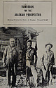
| os eua come] a.Batis aS i Ce. = of Alaska Ernest Wolff ALASKA Eastofof Green! Gre nwich MAP 170°...Straits 18. Yukon-Koyukuk Cordova-McCarthy 19. Fairbanks Valdez-Chitina-Whittier 20. Upper Yukon Palm...—GEOLOGICAL SURVEY. WASHINGTON, DC, MA ITOT ALASKA MAP A "sO 4 * « PSI1 TOA He REA LA Ope e...University of Alaska ERNEST WOLFF Formerly, Research Associate University of Alaska With Contributions...Formerly, Professor of English, University of Alaska Printed in the United States of America By Edwards |
 | | Report (volume) |
| of Metallic and Nonmetallic Mineral Deposits of Alaska Compiled From Published Reports of Federal and...of metallic and nonmetallic mineral deposits of Alaska, compiled from published reports of Federal and...resources Indexes. 2. Mines' and mineral resources Alaska. I. Kachadoorian, Reuben, 1921-, rjoint author...quadrangle_________________________-_________________ Fort Yukon quadrangle______________________________________...investigations__________________---_-_----____-__ Territory of Alaska Department of Mines pamphlets____________--_ 360 |
 | | Report (issue) |
| INVESTIGATION OF MINERAL RESOURCES OF ALASKA IN 1909. By ALFRED H. BROOKS and others. ADMINISTRATIVE...bulletin in which both the conditions of the mining industry of Alaska and the more important economic results...of reference for those who are interested in the mining and mineral resources of the Territory, None of...development of the mining industry. The rapid progress in prospecting and mining in Alaska makes it necessary...that they may become available to the prospector, mine operator, and engineer. In publishing such preliminary |
 | | Report (issue) |
| INDUSTRY OF ALASKA IN 1931 AND ADMINISTRATIVE REPORT BY PHILIP S. SMITH Mineral resources of Alaska, 1931...separate chapters. CONTENTS Mineral industry of Alaska in 1931---_---------------__------------- Page...districts._______-______ __-_-_.______ Southeastern Alaska.-.-.-.____________________ Copper River region...-Cook Inlet-Susitna region_____^--__----__--__-Yukon region..------------------------------Kuskokwim...Peninsula.__-__-_---_-_-__--__--__-___ Northwestern Alaska._-____-_____--_______-__Dredging.._____-______ |


