 | | Report (issue) | | CALITI ES OF UTAH by Kenneth C. Bullock UTAH GEOLOGICAL AND MINERAL SURVEY a division of the UTAH DEPARTMENT...JANUARY 1981 MINERALS AND MINERAL LOCALITIES OF UTAH by Kenneth C. Bullock Nature displays her most.... . . . . . 1 Chapter I. Mining Districts of Counties and the State of Utah. . . . . . . . . . . . .... . . . . . . . . . . . . . . . . . . . . . . 1 County Listings. . . . . . . . . . . . . . . . . . . .... . . . . . . . . . . . 1 Chapter II. Mining Districts of Utah . . . . . . . . . . . . . . . . . . . |  | | Book | | - [ URANIUM GUIDEBOOK FOR THE PARADOX BASIN, UTAH AND COLORADO TABLE OF CONTENTS Page THE PARADOX BASIN...AND MINING AREAS SLICK ROCK DISTRICT GYPSUM VALLEY DISTRICT BULL CANYON DISTRICT URAVAN DISTRICT GATEWAY...GATEWAY DISTRICT (EASTERN GATEWAY AREA) MC ELMO CREEK DRAINAGE AREA LA SAL CREEK AREA PARADOX DISTRICT BEAVER...BEAVER AND POLAR MESAS LISBON VALLEY (BIG INDIAN) DISTRICT MOAB DISTRICT GREEN RIVER DISTRICT THOMPSONS...THOMPSONS DISTRICT INTER-RIVER REGION RICHARDSON-DEWEY AREA LOWER KANE SPRINGS AREA INDIAN CREEK REGION DRY VALLEY |  | | Book (volume) | | beds, excavations, etc.Selenite roses. BRULE COUNTY AREA: in the Oacoma zone of the Pierre Fm. On Elm...gray Barite rosette up to 5 or 6 inches. CAMPBELL COUNTY MOUND CITY, W to the Missouri R., regional hillsides...gravels, etc.petrified wood, wood opal. CORSON COUNTY LITTLE EAGLE: area ridges, slopes, stream beds...beds, etc. petrified wood, wood opal; along the Grand R. though entire Co., regional banks, breaks, gravels...Guide for Rock Hounds in the United States CUSTER COUNTY AREA: The November Mine, 1.2 mi. SE of the Needles |  | | Report (issue) | | of the La Sal Quadrangle San Juan County, Utah, and Montrose County, Colorado GEOLOGICAL SURVEY Prepared...of the La Sal Quadrangle San Juan County, Utah, and Montrose County, Colorado By WILLIAM D. CARTER and...deposits ________________________ ----------History of mining in the La Sal quadrangle _______ _ Distribution...OF THE LA SAL QUADRANGLE, SAN JUAN COUNTY, UTAH, AND MONTROSE COUNTY, COLORADO By WILLIAM D. CARTER and...quadrangle, Utah-Colorado. The La Sal quadrangle, comprising about 240 square miles of San Juan County, Utah |  | | Report (issue) | | Geological Survey, through T. Kaibab fault, southern Utah Nolan, E. V. Shannon, 1927. Ammoniojarosite, a...Geological Survey, 1950) Trinity Anemousite County, California. Contributions to Mineral¬ (discredited... Yavapai County, Ari¬ L. G. Berry, 1947. Composition and Optics of Aluminocopiapite Utah NMNH K.... J. Murata, Trinity County, California M. C. Bandy, 1938. Utah. J. M. Axelrod, F. S. Grimaldi, C...Island Mountain, Mountain, from Mine, Yavapai County, Arizona (L. J. Cabri, 1976) Island Group (F |  | | Report (issue) | | ____________________________________ _ History of mining and production ________________ _ General description...States. FIGURE 1. Map showing location of uranium-mining districts in West-Central United States-------------------------2...faults, and outcrop of the Coconino Sandstone in the Grand Canyon area, Arizona ___ --------- ______ ---------...positions and shapes of sandstone pipes in the Grand Canyon area, Arizona ___________ -------------·...in 1874 at Mauch Chunk (now Jim Thorpe), Carbon County, Pa. ('Genth, 1875, p. 144B). In 1898 a deposit |  | | Report (volume) | | the future: Just, E. ing: Burwell, E. B., Jr., 4. Mining geology, retrospect and Index fossils: Stephenson... Landform interpretation, stereoSearch for new mining districts: Nolan, T. B., 1. pairs: Powers, W. E...described. Div. Mines, 1; Jenkins, O. P., Choctaw County, Highway 17 area: 3. Toulmin, L. D., Jr., 3. Minor:...limestone: Lamar, Shotts, R. C., 5. J. E., 11. Gold, mining districts: Pallister, Trace elements and potash...analysis: KelH. D., 5. ler, W. D., 3. Talladega County, hematiteOklahoma, potash agstone, granite magnetite |  | | Book (edition) | | (Brazil). Malcolm Back (Canada), Henry L. Barwood (USA). Dmitriy Belakovskiy (Russia). Fabio Bellatreccia...(Italy), T.S. Ercit (Canada). Alexander Falster (USA). Jeffrey de Fourestier (Canada). Robert Gault (Canada)...Henderson. Jr. (USA). D.D. Hogarth (Canada). J.L. Jam bor (Canada), Anthony R. Kampf (USA). Pave! M. Kartashov...Karnp-Moller (Denmark). Akira Kato (Japan). Lance E. Keams (USA). Elisabeth Kirchner (Austria), Uwe Kolitsch (Austria)...Republic). Per Nystcn (Sweden), David O'Hanlcy (USA). Filippo Olmi (deccased) (ltaly). Werner H. Paar |  | | Book | | individual deposits or districts. (in brackets country, district, deposit reviewed): Adamek P. (Scandinavia), Adams...Africa, Namibia), Chenoweth W. (Colorado Plateau, USA), Coste A. (Limousin, France), Cuney M. (granites...Grauch R (western USA), Gautier A. (breccia pipe deposits, USA), Halladay Ch.R (eastern USA), Harshman E.N...N. (Wyoming Basins, USA), Hruby J. (CSFR), Kolb S. (Bavaria, W-Germany), Krol W. (Eastern Europe), Matos... N.M., USA), Smith RB. (South Texas, USA), Tan H.B. (Canada), Thamm J. (Colorado Plateau, USA), Tauchid |  | | Book | | Enterprises, PO Box 213, Livermore, California, 94551, USA. Because of space limitations, only a subset of the...Hidden Valley Road, Kingsport, Tennessee, 37663, USA. The authors appreciate the advice and kind assistance...City, Nevada, USA; Peter Embrey, London, England; Jessie Hardman, Long Beach, California, USA; and Barbara...Barbara Nichols, Livermore, California, USA. All of these colleagues made helpful comments and substantive...Enterprises PC Box 213 Livermore California 94551 USA Elemental Table “Element” Aluminum Amide Ammonium |  | | Book | | variety amethyst, sceptre habit, Denny Mountain, King County, Washington, U.S.A. / Photo by Ken Mayer Production...imprimeur inc. Barite on Quartz, Rock Candy mine, Grand Forks, British Columbia / Photo by Ken Mayer Publisher...organic geochemistry. Green River Formation, Uinta County, Utah, U.S.A. Trudell, L.C. (1970): Lithologic Description...Description of Western Oil Shale Corporation Project Utah EX—]. Laramie Petroteum Research Center. Milton...Poudrette quarry, Mont Saint-Hilaire, Rouville County, Quebec, Canada. McDonald, AM. & Chao, G.Y. (1994): |  | | Report (volume) | | are as follows: COLORADO. Mineralogy. Montrose County, uranium-vanadium deposits: Weeks, A. D., 13R....Iron, Cook County, titaniferous magnetite: Grout, F. F., 5. IRON. Minnesota, Cook County, titaniferous...and have not been searched completely. A.I.M.E., Mining Geology Geophysics Div. Ann. Mtg., Abs. Tech. Papers;...Br. Abs. American Institute of Mining and Metallurgical Engineers, Mining, Geology, and Geophysics Division...Technical Papers; Mining Branch Abstracts. New York. A.I.M.E. Trans. American Institute of Mining, Metallurgical |  | | Book (edition) | | abbreviations: Rep. (republic), prov. (province), co. (county), munic. (municipio), pref. (prefecture), dept...dept. (departement), dept. (departamento), dist. (district). Less common terms are not abbreviated, e.g....always included in text, except in the cases of the USA, UK, and the provinces Ontario and Quebec in Canada...Uintah County. Utah. and m (2.B. acanthite group). Monoclinic, C2/m, a,b,c Rio Blanco County. Colorado...Dakota. and at the Fuemrole No2 mine, Emery co .. Utah. Also at Menzenschwand Scbwarzwald Mts., in the |  | Gaines, Richard V., Skinner, H. Catherine W., Foord, Eugene E., Mason, Brian, Rosenzweig, Abraham, King, Vandall T. (1997) Dana's New Mineralogy (8th ed.) Wiley-Interscience. p.1872 | Book (edition) | | Isand South Carolina South Dakota Tennessee Texas Utah Vermont Virginia AL AK AZ AR CA CO CT DE FL GA...Co., Bonanza mine, Trinity Co., Michigan Bluff district, Placer Co., in AK, placers at Fairbanks, Iditarod...and quartz veins at Juneau. In Canada, Noranda district, PQ; Porcupine, Kirkland Lake, and Larder Lake...deposits, ON; Atlin and Caribou, BC; and Klondike district, YT. In Mexico, Altar and Magdalena, SON; Parral...to depths exceeding 2 miles. Many important gold mining districts in Australia, including Hill End, Hillgrove |
|
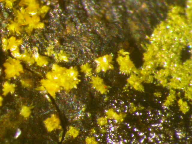


Polar Mesa, Gateway Mining District, Grand County, Utah, USA