 | | Journal (article/letter/editorial) | | GEORGIA Downloaded by [University of Calgary] at 09:55 07 August 2017 MINERAL LOCALITY INDEX JENNINGS...JENNINGS B. GORDON, JR. P . O . Box 6214 Rome, Georgia 30162 Although perhaps best known for its gold, rutUe...rutUe, and staurolite (the state mineral), Georgia has, in fact, almost two hundred mineral species. ...have been reported and verified from the state of Georgia. The index has been compiled from the literature...be either a report on the economic geology of Georgia or a field guide for lapidaries, it excludes commercial |  | | Book (volume) | | Location Guide for Rock Hounds in the United States GEORGIA Georgia’s nearly 59,000 square miles makes it the...highest elevation in the state at 4,784 feet. 145 Georgia Beginning in the northwest, where the Lookout...mountains loom over rich agricultural valleys, Georgia easily divides into five major physiographic provinces...The first real Gold Rush in America occurred in Georgia following two simultaneous discoveries of Gold... some Ruby-red Corundum, Spodumene and Topaz. Georgia has been actively prospected for gold since colonial |  | | Book | | commercial ores and secondary minerals by state, county, township, and geologic range. For easy identification...cities, and many of today’s prosperous western county seats began as mining-boom camps. trating sand...Whether you such as those listed alphabetically by county, township, and range in Part II of this book. Where...fracture Obsidian Frothy obsidian Consolidated fragments of rock Consolidated volcanic ash and dust Lightweight...Disintegration Type Occurrence Unconsolidated Consolidated Residuals Gravels Coarse arkose Arkose conglomerate |  | | Report (issue) | | COVER PHOTO : Gold nugget from Dukes Creek, White County, weight 5 oz., 12 dwt., approx. 2x. BACK COVER...approx. 1.5x. Lower left - Goethite from Pulaski County, approx. lx. Right - Magnetite crystal face showing... MINERALS OF GEORGIA: THEIR PROPERTIES AND OCCURRENCES by Robert B. Cook STATE OF GEORGIA DEPARTMENT OF................................................ Stibnite .......................................................................................... 170 County Index ........................................ |  | | Book | | California Colorado Connecticut Delaware Florida Georgia Hawaii Idaho Illinois Indiana Iowa Kansas Kentucky...Caucasus Mountains in the land of Colchis (now Soviet Georgia). The picturesque legend of Jason and the Golden...listed by county and community, range and distance. Whenever the collector crosses a county line, he will...of the county he is entering posted alongside the highway. By looking up the state and county, the user...guide can determine the collecting sites in that county by range and distance from the major cities and |  | | Book (volume) | | 600 to 800 feet thick in the north. ALEXANDER COUNTY FAYVILLE, area stream gravels⎯agate, jasper, rare...⎯agate, jasper; d RR siding of Clay⎯agate. CALHOUN COUNTY AREA, shores of the Mississippi R., in the Warsaw...crystals). CRAWFORD COUNTY PALESTINE, area deposits⎯Siderite. EDWARDS COUNTY AREA, T. 1 S, R. 10 E...E, regional deposits⎯Siderite. FULTON COUNTY FARMINGTON, W 6 mi. on Rte. 116 to the Rapatee No. 5 strip...mine⎯pyritized gastropods (Pennsylvanian age). GRUNDY COUNTY AREA: c Regional rd. and RR cuts and banks of Mason |  | | Book (volume) | | 600 to 800 feet thick in the north. ALEXANDER COUNTY FAYVILLE, area stream gravels⎯agate, jasper, rare...⎯agate, jasper; d RR siding of Clay⎯agate. CALHOUN COUNTY AREA, shores of the Mississippi R., in the Warsaw...crystals). CRAWFORD COUNTY PALESTINE, area deposits⎯Siderite. EDWARDS COUNTY AREA, T. 1 S, R. 10 E...E, regional deposits⎯Siderite. FULTON COUNTY FARMINGTON, W 6 mi. on Rte. 116 to the Rapatee No. 5 strip...mine⎯pyritized gastropods (Pennsylvanian age). GRUNDY COUNTY AREA: c Regional rd. and RR cuts and banks of Mason | 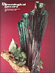 | | Journal (issue) | | Topeka-Kentucky Giant and Indiana veins, Ouray County, Colorado........................................now in the Natural History Museum of Los Angeles County (NHMLAC). In 1933 Martin sold Kunz Collection specimens...1933 and was later obtained by the Los Angeles County Mu seum of Natural History. Van Pelt photo. ulcerated...governor of Maryland; Annapolis is in Anne Arundel County). All the minerals and shells had to be cleaned...Sicilian sulfur, Russian crocoite and Romanian stibnite. More interestingly, one writer refers to “Dr |
|


