 | | Report (issue) |
| Hydrothermal Alteration Mineralogy in Newberry 2 Drill Core, Newberry Volcano, Oregon by Keith E. Bargar and Terry...iMenlo Park, CA INTRODUCTION Newberry Volcano, located in central Oregon about 40 km south of Bend, lies...western end of a volcanic terrain that extends across much of the southeastern part of Oregon, and becomes...the west (Macleod and others, 1976). The caldera of Newberry Volcano contains several hot-springs, fumaroles...1981; MacLeod and Sammel, 1982). Accordingly, Newberry 2, a 932 m deep drill hole was drilled by the |
 | | Journal (issue) |
| ORECiON CiEOLOCiY published by the Oregon Department of Geology and Mineral Industries VOLUME 44, NUMBER...NUMBER 4 !' APRIL 1982 OREGON GEOLOGY OIL AND GAS NEWS (ISSN 0164-3304) Mist Gas Field: VOLUME 44... APRIL 1982 Published monthly by the State of Oregon Department of Geology and Mineral Industries (Volumes...company recently finished the redrill of Columbia County 41-2 in sec. 2, T. 6 N., R. 5 W. The redrill, which...moved the Taylor Drilling Company rig to Columbia County 12-9, a well drilled in 1980, and redrilled it |
 | | Report (issue) |
| REsOURCES OF OREGON I SIXTH SUPPLEMENT I January l, 1971 to Dec ember 31, 1975 STATE OF OREGON DEPAIItTME:NT...GEOLOGY AND MINI!:RAL 1978 INDUSTRIES STATE OF OREGON DEPARTMENT OF GEOLOGY AND MINERAL INDUSTRIES 1069...1069 State Office Building Portland, Oregon 97201 BULLETIN 97 BIBLIOGRAPHY of the GEOLOGY and MINERAL...MINERAL RESOURCES S i xt h of OREGON Supplement January 1, 1971 to December 31, 1975 Compiled by...Va. 22041 with the assistance of Ainslie Bricker Oregon Department of Geology and Mineral Industries Edited |
 | | Report (issue) |
| hydrothermal minerals in the Cascade Mountains of northern Oregon by Keith E. Bargar and Robert L. Oscarson Open-File...area ........................................ .6 Newberry volcano ........................................from outcrops and geothermal drill holes in the Oregon Cascade Mountains ................... 24 4. Scanning............................ .45 25 Wedge-shaped dolomite crystal clusters .......................... 46...specimens and late Tertiary volcanic rock outcrop samples in three areas of the Oregon Cascade Mountains (near |
 | | Report (issue) |
| Reconnaissance geology of the Mount Edgecumbe volcanic field, Kruzof Island, southeastern Alaska, by...Concentric structure in elongate pillows, Amador County, Calif., by W. A. Duffield._______________________________...lapilli deposits from Central Pumice Cone, Newberry Caldera, Oreg., by M. W. Higgins______ Similarity...__________ Ultramafic xenoliths in basalt, Nye County, Nev., by N. J. Trask___-____-___________----_...Pink copper-bearing prehnite from Isle Royale National Park, Mich., by N. K. Huber_____________________________ |
 | | Report (issue) |
| 58 Scanning electron micrograph showing rhombic dolomite crystals .......... .59 21. Scanning electron...370 m) were collected for this investigation. Volcanic glass and open spaces of fractures, vesicles,...drill holes located both outside and within the caldera show the effects of hydrothermal alteration. The...(DonnellyNolan and others, 1990). The most recent volcanic activity (about 900 years ago), at Glass Mountain...Mountain, occurs in the vicinity of the 7 x 12 km caldera (Figure 2) (Donnelly-Nolan and others, 1990). Figure |
 | | Report (issue) |
| Washington. Lower left: South Sister Volcano, Oregon, viewed from south. Devil’s Hill rhyodacite dome...the lava dome at Mount St. Helens, Washington, (USA), 1981-1983 ........ D. A. Swanson, D. Dzurisin...J. Casadevall, J. W. Ewert, and C. C. Heliker Volcanic activity at Santiaguito volcano, 1976-1984 oo...eruptions on the flanks of South Sister volcano, Oregon ......... William E. Scott Tephra deposits associated...structures in the 600-year-old lavas of the Inyo volcanic chain, eastern California ......... 0c ccc eee |
 | | Journal (issue) |
| State of Oregon Departmentaf Geology and Mineral Industries 1069 State Office Bldg. Portland Oregon 97201...THE GEOLOGY OF PART OF THE SNAKE RIVER CANYON, OREGON AND IDAHO By Howard C. Brooks* and Tracy L. Vallier**...between Oregon and Idaho. The area discussed extends from Farewell Bend near Hunti ngton, Oregon downriver...work progresses. The geological coverage of the Oregon portion of the canyon from Farewell Bend to Powder...area from Farewell Bend to * Geologist, State of Oregon Department of Geology and Mineral Industries. ** |
 | | Journal (article/letter/editorial) |
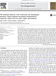
| elsevier.com/locate/oregeorev The Southeast Missouri (USA) Proterozoic iron metallogenic province—Types of...University of Central Missouri, Warrensburg, MO 64093, USA ARC Centre of Excellence in Ore Deposits, University...Available online 10 October 2013 Keywords: Missouri (USA) iron district Proterozoic Magnetite Hematite IOCG-IOA...IOCG-IOA a b s t r a c t The Southeast Missouri (USA) iron metallogenic province within the Mesoproterozoic...oxide magma, and/or by hydrothermal replacement of volcanic rocks. Iron oxides within all district deposits |
 | | Journal (article/letter/editorial) |
| from a sulfur- and pyrite-rich clay deposit in the Oregon Cascades. The deposit is located along a fault...fault zone west of Crater Lake, in Eocene-age volcanic rocks. Mineralogical relationships were used to deduce...Life Sciences Directorate, Lawrence Livermore National Laboratory, Livermore, California 94550; e-mail...the antibacterial mechanism of clay marketed by Oregon Mineral Technologies Inc. (OMT) as healing clay...illitesmectite (I-S) and thought to be related to volcanic activity in the Massif Central region of France |
 | | Report (volume) |
| Road) near town of Abel, Cleburne County. Absaroka Supergroup/Volcanic Supergroup U ABRK03 1. Eocene 2...10. Type area: Absaroka volcanic field, Yellowstone National Park, Park County, Wyo. Academy Church Shale...W1/2NW1/4NE1/4SE1/4 sec. 1, T. 3 s., R. 2 E., Carter County. Adams Formation ADMS01 1. Holocene 2. Alaska (SE)...Quadrangle, lat 45° N., long 70°50'-55' W., Oxford County. Adamstown Member (Frederick Limestone) U ADMS06...section W of Lime Kiln in Frederick Valley, Frederick County. Named for town of Adamstown. Adobe Town Member |
 | | Journal (issue) |
| OREGON GEOLOGY published by the Oregon Department of Geology and Mineral Industries VOLUME 52, NUMBER...NUMBER 2 MARCH 1990 OIL AND GAS NEWS OREGON GEOLOGY Mist Gas Field report revised VOLUME 52, NUMBER...Supervisor. Second cw IXlSlage paid at Portland. Oregon. Subscriplion 11'teS: J year. $6; 3 yens. $15....Single ~ues. 51. Available l:a:k issues of 0" Bin/Oregon Geology tlvwgh v, 50, flO. 4, $1. Address subscription...subscription on:Iers. renewals. and cI\mges of address to Oregon Gl'OIogy, 910 State OffICe Building. 1400 SW 5th |
 | | Report (volume) |
| Survey Bull. 1200; issued, Paris, 1967, by Centre National de Ia Recherche Scientifique as Volume 7 Amerique...p. 58-59, 227. Mainly silty sandy thick-bedded dolomite containing layers of dolomitic medium-grained...74, Ph miles east of Dutchtown, Cape Girardeau County, Mo. Type section cut by northtrending fault with...stream in NEIA sec. 33, T. 16 N., R. 14 E, Wayne County. Named after village of Abington, about 3 miles...locality Achiote Conglomerate consists of massive red volcanic conglomerate with well-rounded clasts as large |
 | | Book |
| information is available for the shelf area off Oregon and Washington. Most of the discussion in this...from ‘Triassic to PlioPleistocene in age. Similar volcanic and meta- morphic rocks are also found in the...different fault systems. Continental Margin off Oregon and Washington Information regarding the nature...greater than 10 miles in width at the California-Oregon state line. From here it widens somewhat and attains...Sunderland Wicomico Coharie Okefenokee Wicomico Newberry 170 100 Talbot Talbot 25 Pamlico Pamlico |
 | | Report (issue) |
| Geological Survey (USGS). The USGS has three national programs in mineralrelated studies. The Development...This information is essential for formulating a national mineral policy and for identifying secure foreign...mineral resources in covered areas of Alaska. The National Mineral Resources Assessment Program (NAMRAP)...communities, and all those who are concerned with national mineral policy and land use decisions. These mineralresource...land. The result is an integrated approach to national mineral-resource problems. VI PROGRAM TUESDAY |
 | | Journal (article/letter/editorial) |
| SAMPLES The samples in these experiments were volcanic and pyroclastic rocks in both solid and granular... 2: Dacite pumice from the Crater Lake region, Oregon. This is a Quaternary nue~ ardente deposit which...Sample No. 3: Semiwelded tufffrom the Bend quarry, Oregon, Section 6, T18S, R12E. This is a standard sample...vitrophyre, and welded tuff fragments are included in a volcanic dust and glass matrix. The overall Si02 content...Sample No. 12: Obsidian from the Newberry Caldera, "Big Obsidian Flow," Oregon, Section 36, T21S, R12E. This |
 | | Book |
| 75 CENOZOIC VOLCANISM IN THE NEWBERRY MOUNTAINS, SAN BERNARDINO COUNTY, CALIFORNIA . . . . . . . . .... • • • • • • • • • ♦ • ■ SAN DIEGO COUNTY, CALIFORNIA . . . . . . . . . . . . . . . . . ...transform system itself, local sedimentary basins and volcanic fields re l ated 3 to Neogene passage of the...oceanic hotspot tracks composed of seamounts and volcanic islands. Uncertainties about the timing of some...specifically from the potassium gradients in arc volcanic rocks (Keith, 1978). During latest Cretaceous |
 | | Report (issue) |
| 1965. 1966. 1967. 1968. Numerous Federal, State, county, and local agencies and other organizations and...______ North Carolina-__--___--__--__-_-___-._ Oregon._ ______________________________ South Dakota_____________...Montana disturbed belt.________________ Yellowstone National Park and vicinity. __ Snake River Plain______________________...-____ Washington-- _ ____--__-_-_-_______-_--_ Oregon ____-_______----_--_-__-_--__-_Nevada __ _____..._______________________________ Volcanic rocks and processes. _ _______________ Recent volcanic activity. ________________ |
 | | Book (volume) |
| HALKA CHRONIC PAGES OF STONE GEOLOGY OF WESTERN NATIONAL PARKS & MONUMENTS 2: SERRA NEVADA, CASCADES,...Half Dome, Yosemite National Park. Inset: Jointed volcanic rock, Mount Rainier National Park. Manufactured...and Pacific Coast. 1. Geology—West (U.S.) 2. National parks and reserves—West (U.S.) 3. Natural monuments—West...Part 2. National Parks and Monuments Cabrillo National Monument Channel Islands National Park Crater...Crater Lake National Park Devils Postpile National Monument John Day Fossil Beds National Monument Lassen |
 | | Report (issue) |
| 1966 1967 1968 1969 1970 Numerous Federal, State, county, and local agencies and other organizations and...••.••••••..•.•••... Yellowstone and Grand Teton National Parks ••••.• Geological and geophysical studies...•• Washington .......................•........ Oregon .................................. . Idaho ......silicate, and of gowerite ....................• Volcanic rocks and processes .................... . Plutonic...investigations .......•.......•..•..•........ Volcanic investigations .......•...........•......•. Cosmic |
 | | Report (issue) |
| A293-A298 of this chapter. Numerous Federal, State, county, 1and local agencies and other organizations and...-----Structural and geophysical studies_ - -----Grand Teton National Park and vicinity--Igneous and metamorp hie rocks_...___ _ Washington ___________________________ _ Oregon _______________________________ _ California _...and petrology-Con. Volcanic rocks and processes _________ -------_ Al19 Volcanic activity ______________________...______________________ _ 119 Chemistry of volcanic rocks and gases ____ _ 121 Xenoliths in basalt _____________________ |
 | | Report (volume) |
| Taipei, Taiwan, China. Science reports of the National Acta Geophys. Polonica- Acta Geophysica Polonica...Quaternaire. Pub lie avec le concours du Centre National de la Recherche Scientifique. Paris, France. Assoc...Geotechnical Journal. Revue Canadienne de Geotechnique. National Research Council of Canada. Ottawa, Ontario, Canada...Canadian Jour. Botany- Canadian Journal of Botany. National Research Council of Canada. Ottawa, Ontario, Canada...Jour. Chemistry- Canadian Journal of Chemistry. National Research Council of Canada. Ottawa, Ontario, Canada |
 | | Report (issue) |
| ________________ Lithium investigations in sedimentary and volcanic rocks ______________________ Phosphate investigation...—— —— _______ California _______________-_—————— Oregon ___________——-——--———-_-Washington _——————————————————...______________________ Nevada _____________________ Oregon ________________———___ Washington _________________...Coordination ___ Water-data storage system _____—__ National Water Data Exchange _____ Urban water program...program ________—__ Water use _____________________ National water quality programs ______ The Regional Aquifer-System |
 | | Report (issue) |
| complex and difficult, and more critical to the National Welfare. W^ V. E. McKELVEY, Director III CONTENTS...___72 California ___________________________72 Oregon ____________________________________76 Regional...___123 Nevada _____________________________124 Oregon _____________________________124 Washington __...coordination, acquisition, and storage _ _______124 National water data exchange ____________126 Water-data...___________________127 Water use ________________________127 National water-quality programs _ _ _ _ _ __ _132 Marine |
 | | Report (volume) |
| Quaternaire. Publie avec le concours du Centre National de Ia Recherche Scientifique. Paris, France. Assoc...of the Association of Pacific Coast Geographers. Oregon State University Press. Corvallis, Oreg. Auk- Auk...Canada. Canada Natl. Mus. Nat. History Paper- National Museum of Canada Natural History Papers. Ottawa...Associate Committee on Soil and Snow Mechanics, National Research Council, and the Geotechnical Engineering...Canadian Jour. Botany- Canadian Journal of Botany. National Research Council of Canada. Ottawa, Ontario, Canada |


