 | | Book |
| anc MINERALS OF MEXICO 7 | : = Pras #0 AaprTTARE ; | MINERALS OF MEXICO William D. Panczner...1938Minerals of Mexico. Bibliography: p. 1. Mineralogy— Collectors and collecting— Mexico. 2. Mines and...and mineral resources— Mexico. I. Title. QE377.M6P36 1987 549.972 86-13325 ISBN 0-442-27285-5 This book...Jalisco; D. Santiago Ramirez’s La Riqueza Minera de Mexico, and his translation of Dana’s Tratado de Mineralogia...Peter Megaw, John Whitmire, Paul Desautels, Jose Luis Garza-Nieto, A. P. Salas-Guillero, Eugene Schlepp |
| | Book |
| "'<' ~/ BOUNDARIES U A Mo<'« u~ o V :¾ MEXICO r - ·•-.. ·-··-··-··-·· < •• ....... V S TATES...org/details/mineralsofmexico0000panc MINERALS OF MEXICO • ERALS OF ~XICO M ______ William D. Panczner...1938Minerals of Mexico. Bibliography: p. 1. Mineralogy-Collectors and collecting-Mexico. 2. Mines and mineral...mineral resources-Mexico. I. Title. QE377.M6P36 1987 549.972 86-13325 ISBN 0-442-27285-5 This boo i...i.. is deJicated tu the people of Mexico and to the three people who directly affected me and this project |
 | | Report (issue) |
| Geology—Mexico. 2. Geology, Structural—Mexico. 3. Faults (Geology)—Mexico. 4. Ore deposits—Mexico. I. Alaniz-Álvarez...deposit with hummocky topography. Photograph by José Luis Macías taken in January 2004. 10 9 8 7 6 5 4 3.... . 233 R.S. Molina-Garza and A. Iriondo 8. The San Marcos fault: A Jurassic multireactivated basement...Bigot-Cormier, A. Chabert, and J. Bourgois 10. The Taxco–San Miguel de Allende fault system and the Trans-Mexican...which bound the plateau: the San Luis–Tepehuanes fault and the Taxco– San Miguel de Allende fault system |
 | | Report (issue) |
| Palmdale, Valyermo, and Cajon Pass areas ____ _ San Francisquito Formation _____________ _ Vasquez Formation..._ Oso Canyon Formation _________________ _ Meeke Mine Formation ________________ _ Rock units of central...Page FIGURE 19. Juniper Flat area, northwestern San Bernardino Mountains_______________________ 32 20...of Lancaster____ 26. San Francisquito Canyon area_____________ 45 47 27. Soledad Pass area ______ ~----------------48...Pass area, northwestern part ______ 52-53, 54 33. San Gabriel Mountain foothill area near Mescal Creek_ |
 | | Report (volume) |
| technical assistance to private mine operators about mineral exploration, mine development and operation,...trained to provide technical assistance to private mine operators, as well as to conduct reconnaissance...personnel were to supply guidance to small private mine operators on management and bookkeeping, service...1959, when the program ceased to grant loans to mine operators, the small staff consisted of one geologist...that extends from the Corocoro mine southeast to the Chacarilla mine. The second project mapped a belt-like |
 | | Report (issue) |
| Mineralogist OIAF GEOLOGIC BFL^NCH Ferry Building, San Francisco San Francisco P. JENKINS Chief Geologist ...°\ x *T U L A R E I s_ i»KCBSFltLO •Z R f SAN, BERNARDINO \ SSANTA BARBARA j^^'»-f"''*\L0SAN6tLCS...j^^'»-f"''*\L0SAN6tLCS 'O.to , V E R 5 1 D E J •LEGEND- MEXICO -^ Mining O Division Boundaries. Mining Division...commercial products. The gem-bearing pegmatites of San Diego County have aroused special masses, interest...considerable amounts in the wall rock at the Argonaut mine, Josephson (32). County: It is found in the copper-bearing |
 | | Journal (volume) |
| NORDENHOLT, Director DIVISION OF MINES FERRY BUILDING, SAN FRANCISCO WALTER Vol. 31 W. BRADLEY State Mineralogist...REPORT XXXI STATE DIVISION OF MINES FERRY BUILDING, SAN FRANCISCO, CALIFORNIA CALIFORNIA STATE PRINTING OFFICE...Laizure, District W. Burling Tucker, Reid J. San Francisco - - Mining Engineer District Sampson...Redding - San Francisco Mineral Technologist Henry H. Symons, Sacramento s an Francisco - San Francisco... Franke, Junior Mining Engineer (Librarian) - San Francisco TABLE OF CONTENTS REPORTS OF DISTRICT |
 | | Report (issue) |
| ;wIFORNIA STATE Mii^ix^v BtmiiAU FERRY BUILDING - SAN FRANOSCC im^ ibiiiiiiliiii .III— Bb^aa^Aai^^...FERRY BUILDIN(;. MININC; BUREAU SAN FRANCISCO FLETCHER HAMILTON San Francisco] State Mineralogi8l ...small diamonds are said to have been found near the San Diego border. Nevada County A 1^ carat stone was...found seven miles northwest of Coyote Wells on the San Diego and Arizona Railroad. Inyo County: Graphite...Angeles. It occurs a stratum running from the head of San Francisquito Canj^on across in the as Canyon. Mendocino |
 | | Report (issue) |
| and Geology mineral exhibit in in the Cali- San Francisco MINERALS OF CALIFORNIA CENTENNIAL VOLUME...BULLETIN California Division of Ferry Building, San 189 Mines and Geology Francisco, 1966 CA 94111...represented by specimens in the exhibit of the CDMG at San Francisco carry the letters CDMG and the specimen...to the California Division of Mines and Geology, San Francisco. It would be impracticable to acknowledge...account of his visit aboard the vessel Rurik to San Francisco Bay in 1816. Blake's "Annotated Catalog" |
 | | Journal (issue) |
| four MONTHS DURING THE YEAR at 1552 Steiner Street, San Francisco 15, Calif. Advertising rates upon request...Speaking 3 T5I California Convention 4 Yogo Sapphire Mine Reopened 4 Alpha Counters 5 Berkeley Cass iter ite...HAS NEVER BEEN FULLY UNDERSTOOD BY GEOLOGISTS. The San Andreas fault CAUSE OF THE 1906 EARTHQUAKE, AND ONE...CONTINUOUS FAULTS IN THE WORLD, RUNS INTO THE OCEAN BELOW SAN FRANCISCO AND EVIDENCE OF IT AND NUMEROUS MINOR FAULTS...office of the California Division of Mines in the San Francisco Ferry Building, CONTAINING ONE* OF THE |
 | | Report (issue) |
| which a mine first produced. YEAR OF LAST PRODUCTION Year in which an inactive producing mine last operated...(PRESENT/LAST) Person or corporation which owns the mine or mining claims. The most recent owner is listed...OPERATOR Person or corporation which operates the mine. This may be a subsidiary or a lessee. TOTAL INVESTMENT...S. dollars in exploration and development of the mine at the site. MILL CAPACITY PER YR. (THOUS. UNITS)...BELOW SURFACE Maximum depth in meters (M) reached by mine workings. LENGTH OF WORKINGS Cumulative length, |
 | | Report (issue) |
| SUPPLEMENT DIVISION OF MINES FERRY BUILDING, SAN FRANCISCO 1952 MINERALS OF CALIFORNIA SUPPLEMENT...For Vosften, read Vonsen. p. 46. T'nder anatase, San Benito County, add, at end of sentence, 136. They...County: erijthrite 189. arscnopyrite in the Josephine mine, Logan (16), p. p. 1.34. * Professor of Geology...sphene, for San Francisco Counfi/ read San Mateo County. p. 281. Under spinel, San Luis Obi.spo County...for Kunz (11) read Kuns (1). p. 281. Spodumene, San Diego County fifth and sixth line of paragraph, Gabriel |
 | | Book (volume) |
| .......................................315 New Mexico ......................................................................45 Arizona – Yuma Co. Hull Mine Site Map ...............................................50 Arkansas – Garland Co. Coleman Crystal mine Site Map ..............................51 Arkansas...................................84 California – San Diego County Area Site Map .......................................................212 Maine – Pitt mine Map ........................................... |
 | | Report (issue) |
| DIVISION Director OF MINES FERRY BUILDING, SAN FRANCISCO OLAF San Francisco P. 11 JENKINS, Chief BULLETIN...specimens in the exhibit of the Division of Mines at San Francisco carry the letters S.M.B., and the specimen...either of the authors or to the Division of Mines in San Francisco. It would be impracticable to acknowledge...by aboriginal tribes in the northeast corner of San Bernardino County in pre-historic times. The old...claim the Stone Hammer mine. This find aroused so much interest that the San Francisco Call, in 1898 |
 | | Report (issue) |
| 19 NEVADO PGRTUGUESA PAMPA GALERAS TUMIRI TETON SAN MARTIN ESQUILLAY ARGENTINA ORCOPAMPA CHOKTA 26. CERRO...(Peru) Ag base metal veins 15. San Miguel (Peru) -do- -da- 12. San Mart inFar al Ion (Peru) 14. Sucui... -da- Rhyolitic ash flow tuffs associated with San Martin caldera Rim (?) of Esquillay caldera -da-...Ma) Dacite stock near southwestern margin of Soledad caldera (5.4 Ma) Dacite flows in or near ring-fracture...disseminations Sn-Ag veins Oruro (Bolivia) 29. 3O. San Cristobal de Lipez (Bolivia) Ag Au veins Arcata |
 | | Report (issue) |
| Ranges in the far west (left side), through the San Joaquin Valley in the vicinity of Bakersfield, to...Mines and Geology County Report f Ferry Building, San Francisco 1962 LIBRARY UNIVERSITY OF CALIFORNIA...47 district district _ Red Mountain tungsten San Emigdio district 51 51 district 52 52 52 district...of the Rand district Composite plan of the Butte mine Composite plan of the Cactus Queen and Winkler mines...Composite plan of the Golden Queen mine Composite plan of the King Solomon mine Composite plan and longitudinal |
 | | Report (issue) |
| are represented by a mineral occurrence, deposit, mine, or that might be present in the study area. Metallic...listed in the list of references. The Los Angeles, San Bernardino, Needles, Salton Sea, Trona, Bakersfield...encompasses the volcanic center in the Middle Buttes-Soledad Mountain area and adjacent covered areas. The other...between the deposits at Middle Buttes and those at Soledad Mountain has a very high probability for the occurrence...majority of the gold coming from the Yellow Aster Mine. In addition, about 10,000,000 troy oz (-311 tonnes) |
 | | Catalog/List |
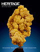
| Assistant Director Alissa Ford Managing Director San Francisco Greg Rohan President Roberta Kramer Managing...Chondrite (Type III) Pueblito de Allende, Chihuahua, Mexico (26° 58’N, 105° 19’W) Witnessed Fall: February...Chondrite (Type III) Pueblito de Allende, Chihuahua, Mexico (26° 58’N, 105° 19’W) Witnessed Fall: February...system. The Allende ireball fell over Chihuahua, Mexico in 1969 providing a large amount of material for...Meteorite Ordinary Chondrite (H4) Wilton Rural Municipality, Saskatchewan, Canada (52°59.76’N, 109°50.89’W) |
 | | Report (issue) |
| R. Meyer-Dombard 3. Eukaryotes of the Cariaco, Soledad, and Santa Barbara Basins: Protists and metazoans...Basin in southern California, the Soledad Basin off Baja California (Mexico), and the Cariaco Basin in Venezuela...fractionations at oil and gas seeps in deepwater Gulf of Mexico: Geochimica et Cosmochimica Acta, v. 64, p. 233–246...al., 2000); at Bahia Concepcion and Punta Mita, Mexico (ProlLedesma, 2003; Alfonso, et al., 2003); on...submarine hydrothermal coastal vents of Punta Mita, Mexico: Journal of Geochemical Exploration, v. 78-79, |
 | | Book (volume) |
| .......................................270 New Mexico .................................................Not a county in Alabama but a tradition of a “lead Mine” worked by Indians.) PELL CITY, NE 3 mi., area quarries⎯black...Copper, Gold and Pyrite; (b) Franklin or Jemison Mine, in NW¼SE¼Sec. 8, on tributary of Mulberry Cr.,...Muscovite mica, Quartz, etc. ASHLAND: c area: (a) M & G Mine⎯Apatite, Garnet and Smoky Quartz; (b) Gibson prospect⎯Garnets;...mines⎯Muscovite mica. (A line drawn from the Delta Mica Mine in the NE corner of the county with a bearing 45º |
 | | Book |
| ^ '“ P r . . . I West Orange SOUTH SAN FRANCISCO PUBLIC LIBRARY 9048 00992838 7 257989 R q549...Meridian (M.D.M. — Mount Diablo Meridian; S.B.M. — San Bernardino Meridian; and H.M. — Humboldt Meridian)...composition between acidic and basic rocks. drift mine Adit(s) driven into gravel. Characterized by the...were reported from San Ysidro, San Arizona. 1828; from Los Angeles County, San Francisquito Canyon...Schist, slate and metachert Lode gold mine Plocer gold mine MILES AMADOR COUNTY CALAVERAS COUNTY |
| | Book |
| Meridian (M.D.M. Mount Diablo Meridian;S.B.M. - San Bernardino Meridian; and H.M. - Humboldt Meridian)...composition between acidic and basic rocks. drift mine Adit(s) driven into gravel. euhedral Characterized...were reported from San Ysidro, San Diego County, in 1828 ; from Los Angeles County, San Francisquito Canyon...---- .,,.,..,. ._ \ I I I SAC~AMENTO I I SAN ;ci JOAQU I ~ OSA E D • It • • .o Mila... 10 1n miles 20 •Mory1v1tlt Socromel'\to & SAN JOAQUIN 0 ,, / ,r Oo~dolt , STANISLAUS MARI |
 | | Report (volume) |
| .......................................... New Mexico..................................................from those of Arkansas, California, Colorado, New Mexico, Oregon, South Dakota, Tennessee, and Texas; to...Geol. Survey Bull. 126, 1895. Jones, F. A., New Mexico mines and minerals, World's Fair edition, 1904...Nashville, Tenn. California____.Mr. William H. Storms, San Francisco. Prof. A. F. Rogers, Stanford University...STATES ALABAMA. H ing in pure white clay at Eureka mine, 4 miles northeast of Valley Head. Etowah County |
 | | Journal (volume) |
| NORDENHOLT. Director DIVISION OF MINES FERRY BUILDING, SAN FRANCISCO WALTER Vol. 35 W. BRADLEY State Mineralogist...REPORT XXXY STATE DIVISION OF MINES FERRY BUILDING, SAN FRANCISCO CALIFORNIA 70803 LIBRARY UNIVERSITY OF...Technologist San Francisco Sacramento San Francisco Los Angeles Los Angeles Redding San Francisco John...Bongard, Ore-Buyers' Inspector San Francisco Henry H. Symons, San Francisco J. C. Statistician ...Curator O'Brien, Junior Mining Engineer (Librarian) San Francisco TABLE OF CONTENTS Page REPORTS OF DISTRICT |


