|
USA | |
|
| Gübelin, E. and Wolgensinger, M. (1976) Edelstenen. Uitgeverij Artis, Brussel (in Dutch). |
|
| (2005) Mineral Resources Data System (MRDS), US Geological Survey. |
|
| (2005) Mineral Resources Data System (MRDS), US Geological Survey. |
|
| (2005) Mineral Resources Data System (MRDS), US Geological Survey. |
|
| (2005) Mineral Resources Data System (MRDS), US Geological Survey. |
- Idaho City Mining District
| Dake, H. C. (1956) Northwest Gem Trails - A Field Guide for the Gem Hunter, Mineral Collector and Tourist (2nd ed.) Gembooks. |
|
| (2005) Mineral Resources Data System (MRDS), US Geological Survey. |
|
| Kim Strange collection |
|
| Extra Lapis - English No. 10 Opal |
|
| |
- Bay Horse Mining District
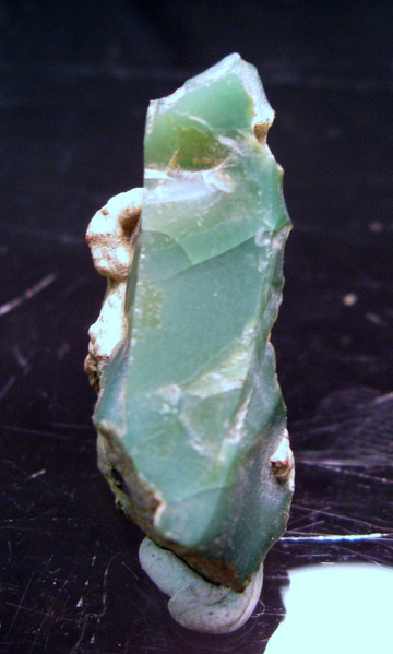
| [Opal-A var. Opal-AN] John Cornish collection |
|
| Ream, Lanny R. (2004) Idaho Minerals (2nd ed.) L. R. Ream Publishing, Coeur d'Alene, ID. |
|
| Dake, H. C. (1956) Northwest Gem Trails - A Field Guide for the Gem Hunter, Mineral Collector and Tourist (2nd ed.) Gembooks. |
|
| (2005) Mineral Resources Data System (MRDS), US Geological Survey. |
|
| (2005) Mineral Resources Data System (MRDS), US Geological Survey. |
|
| (2005) Mineral Resources Data System (MRDS), US Geological Survey. |
|
| (2005) Mineral Resources Data System (MRDS), US Geological Survey. |
|
| (2005) Mineral Resources Data System (MRDS), US Geological Survey. |
|
| (2005) Mineral Resources Data System (MRDS), US Geological Survey. |
|
| The Mineralogist, v. 4, no. 1. p. 15, 15, 54. |
|
| C. Lemanski, Jr. (re-entry lost Mindat data). |
|
| Ream, Lanny R. (2004) Idaho Minerals (2nd ed.) L. R. Ream Publishing, Coeur d'Alene, ID.
Tschernich, Rudy D., Wise, W. S. (1982) Paulingite: variations in composition. American Mineralogist, 67. 799-803 |
|
| Dake, H. C. (1956) Northwest Gem Trails - A Field Guide for the Gem Hunter, Mineral Collector and Tourist (2nd ed.) Gembooks. |
|
| Dake, H. C. (1956) Northwest Gem Trails - A Field Guide for the Gem Hunter, Mineral Collector and Tourist (2nd ed.) Gembooks. |
|
| The Moscow Opal Mines 1890 to 1893 (The First Commercial Opal Mines in the United States), Ron Brockett, 1975 |
|
| Dake, H. C. (1956) Northwest Gem Trails - A Field Guide for the Gem Hunter, Mineral Collector and Tourist (2nd ed.) Gembooks. |
- Blackbird Mining District
| (2005) Mineral Resources Data System (MRDS), US Geological Survey. |
|
| Christopher Wentzell collection (2020) and personally verified on site (2020) |
|
| WC van Laer, 2009 |
|
| Dake, H. C. (1956) Northwest Gem Trails - A Field Guide for the Gem Hunter, Mineral Collector and Tourist (2nd ed.) Gembooks. |
|
| Extra Lapis - English No. 10 Opal |
|
| Dake, H. C. (1956) Northwest Gem Trails - A Field Guide for the Gem Hunter, Mineral Collector and Tourist (2nd ed.) Gembooks. |
|
| Dake, H. C. (1956) Northwest Gem Trails - A Field Guide for the Gem Hunter, Mineral Collector and Tourist (2nd ed.) Gembooks. |
|
| Beste, Bob (2005) Location Guide for Rockhounds in the United States (3rd ed.) |
|
| USGS Bulletin 1720b |
|
| Dake, H. C. (1956) Northwest Gem Trails - A Field Guide for the Gem Hunter, Mineral Collector and Tourist (2nd ed.) Gembooks. |
|
| (2005) Mineral Resources Data System (MRDS), US Geological Survey. |
|
| (2005) Mineral Resources Data System (MRDS), US Geological Survey. |
|
| (2005) Mineral Resources Data System (MRDS), US Geological Survey. |
|
| (2005) Mineral Resources Data System (MRDS), US Geological Survey. |
- Big Creek Mining District
| (2005) Mineral Resources Data System (MRDS), US Geological Survey. |
|
| (2005) Mineral Resources Data System (MRDS), US Geological Survey. |
|
| (2005) Mineral Resources Data System (MRDS), US Geological Survey. |
- Marble Creek Mining District
| (2005) Mineral Resources Data System (MRDS), US Geological Survey. |
- Monumental Creek Mining District
| (2005) Mineral Resources Data System (MRDS), US Geological Survey. |
|
| (2005) Mineral Resources Data System (MRDS), US Geological Survey. |
|
| (2005) Mineral Resources Data System (MRDS), US Geological Survey. |
|
| (2005) Mineral Resources Data System (MRDS), US Geological Survey. |
|
| (2005) Mineral Resources Data System (MRDS), US Geological Survey. |
|
| Ream, Lanny R. (1995) Idaho: Mineral Locality Index. Rocks & Minerals, 70 (4) 242-263 doi:10.1080/00357529.1995.9926628
(1956) Quicksilver deposits near Weiser, Washington County, Idaho. Bulletin Vol. 1042. US Geological Survey doi:10.3133/b1042d |
|
| (2005) Mineral Resources Data System (MRDS), US Geological Survey. |
|
| (2005) Mineral Resources Data System (MRDS), US Geological Survey. |
|
| (2005) Mineral Resources Data System (MRDS), US Geological Survey. |


Spencer Opal Mine, Spencer, Clark County, Idaho, USA