 | | Journal (article/letter/editorial) | | Houston, Texas 77036 ROBERT 0. FAY Oklahoma Geological Survey Norman, Oklahoma 73019 Downloaded by [The Aga...713 15th Street NW Ardmore, Oklahoma 73401 OKLAHOMA Figure 1. Oklahoma counties. Mineral Locality...known for its gypsum crystals and barite roses, Oklahoma also boasts a variety of other species, including...unaware of the variety of minerals available from Oklahoma and think primarily of the prolific gypsum crystals...hundred years, extends into the northeast corner of Oklahoma and has produced notable specimens. Unfortunately | 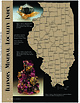 | | Journal (article/letter/editorial) | | Sphalerite and calcite, 5 cm across, Denton mine, Hardin County. Ross Lillie specimen. +!.+!+%% 34!2+ +./8 ...chalcopyrite, and sphalerite, 12.7 cm high, Hardin County. Marv Rausch specimen. 3(%,"9 -!#/50). /5 ....extreme southeast corner of the state has been a major fluorite producer, with some zinc and lead production...and barite, 6 cm high, Minerva No. 1 mine, Hardin County. Ross Lillie specimen. Figure 5 (above right).... Barite, 12.9 cm across, Denton mine, Hardin County. Ross Lillie specimen. Figure 6 (right). Fluorite |  | | Journal (article/letter/editorial) | | Painton's, of Fairview, Okla., who regularly advertise in R&M. Painton's Rockery, Fairview, Oklahoma, is a full...top quality Montana and Mexican agates, colorful Oklahoma jasper, supplies and equipment, faceting material...Note: Four very nice dolomite pyramids were sent to us by Mr. Painton. The dolomite pyramids were collected...collected in Major County, Okla., and one of these specimens is very unusual and rare with a ROCKS AND MINERALS |  | | Report (issue) | | Thickness and stratigraphic relations — — —— Saluda Dolomite Member ———————————— Thickness and stratigraphic...Siltstone 7. Lithofacies and nomenclature of the Fairview Formation, the Galloway Creek Limestone, and younger...containing out crops of Ordovician rocks, and major geographic divisions ——————————————————————————————————...Map showing area of outcrop and thickness of the Fairview Formation and the Galloway Creek Limestone ————————...Clasts of the Drakes Formation in the Brassfield Dolomite ——————————————————————————————— 38. Mud cracks |  | | Report (issue) | | DEEP-SEATED LEFT-LATERAL STRIKE-SLIP MOVEMENT ALONG MAJOR FAULT OF THE LEXINGTON FAULT SYSTEM PHOTO MOSAIC...also are recorded by conjugate shears close to the major fault. Strike-slip offsets of adjacent fault blocks...slickensides on the nearly vertical face of the major fault. These dip at a low-oblique angle toward the...Notes 34 35 35 EAST CONTINENT GRAVITY HIGH: CLARK COUNTY EMBAYMENT Seismic Responses Interpretive Notes...EMBAYMENTS SOUTH OF THE ROME TROUGH, AND THE PERRY COUNTY PROMINENCE Correlations Seismic Interpretations |  | | Report (issue) | | ----------------------------------------------Saluda Dolomite ]dember (or Saluda Formation in Indiana) -------Hitz...Pleasant Tongue11 / Bellevue Tongue3 1 --..., Fairview Formation , : --l , \ ' l Kope -~......Lexington Limestone I Grant Lake Limestone Fairview Grier Limestone Member of Lexington Limestone...the bedding. Bedding cilutite interlaced with dolomite. The interlaced dolois even to irregular, and...Cressman (1973, p. 46) : "The rocks in Gallatin County called Lexington Limestone by Brown and Anstey |  | | Report (issue) | | eastern New Mexico and northwestern Texas and Oklahoma. The northern extension of the deposit in the...associated with more or less gypsum, anhydrite, dolomite, and limestone. The salt is in bodies that vary...|McCU V MAP OF SALT BASIN IN NEW MEXICO, KANSAS, OKLAHOMA, AND TEXAS. PERMIAN SALT DEPOSITS OF SOUTH-CENTRAL...reported from both higher and lower horizons. In Oklahoma, Texas, and New Mexico gypsum and anhydrite occur...measures, which are from 200 to 400 feet thick in the major deposits, are regarded as an upper member of the |  | | Report (issue) | | GEOLOGIC MAP OF THE BRISTOL WELL QUADRANGLE, LINCOLN COUNTY, NEVADA By W.R. Page 1 and E.B. Ekren 2 Prepared...from the Eureka Quartzite (Oe) and Ely Springs Dolomite (Oes). Fan surfaces consist of abundant carbonate...ash-flow tuff. Limited exposures in Scotty and Fairview Washes suggest a simple cooling unit a few tens...Limestone (Lower Mississippian)-ln the southern Fairview Range (northeast corner of the quadrangle), consists...overlying Joana Limestone. In the southernmost Fairview Range (northeast part of quadrangle) the unit |  | | Report (volume) | | _____________________________________________ Fairview, Fairmount, and Mount Hope_______--______-___----___...______-____-_-__-_____________-_____--------_ Kope and Fairview Formations__________________________-_-----_ Grant...Sleepy Hollow_--__-____--_-__-_______-___--_ 2. County line-___--______--____-_---__-___--_- B22 26 ...showing contact of the Grant Lake Limestone and the Fairview Formation________________________________ Photograph...Kope Formation is overlain by the Fairview Formation. Above the Fairview are two newly defined map units |  | Ryder, Robert T., Repetski, John E., Harris, Anita G., Lentz, Erika E. (2014) Stratigraphic framework of Cambrian and Ordovician rocks in the central Appalachian basin from Campbell County, Kentucky, to Tazewell County, Virginia: Chapter E.2.4 in Coal and petroleum resources in the Appalachian basin: distribution, geologic framework, and geochemical character. Professional Paper 1708e.2.4. US Geological Survey doi:10.3133/pp1708e.2.4 | Report (issue) | | 3000 0 Bull Fork Formation Grant Lake Ls. Fairview Formation Kope Formation Point Pleasant Tongue...Knox Group1 Rose Run Sandstone Copper Ridge Dolomite Conasauga Formation 5 Conasauga5 Formation ...Formation undifferentiated dolomite f1 lle Limesto ne unnamed dolomite member 10,000 9000 The Upper...Upper Cambrian and Lower Ordovician dolomite with minor sandstone and chert that lies between the Knox...subdivided into a thick lower dolomite unit, the Copper Ridge Dolomite; a thin middle sandstone unit |  | | Journal (article/letter/editorial) | | Geologic Provinces The state can be divided into four major geologic provinces. The eastern third is dominated...Indian Queen mine ca. 1905 at Farlin, Beaverhead County. 208 ROCKS & MINERALS Downloaded by [University...mines at Butte in Silver Bow County and the Black Pine mine in Granite County have produced many fine crystal...Beaverhead County, the pegmatites of Jefferson County, and the Snowbird mine in Mineral County continue...Highlands Centennial Nugget in 1989 in Silver Bow County. The seventh largest gold nugget found in Montana; |  | | Journal (article/letter/editorial) | | nor even under an argon lamp. "Fluorite. Teller County, Colorado." —on label. CONNECTICUT—"Perhaps you...found in Dodge County near Empire, Plainfield and Jay Bird Springs, and in Irwin County near Osierfield...calcite which fl. yellow, s. w. No. 2 is brown xled dolomite on white xline calcite on dark gray limestone...believe that this will prove to be a location of major mineralogical interest. Anyone visiting the area...limonite, and light brown limonite on xled white dolomite were the specimens received from Mr. Bignail. |  | | Journal (issue) | | Tatauml, 1969). THE PHOSPHATE MINERALS of the FAIRVIEW ROCK PHOSPHATE DEPOSIT SOUTH AUSTRALIA by I ...associated with phosphatized sediments at the Fairview Rock phosphate workings. The mineralogy and ongin...several low temperature phosphates that occur at the Fairview rock phosphate deposit. This occurrence is located...years later, the main deposit was opened up by the Fairview company, which, for a short time, undertook a...Dora phosphate deposit some 2.4km N . W. of the Fairview worlcings; an increased level of background radiation |  | | Report (issue) | | of the Santa Maria oil district, Santa Barbara County, Cal., by Ralph Arnold and Robert Anderson. 329...Geology of the Rangely oil district, Rio Blanco County, Colo., with a section on the water supply, by...Munn in western Pennsylvania, by J. A. Taff in Oklahoma, by C. W. Washburne in Colorado, and by Ralph...Black Mountains, and Grand Wash Cliffs, Mohave County, Arizona, by F. C. Schrader. The Innoko gold placer...and C. H. Gordon. The copper deposits of Shasta County, Cal., by L. C. Graton. Geology and ore deposits |  | | Report (issue) | | -----------------------------------------Clark County-----------------------------------------------...---------------------------------------Lincoln County-----------------------------------------------...----------------------------------Southern Nye County-----------------------------------------------...----------------------------------Northern Nye County-----------------------------------------------...-------------------------------------Esmeralda County----------------------------------------------- |  | | Report (issue) | | notable production include: Chalk Mountain (Pb, Ag), Fairview (Ag, Au, Pb, Cu), Sand Springs (Ag, Au), Toy (W)...Basin (Fe) in Churchill County; Buckskin (Fe, Cu, Au, Ag) in Douglas County; Como (Ag, Au, Cu) and Yerington...Yerington (Cu, Ag, Au) In Lyon County; Broken Hills (Ag, Pb, Cu, Au, Zn), Nevada Scheelite (W, Pb, Ag...Au, Pb, Cu) in Mineral County; Quartz Mountain (Ag, Pb, Au, W) in Nye County; Ragged Top (W) and Nightingale...Nightingale (W) in Pershing County; Gooseberry (Ag, Au) in Storey County; and Galena (Zn, Pb, Ag, Cu), Olinghouse |  | | Journal (article/letter/editorial) | | figure 2 (leftI: Galena. Crawford mine, Pirher, Oklahoma, Tri-State district; 6' 2 cm across; Harvard Mineralogical...lead. As a group, mines classified as MVT are also major producers of zinc, fluorite, and barite as well...ore deposits are the very coarsely crystalline dolomite of the Presquile Forma tion and the dolomitic...marcasite, calcite with crystals up to 16 cm long, and dolomite crystals are also common. Smithsonite, cerussite...of the Crescent Formation, Robertson Pit, Mason County, Washington" (January/February 1988). From 1961 |  | | Journal (article/letter/editorial) | | chemistry of gold and associated sulphides at Sheba, Fairview, and New Consort gold mines in the Barberton Greenstone...tonnes of gold produced coming from the Sheba, Fairview, and New Consort Mines between 1884 to 1995 (Anhaeusser...terrane of the BGB, in fairly close proximity, the Fairview, Sheba and New Consort Mines show very distinct...individual sulphide and gold grains from the Sheba, Fairview and New Consort gold mines from the BGB (Fig....assess the variability of mineral compositions, the major and trace elements were measured, respectively using |  | | Report (issue) | | 31 University of Nevada Press, Reno, Nevada 89557 USA Copyright © 2004 by University of Nevada Press Photographs... Majuba Hill Mine, Antelope district, Pershing County. N. Prenn collection. Photograph by J. Scovil....Goodsprings (Yellow Pine) Mining District, Clark County John C. Kepper 91 References 467 Contributors...Humboldt County and the crystalline quartz collecting area on Petersen Mountain in Washoe County, permission...as well as mine fires, Mineral wealth was the major factor in the settling of Nevada. Discoveries of |  | | Report (issue) | | Canyon metasedimentary belt Fairview metasedimentary belt 9 11 Fairview pendant and correlative pendants...boundaries in the original sedimentary section. Major faults shown by heavy solid lines 2. Index to...Location of selected samples from pendants of the Fairview belt. Rock types determined by thin section...section petrographic examination. 4. A. Fairview pendant and related bodies. B. French Gulch pendant. ...and diagrammatic cross-section of north end of Fairview pendant.. 5. Area of enigmatic contact relations |  | | Report (volume) | | ............................................. Dolomite ................................................geology. ....I................................. 43 Fairview mine.-....-.-----------.-.-.-----.---.--..-.-...-,.-...-..---..-.--.-.Scattered mines in Hardin County.......... ........................ General statement.... ....--..-.-....-.... Scattered mines in Pope County.................................. General relations...------.-,..--------..-......--.. Mines in Saline County .....-..--....-...-.--....-.---.........--General |  | | Journal (article/letter/editorial) | | relations of Appalachian a•d O•chita •oo•tains a•d the major zone of deformation of the •ississippi valley. •eav•...Missouri and the Senecafault zone of Oklahoma. (Fig. 2). This major zoneof faultingand foldingis morethan...placesknown to be severalhundredfeet. In Perry County, Missouri, a great fault zone crossesthe Mississippi...a displacementof more than 7oo feet. Along the major zoneof deformationof the Mississippivalley lowlandsarea...mining districtsproducingsulphide ores (Fig. 2). The major zoneof deformationis crossedby the Cincinnati anticline |  | | Report (issue) | | DEPOSITS OP BARSTOW QUADRANGLE SAN BERN.ABDINO COUNTY. CAIJFOBNIA Bulleln 16.§ 1954 - - """' DIVISION~OF...deposits of Barsto,1 qu,idrangle, San Bernardino county, California. coo.l - (., ,. °1'- MOUNT SHASTA...DEPOSITS OF BARSTOW QUADRANGLE SAN BERNARDINO COUNTY, CALIFORNIA By OLIVER E. BOWEN, JR. and THERMAL...Geologic 1nap of Barsto,v qnadrangle, San Bernard ino County, California __ _ _ __ _____________ Ill pol.'.ket...DEPOSITS OF BARSTOW QUADRANGLE, SAN BERNARDINO COUNTY, CALIFORNIA BY OLIVER E. BOWEN, JR. * OUTLI N |  | | Report (issue) | | ..... . . ............ 10 Pike National Forest County of El Paso (Black Forest) Land Exchange Offer ...MRDS DC01243: Fairview ............... 78 Fig. 39. Attachment S. MAS 0080510124: Fairview Mine ..........comprise an unspecified number of acres in Weld County, Colorado. Sincerely yours, Anna B. Wilson, Geologist...GRASSLAND, ARAPAHO AND ROOSEVELT NATIONAL FORESTS,WELD COUNTY, COLORADO By Anna B. Wilson U.S. Geological Survey...Platte River (Scott, 1978) in northeastern Weld County, Colorado. The three northern-most parcels are |  | | Book (volume) | | chalcedony, jasper and gem petrified wood. BUFFALO COUNTY KEARNEY, area gravel bars and pits along the Platte...townagate, chalcedony, jasper, petrified wood. CASS COUNTY WEEPING WATER, SE, on rd. to Nehawka, in the Snyderville...chalcedony, jasper, fossils. CHERRY COUNTY VALENTINE, in the Sandhills county along the Niobrara R. and Minnechaduza...gem qualityagatized and opalized wood. DAWES COUNTY CHADRON, in N part of Co. and as far W as Crawford...woods, etc. DAWSON COUNTY GOTHENBURG, in sand pitspetrified palm wood. DEUEL COUNTY CHAPPELL, all regional |
|


Fairview, Major County, Oklahoma, USA