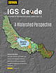
 | | Journal (issue) | | Contents From the State Geologist Activities of the Iowa Geological Survey 2021-22 A 1:24,000 scale surficial...Survey's Earth MRI Program 8 Partnering with the Iowa Department of Natural Resources 9 Mapping the...the Illinoian Glacial Boundary in Southeast Iowa 10 Mapping Bedrock Topography in Detail recognized leader...Iowa's Phosphorus Using Turbidity 20 Fluoride in Iowa Groundwater 22 Assessing Delta Sediments and NO...Watershed, which includes Storm Lake in Buena Vista County. 1 ~ o,.. To collect, reposit, T E ,~ and interpret |  | | Report (issue) | | with the IOWA DEPARTMENT OF NATURAL RESOURCES, IOWA GEOLOGICAL SURVEY; and the UNIVERSITY OF IOWA HYGIENIC...Water Used for Selected Municipal Water Supplies in Iowa, 1997–2002 Water Years Open-File Report 2004–1048...Supplies in Iowa, 1997–2002 Water Years By Gregory R. Littin Prepared in cooperation with the Iowa Department...Department of Natural Resources, Iowa Geological Survey, and the University of Iowa Hygienic Laboratory Open-File...water used for selected municipal water supplies in Iowa, 1997–2002 water years: U.S. Geological Survey Open-File |  | | Journal (article/letter/editorial) | | Postcard view of the Waukon iron mine, Allamakee County, cia. 1912. John Taylor collection. ARTHUR E ...HAROLD L. PRlOR P.O. Box 111 Columbus Junction, Iowa 52738 halprior@ louisacomm.net When we began this...too, could be cited with many other localities. Iowa contains the type locality for one mineral, iowaite...December 2014 Figure 2. Map of Iowa showing the counties. Courtesy Iowa Geological Survey. ACKNOWLEDGMENTS...is courtesy of the Iowa Geological Survey. Localities by County Allamakee County Lansing, Lansing lead |  | | Book (edition) | | are valued chiefly for pattern, and agate and jasper among semi- precious materials are even classified...topaz crystal And is such a chameleon color, or jasper), etc. gem if you not yellow, nor are might...masses such as occur in the — hollow, found geodes Iowa region, and from them weather the types of agates...specific locations are comparatively few, but jasper, agate and even more valuable stones may turn...portion just left of center. Orbicular or "poppy" jasper with yellow, red, and orange patterns. How |  | | Journal (article/letter/editorial) | | large area covering northern Missouri, southern Iowa, northeastern Kansas and eastern Nebraska, in which...and possibly it occurs as far south as northern Iowa. The Illinois glacial lobe at its maximum extension...crossed the Mississippi and encroached a few miles on Iowa, in the district between Clinton and Ft. Madison...formed by the western lobe which covered much of Iowa and portions of the neighboring states. The southwestern...ridged drift. Beginning at the south, in Jersey county, Ill., a few miles north of St. Louis, and tracing |  | | Report (issue) | | I s { IOWA ft 7 ■■• A * i . ;» \ P* A 7-. ■ «*"V ' r * < •+ ' 1 ’ T, / • k’-/ 5...i S' s I . " * • * «r- ‘ ; ' Geologist, Iowa Geological Survey ' .*4** =»*' I Paul*J. Horick...Jithill * v'v* l* Iowa Geolo^ica^Survey Educational Series 2 V . - -■' ( J Iowa Geological Survey...Educational Series 2 THE MINERALS OF IOWA by Paul J. Horick Geologist Iowa Geological Survey edited by Otto...STATE OF IOWA 1974 Library of Congress Catalog Card Number: 74-620075 Available from the Iowa Geological |  | | Report (issue) | | IN SOUTHEASTERN IOWA Open-File Report 79-415 Prepared in cooperation with the Iowa Geological Survey...Survey U.S. GEOLOGfCAL SURVEY P.O. BOX 1230 IOWA CITY, IA 52244 f f '• i't " : UNITED STATES DEPARTMENT...SOUTHEASTERN IOWA By Daniel J. Gockel Open-File Report 79-415 Prepared in cooperation with the Iowa Geological...Geological Survey Iowa City, Iowa January 1979 k. •♦ .'.••••••,- *$• TABLE OF CONTENTS Page Abstract...Henry 29 Iowa 37 Jasper Jefferson Johnson Keokuk Lee Louisa Mahaska Marion Monroe Muscatine Poweshiek |  | | Journal (article/letter/editorial) | | University of Memphis, Memphis, Tennessee 38152, USA ABSTRACT Late Neogene upland gravels of the Mississippi...(Willman and Frye 1970). In Minnesota, Wisconsin, and Iowa, similar gravels are called the Windrow Formation...Adams, and Pike Counties in Illinois and in Muscatine County, Iowa (Horberg 1950; Nelson 2010), suggest that...Zumbro-Buffalo, D p Root-LaCrosse, E p Turkey–upper Iowa–Pecatonica, F p Kickapoo, G p Maquoketa, H p Wapsipinicon...Wisconsin but also occurs in some glaciated regions of Iowa and Minnesota (figs. 1, 2; Horberg 1950). The Windrow |  | | Report (volume) | | DIRECTOR BULLETIN 569 RESULTS OF SPIRIT LEVELING IN IOWA 1896 TO 1913, INCLUSIVE R. B. MARSHALL, CHIEF GEOGRAPHER...GEOGRAPHER WORK DONE IN COOPERATION WITH THE STATE OF IOWA FROM 1907 TO 1913, INCLUSIVE WASHINGTON GOVERNMENT...quadrangle (Lee County)...................................... Des Moines quadrangle (Polk County) ...........counties). Attica and Knoxville quadrangles (Marion County)...................... Pella quadrangle (Mahaska............... Burlington quadrangle (Des Moines County)................:........... 8 12 12 18 20 20 |  | | Report (issue) | | Water Used for Selected Municipal Water Supplies in Iowa, 1982-96 Water Years By BRYAN D. SCHAAP and S. MIKE...with the IOWA DEPARTMENT OF NATURAL RESOURCES, GEOLOGICAL SURVEY BUREAU; and the UNIVERSITY OF IOWA HYGIENIC...HYGIENIC LABORATORY Iowa City, Iowa 1998 U.S. DEPARTMENT OF THE INTERIOR BRUCE BABBITT, Secretary U.S...Room 269, Federal Building 400 South Clinton Street Iowa City, IA 52244 U.S. Geological Survey Information..................................^ Description of Iowa Ground-Water-Quality Monitoring Program........ |  | | Book (volume) | | Virginia VOLUME 3: THE NORTHWESTERN QUANDRANT Idaho, Iowa, Kansas, Minnesota, Missouri, Montana, Nebraska...TREASURES VOLUME ep The Northwestern Quadrant Idaho, Iowa, Kansas, Minnesota, Missouri, Montana, Nebraska...volumes, through very precise directions and accurate county maps, to get you to the best and most accessible...for the county in which it is located. This site number also appears under the given county in the text...under the heading of Nebraska, on the map of Sioux County, the site x How to Use This Book indicated |  | | Book (volume) | | Dahlonega Co. and Rabum Co., and the McDuffie County Belt extending through portions of McDuffie, Warren...Sphalerite. BALDWIN COUNTY MILLEDGEVILLE, at state farmjasper. BANKS COUNTY COMMERCE, along Hwy. 59...along adjoining Co. linerock crystal. BARROW COUNTY WINDER, along rd. to Jefferson and 1½ mi. inside...in the United States BARTOW COUNTY AREA, Saltpeter Cave, as floatjasper. CARTERSVILLE: area barite...cuts, etc.agate, (banded, various colors), jasper. BIBB COUNTY MACON: at Holton Quarry, 7½ mi. NWagate; |  | | Report (issue) | | WATER-RESOURCES ACTIVITIES OF THE U.S. GEOLOGICAL SURVEY IN IOWA, FISCAL YEAR 1994 Compiled by ROBERT C. BUCHMILLER_____________...cooperation with the STATE OF IOWA and other agencies Iowa City, Iowa 1994 U.S. DEPARTMENT OF THE...Federal Building, Room 269 400 South Clinton Street Iowa City, IA 52244-1230 U.S. Geological Survey Earth...WATER-RESOURCES ACTIVITIES OF THE U.S. GEOLOGICAL SURVEY IN IOWA, FISCAL YEAR 1994 CONTENTS Page Message from the.................................................2 Iowa District Organization.......................... | | | Report (issue) | | Prepared in cooperation with the Iowa Department of Transportation and Iowa Highway Research Board (Project...in the Iowa River and Cedar River Basins, Eastern Iowa Cedar River Basin Iowa River Basin IOWA Open-File...30 to June 15, 2008, in the Iowa River and Cedar River Basins, Eastern Iowa By S. Mike Linhart and David...Prepared in cooperation with the Iowa Department of Transportation and Iowa Highway Research Board (Project...May 30 to June 15, 2008, in the Iowa and Cedar River basins, eastern Iowa: U.S. Geological Survey Open-File |  | | Report (issue) | | THE GROUND-WATER-LEVEL MONITORING NETWORK IN IOWA By Rebecca B. Lambert___________________________________...in cooperation with the IOWA DEPARTMENT OF NATURAL RESOURCES Iowa City, Iowa 1992 U.S. DEPARTMENT OF...Federal Building 400 South Clinton Street Iowa City, Iowa 52244 U.S. Geological Survey Books and Open-File...11 THE GROUND-WATER-LEVEL MONITORING NETWORK IN IOWA CONTENTS Page Abstract.........................purposes, and applications to principal aquifers in Iowa................................................ |  | | Book (edition) | | describes sites under of the nearest town and county. and the many maps included book contain such...eye. Minerals of this sort, such as agate and jasper, are described as cryptocrystal- line. For example...Tenacity is a quality closely allied chalcedony and jasper, because of their makeup, are tougher than their...but inexhaustibly various patterns of agate and jasper. So typical are their patterns that these materials...jaspers eroded from older rocks. The Indiana and Iowa geodes and the Montana moss agates are produced |  | | Book (edition) | | MARIN COUNTY FREE LIBRARY 3 1111 00289 4184 \ I s Fifth Revised Edition A complete, state-by-state...the eye. Minerals of this sort, such as agate and jasper, are described as cryptocrystalline. For example...closely allied to fracture pattern; chalcedony and jasper, because of their cryptocrystalline makeup, are...opaque does not pass light. Agate is translucent; jasper is opaque. if it Color one of the principal...but inexhaustibly various patterns of agate and jasper. So typical are their patterns that these materials |  | | Book (volume) | | in the north. ALEXANDER COUNTY FAYVILLE, area stream gravels⎯agate, jasper, rare alluvial Diamond. THEBES:...the Mississippi R.⎯agate, jasper; d RR siding of Clay⎯agate. CALHOUN COUNTY AREA, shores of the Mississippi...crystals). CRAWFORD COUNTY PALESTINE, area deposits⎯Siderite. EDWARDS COUNTY AREA, T. 1 S, R. 10 E...E, regional deposits⎯Siderite. FULTON COUNTY FARMINGTON, W 6 mi. on Rte. 116 to the Rapatee No. 5 strip...mine⎯pyritized gastropods (Pennsylvanian age). GRUNDY COUNTY AREA: c Regional rd. and RR cuts and banks of Mason |  | | Book (volume) | | in the north. ALEXANDER COUNTY FAYVILLE, area stream gravels⎯agate, jasper, rare alluvial Diamond. THEBES:...the Mississippi R.⎯agate, jasper; d RR siding of Clay⎯agate. CALHOUN COUNTY AREA, shores of the Mississippi...crystals). CRAWFORD COUNTY PALESTINE, area deposits⎯Siderite. EDWARDS COUNTY AREA, T. 1 S, R. 10 E...E, regional deposits⎯Siderite. FULTON COUNTY FARMINGTON, W 6 mi. on Rte. 116 to the Rapatee No. 5 strip...mine⎯pyritized gastropods (Pennsylvanian age). GRUNDY COUNTY AREA: c Regional rd. and RR cuts and banks of Mason |  | | Report (volume) | | Edward Barrett, Indianapolis. Iowa.............. Prof. George F. Kay, Iowa City. Kansas............Prof...See Bauxite and Hallpysite. Asbestos. Tallapoosa County, with corundum deposits near Dudleyville; not found...commercial quantity or quality. Asphalt. Colbert County, small quantity has been shipped from near Leighton;...following localities: Bibb County, Pratts Ferry; Calhoun County, near Tampa; Clay County, T. 20, Pv. 7 E.; Jefferson...Jefferson County, at Elyton; Lee County, at Chewacla lime works; St. Clair County, at Gfeensport; Shelby |  | | Report (volume) | | ..'........................................ 126 Iowa...................................................Barrett, Indianapolis. Iowa___ __Prof. George F. Kay, Iowa City. Kansas_____Prof. Erasmus Haworth, Lawrence...See Bauxite and Halloysite. Asbestos. Tallapoosa County, with corundum deposits near Dudleyville; not found...commercial quantity or quality. Asphalt. Colbert County, small quantity has been shipped from near Leighton;...following localities : Bibb County, Pratts Ferry; Calhoun County, near Tampa; Clay County, T. 20 S., R. 7 E.; |  | | Book | | HfiRIN COUNTY FREE LIBRfiRY 311110G386652Q I V Russell P MacFal A COLOR TREASUF FOR COLLECTORS...to Hunting Locations ? i 9 GIVEN TO THE MARIN COUNTY LIBRARY BY MARI N L MTNF.RAT. SOCTETY DAVID...may be able to buy specimens. map of Keweenaw County. Mich- Part of the U.S. Geological Survey topographic...may be necessary crystals size. the area where Iowa, and Illinois tVlissouri, together near the Mississippi...Tumbler-polished stones. First row above, left to rigfnt; jasper from Nepal: rose quartz and ametfiyst quartz from |  | | Report (issue) | | locality, or civil division (city, village, or county) named for a physical feature is always listed...information is usually self-explanatory, for example: county seat. Feature Class (second column) The terms listed...their definitions. County (third column) This column lists the name of the county in which the entity...place, feature, or area lies in more than one county, the county listed is the one in which the center of...in the case of a stream, valley, or arroyo, the county listed is the one in which the mouth of the feature |  | | Report (issue) | | north threeIsland. Mercer County, and the south quarter is in Warren County. (See fig. 1.) It is bounded...the largest town in the Aledo, the county seat of Mercer County, quadrangle and has a population of...Rock Island County, it is 250 feet thick. Dresbach is the name of a town in Winona County, Minnesota,...name is derived from a river (now called Upper Iowa), in Iowa along whose valley the formation is well developed...is derived from the town of Shakopee, in Scott County, Minnesota, where it was quarried for lime. 17 |  | | Book | | canbe (tw ne wt? re by= es ids sy < Seu COUNTY ne i ne Ne tee 2 ae Nhe Se ‘ Ds aan v~ s...encroached upon the marsh. “In the eastern part of the county, along the lake shore, we often find the black...at various points along the lake shore in this county and elsewhere. The bed no. 7 of the section was...S. Blatchley in discussing the geology of Lake County, mentions glacial Lake Chicago. On page 38 silts...Buffalo, Michigan. Mr. Glavin, formerly county surveyor of Berrien County, reports having observed shells as |
|


