| Classification |
|---|
|
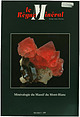
| Species: | Aeschynite-(Y) |
| Formula: | (Y,Ln,Ca,Th)(Ti,Nb)2(O,OH)6 |
| Confirmation |
|---|
|
| Validity: | Believed Valid |
| Data |
|---|
|
| Mineral Data: | Click here to view Aeschynite-(Y) data |
| Locality Data: | Click here to view Tête Noire, Trient, Martigny, Valais, Switzerland |
| Data Identifiers |
|---|
|
| Mindat Occurrence Record ID: | 434286 |
| Long-form Identifier: | 1:3:434286:1 |
| GUID (UUID V4): | 73f3ef01-845d-42ff-a557-4a9af4abaeb0 |
| Nearest other occurrences of Aeschynite-(Y) |
|---|
|
|
| 8.7km (5.4 miles) | ⓘMartigny road tunnel, Mont Chemin mining district, Martigny, Valais, Switzerland |
| 11.0km (6.8 miles) | ⓘTête des Econduits, Mont Chemin mining district, Martigny, Valais, Switzerland |
| 14.0km (8.7 miles) | ⓘAiguille de l'A Neuve, La Fouly, Ferret Valley, Orsières, Entremont, Valais, Switzerland |
| 20.2km (12.6 miles) | ⓘTriolet Glacier, Courmayeur, Aosta Valley, Italy |
| 28.5km (17.7 miles) | ⓘBrenva Glacier, Courmayeur, Aosta Valley, Italy |
| 71.6km (44.5 miles) | ⓘLa Baisse, Bonneval-Tarentaise, La Léchère, Albertville, Savoie, Auvergne-Rhône-Alpes, France |
| 87.4km (54.3 miles) | ⓘArnas Valley (Rio Arnas Valley), Mussa Alp (Pian della Mussa; Piano della Mussa; La Mussa; Lamussa), Balme, Metropolitan City of Turin, Piedmont, Italy |
| 93.0km (57.8 miles) | ⓘVeglia Alp (Alpe Veglia), Varzo, Verbano-Cusio-Ossola Province, Piedmont, Italy |
| 94.3km (58.6 miles) | ⓘAl Piudel inferior REE-mineralization, Veglia Alp (Alpe Veglia), Varzo, Verbano-Cusio-Ossola Province, Piedmont, Italy |
| 94.5km (58.7 miles) | ⓘAl Piudel superior REE-mineralization, Veglia Alp (Alpe Veglia), Varzo, Verbano-Cusio-Ossola Province, Piedmont, Italy |
| References |
|---|
|
|
| Reference Search (possible matching items) |
|---|
 | | Journal (issue) | | - Andréa DALIA - Jacques DIETRJCH Catherine FERA Y - Jacques GAL VIER - Laurent GAUTRON Jean-Christian...Alain BOUEZ Claude-Julien DUCARRE - Dominique FERA Y - Roland FOURNEL Jean-Christian GOUJOU - F. HANS -...perfection nulle part égalé. Au début, j'avais, sans y prendre garde, presque oublié cette singularité. Puis...place en métamorphisant les sédiments anciens et en y injectant des filons: ce sont les gneiss et schistes...in értd • h o r s sér ie V une coupe régionale y est dessinée (figure 3g) ainsi qu'un scénario schématique |  | | Journal (issue) | | cette revue, rêvée depuis longtemps, est née il y a dix années ... Contre vents et marées, à l'encontre...donc dans vos boîtes aux lettres début mars, nous y travaillons d' arrache-pied (n ' est-ce pas RDAG et...and rare earths minerais (allanite-Ce and xenotime-Y). ln 2001, he collected aggregates of orpiment with...titanium, Upper Triassic, Vanoise massif, xenotime-(Y), "1731 Mine". INTRODUCTION En 1968, une fente alpine...dans des schistes riches en veines. Une paroi gravée y mentionnait l' année 1731, époque de Charles-Emmanuel |
|


