 | | Report (issue) | | that originally contained halite and probably dolomite; and (3) scapolitic siltite, metamorphosed siltstone...content for possible application in reclamation of mine waste. The small volume of limestone, and the intimately...those of the formation in the vicinity of the townsite of Yellowjacket, where the formation was originally...Creek (fig. 2), for about 7 km north from the townsite of Yellowjacket, as the principal reference section...Yellowjacket Formation in the vicinity of the townsite of Yellowjacket (figs. 1, 2). Rember and Bennett |  | | Report (issue) | | PRELIMINARY GEOLOGIC MAP OF THE FRISCO QUADRANGLE, BEAVER COUNTY, UTAH By D. M. Lemmon and H. T. Morris U.S. Geological...is present only in the general vicinity of the townsite of Frisco, where it overlies the Isom Formation...near Frisco townsite are alunitized and silicified, and the pipes near the Cactus mine are mineralized...Silver Andesite of Stringham (1967) near Frisco townsite. Except for their distinctly porphyritic texture...a dacite* In the area north of the Horn Silver mine, some of these rocks have been propylitized, argillized |  | | Journal (article/letter/editorial) | | quartz and rhombic dolomite, fracturing, fracture-filling cementation, saddle dolomite, late leaching, and...contemporaneous with such late diagenetic features as saddle dolomite and authigenic sulfides; however, the extent to...1970's and evolved into five shur County; M.S. theses at Texas A&M County; Faucette, 1981; 0037-0738/89/$03...Publishers B.V. Teague porosity Rock-Gilmer Townsite problem" at Field, Up- Field, Freestone and...of the studies on Indian RockGilmer and Teague Townsite Fields have been published previously (Fall and |  | | Report (issue) | | Thomas Range and Northern Drum Mountains, Juab County, Utah By DAVID A. LINDSEY GEOLOGICAL SURVEY PROFESSIONAL...Spor Mountain Formation at the Roadside beryllium mine 22. Histograms showing the abundance of BeO, uranium...geochemical samples in two ore lenses in the Yellow Chief mine 39 42 43 48 49 50 52 TABLES Page TABLE 1. 2...samples from two ore lenses in the Yellow Chief mine Chemical analyses of igneous rocks of the Thomas...THOMAS RANGE AND NORTHERN DRUM MOUNTAINS, JUAB COUNTY, UTAH By DAVID A. LlNDSEY ABSTRACT The Thomas |  | | Journal (article/letter/editorial) | | 2016 A History of Mineral Collecting at the Chino Mine VIRGIL W. LUETH New Mexico Bureau of Geology and...Socorro, New Mexico 87801 vwlueth@nmt.edu Grant County, New Mexico RONALD B. GIBBS ROBERT M. NORTH Freeport...ron_gibbs@fmi.com robert_north@fmi.com T he Chino mine is probably one of the oldest collecting sites in...collected at the site since prehistoric time. The mine derives its name from the Spanish term for chalcopyrite...long been reported. The Chino mine is located in eastern Grant County, New Mexico, approximately 12 miles |  | | Journal (issue) | | The Tri-State Mining District Missouri-Kansas-Oklahoma by Denise Bicknell Wendell E. Wilson 2017 The...Thomas P. Moore COVER: CALCITE on GALENA and dolomite, 19 cm, from Webb City, Missouri. Mark Pospisil...Tucson USA Visit us at these international shows: Houston Ste. Marie Denver Munich USA France USA Germany...and Riverpark Inn Rhodochrosite, Sweet Home Mine, USA, 10 cm Photo: Malte Sickinger MARCUS BUDIL Monaco... The Tri-State Mining District Missouri-Kansas-Oklahoma Denise Bicknell 16711 East Whimbrel Circle Conroe |  | | Report (issue) | | replacing older host rocks, commonly limestone or dolomite. It is a useful ore guide in many mining districts............................ Tri-State district, Oklahoma, Kansas, and Missouri ................................................................ Getchell mine area (Potosi district) ................ Gilbert........................................... Howell mine area ............................................................... 12. Incipient jasperoid in dolomite ............................................. |  | | Report (volume) | | debris flows 21 Discussion 23 Recovery of Skidoo townsite and the Skidoo pipeline 24 History of Skidoo and...Methods 26 Skidoo townsite 26 The Skidoo pipeline 29 Results 31 Recovery at Skidoo townsite 31 Recovery along...terraces in Gold Valley and recovery of Gold Valley townsite 34 Methods 36 Terrace sequences A and B 36 Terrace...Terrace sequence C and Gold Valley townsite 37 Discussion 42 Recovery of Greenwater, Kunze, and Furnace...townsites 50 Recovery of vegetation at Greenwater townsite 51 Recovery of vegetation at Furnace and Kunze |  | | Journal (issue) | | ................ 85 by J. R. Thompson Ferroan dolomite from the Vekol m in e ..........................by D. Jones The minerals of Malpais Hill, Pinal County, Arizona..............................109 by R...by W. Hunt Famous mineral localities: the Hilltop mine ..........................................121 by...by D. K. Miller and W. E. Wilson The Silver Bill mine, Gleeson, Arizona ................................of an Indian miner was found preserved in a salt mine, where he had been killed in a cave-in (see Thompson |  | | Report (volume) | | some existing unimproved roads and the proposed townsite at East Clark Bench 24 Map showing all deep drill...mudstone, and marine shale. Conglomerate, limestone, dolomite, gypsum, and coal are common lo- cally. Many...1920's (Gregory and Moore, 1931). The Spencer coal mine was opened in 1913 in the southern Kaiparowits Plateau...Coal-Basin Area, Utah Creek (fig. 3). Coal from that mine was transported by wagon and pack horse, and finally...1978), wooden rails used for coal transport at a mine that worked this seam could be seen as late as 1965 |  | | Report (issue) | | Arbuckle Group and consists of sandstone, shale, dolomite, and limestone. The group thins regionally toward...much as 239 feet thick, consists of limestone, dolomite, and chert. In much of the western part of the...deposited. The Sylvan Shale consists of shale and dolomite and unconformably overlies the Viola. It is found...southwestern part of the area adjacent to the Oklahoma State line. In the eastern part of the study area...north from a more rapidly subsiding basin area in Oklahoma. Precambrian rocks were locally exposed by erosion |  | | Report (issue) | | but is not labelled. - BANCROFT TRlP 1 - This mine is closed and most of the Photo 27, p. 59 buildings...now Highway 28. - From Stop 11, Craigmont Corundum Mine, to Combermere, take Highway 517; the road as illustrated...miles northeast of Toronto and 150 miles west of Ottawa. The countryside is of great scenic beauty with...massive quartz core; cover Quadeville. Genesee No. 2 mine, north of Bancroft. (4 The lift lock on the Trent...mill, Bancroft. Sodalite from the Princess sodalite mine near Bancroft. Granite gneiss cliffs just outside |  | | Journal (article/letter/editorial) | | hydrothermal replacement of Middle ProterozOic dolomite m an intracontmental rift setting. A variety of...contained the chemical solutIOns that reacted With the dolomite and crcated the enormous concentratIOn ofminerahzed...bodies occur as hydrothermal replacements of the dolomite unit (Y8) of the Bayan Obo Group of Middle Proterozoic...shale with carbonate beds Y8 390 Limestone and dolomite with quartzite beds '" '" Y7 115 '0 Y6 Sandstone...ore-bearing syncline, this unit is a 45 tan dolomite and also contains thin shale beds and scattered |  | | Journal (article/letter/editorial) | | including gold. However. except for the Homestake mine, which has operated for more than 120 years, most...FiridofGt~rnSphultirite ut IIIP Bulinut Zinc Mine, St. Luwrence County, tditor of NPW b r k ” unrl iipptwwl...and additions. Mlneral Index by Counties Brule County Elm Creek, IS mi. S. of Chamberlain, near junction...of Pierre Formation: barite (gray roses). Butte County Belle Fourche, 6 mi. W., secs. 23, 24, 25. and...Moreau River: barite* (similar to Elk Creek. Meade County, but smaller), calcite (yellow crystals), gypsum |  | | Book | | AMERICAN PLATE 2. CAMBRIAN SLATE, QUARTZITE 3. DOLOMITE, SHALE, LIMESTONE 4. SANDSTONE, SHALE sailing...Banff townsite is in the Front Ranges and Jasper townsite is in the Main Ranges. Radium townsite is right...to pale-grey limestone or a light brown to pink dolomite (rock which contains a lot of calcium which has...years ago this rock is dark-brown limestone and dolomite. The best places to see it are: (1) 100 m west...475 million years ago, this rock is light-grey dolomite and may change col or to yellow or orange when |  | | Field Trip Notes | | adapted from the 1991 guide are noted by (91). All mine production values are from the 1941 or 1991 guides...Mariposa and to terminate at Georgetown in Placer County. It forms a more or less continuous belt of quartz...terminus of Highway 49. Mariposa, the county seat of Mariposa County, is on the tourist route to Yosemite...Yosemite Valley, and its fine old County Courthouse, a white frame structure erected in 1854 has been in use...Museum, Mariposa County Fairgrounds, Mariposa COUNTY FAIR GROUNDS : Mariposa Mine A mile south of Mariposa |  | | Report (issue) | | Mountains. Geologic map of the Montosa Canyon-Glove mine area, west flank of the Santa Rita Mountains. Geologic...Permian § 5 Naco Group * 200 Limestone and dolomite; a little sandstone. 0-300 Concha Limestone...pale-reddish-gray, fine-grained. 140 ± Middle dolomite member Dolomite, light- to medium-gray. 120 ± Lower...quartzite and basal siltstone members Epitaph Dolomite fine - grained ; 460 ± Upper member Limestone...intercalated dark- to medium-gray medium-thickbedded dolomite. 620 ± Quartzite, pale -yellowish - gray, basal |  | | Report (issue) | | of Dr. Zeller's geologic findings in the Hidalgo County region. Frank E. Kottlowski NEW MEXICO STATE...500-foot-thick unnamed unit of thin-bedded limestone, dolomite, gypsum, and shale of probable Early Cretaceous...Comparisons of his map and mine show great differences, and the burden of proof is mine in areas in which we...southern part of the range, from the Copper Dick mine southward, has a large percentage of intrusive masses;...rock is thin-bedded, brownweathered siltstone and dolomite. The contact of these beds with the Horquilla |  | | Report (issue) | | Geology and Ore Deposits of the Picher Field Oklahoma and Kansas GEOLOGICAL SURVEY PROFESSIONAL PAPER... Geology and Ore Deposits of the Picher Field Oklahoma and Kansas By EDWIN T. McKNIGHT and RICHARD P...Ordovician Series.____________________ Cotter Dolomite._______________________ Devonian and Mississippian...PLATE FIGURE 1. 2. 3. 4. Map showing towns and mine workings in the main part of the Picher field. Geologic...dolomitized areas in part of the Picher zinc-lead field, Oklahoma and Kansas: 5. Northwest sheet. 6. Northeast sheet |  | | Book | | Geological Map of the Sudbury Area (1891) 49 4.1 Early Mine Sites in the Sudbury Area (1884-1917) 57 5.1 Early...Mand-Victoria Mines Setting and Finns in Mond Townsite (ea. 1917-1918) 8.3 Sketch Map of Garson (1935)...Date of Survey, and Origin of Name 46 4.1 Early Mine Sites in the Sudbury Area (1884-1917) 54 5.1 Population...Force by Industry (1951-2001) 230 13.1 Presidents of Mine Mill/CAW and Steelworkers Locals in Sudbury 239...a look at the evolution of Sudbury from a CPR townsite first into a town, and then a city by the Second |  | | Report (volume) | | _____________ Kergon mine.__________-__--__-_----_--_____-_----____________ Miracle mine.________________...the- Kergon mine. 23. Geologic map of the Kergon mine area. 24. Geologic map of the Miracle mine area. 25...surface and underground workings at the Miracle mine. FIGURE 21. Index map showing the location of the...of some uranium-bearing samples from the Kergon mine._________________________ ________ 6. Chemical and...of some uranium-bearing samples from the Miracle mine area____________________________ 8. Chemical and |  | | Journal (issue) | | COTTONWOOD AREA, UT AH. By Ronald L. 1-ves... . CHlLIAN DOLOMITE DEPOSITS PROMISE INDUSTRIAL VALUE ........................ . SHEBA, SOUTH AFRICA'S OLD EST GOLD MINE ....................................... . WITH OUR...topography of the Little Cottonwood Area, Salt Lake County, Utah, are here described, and the geologic history...an unconformity, separating the Jefferson ( ?) dolomite, of probable Devonian age, from the lower formations...formations. Resting unconformably on the Jefferson dolomite is a thick sequence of beds, composed of the Deseret | 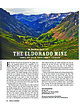 | | Journal (article/letter/editorial) | | 20:52 13 January 2015 Mineralogy of the Eldorado Mine YA N K E E B O Y B A S I N , O U R AY C O U N T...almost every major mining camp had a vein, claim, or mine with that name. This article details the history...history, geology, and mineralogy of the Eldorado mine in the San Juan Mountains of southwestern Colorado, one...not bring wealth to its many owners. The Eldorado mine is located about 8.6 miles southwest of Ouray, Colorado...the Sneffels mining district. The portal to the mine is at an elevation of 11,600 feet and is situated |  | McCammon, Richard B., Light, Thomas D., Rinehart, C. Dean, Weber, Florence R., Lee, Gregory K., Bie, Scott W. (1997) Map showing mineral resource potential of the Livengood Quadrangle, Alaska. Open-File Report Vol. 1997 (97-484) US Geological Survey doi:10.3133/ofr97484b | Report (issue) | | a belt of grit, slate, mafic-ultramafic rocks, dolomite, chert, conglomerate, shale, and limestone of...(Hollister, 1991b). 10 L5tf Off Livengood townsite 6^00' Figure 2. Area of mineral resource tract...tract 1 (shaded). istfcw Livengood townsite l-tS'OO' Figure 3. Area of mineral resource tract 2 (shaded)...Ruth, Lillian, and Olive Creeks, near Livengood townsite. The claims were located principally on quartz...the intrusion is lacking however. 18 Livengood townsite Iff 00' Figure 6. Area of mineral resource tract |  | Shelton, K. L., McMenamy, T. A., Hees, E. H. P. v., Falck, H. (2004) Deciphering the Complex Fluid History of a Greenstone-Hosted Gold Deposit: Fluid Inclusion and Stable Isotope Studies of the Giant Mine, Yellowknife, Northwest Territories, Canada. Economic Geology, 99 (8) 1643-1663 doi:10.2113/gsecongeo.99.8.1643 | Journal (article/letter/editorial) | | Inclusion and Stable Isotope Studies of the Giant Mine, Yellowknife, Northwest Territories, Canada KEVIN...various times throughout their histories. The Giant mine is an example of such an extremely complicated system...least two styles of gold ore introduction in the mine area, including both refractory, sulfide-hosted...quartz-carbonate mineralization are recognized in the Giant mine. Stage I encompasses deposition of dominant refractory...are connected to metasedimentary rocks east of the mine by an east-dipping alteration zone characterized |
|


