| Locality type: | Mine |
| Classification |
|---|
|
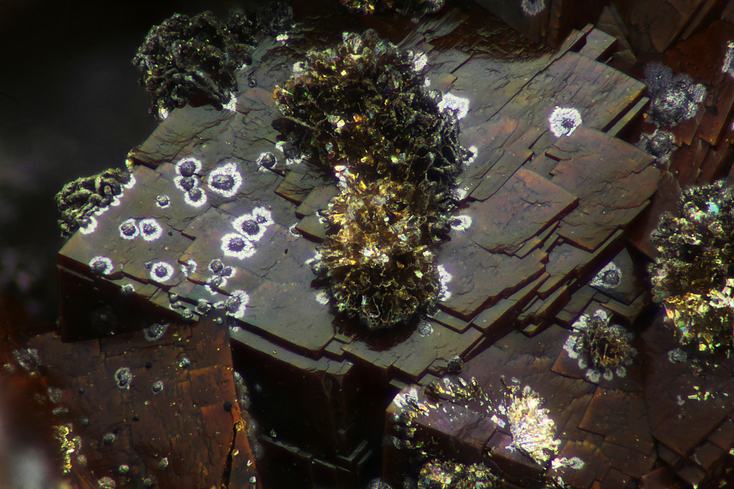
| Species: | Ranciéite |
| Formula: | (Ca,Mn2+)0.2(Mn4+,Mn3+)O2 · 0.6H2O |
| Confirmation |
|---|
|
| Validity: | Believed Valid |
| Associated Minerals Based on Photo Data: |
|---|
|
| Ankerite | ⓘ4 photos of Ranciéite associated with Ankerite at this locality. |
| Aragonite | ⓘ2 photos of Ranciéite associated with Aragonite at this locality. |
| Data |
|---|
|
| Mineral Data: | Click here to view Ranciéite data |
| Locality Data: | Click here to view St Nicolas Mine (Großsilberthal vein), Silberthal, Steinbach, Thann-Guebwiller, Haut-Rhin, Grand Est, France |
| Photo Gallery | View Gallery (4 photos) |
| Data Identifiers |
|---|
|
| Mindat Occurrence Record ID: | 1038446 |
| Long-form Identifier: | 1:3:1038446:0 |
| GUID (UUID V4): | 1bdbb06e-e2c3-40cb-b876-f1d61636665b |
| Nearest other occurrences of Ranciéite |
|---|
|
|
| 6.4km (3.9 miles) | ⓘAllenbourn (Allenburn), Bitschwiller-lès-Thann, Thann-Guebwiller, Haut-Rhin, Grand Est, France |
| 17.4km (10.8 miles) | ⓘSteingraben Mine, Urbès, Thann-Guebwiller, Haut-Rhin, Grand Est, France |
| 40.8km (25.3 miles) | ⓘLe Couvent workings, Saphoz, Esmoulières, Lure, Haute-Saône, Bourgogne-Franche-Comté, France |
| 41.2km (25.6 miles) | ⓘLa Corveraine workings, Saphoz, Esmoulières, Lure, Haute-Saône, Bourgogne-Franche-Comté, France |
| 41.9km (26.0 miles) | ⓘLes Rans workings (Forêt des Mottes), Saphoz, Esmoulières, Lure, Haute-Saône, Bourgogne-Franche-Comté, France |
| 43.2km (26.8 miles) | ⓘAltenberg, Sainte-Marie-aux-Mines, Colmar-Ribeauvillé, Haut-Rhin, Grand Est, France |
| 45.7km (28.4 miles) | ⓘCep de Vigne, Altenberg, Sainte-Marie-aux-Mines, Colmar-Ribeauvillé, Haut-Rhin, Grand Est, France |
| 74.2km (46.1 miles) | ⓘGruhalden clay pit, Frick, Laufenburg, Aargau, Switzerland |
| 89.4km (55.5 miles) | ⓘChalch quarry, Holderbank, Lenzburg, Aargau, Switzerland |
| References |
|---|
|
|


St Nicolas Mine, Silberthal, Steinbach, Thann-Guebwiller, Haut-Rhin, Grand Est, France