| Locality type: | Placer |
| Classification |
|---|
|
| Type: | Sand |
| Confirmation |
|---|
|
| Validity: | Believed Valid |
| Data |
|---|
|
| Mineral Data: | Click here to view Sand data |
| Locality Data: | Click here to view Fisher Placer, Castle Creek Mining District, Idaho County, Idaho, USA |
| Data Identifiers |
|---|
|
| Mindat Occurrence Record ID: | 1050976 |
| Long-form Identifier: | 1:3:1050976:8 |
| GUID (UUID V4): | 78c10c5f-a964-424e-8e48-969729395566 |
| Nearest other occurrences of Sand |
|---|
|
|
| 2.3km (1.4 miles) | ⓘHolmes Placer, Castle Creek Mining District, Idaho County, Idaho, USA |
| 2.8km (1.7 miles) | ⓘClara Ophelia Placer, Castle Creek Mining District, Idaho County, Idaho, USA |
| 3.6km (2.2 miles) | ⓘTelegram Placer, Castle Creek Mining District, Idaho County, Idaho, USA |
| 5.2km (3.2 miles) | ⓘGrouse Creek Placer (1), Castle Creek Mining District, Idaho County, Idaho, USA |
| 8.5km (5.3 miles) | ⓘGeary Placer (Big Cove), Castle Creek Mining District, Idaho County, Idaho, USA |
| 23.3km (14.5 miles) | ⓘNewsome and Leggett Creek Placer, Tenmile Mining District, Idaho County, Idaho, USA |
| 23.4km (14.5 miles) | ⓘBuckeye Placer, Tenmile Mining District, Idaho County, Idaho, USA |
| 29.7km (18.5 miles) | ⓘCrooked River Placer (Gold Point Claims; Lux; Hi - Lo; Riverside; Mt. Carmel Black Sand; Blue Moon; Alma; Ramona; Vista), Tenmile Mining District, Idaho County, Idaho, USA |
| 32.4km (20.1 miles) | ⓘMiller Creek Placer Mine, Florence Mining District (French Creek Mining District), Idaho County, Idaho, USA |
| 34.1km (21.2 miles) | ⓘBuffalo Hill Placer (Elk City; Elk City Mine; Buffalo Gulch Mine; Buffalo Gulch Project; Buffalo Gulch Dredge), Elk City Mining District, Idaho County, Idaho, USA |
| References |
|---|
|
|
| Reference Search (possible matching items) |
|---|
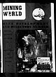 | | Journal (issue) | | COVERED BY PATENTS AND APPLICATIONS IN THE MAJOR MINING cewrens: oF THe woRtoes F _—, pf fj / N >,...feel that you are getting good i Familiar with mining structions, Ay as a = A i) al )q equipment ...Tr ade Seyurnals, “Inc , 124 West Fourth Street, MINING WORLD, published Ente vear. California, U.S \ Subsscription...rock breaking. This distinguished service to the mining and contracting industry is the result of carefully...Francisc TRADEMARK “CALOL"* REG. U.S. PAT. OFS. MINING WORLD Style S—Standard Gyrasphere has— , ' |  | | Report (issue) | | . . . . . . . . . . . . . . . . . . Fairbanks district . . . . . . . . . . . . . . . . . . . . . Geology... . . . . . . . . . . . . . . CHAPTER B. -Grant Creek area, by · P. L. Killeen and M. G. White Abstract...sketch map of the Pedro Dome area., Fairbanks district. .................... ,. . . . . . . . . . . ... . . . . . . . . . . Drainage map of the Grant Creek area, Yukon region . . . . . . . . . . . . . . ................................... 21 2. Data on placer concentrates from Grant and Tozimoran Creeks. | 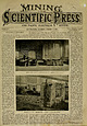 | | Journal (volume) | | center of each end wall of Falls, is as follows: sand (which amor- are produced in one run. It is at...thorough surprise to the Mining and Scientific Press. possessing the colors of Mining and Scientific Press...Press. ESTABLISHED 1S«50. Oldest Mining; Journal on the American Continent. e. No. 220 Market Street ,...California Delegation in Congress; The Revival of Mining and Mining Machinery; "Jumping," 2. MECHANICAL PROGRESS...Power; Gas Light Unit; Magnetic Map of the Earth, 8. MINING From the Various Counties of California, Nevada |
|


