 | | Journal (article/letter/editorial) |
| 1951 Short Notes STRUCTURE OF THE SUGARLOAF MOUNTAIN AREA, MARYLAND, AS A KEY TO PIEDMONT STRATIGRAPHY...regards all the beds of the Sugarloaf Mountain quartzite as Weverton quartzite, as we suggested they might...which overlies Weverton quartzite in the Blue Ridge uplift west of Frederick Valley. Also he regards...regards the structure of the Sugarloaf Mountain area as anticlinal, not synclinal as we interpret it. The section...section at Sugarloaf Mountain as interpreted by the Stoses is as follows: Feet Thick-bedded white quartzite |
 | | Book |
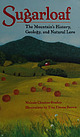
| nf * a9 : fae= ris ap ‘gts Leo Sugarloaf Sugarloaf The Mountain's History, Geology, and Natural... Publication of this book was assisted by a grant from Sugarloaf Regional Trails. This book was developed for publication...2003 DE Say (Oe ina ore at Frontispiece: Sugarloaf Mountain, view from Comus LIBRARY OF CONGRESS CAT...CATALOGING-IN-PUBLICATION DATA Choukas-Bradley, Melanie Sugarloaf: the mountain’s history, geology, and natural...0-8139-2168-6 (pbk. : alk. paper) 1. Sugar Loaf Mountain (Md.) —Guidebooks. Thieme, 1952— II. Center |
 | | Journal (issue) |
| highlights ........................ p. 10 Making Sugarloaf Mountain ..................... p. 11 Deadline for...serpentines of quarries along the Pennsylvania/Maryland border and in similar belts in North Carolina... Virginia has a soapstone deposit in Albemarle County. I’ll see if we can do a field trip there, but...program on the geological origins of Maryland’s Sugarloaf Mountain presented by Joe Marx (see the program summary...Theodora Copper Mine near Herndon in western Fairfax County. (Lawrence R. Bernstein describes the mine and |
 | | Journal (article/letter/editorial) |
| the cross-section made of them by the state of Maryland. The land area of the state may be set down in...eastern half of the state, there spreads out in Maryland an expanse of high, but nearly level, country...Fiedmont plateau in Maryland may be considered to begin at the eastern base of Catoctin mountain, a sharply defined...eastern border emerge the upturned edges of the Frederick valley limestone, which we now know to be of the...rises on its left bank the sandstone mass of Sugarloaf mountain. This is a thick monocline of easterly dipping |
 | | Journal (article/letter/editorial) |
| NOVEMBER 1958 FAULT IN PALEOZOIC ROCKS NEAR FREDERICK, MARYLAND BY R. B. HOY AND R. L. SCHUMACHER ABSTRACT...cores from an area 5 miles southwest of Frederick, Maryland, reveal significant stratigraphic and structural...(Ordovician) are involved. The Antietam has some quartzite layers but is predominantly quartzose phyllite...breccia, and slickensides. The absence of the Frederick limestone and the angular relationship of the...Paleozoic rocks along the eastern edge of Catoctin Mountain. Locally, where the Antietam and/or Tomstown formations |
 | | Journal (article/letter/editorial) |
| 355 General geology of the eastern Piedmont of Maryland................................... 356 General...General geology of the western Piedmont of Maryland................................. 357 Previous work in the...the western Piedmont of Maryland..................................... 357 Recent work in the western...western Piedmont of Maryland......................................... 358 General statement.................... 363 I n t r o d u c t io n The Piedmont of Maryland occupies a belt about 55 miles wide, ex tending |
 | | Journal (article/letter/editorial) |
| REGIONALE TEKTONIK APPALACHENPROFIL IN MARYLAND Von ]~'RNST CLC)OS The Johns Hopkins University Baltimore...(III) Sugarloaf-Zone (IV) Martie-Linie (V) Frederi& Valley (VI) Triasgraben (VII) South Mountain Fold...Allegheny-Plateau (XII) Kristalline Aehse Einleitung Maryland reieht vom At]antisehen Ozean bis auf die Westseite...Baden aueh wie Maryland v o n d e r kristallinen Aehse bis in das Vorland reiehen. Maryland ist zwar bei...sind veraltet und neue erseheinen nur langsam. Maryland ist einer ,der wenigen Staaten, der topographiseh |
 | | Journal (article/letter/editorial) |
| FIGS.. 3 PLS. APRIL 1955 GEOLOGY OF CATOCTIN MOUNTAIN, MARYLAND AND VIRGINIA BY JOHN C. WHITAKER ABSTRACT...and underlying metavolcanics of Catoctin Mountain in Maryland and northern Virginia indicates that the...forms the upper and eastern limb of the South Mountain anticlinorium. This interpretation necessitates...border of Catoctin Mountain constitute a zone including the upper Weverton quartzite and the basal Harpers...pattern 457 General 441 Structure of Catoctin Mountain 457 Basal phyllite member 441 Triassic border |
 | | Journal (article/letter/editorial) |
| pp. 329-346 M a y 29 , 1905 CORRELATION OF MARYLAND AND PENNSYLVANIA PIEDM ONT FORM ATIONS* BY EDW................................... 330 Setters quartzite ................................................................................ 335 Cardiff quartzite.................................................territory west of this line to the area of the Frederick and West W ashington sheets, where the work of...responsible for them. * Published by permission of the Maryland Geological Survey. XLIV—Buu.. Q e o i,. S o c |
 | | Report (issue) |
| near-horizontal Sugarloaf Mountain thrust on Round Top Mountain that placed Poor Mountain Formation rocks...about half way from the cliffs to the top of the mountain. Studies of Inner Piedmont Geology with a focus................... 110 Stop 4 (Alternate): Poor Mountain Formation schist ........................................................ 110 111 Stop 5 Poor Mountain Amphibolite .................................................... Stop 6 Henderson Gneiss and Sugarloaf MountainThrust Fault ........................ |
 | | Report (volume) |
| southeast (fig. 1). It is underlain by slate and quartzite of the Grand Pitch Formation (Grand Falls Formation...calcareous slaty "ribbon rock" of eastern Aroostook County (Pavlides and others, 1961). ACKNOWLEDGMENTS John...George Eaton, first discovered fossils on Sugarloaf Mountain (fig. 1) in the course of sampling igneous...R. 7 W., in the Shin Pond quadrangle, Penobscot County (figs. 1 and 2). The formation consists of bedded...grained layers contain fragments of fine-grained quartzite and chips of slate like that in the underlying |
 | | Report (issue) |
| . . . 7 Metamorphic Gradients in Pittsylvania County, Virginia (J. P. Gregory). . . . . . . . . . .... 49 Cataclastic Zone Associated with the Davie County Triassic Basin (D. V. Milton). . . . . . . . ....contact of the Candler from southern Albemarle county southward to Leesville, just north of the study...of the Blue Ridge anticlinorium, and the Fork Mountain and Bassett formations of the Smith River Allochthon...open northeastward trending warps. South of Smith Mountain Dam hinges of very attenuated intrafolial Fl isoclines |
 | | Report (issue) |
| POTOMAC RIVER CHANNEL BETWEEN BLOCKHOUSE POINT, MARYLAND, AND GEORGETOWN, DISTRICT OF COLUMBIA, WITH EMPHASIS...Va., and Department of Geology, University of Maryland, College Park, Md., 20742 # with apologies to...Table 7. Potential source areas for Weverton Quartzite boulders of Glade Hill boulder bed .... 77 11...boulders composed of the basal Paleozoic Weverton Quartzite at Glade Hill within the Great Falls National... INTRODUCTION Between the top of Great Falls, Maryland and Virginia and tidewater near Key Bridge (Figures |
 | | Report (issue) |
| (Pleistocene) Occurs on the north face of Blackhawk Mountain where unit consists of intact and shattered blocks...Sandstone, and Cretaceous monzogranite. On Blackhawk Mountain, Sadler (1981, 1982d) included these deposits...Sadler (1982b,h) in his units ?a [arkose] and acq [quartzite-clast-bearing conglomerate]. The unit probably...recognized by Smith (1982a,b). In vicinity of White Mountain, unit consists of intermingled biotite monzogranite...monzonite (Thm), and diorite (Td). East of White Mountain, biotite monzogranite (Km) is intermingled mainly |
 | | Journal (issue) |
| website! November Meeting Program: Making Sugarloaf Mountain (details on page 5) In this issue … Datolite...2019 Datolite crystal from Prospect Park, Passaic County, NJ. Photo: Bob Cooke. 2 vugs in the basalt...pseudomorph after anhydrite, Prospect Park, Passaic County, NJ. Photo: Bob Cooke. Initially, datolite nodules...were found in the traprock quarries of Passaic County and in Hudson and Somerset Counties as well. The...Datolite nodule from the Caledonia Mine, Ontonagon County, MI. Photo: Bob Cooke. The Mineral Newsletter |
 | | Report (issue) |
| geologic map of Chiricahua National Monument Cochise County, Arizona, with digital geologic map data by Edward...flow banding. Thickness 0-30 m Dacite of Sugarloaf Mountain Tdpl Dacite porphyry lava (Oligocene)-Isolated...weight percent SiO2) lava flow remnant atop Sugarloaf Mountain; equivalent of dacite that forms both lava...principally as erosional outlier near top of Sugarloaf Mountain, although ash-rich zone and overlying tuff...northwest part of map area. Thickness 24 m at Sugarloaf Mountain Trcm Outflow facies, middle member-Voluminous |
 | | Report (issue) |
| Map relationships show that the Seneca and Sugarloaf Mountain thrusts, previously believed to be separate...IP. INNER PIEDMONT RELATIONSHIPS AND THE SUGARLOAF MOUNTAIN THRUST The 1993 Carolina Geological Society...Promontory (Hatcher, 1993; Davis, 1993). The Sugarloaf Mountain thrust was first described by Lemmon (1973)...correlated those Inner Piedmont rocks with the Poor Mountain Formation and the upper Mill Spring complex (equivalent...1999a) and referred to the basal fault as the Sugarloaf Mountain thrust. In the area of Hendersonville, North |
 | | Report (issue) |
| Robert D. Hatcher, Jr. Geology of Standingstone Mountain quadrangle, western Inner Piedmont, North and...between upper Tallulah Falls Formation and Poor Mountain Amphibolite ....................................C. Hill vi STOP 6 Intensely migmatitic Poor Mountain (and Tallulah Falls?) Formation at Camp McCall...STOP 8 Dysartsville Tonalite northwest of Turkey Mountain ............................................ 135...Williams and Brendan R. Bream STOP 9 (ALTERNATE) Poor Mountain Amphibolite Migmatite at Houston House....... |
 | | Journal (issue) |
| Two natural lakes occur in Virginia, Mountain Lake in Giles County and Lake Drummond in the City of Chesapeake...alphabetically by county or city. Features along county lines are described in only one county with references...control. (Oaks and Coch, 1973) Mountain Lake (see Giles County) Mountain Lake, one of two natural lakes...in Virginia, is in a high saddle on Salt Pond Mountain at an elevation of 3875 feet. The lake is about...Rockbridge County) This large rock arch has been viewed by thousands Figure 2. Mountain Lake. Figure |
 | | Report (issue) |
| Department of Geology, University of Maryland, College Park, Maryland 20742 TABLE OF CONTENTS INTRODUCTION...meters to a few tens of meters across. On Keokirk Mountain (wc/vp), its type locality, dikes of the Keokirk...isolated mafic quartz-diorite dike north of Maurice Mountain (ne/mm) and adjacent to the Clifford Creek Granite...sample of a large dike at the north end of Keokirk Mountain. It is the oldest pluton in the area reported...Devonian and Mississippian carbonate units on Keokirk Mountain. Hybridized rocks consist of epidote-rich tonalite-like |
 | | Report (issue) |
| Rock units. _________________________ Schist and quartzite- _____________ Amphibolite __ ________________...near Washington, D.C. Textures and structures of quartzite, schist, and migmatite-______________________...___-_-___-___---____. Sketch of inclusion of quartzite and schist in granitic body_-----__------_---...Potomac River near 'Great Falls are schist and quartzite of early Paleozoic (?) age, coarse-grained amphibolite...central part of the area; there the schist and quartzite contain sillimanite, and migmatitic rocks are |
 | | Report (issue) |
| metachert, siliceous schist, interbedded marble and quartzite, and greenstone also occur within this unit. All...suite consists of approximately 7,000 ft of tan quartzite, gray to white marble, and amphibolite-grade biotite...and micaceous quartzite; the marble beds thicken to the west and occur with quartzite, schist, and graphitic...compositionally-layered paragneiss, schist, and quartzite, and a younger sequence of 1750±15-Ma (Silver...and are divided into a quartzite sequence and a carbonate sequence. The quartzite sequence consists of |
 | | Report (issue) |
| Upper Devonian, along the meridian of County, IL Y., to Bradford County, Pa., by Henry S. Williams. 1884....cents. 16. On the Higher Devonian Faunas of )ntario County, New York, by John M. Clarke. 8°. 1885. 86 pp....Ohio, Kentucky, Indiana, and Illinois, by George Frederick Wright, with an introduction by Thomas Chrowder...Gal)bros and Associated Rocks in Delaware, by Frederick D. Chester. 1890. 45 pp. 1 pi. Price 10 cents...1891. 74. The Minerals of North Carolina, ))y Frederick Augustus Genth. 69. 8". 101pp. 15 cents. for |
 | | Report (volume) |
| . . . . . . . . . . . . . . . . . . . . Davie County Basin............................................Culpeper and Barboursville basins, Virginia and Maryland . .. . . . . .. .. . . . . . . . . . . . . . ...Present stratigraphic nomenclature of the Davie County and Dan River-Danville basins .............. 3...subsurface. Well data from the Coastal Plain in Maryland and Virginia indicate areas in the subsurface...Carolina 5. Durham basin, North Carolina 6. Davie County basin, North Carolina 7. Dan River-Danville basin |
 | | Report (issue) |
| Shin Pond and Stacyville Quadrangles Penobscot County, Maine GEOLOGICAL SURVEY PROFESSIONAL PAPER...Shin Pond and Stacyville Quadrangles Penobscot County, Maine By ROBERT B. NEUMAN SHORTER CONTRIBUTIONS...SHIN POND AND STACYVILLE QUADRANGLES PENOBSCOT COUNTY, MAINE By RoBERT B. ABSTRACT The bedrock of the...and Stacyville quadrangles, northern Penobscot County, Maine, is formed by Cambrian(?) to Lower Devonian...Katahdin Quartz Monzonite. Complexly deformed slate, quartzite, and related rocks of the Lower Cambrian(?) Grand |


