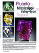
Log InRegister
Quick Links : The Mindat ManualThe Rock H. Currier Digital LibraryMindat Newsletter [Free Download]
Home PageAbout MindatThe Mindat ManualHistory of MindatCopyright StatusWho We AreContact UsAdvertise on Mindat
Donate to MindatCorporate SponsorshipSponsor a PageSponsored PagesMindat AdvertisersAdvertise on Mindat
Learning CenterWhat is a mineral?The most common minerals on earthInformation for EducatorsMindat ArticlesThe ElementsThe Rock H. Currier Digital LibraryGeologic Time
Minerals by PropertiesMinerals by ChemistryAdvanced Locality SearchRandom MineralRandom LocalitySearch by minIDLocalities Near MeSearch ArticlesSearch GlossaryMore Search Options
Search For:
Mineral Name:
Locality Name:
Keyword(s):
 
The Mindat ManualAdd a New PhotoRate PhotosLocality Edit ReportCoordinate Completion ReportAdd Glossary Item
Mining CompaniesStatisticsUsersMineral MuseumsClubs & OrganizationsMineral Shows & EventsThe Mindat DirectoryDevice SettingsThe Mineral Quiz
Photo SearchPhoto GalleriesSearch by ColorNew Photos TodayNew Photos YesterdayMembers' Photo GalleriesPast Photo of the Day GalleryPhotography

Marcasite from
Middlehope Burn, Westgate, Stanhope, County Durham, England, UK


Locality type:Stream
Classification
Species:Marcasite
Formula:FeS2
Confirmation
Validity:Confirmed
Confirmation Methods:Visually Identified
Data
Mineral Data:Click here to view Marcasite data
Locality Data:Click here to view Middlehope Burn, Westgate, Stanhope, County Durham, England, UK
Data Identifiers
Mindat Occurrence Record ID:1101826
Long-form Identifier:1:3:1101826:3
GUID (UUID V4):f8c7690a-0c66-4a1e-80b4-56edb30cab2d
Nearest other occurrences of Marcasite
0.6km (0.4 miles) Slitt Mine, Westgate, Stanhope, County Durham, England, UK
5.2km (3.2 miles) Boltsburn Mine, Rookhope, Stanhope, County Durham, England, UK
5.4km (3.4 miles) Burtree Slits, Cowshill, Stanhope, County Durham, England, UK
5.4km (3.4 miles) Harthope Head Quarries, St. John's Chapel, Stanhope, County Durham, England, UK
6.0km (3.7 miles) Frazer's Hush Mine, Rookhope, Stanhope, County Durham, England, UK
9.3km (5.8 miles) Whiteheaps Mine, Hunstanworth, County Durham, England, UK
14.2km (8.8 miles) Brownley Hill Mine (Bloomsberry Horse Level), Nenthead, Alston Moor, Eden, Cumbria, England, UK
14.4km (9.0 miles) Tynehead Mine, Garrigill, Alston Moor, Eden, Cumbria, England, UK
15.5km (9.6 miles) Calvert Mine, Alston Moor, Eden, Cumbria, England, UK
16.4km (10.2 miles) Great Sulphur vein, Garrigill, Alston Moor, Eden, Cumbria, England, UK
References
Reference Search (possible matching items)
Journal (article/letter/editorial)
mine, North vein, near Eastgate, Weardale, County Durham, England. This transparent, dark green twinned fluorite...Hilton mine, near Appleby, Scordale, Cumbria, England. This well-formed twinned yellow fluorite crystal...level, Denton mine, Harris Creek district, Hardin County, Illinois. The specimen is 8.5 × 7.5 × 7 cm and...the Lead Hill area, Cave-in-Rock district, Hardin County, Illinois, and is 5.5 cm. Ross Lillie specimen...galena (Pb). Other common minerals include pyrite, marcasite, dolomite, calcite, quartz, and occasionally barite
Report (edition)
abundance in the lead and zinc veins of Derbyshire and Durham, and in smaller quantities elsewhere. It is commonly...association is· with calc-spar and barytes, though in Durham where much of the country-rock is arenaceous, the...being had to the more costly process of mining. In Durham the veins, which were left intact by the old miners...Carruthers has had charge of the Northumberland, Durham and • Yorkshire sections; Mr. R. W. Pocock has... PREFACE TO THE FOURTH EDITION of fluorspar in England and Wales were investigated as part of the programme
Book (edition)
Stainmore The northern one-third of the Backbone of England, that ridge of hilly country known since last century...sheets 19 and 25, and parts of 13, 24, 26, 31, 32 (England and Wales) LONDON: HMSO 1990 . I\. © C,rown...sheets 19 and 25 and parts of 13, 24, 26, 31, 32 (England and Wales). Author Sir Kingsle_y Dunham, DSc, SD...FRS, FEng, FIMM Charleycroft, QuarryheadsLane) Durham DHJ 3D Y Other publications of the Survey dealing...country around Brough-under-Stainmore country between Durham and Hartlepool country around Barnard Castle, Sheet
Book (edition)
MEMOIRS OF THE GEOLOGICAL SURVEY OF GREAT BRITAIN ENGLAND AND WALF�S GEOLOGY OF THE NORTHERN PENNINE OREFIELD...counties of Cumberland, Westmorland., Northumberland, Durham and Yorkshire. It is divided into two comple­ mentary...described here, have been found farther east in the Durham coalfield. The western escarpment is drained by...east. The three principal rivers of North-eastern England, Tyne, Wear and Tees, rise within sight of Cross...centre. Alston, Allendale Town, St. John's Chapel, Stanhope, Walsingham and Middleton-in-Teesdale are the
Book
publishers. Beamish, The North of England Open Air Museum,County Durham [Beamish]: pages 41, 46, 54, 59(x2)...Earth Sciences,University of Durham: page_26 C H. Emeleus,University of Durham: page 26 Friends of Killhope...Valley ................... The Northumberland and Durham Coalfield ............. The Northern Pennine Orefield................... 201 72 Foreword ORTHERN England, an area of great natural beauty, is additionally...Pennines, Cumbria, various regions of north-east England, and North Yorkshire. Such a diverse expanse naturally
 
Mineral and/or Locality  
Mindat Discussions Facebook Logo Instagram Logo Discord Logo
Mindat.org is an outreach project of the Hudson Institute of Mineralogy, a 501(c)(3) not-for-profit organization.
Copyright © mindat.org and the Hudson Institute of Mineralogy 1993-2024, except where stated. Most political location boundaries are © OpenStreetMap contributors. Mindat.org relies on the contributions of thousands of members and supporters. Founded in 2000 by Jolyon Ralph.
Privacy Policy - Terms & Conditions - Contact Us / DMCA issues - Report a bug/vulnerability Current server date and time: May 1, 2024 14:18:51
Go to top of page