| Locality type: | Mine |
| Classification |
|---|
|
| Species: | Aragonite |
| Formula: | CaCO3 |
| Confirmation |
|---|
|
| Validity: | Believed Valid |
| Data |
|---|
|
| Mineral Data: | Click here to view Aragonite data |
| Locality Data: | Click here to view Faggergill Mine, Hoove Hill, Arkengarthdale, Richmondshire, North Yorkshire, England, UK |
| Data Identifiers |
|---|
|
| Mindat Occurrence Record ID: | 1110 |
| Long-form Identifier: | 1:3:1110:5 |
| GUID (UUID V4): | 3a8dddbf-7e88-40c7-af1f-4d6d2c6fdb58 |
| Nearest other occurrences of Aragonite |
|---|
|
|
| 4.5km (2.8 miles) | ⓘTanner's Rake (Primrose Vein; Slack Vein), Slei Gill, Booze Moor, Arkengarthdale, Richmondshire, North Yorkshire, England, UK |
| 4.7km (2.9 miles) | ⓘWashy Green Mine, Slei Gill, Booze Moor, Arkengarthdale, Richmondshire, North Yorkshire, England, UK |
| 5.7km (3.5 miles) | ⓘBarras End Mine, Langthwaite, Arkengarthdale, Richmondshire, North Yorkshire, England, UK |
| 7.2km (4.5 miles) | ⓘHind Rake, Marrick, Richmondshire, North Yorkshire, England, UK |
| 7.4km (4.6 miles) | ⓘSun Hush, Lownathwaite Mine (Lownithwaite Mine; Lownethwaite Mine), Gunnerside Gill (Gunnerside Ghyll), Melbecks, Richmondshire, North Yorkshire, England, UK |
| 8.9km (5.5 miles) | ⓘFremington Edge Lead Workings, Reeth, Fremington and Healaugh, Richmondshire, North Yorkshire, England, UK |
| 9.3km (5.8 miles) | ⓘCopperthwaite Mine, Reeth, Fremington and Healaugh, Richmondshire, North Yorkshire, England, UK |
| 10.0km (6.2 miles) | ⓘHall Side Edge, Muker, Richmondshire, North Yorkshire, England, UK |
| 10.1km (6.3 miles) | ⓘCopperthwaite Vein, Marrick, Richmondshire, North Yorkshire, England, UK |
| 10.2km (6.4 miles) | ⓘGuy Mine, Reeth, Fremington and Healaugh, Richmondshire, North Yorkshire, England, UK |
| References |
|---|
|
|
| Reference Search (possible matching items) |
|---|
 | Dunham, K. C., Wilson, A. A. (1985) Geology of the Northern Pennine Orefield (1st ed.) Vol. 2 - Stainmore to Craven - Economic memoir covering the areas of one-inch and 1:50 000 geological sheets 40, 41 and 50, and parts of 31, 32, 51, 60 and 61, New Series. Natural Environment Research Council, London. | Book (volume) | | characteristic imprint upon the beautiful hill country of the Yorkshire Dales, the geology and mineral deposits...the stable Askrigg fault-block is flanked to the north by the Stainmore Trough and the Craven Basin respectively...of vein 0.35 m , BRITISH GEOLOGICAL SURVEY England and Wales K. C. DUNHAM and A. A. WILSON CONTRIBl;·roRS... PhD South Chiltern) OrchardCoombe, Whitchurch Hill, Berkshire RG8 7QL D. J. C. Mundy, PhD, J. Pattison... Sheet 31 British Regional Geology Northern England ( 4th edition) Maps 1:625 000 Solid geology, south | 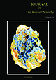 | | Journal (volume) | | 8QQ. Printed by: Acorn Print Media, Quorn House, North Road, Loughborough, Leicestershire, LE11 1LE. Published...plumbogummite with yellow pyromorphite. Roughton Gill Mine, Caldbeck Fells, Cumbria. R.J. King Collection (ex...cavity lined with green malachite. Roughton Gill Mine, Caldbeck Fells, Cumbria. Norman Thomson Collection...mines, Caldbeck Fells, Cumbria: Part 3 Roughton Gill Mine Trevor F. Bridges, David Green, Michael S. Rumsey...Danburite from Meldon Quarry, Okehampton and other UK localities Michael S. Rumsey, George Ryback and Richard |  | | Book | | pleasecontact the publishers. Beamish, The North of England Open Air Museum,County Durham [Beamish]: pages................... 201 72 Foreword ORTHERN England, an area of great natural beauty, is additionally...District, the north Pennines, Cumbria, various regions of north-east England, and North Yorkshire. Such a diverse...finest examples of a zoned orefield. Indeed, the north Pennines are designated a Global Geopark. Economic...ground; trial workings, mine dumps, mine buildings and smeltings, plus mine location maps and a wealth | 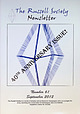 | | Journal (issue) | | ___ , ., ,___ . .. The Russell Society Dronch Mine, I Oal!eri D , 1..-, J Few Clicksl - -- LC•U~01....................................... Herodsfoot Mine Celebrated ..... ........................ ........bags being deposited on garage floors all over the UK. It was an altogether memorable trip - socially,...Society. Professor Bob Howie was major figure in UK geology and well known to many members. He will be...being from 1974 on a field trip to Nant-yr-Eira Mine, Hafren Forest, Powys, Wales. The collection includes | 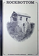 | | Journal (issue) | | ROCKBOTTOM UK JOURNAL OF MINES & MINERALS ISSUE No. 1 ROCKBOTTOM A U.K. JOURNAL FOR MINING AND MINERAL...•~_S_,.Sp~ef:· EDITORIAL .P.UBLiCATION • RED GILL MINE ?.Briscoe 2 LLANRWST MINES E.Otty 5 TUCSON...-r:e1,.:.0302 1io244;-~ . • •• • 1.1 fALLOWFIELD MINE P.3riscoe DIARY OE' EVENTS ·•. 12 15 E'OR...HOOVER AND DE RE METALLICA C:.Otty 30 HILTON MINE A.Winrow J!. HEIGHTS AND THE GREEN HOLE ? .S...STRONTIAN A.Wi:i.=ow 40 HALITE :ROM SOUTH YORKSHIRE S. Utt!.ey H DALRADIAN GOLD D .:-!cCa.!. lum |  | | Book | | Islands Juan Carlos Carracedo & Simon Day 5. The north of Ireland Paul Lyle 6. Leinster Chris Stillman...PO Box 315. Harpenden. Hertfordshire AL5 2ZD. England Telephone: +44 (0)1582 762413 Fax: +44 (0)870 055...from localities in Cornwall. Devon. Cumbria and Yorkshire. He was renowned for his compendious knowledge...meneghinile Pengenna mine,St Kew,Cornwall; Shallowfield Bridge,SouthMolton,Devon Tynebottom mine,Alston.CUm~ria...CUm~ria mercury Chatsworth mine,Grassinglon, Yorkshire Severallocalities in theLakeDistrictandComw melacinnabar |
|


