 | | Book |
| COLORADO MININC DIRECTORY. . 1 THE te COLORADO Directory of Mines, DESCRIPTION OF THE MINES AND...MILLS, AND THE MINING AND MILLING CORPORATIONS OF COLORADO, ARRANGED ALPHABETICALLY BY COUNTUS. j^ISTORY... WHOSE NERVE, ENERGY AND INDUSTRY HAVE PLACED COLORADO IN THE FRONT RANK OF BULLION PRODUCING STATES...FARM FOB EVERYBODY Railway. COLORADO. Healthy, Attractive. Colorado is the great Sanitarium and Pl...atmosphere, .should go to"T^oToracToT climate ol Colorado is peculmrT^^In^aTioTir^ri'^unTIinraUn]^clinn |
 | | Book (edition) |
| 0Ofoss Colorado LITHO BY WALSWORTH PUB. CO., INC., MARCELINE, MO. Colorado GOLD AND FARMS...FARMS SILVER AND STOCK MINES. RANGES, AND HEALTH AND PLEASURE Tourist’s TO KRQCK F BY SECOND... of all other McMahon, unpublished Mining District, in reproduction. map Colo. places Albuquerque...Albuquerque, NM of Leadville a map of Territorial Colorado c. 1876, and a woodcut engraving Bird’s Eye View...Publication Data Fossett, Frank. CoLorade, ite gold and silver mines, farms renees, and health and pleasure |
| | Book (edition) |
| org/details/coloradoitsgolds1880foss 77 Colorado Gold and Silver Mines, FARMS AND STOCK RANGES, HEALTH...r^HIS volume, as its name implies, is devoted to Colorado. Its con¬ tents are descriptive, statistical...research could make them. The narrative of gold and silver mining possesses enough of romance and adventure... of useful and general information concerning Colorado, and trusts this book will meet the present requirements...Denver—Pueblo. 33-42 Colorado Springs—Maniton... 33-42 Union Pacific Railway System. 42 Colorado Central and Kansas |
 | | Book (edition) |
| Opbir-Burroughs, HILL anp NEVADAVILLE. Mercer County. ; ; California, First Nat’] Burroughs and Kansas...Hilae Ss POSEN 1% xiS LEA Colorado GOLD AND FARMS SILVER AND Peet tt Ae STOCK TO ROCKY...HIS volume, as its name implies, is devoted to Colorado. tents are descriptive, statistical, and historical...research could make them. The narrative of gold and silver mining and possesses enough of romance...compendium f useful and general information concerning Colorado, and trusts this book will meet the present requirements |
 | | Report (issue) |
| GEOLOGY OF THE GEORGETOWN QlJADRANGLE (TOGETHER 'VITH THE EMPIRE DISTRICT) COLORADo· BY JOSIAH E. SPURR............... Topography and geography of the Georgetown quadrangle ......................................................................... _... _._ Silver Plume granite (porphyritic biotite granite) ....................._.......... . Distribution in Colorado ...................................................................... . Distribution in the Georgetown quadrangle ................................. |
 | | Report (issue) |
| Geology and Ore Deposits of the Front Range Colorado By T. S. LO\'ERING and E. N. GODDARD GEOLOGICAL...in cooperation with the Colorado State Geological Survey Board and the Colorado Metal Mining Fund ~ oopr...hornblende gneiss ____________ _ Quartzite at Coal Creek ________________ _ Igneous rocks _____________________________...Boulder Creek granite _________________ _ Pikes Peak granite _____________________ _ Silver Plume granite..._____________________ _ Copper deposits in Jefferson County __ _ F. M.D. property _____________ _ Malachite |
 | | Journal (article/letter/editorial) |
| 2003, pp. 409–424 Geology of the Ivanhoe Hg-Au District, Northern Nevada: Influence of Miocene Volcanism...89557-0047 Abstract The mercury-gold deposits of the Ivanhoe mining district in northern Nevada formed when...formed at and near the paleosurface, and disseminated gold deposits and high-grade goldsilver veins formed...soft-sediment deformation in the lakebeds. Mercury-gold mineralization was coeval with rhyolite volcanism...cinnabar-bearing replacement bodies and sinters. Disseminated gold was deposited in sedimentary and volcanic rocks |
 | | Journal (issue) |
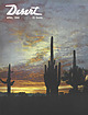
| embracing a rainbow Brushing the dew, Then up through a cloud bank With stars shining through. Bellflower, California...silk moire Of changeable weave of mauve and gray. CLOUD SHADOWS! DESERT MAGIC By WILMA Ross WESTPHAL Angwin...Springs, California Cloud shadows roaming the desert, Do you bring promise of rain? Cloud shadows crossing...Fair, Socorro, New Mexico. April 11 -12—Maricopa County 4-H Fair, Phoenix. April 11-13—9th Annual Fiesta...met, California. April 23-27 — 5th Annual Yuma County Fair, Yuma, Arizona. April 25—Spring Festival Days |
 | | Journal (article/letter/editorial) |
| abandoned mercury mines in West-Central Nevada, USA John E. Gray*, James G. Crock, David L. Fey US Geological...25046, Federal Center, MS 973, Denver, CO 80225, USA Abstract The Humboldt River is a closed basin and...mines studied District Mines studied Geology Approximate mercury production per district Imlay Eldorado...sandstone, and Tertiary opalite 600 flasks Ivanhoe Silver Cloud Opalite altered Tertiary volcanic tuff > 2000...Paleozoic greenstone and breccia 500 flasks Bottle Creek White Peaks Veins in Paleozoic and Triassic tuffs |
 | | Report (issue) |
| (soil gas) correlates well with the distribution of gold-bearing rocks that are covered by as much as 100...atmosphere was collected by amalgamation on gold or silver foil and was subsequently released and measured...low-level flying over the copper deposits at Ajo and Silver Bell. APPARATUS AND TECHNIQUE FOR MEASURING MERCURY...plastic were used to funnel soil gas through gold or silver f~' 1 to t r a p mercury. The tents (fig. 1)...free movement of air into it from the outside. Gold or silver flakes (about 1 gram) we1·e spread evenly in |
 | | Journal (issue) |
| Month LOST MINE The Old Dutchman's Lost Ledge of Gold By HAROLD O. WEIGHT NATURE Lost Birds in a Strange...agate ledge called The Rockhound's Dream; of an old gold mining camp in the northeastern corner of Nevada;...good miner, too, and despite the fact she calls gold mining "a rat race," Rene admits she can't leave...gray; but there were streaks of white, patches of clear translucence, and flecks of yellow and green. Then...proud to own. The agate occurred in a ledge on Jack Creek, about four miles from town by road and foot-trail |
 | | Book |
| MINES AND MINERALS OF THE GREAT AMERICAN RIFT (COLORADO-NEW MEXICO) Sine —_—< ¢ te om At _SHT 40...MINES AND MINERALS OF THE GREAT AMERICAN RIFT (COLORADO-NEW MEXICO) Richard Walker Holmes and Marrianna...Mines and minerals of the Great American Rift (Colorado-New Mexico). Bibliography: p. Includes index...index. 1. Mines and mineral resources—Colorado. 2. Mines and mineral resources—New Mexico. I. Kennedy, Marrianna...netlaneaiveme beneigs ony Snir » be = Ba and a Creek: oe * Md 8 _ yo ae Ve ja rete: _ |
 | | Journal (issue) |
| Colorado Springs Mineralogical Society Founded in 1936 Lazard Cahn Honorary President “Pick & Pack” Vol...Feature Article - S. Veatch, Keeper of Cripple Creek Light: the Miners’ Candlesticks Feature Article...Jackson 2017. COLORADO SPRINGS MINERALOGICAL SOCIETY PO BOX 2 COLORADO SPRINGS, COLORADO 80901-0002 Sept...Event Center, 1045 Lower Gold Camp Road, Colorado Springs. Sponsored by the Colorado Springs Mineralogical...collected from non-resale customers.” Sep 10-18: Colorado Mineral and Fossil Fall Show, at the Crowne Plaza |
 | | Report (issue) |
| 1 COUNTY REPORT HYSICAL >ci 8 PHYSICAL •CI. .Lib. IES TN 24 C3 1ERAL RESOURCES OF A34 1 IPINE...IPINE COUNTY, CA! IA -*ci?2®^?^a£~Vfes^A^Gw^i I ver Mou nta i nV-*- Digitized by the Internet...OF ALPINE COUNTY, CALIFORNIA by WILLIAM B.CLARK With sections on the Zaca gold-silver mine and the...the Leviathan COUNTY REPORT sulfur mine by James R. Evans 8 1977 CALIFORNIA DIVISION OF MINES...2 i DOCS. -US Frontispiece. Typical Alpine County scenery. View looking southeast across Twin Lakes |
 | | Report (issue) |
| INTERIOR GEOLOGICAL SURVEY MINERAL RESOURCES OF ELKO COUNTY, NEVADA By Roscoe M. Smith Prepared in cooperation...districts . Alder district-Aura district -Beaver district Black Mountain district Bootstrap district Burner district...Basin district-- -Carlin district Cave Creek district ----Charleston district_--Coal Mine district~ Contact...Contact district Cornucopia district - -Corral Creek district - Decoy district Delano district Delker districtDivide...districtDivide district - Dolly Varden district --Edgemont district---Elk Mountain district-----Elko district ' Ferber |
 | | Report (issue) |
| tungsten, mercury, nickel in small intrusions, vein gold, mafic volcanogenic sulfide, felsic and intermediate...present the combination of several deposits from a district. Reports of multiple grades from different parts...Vlar Bond War Eagle and Miller Deposits Location (County) Alameda Amador ...do.. ...do.. ...do.. ...do...Bonanza Chrome Hill No 1 Coon Mt. Nos. 1-3 Copper Creek (Low divide) Fourth of July French Hill High Dome...Rattlesnake Mt. Richey, U.S. and S.J. Location (County) Calaveras ...do... ...do... ...do... ...do... |
 | | Book (volume) |
| 600 to 800 feet thick in the north. ALEXANDER COUNTY FAYVILLE, area stream gravels⎯agate, jasper, rare...⎯agate, jasper; d RR siding of Clay⎯agate. CALHOUN COUNTY AREA, shores of the Mississippi R., in the Warsaw...crystals). CRAWFORD COUNTY PALESTINE, area deposits⎯Siderite. EDWARDS COUNTY AREA, T. 1 S, R. 10 E...E, regional deposits⎯Siderite. FULTON COUNTY FARMINGTON, W 6 mi. on Rte. 116 to the Rapatee No. 5 strip...mine⎯pyritized gastropods (Pennsylvanian age). GRUNDY COUNTY AREA: c Regional rd. and RR cuts and banks of Mason |
 | | Journal (volume) |
| Nevada Mining at Bingham, Utah The Greenwater District Ditto Ditto Ditto Abyssinia, Minerals In The...Charles [64 James W. 82 431 114 Nelll 815 District, British W Columbia, The 783 431 795 736 241...Tube-Mill Lining Forbes Rlckard 511 17 The Boundary District The Mineral Output of. In 1906 Broken Hill, Acid...Editorial Wm. Amalgamation of Copper Ore Pan Amalle District of California, The American Copper Spiral Pipe...James Darroch Arizona, Secondary Changes at Cherry Creek John A. Reld The Vulture Mine C. W. Purlngton Arnold |
 | | Report (issue) |
| mines, and prospects.................. Churchill County . ................................................................................... Fairview district . ..............................................Mountain Wells district............... . ........................................ Unnamed district ................................................ Unnamed district................... . . ............................................................. Eldorado district ............................................. |
 | | Report (issue) |
| activities a Bunker Hill & Sullivan M. & C. Co.: Valley County.........-+-+++++-+-:eae 6 t Fo ine oIOks Crate...Tees oat ata r Talache Mines, Inc., operations at Gold Hill MING. o nse Saveueens Oh ORIGIN nn OO Se! 8...siete w Sue ee eas eyo miteudes Bata eae AGA Ss: COUNTY. aI PSVUNOCK. COUMEV ye ato tiene Gye. 6 Sel oles...itefolie ac Meare ea nC Ren Mc eo ea ee BENE Wwah County: cscs cece ss wre a eecnace, s)ecacsr ojerte hs...GiAMOLteMone te wcetas tacit mene Ones Bingham “County. os... 5 sor o oheckede s omewetc costs: ogee ceo |
 | | Report (issue) |
| collected from the Eldorado mine in the Imlay District............... Figure 3. Location of samples collected...collected from the Dutch Rat mine in the Dutch Rat District....... Figure 4. Location of samples collected...collected from the Cahill mine in the Poverty Peaks District ........ Figure 5. Location of samples collected...the Goldbanks District....... Figure 6. Location of samples collected from the Silver Cloud mine in the...the Ivanhoe District......... Figure 7. Location of samples collected from the Pershing mine and the Juniper |
 | | Report (issue) |
| 31 University of Nevada Press, Reno, Nevada 89557 USA Copyright © 2004 by University of Nevada Press Photographs...6-cm cluster, Majuba Hill Mine, Antelope district, Pershing County. N. Prenn collection. Photograph by J...Castor PART PART Il MINERAL DEPOSITS Carlin-Type Gold Deposits MINERAL CATALOG Nevada Mineral Catalog... The Goodsprings (Yellow Pine) Mining District, Clark County John C. Kepper 91 References 467 Contributors...242) Gold, Mexican Mine Gold, Majuba Placer Pyromorphite after Galena with Conichalcite Gold, Round |
 | | Book |
| Ts.'Mf ECONOMIC GEOLOGY OF THE MEROUR MINING DISTRICT, UTAH, BY J. EDWARD SPURR. /' \ WITH INTROr>UCTION...of mining districts Camp Floyd or Mercur mining district 349 349 351 351 354 356 360 360 General geology...370 371 372 374 Mercur district Conclusions Chapter I. —The Mercur District Structure Lower Blue...Chapter II.—The ; 377 379 general distribution Silver 381 Ledge 383 Descriptive geology 383 Mercur...Mercur Hill Marion Hill Marion Gulch and westward Silver Cloud shaft and vicinity Nature of ores Quartz 383 |
 | | Report (issue) |
| AND ORE DEPOSITS OF TILE LEADVILLE MINING DISTRICT, COLORADO BY S. F. EMMONS, J. D. IRVING, AND G. F...porphyries at Lead85 General features _ 52 ville _ Cloud City and Valentine faults_86 52 Forms of intrusive...anticline _ Origin of the Iron-Mikado fault 61 Colorado Prince anticline _ group _ 95 61 Mosquito Gulch...fold-fault _ Faults in the eastern part of the district 95 62 Kokomo syncline_ Faults southeast_ of _..._ Leadville 62 the_ Fryer Hill folds _ 62 district _ 95 Warping and drag along normal faults, _ _ _ 96 |


