 | | Report (issue) | | GEOLOGY OF THE - GREATER ATLANTA REGION Keith I. McConnell and Charlotte E. Abrams Department of Natural... GEOLOQY OF THE GREATER ATLANTA REGION Keith I. McConnell and Charlotte E. Abrams = = = = = = = = =..... . .......... ... ................. Shale and clay . . . . . . . . . . . . . . . . . . . . . . . ..... . . . . . . . . . . . . . . . . . . . . . . . Clay ................................................... . . . . . . . . . . . . . . . . . . . . . . . Clay, sand and gravel, and fill material . . . . . . | 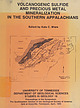 | | Report (issue) | | aie! BARTLETT'S/27 FERRY FAULT } i GEORGIA ALABAMA sy .i % OP A iar an waeew ows mp ede eel (...CAROLINA ug 5; “A BARTLETT'S/.2 FERRY FAULT ? ALABAMA GEORGIA 50 . Lee 50 MILES SO KILOMETRES UNIVERSITY...this volume on the sulfide deposits of Georgia-Alabama. from does It has been the authors not involve...Appalachians in Paleorift the Southern Flank Alabama (Robert W. of Turkey Haven Schafer and J. Settings...Copper Anomaly at the Peachbottom Deposit, Alleghany County, North Carolina (John E. Callahan, J. Hatten Metal |  | | Report (issue) | | STRUCTURAL MATERIALS, ETC. THE ABERDEEN GRANITE QUARRY NEAR GUNNISON, COLORADO. By J. FEED. HUNTEK. '...make a hasty examination of the Aberdeen granite quarry, which lies about three-quarters of a mile east...described. The Aberdeen granite quarry is located in Gunnison County, on South Beaver Creek, about 4...the stone has been shipped in re'cent years. The quarry is owned jointly by F. G. Zugelder, of Gunnison...F. Bossie, and Gettis & Seerie, of Denver. The quarry site was patented in 1890 as placer claims, and |  | | Report (issue) | | Effects of flood-detention reservoirs, Gwinnett County, Georgia, GA090 27 Hydrology of the Upper Floridan...GA092 29 Water-resource evaluation of the Glynn County, Georgia, area, GA093 30 Hydrology of the Valdosta...Assessment of the water resources of the Chatham County, Georgia, area, GA100 34 Use of chlorofluorocarbons...GA104 38 Quality of storm-water runoff in DeKalb County, Georgia, GA106 40 Reconnaissance evaluation of...in the White and Mossy Creek watersheds, White County, Georgia, GA107 41 Assessment of air-pollutant |  | | Report (issue) | | system, Alabama, Florida, and Georgia, GA089 20 Effects of flood detention reservoirs, Gwinnett County, GA090...Assessment of the water resources of the Chatham County, Georgia area, GA100 27 Use of chlorofluorocarbons...Bibl) County Chatham County-Savannah Metropolitan Planning Commission DeKalb County Glynn County Gwinnett...Gwinnett County Clayton County Water Authority Macon-Bibb County Water and Sewage Authority Tifton County...Experiment Station U.S. Army Corps of Engineers Mobile District Savannah District U.S. Department of Commerce |  | Higgins, M.W., Atkins, R.L., Crawford, T.J., Crawford, R.F., Brooks, Rebekah, Cook, R.B. (1988) The structure, stratigraphy, tectonostratigraphy, and evolution of the southernmost part of the Appalachian Orogen. Professional Paper 1475. US Geological Survey doi:10.3133/pp1475 | Report (issue) | | Geology, Structural. 3. Geology Georgia. 4. Geology Alabama. I. Higgins, Michael W . II. Series: Geological...southernmost part of the Appalachian orogen, Georgia and Alabama ....... In pocket 2. Schematic diagrams illustrating...southernmost part of the Appalachian orogen, Georgia and Alabama .................................................and Rome-Kingston thrust stack in Georgia and in Alabama ........... 5. Summaries of thrust sheets in the...part of the Appalachian orogen in Georgia and Alabama is composed of three stacks of folded thrust sheets |  | | Journal (article/letter/editorial) | | ans THORNTON L. NEATHERY GeologicalSurveyof Alabama,P.O. Box O, UniversityStation,Tuscaloosa, Alabama35486...1963; LaMont and Hastings, 1964; Magee, 1968; Alabama-Georgia state line; and (3) the Wedowee terrane...extends from the Coastal Plain onlap in central Alabama northeastward at least as far as the SouthCa...disseminated sulfide mineralization. onlap in central Alabama to Cartersville, Georgia; The basalclasticrocks...TalladegaGroup (2) the Ashlandterrane is exposedin the Alabama are interpreted as marginal depositsformed along |  | | Report (volume) | | producing States include North Carolina, Nevada, Alabama, Arkansas, and Washington. Most of Virginia's production...other States. The deposits of Texas, Georgia, Alabama, and Arkansas include both types of associations... W., 1942, Soapstone of northeastern Gillespie County, Texas : Texas Univ. Bur. Econ. Geol. Min. Res...Vermont, Hammondsville talc quarry, Reading, Vermont, and Vermont talc Company quarry, Windham, Vermont: U.S...ortho-antigorite), in Swineford and Plummer, eds., Clays and clay minerals: Natl. Research Council Pub. 327, p. 360-363 |  | | Report (issue) | | Bulletin 76 Geology and Mineral Resources of Moore County, North Carolina By JAMES F. CONLEY RALEIGH...Bulletin 76 Geology and Mineral Resources of Moore County, North Carolina By JAMES F. CONLEY RALEIGH ...Bulletin 76, "Geology and Mineral Resources of Moore County, North Carolina", by James F. Conley. This report...investigations of the geology and mineral resources of Moore County and should be of value to those interested in the...the geology and mineral resources of Moore County and adjacent areas. Respectfully submitted, HARGROVE |  | | Report (volume) | | 250-12,460 ft, sec. 14, T. 45 S., R. 27 E., Lee County, Fla. Named for the nearby Able Canal. The Able...H-20, northwest of Wattsville, northern Accomack County, Va. Reference sections: facies E and F, sand pits...Wattsville, Persimmon Point, and Accomack, Accomack County, Va. The informal Accomack beds of Mixon and others...and west of the Ames Ridge shoreline in Accomack County, Va., and are well developed from Wallops Station...dominantly transgressive sequence of sand, gravel, silt, clay, and peat divided into seven principal interfingering |  | | Report (issue) | | Geology of the Southernmost Brevard Fault Zone, Alabama, and Its Implications for Southern AppalachianTectonostratigraphy...Carolinas and NE Georgia, but into a synform in Alabama and western Georgia. Extensive use of kinematic...same assemblage the Dadeville belt in Georgia and Alabama, and Crickmay indicated that the rocks of this...Neathery (1970) subdivided the Inner Piedmont in Alabama and western Georgia into an upper series they called...throughout the western Inner Piedmont of Georgia and Alabama (Waresville formation, Jacksons Gap group, Ropes |  | | Report (volume) | | meridian of 76° 30', from Tompkins County, New York, to Bradford County, Pennsylvania, by Henry S.Williams...cents. 10. On the Higher Devonian Faunas of Ontario County, New York, by John M. Clarke. 1885. 8°. 86 pp....57 pi. Price 25 cents. 38. Peridotite of Elliott County, Kentucky, by J. S. Diller. 1887. 8°. 31 pp. 1...Cretaceous Strata of the Tuscaloosa, Tombigbee, and Alabama Rivers, by Eugene A. Smith and Lawrence C. Johnson...Washington, 1891. (l) GEOGRAPHIC SUBJECTS. Alabama. Alaska. Arizona. Arkansas. Asia. Australia. California |  | | Journal (article/letter/editorial) | | and MacNeil, tr'. S. Gorceixite from Dale 688 County,Alabama.... with Milton, C., and Ingram, B. Bismutoferrite...t ) .. . 768 Biotite, chlorine-rich, from Lemhi County, Idaho (Lee) r07 Bismutoferrite, chapmanite and...F. A. Cerite from Mountain Pass, San Bernardino County, California 460 with Milton, C., MacNeil, F. S..., and Axelrod, J. M. Gorceixite from Dale County, Alabama. 688 Mrose,M. E., and Murata, K. J. Relationof... 177 Cerite from Mountain Pass, San Bernardino County, Calif ornia (Glass, Evans, Carron, Hilde- 1228 |  | | Report (volume) | | nos. 5, 6; vol. 23, nos. 1, 2. St. Louis, Mo. Alabama Geological Survey: Bulletin, no. 14. Montgomery...Proceedings, vol. 13, pp. 1-46. Davenport, Iowa. Delaware County Institute of Science: Proceedings, vol. 7, no....Virginia Geological Survey: County Reports, Kanawha County; Preston County; Map of... coal, oil, etc....16. Ancient auriferous gravel channels of Sierra County, California: Am. Inst. Min. Eng., Bull., no. 91...deposits of the San Juan district, San Luis Obispo County, California: California Acad. Sci., Proc., 4th |  | | Report (volume) | | Geol. Survey Misc. Ser., no. 54, p. 3-5 4. Silt, clay, and sand 5. Light-brown, dark-gray 6. 0.35 m, range... 147 N., R. 84 W., 4 km N of Riverdale, McLean County, N. Oak. Named for Aggie Brown Coulee, which flows...NW1/4NW1/4SW1/4SW1/4 sec. 17, T. 85 N., R. 7 W., Linn County, Iowa. A-L Peak Rhyolite Oligocene 1. New Mexico...structures in the San Mateo Mountains, Socorro County, New Mexico: New Mexico Geol. Soc. Spec. Pub. 5...Mountains, 10. sees. 33-35, T. 4 S., R. 6 W., Socorro County, N.Mex. Anapra Sandstone 1. Early Cretaceous 2 |  | | Report (volume) | | fllE SUBJECT ENTRIES. (1) GEOGRAPHIC SUBJECTS. Alabama. Alaska, and the other States and Territories....America. Devonian, with sub-headings as follows: Alabama. Canada. Central America. England. Illinois. Iowa...sub-headings as follows: Appalachians (Maine to Alabama). Canada. Central and Western States. Nomenclature..., Bull., vol. 16, pp. 157-158. Alabama. Analyses of dolomite and clay, HlLLEBRAND. Appotnattox formation...CATLETT. Geology of Mon Louis island, LANGDON. Alabama Continued. Macfarlane's Eailway Guide, CAMPBELL |  | | Journal (article/letter/editorial) | | MetavolcanicTerrain CHARLOTTE E. ABRAMS AND KEITH I. MCCONNELL GeorgiaGeologicSurvey,19 M.L. King,Jr., Drive...-19$2.50 1521 1522 c. E. ABRAMSAND K. I. McCONNELL NORTH CAROLINA SOUTH CAROLINA TENNESSEE GEORGIA...eaand regionalgeologicfeatures(modifiedafter McConnell and Abrams, 1984). Stratigraphy provinceand...arealyingbetweenthe Allatoona-Hayesvillereasons,McConnell and Abrams (1984) define this faultandthe Brevardfaultzone(Fig...andno systematic 1524 C. E. ABRAMSAND K. I. McCONNELL %?• %x •,X• • • • • _ • •- // • • |  | | Report (issue) | | SURVEY GEOLOGIC RADON POTENTIAL OF EPA REGION 4 Alabama Florida Georgia Kentucky Mississippi North Carolina...SURVEY GEOLOGIC RADON POTENTIAL OF EPA REGION 4 Alabama, Florida, Georgia, Kentucky, Mississippi, North...Preliminary Geologic Radon Potential Assessment of Alabama Linda C.S. Gundersen 4. Preliminary Geologic Radon...aerial radioactivity, and indoor radon data by county. Because of constraints on the scales of maps presented...and prismatic structures form in soils with high clay contents. In soils with shrink-swell clays, air |  | | Report (issue) | | Pegmatite& in the stream bed of Toonlgh Creek, Cherokee County. THE GEOCHEMISTRY AND ORIGIN OF PEGMATITES CHEROKEE-PICKENS...Geologic map of the Cochran pegmatite, Cherokee County, Georgia . . ......... . ................ . .....tourmaline crystal; Cochran pegmatite, Cherokee County ... . 0 • 0 •• • • • • • •••• •• • ...smoky quartz at the Cochran pegmatite, Cherokee County ... . ... . .. 45 16. Example of relatively fresh...the Marblehill pegmatite in southeastern Pickens County . 19. Lenses of mica schist containing coarse-grained |  | | Report (issue) | | Geochemistry of the Franklin-Creighton Gold Mine, Cherokee County, Georgia by R. B. COOK . . . . . . . . . . . .... and Stratigraphy by M. W. HIGGINS and K. I. McCONNELL Landsat image showing the topographic expression...stratigraphic column of the Sandy Springs Group. Figure 2. County outline map of Georgia showing known outcrop Figure...Richmond County, Georgia . . . . . . . . . Stratigraphic cross-section in Burke and Richmond County, Georgia...Stratigraphic and columnal cross-section in Washington County, Georgia . . . . . . Section of Tobacco Road Sand |  | | Book | | distribution of bog-iron OLCM vil MUSEUM. EA Clay iron-stone es Og 1a ee het oe pa yee east hay...ose Specimens illustrating the distribution of clay EPOTMEGOME TH Opal sucka vy Aat DARe Prod sete?...IATHIGleSs made: OL AS DESUUIS wens weds elie eee Fire-clay, kaolin, etc lie: ahs (phe: alet eh > seule ate)...Weer ie,© Wleag vo, yd AMON ee gee aR ees Soap. clay, employed as a detergent..............5. 162 162...Graphite.—Lot 3, range II. of Grenville, Argenteuil county, Q.—Coll., R. Bell, 1856. (1228.) — columnar.——Lot |  | | Report (volume) | | PUBLICATIONS EXAMINED. OFFICIAL AND SERIAL PUBLICATIONS. Alabama Geological Survey: Tuomey, First Biennial Report...Coastal Plain of Alabama, 1894. Report on Valley Regions of Alabama, Parts I-II. Alabama Industrial and...(F.), Report on the Geological Survey of Miami County, Kans., 1865. ' Kansas University Geological Survey:...Report on Geology of'Mercer County. Report on Geology of Lincoln County. Report or Geology of Henry,...Report OL Geology of Mason County. : Report on Geology of Garrard County. Report on Geology of Spencer |  | | Report (issue) | | saturated zones at a selected site in southeast Lee County, Georgia Simulation of fluid flow in fractured...City of Thomaston Bibb County Clayton County Water Authority Macon-Bibb County Water and Sewei-age Authority...follows: Department of the Army Corps of Engineers Mobile District Savannah District Federal Energy Regulatory...Cooperation: Continuing U.S. Army Corps of Engineers, Mobile District Problem: Water-resources planning and...Creek, Northeast Georgia, GA00501 Location: Towns County Project Chief: Gary R. Buell Period of Project: |  | | Journal (article/letter/editorial) | | Abbreviations: xl—crystal xled—crystallized ALABAMA: Near Vance, in Tuscaloose Co., Ala., many beautiful...be recorded." Pala is in northwestern San Diego County of Southern California. COLORADO: Prof. Richard...the abandoned Laurel Creek corundum mine in Rabun County, where it is associated with corundum. The mineral...item: "The Ima Tungsten Mine of Patterson, Lemhi County, Idaho, producer of a large supply of tungsten...the New Point lime- ROCKS AND MINERALS stone quarry at New Point, Ind., (in Decatur Co.) with Roy Grossman |  | | Report (volume) | | WASHINGTON, March 15,1887. (348) BIBLIOGRAPHY. A. Alabama, geologic survey report, SMITH. iron and coal,...Preliminary report upon the Tertiary fossils of Alabama and Mississippi. Geol. Survey of"Ala. Bulletin...for oil in Jackson and Abbott Townships, Potter County. Annual Report of the Geol. Survey of Pa. for 1885...Report on the Brandywine Summit kaolin bed, Delaware County. Annual Report of the Geol. Survey of Pa. for 1885...associated beds and modes of mining and preparing the clay for market. Calls attention to the relation of kaolinization |
|


