| Locality type: | Mine |
| Classification |
|---|
|
| Commodity: | Zircon (commodity) |
| Data |
|---|
|
| Commodity Data: | Click here to view Zircon (commodity) data |
| Locality Data: | Click here to view Poorman Creek; Kast; Nelson And Larson Mine, Yentna Mining District, Matanuska-Susitna Borough, Alaska, USA |
| Data Identifiers |
|---|
|
| Mindat Occurrence Record ID: | 1188831 |
| Long-form Identifier: | 1:3:1188831:6 |
| GUID (UUID V4): | f06eeacc-48dc-4c9a-a9db-c9ebf17ec539 |
| Nearest other deposits of Zircon (commodity) |
|---|
|
|
| 2.2km (1.3 miles) | ⓘWillow Creek; Big Willow Creek; Little Willow Creek; Wilson Creek; Hansen; Jennings; Rice; Rocky Gulch; Slate Gulch; Snow Gulch Mine, Yentna Mining District, Matanuska-Susitna Borough, Alaska, USA |
| 46.5km (28.9 miles) | ⓘKahiltna River; Sholan Bar; Round Bend Bar; Red Hill Bar; Boulder Bench Mine, Yentna Mining District, Matanuska-Susitna Borough, Alaska, USA |
| 66.8km (41.5 miles) | ⓘKahiltna River Mine (ARDF - TY027), Yentna Mining District, Matanuska-Susitna Borough, Alaska, USA |
| 73.6km (45.7 miles) | ⓘKahiltna River Mine (ARDF - TY028), Yentna Mining District, Matanuska-Susitna Borough, Alaska, USA |
| 78.1km (48.5 miles) | ⓘKahiltna River Mine (ARDF - TY029), Yentna Mining District, Matanuska-Susitna Borough, Alaska, USA |
| Reference Search (possible matching items) |
|---|
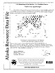 | | Report (issue) | | database on mines, prospects and mineral occurrences throughout Alaska. 153 00 63 00 TL004 TL005 TL006...Talkeetna 1:250,000-scale quadrangle, southcentral Alaska This and related reports are accessible through the...AK 99511 Location of map area in Alaska This report is preliminary and has not been reviewed for conformity...or firm '! names is for descriptive purposes only and does not imply endorsement by the U.S. Government...REPORT 99-139 ZUSGS science for a changing world Alaska Resource Data File TL001 Site name(s): Boedeker; |
|


