 | Holdgate, G. R., Wallace, M. W., Gallagher, S. J., Witten, R. B., Stats, B., Wagstaff, B. E. (2006) Cenozoic fault control on ‘deep lead’ palaeoriver systems, Central Highlands, Victoria. Australian Journal of Earth Sciences, 53 (3) 445-468 doi:10.1080/08120090600632334 | Journal (article/letter/editorial) | | lead’ palaeoriver systems, Central Highlands, Victoria G. R. HOLDGATE*, M. W. WALLACE, S. J. GALLAGHER...Melbourne, Vic 3010, Australia. Basaltic eruptions across the Central Highlands of Victoria have sealed in-place...mined extensively in the past for their rich placer-gold deposits. Detailed mapping of the distribution of...and this is where, in the historical past, some gold leads were ‘lost’. The initial timing of the block...leads, Otway Basin palaeovalleys, uplift history, Victoria. INTRODUCTION The Victorian Central Highlands | 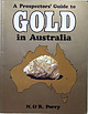 | | Book | | Prospectors' Cuide to· in Australia A Prospectors' ·G uide to in Australia N. 8 R._Perry BY THE SAME...Gemstones in Australia Practical Gemcutting Prospectors' Guide to Gemstones in Australia AH&AW REED PTY...Library of Australia Cataloguing-in-Publication Data Perry, Ron Prospectors' guide to gold in Australia. Includes...50328 6. I. Prospecting - Australia. 2. Gold mines and mining - Australia. I. Perry, Nance. II. Title...Preface 5 Acknowledgments Introduction 6 What is gold? 7 5 Definition, fineness, chemical character |  | | Journal (article/letter/editorial) | | Davis á J. F. M. Hippertt Relationships between gold concentration and structure in quartz veins from...from the Hodgkinson Province, northeastern Australia Received: 24 August 1997 / Accepted: 14 October 1997...north Queensland, Australia. Gold-bearing quartz veins from the West Normanby Gold®eld in the northern...planes due to progressive shortening during D4. Gold particles have preferentially nucleated in zones...caused microfracturing and allowed ¯uid access. Gold may have been introduced with Editorial handling: |  | Kampf, A. R., Adams, P. M., Kolitsch, U., Steele, I. M. (2009) Meurigite-Na, a new species, and the relationship between phosphofibrite and meurigite. American Mineralogist, 94 (5) 720-727 doi:10.2138/am.2009.3134 | Journal (article/letter/editorial) | | South Australia, Australia, Lake Boga quarry and probably Rixon’s Sandstone quarry in Victoria, Australia...specimen provided by the Museum of Victoria (Melbourne, Australia), also yielded a crystal fragment of...also contained a little lead and about 0.02 ounce gold per ton. Development consists of several shallow...several localities in Australia: Tom’s quarry, Kapunda, Mt. Lofty Ranges, South Australia; Moculta quarry,...Angaston, Mt. Lofty Ranges, South Australia; Lake Boga quarry, Lake Boga, Victoria; and probably Rixon’s Sandstone |  | | Book | | Survey Report 102 Industrial minerals and rocks of Victoria I. W. McHaffie & R. W. Buckley 1995 Geological...Survey Report 102 Industrial minerals and rocks of Victoria I. W. McHaffie & R. W. Buckley 1995 Bibliographic...and rocks of Victoria. Geological Survey of Victoria Report 102. Crown (State of Victoria) Copyright...Geological Survey of Victoria ISSN 0817 4725 ISBN 0 7306 7474 6 Keywords: Victoria, industrial minerals...purchased from: Information Victoria, 318 Little Bourke Street, Melbourne Victoria 3000. or Business Centre |  | | Journal (issue) | | Western Australia 65-71 Cyrilovite and natrodufrenite from near Campbells Creek, Victoria 73-82 Sulphide-carbonate...in recrystallised limestone at Lilydale, Victoria, Australia : a new occurrence of phosphohedyphane 83-88...Uramarsit, Yakuvenchukit-(Y). 9-11 Coronadit 13-24 Gold im Sächsischen Vogtland 25-27 Neufunde 2007 am Riffelkees...Tambar Springs, Pottinger County, New South Wales, Australia. De ongetwijfeld allerbeste kristallen, langbladig |  | | Report (volume) | | Annual Report of the Minister of Mines for 1912. Victoria, B. C.. California Academy of Sciences: Proceedings...Survey: Memoirs, nos. 20, 23, 26, 29, 30, 33, 37. Victoria Memorial Museum: Bulletin, no. 1. Ottawa, Ont...March 28, 1913. Includes notes on the eruption of Mount Kiitmai in Alaska. Abele, Charles Arthur. 3. Statistics...Trade. 20. The gold fields of Atlin, B. C., Canada. 36 pp., 1 map. London, Alexander Moring, 1913. Babb...silver and gold. See Palmer and Bastin, no. 877. Metallic minerals as precipitants of silver and gold. See |  | | Report (volume) | | Annual Report of the Minister of Mines for 1913. Victoria, B.C. Buffalo Society of Natural Science: Bulletin...GEOLOGY, 1914. 15 Bell, Robert. 75. The Klondike gold district in the Yukon Valley, Canada: Australasian...July 19,1914. Boyce, Edward. 112. Impressions of Mount Lassen [California]: Mazama, vol. 4, no. 3, pp....mining operations for gold, coal, etc., in the Province of British Columbia. Victoria, B. C., 1914. See Kobertson...592, pp. 309320, 2 pis. (sketch maps), 1914. 124. Gold, silver, and copper in Alaska in 1913: U. S. Geol |  | | Report (volume) | | ms______ mamiscript Inf______. Information Mt_______. Mount Ing_____ Ingenieros, Ingenieurs Mtg______- Meeting...1943-1944; Bulletins nos. 18-19, 20 pts. 2-6. Victoria, British Columbia. Buffalo Society of Natural...Dec. 28, 1944, Proc. 1944, p. 1-351, May 1945. Alexander, Cliarles Ivan.. 1. (and Burnett, Thomas Jefferson...Bull,, YOl, 2S, no, 10, p, 1037-1033, Oct. 1944, Alexander, Clyde Wayne. l. (and Morgan, Cecil L., and Norman... 6, p. 815-835, 1 fig. index map, June 1945. Alexander, Walter Herbert, Jr. See Rose, N. A., 2. BIBLIOGRAPHY |  | | Report (volume) | | vol. 26, pp. 413-1016, 190.3. Washington, D. C. Victoria Institute: Journal of Transactions, vol. 35, 1903...composition, and classification of the rocks composing Mount Johnson, and discusses its structure. 4: Adams...of borings, and gives notes upon the geology of Victoria Cove, Quebec. 23 : On the Upper Cambrian age...Waldemar Lindgren, "The geological features of the gold production of North America."] Am. Inst. Mg. Engrs...1079-1081, 1903. Calls attention to the occurrence of a gold deposit of supposed Cambrian age in Colorado. B |  | | Journal (issue) | | 0 S8 Uranmineralien aus dem LakeBoga-Granit, Victoria, Australien 62 Ein Neufund fantastischer Sulfate...BerrendoAchate (Mexican Red Hots) , Royal Sahara Jasper, Red Creek Ja sper und Arizona Petrified Wood rundeten sein... crysta luniverse.com.au) aus Port Melbourne, Victoria. Im gleißenden Licht seiner Vitrinen zeigten sich...sich viele hochkarätige Thundereggs vom Agate Creek. Ken behauptete stock und steif, dies seien alte...der nach dem amerikanischen Geologen Richard Alexander Fullerton Penrose ( 1863-1931) benannt worden |  | | Book | | B. 3 Preliminary report on a µirt of the lower gold belt of Cement resources of Alabama, Alabama, in...report on the B. 11 Roads and road materials of upper gold belt of Alabama, in the counties of Cleburne, Rand-...Alabama for 1921, by J. H. Wingard. 1923. 31 r lo Gold deposits of Alabama and occurrence of copper, pyrite...Josse1948. 172 lyn. 1960. 185 0 0 MP.0 26 Little Bear Creek site , Study of Indian material from Cr 8, by W...Technology 1) 223 Series no. 11) 234 B. 21 B. 10 Gold placers of Arizona, 1916. by F. G. McClure. 1915 |  | | Report (volume) | | [1st] 4th (of this series). Burlington, Vt. ., - . Victoria Institute: Journal of Transactions, vols. 35-37...general geology, and the occurrence of copper and gold ores in Alaska. ' Adams (Charles C.). 1. Baseleveling...composition, and classification of the rocks composing Mount Johnson. 8. On a new nepheline rock from the Province...of borings, and gives notes upon the geology of Victoria Cove, Quebec. Bull. 301 06 2 18 BIBLIOGEAPHY...581-582, 1904. 7. A stratigraphic study in the Mount Diablo Range of California. Cal. Acad. Sci., Proc |  | | Report (volume) | | Columbia Department of Mmes Annual Report, Bulletm. VIctoria, Bntish Columbia. Buffalo Soc. Nat Sci Bull.-Buffalo...p. 49-61, Illus. mel. geol. sketch map, 1948. Alexander, Alexandre Emile. An X-ray study of aragomte m...v. 238, no. 5, p. 366-371, Illus., May 1940. Alexander, Charles Ivan. 1. Concord salt dome, Anderson... 6th Field Trip, June 194~ p. 49-51(t), 194& Alexander, Clyde Wayne. See also Weeks, W. B., 1. (and Harris...Geol Bull, v. 30, no. 11, p. 1964, Nov. 1946 Alexander, J. W. Key beds of the Pennsylvaman section of |  | | Report (volume) | | Survey. Named for exposures at McBean and on McBean Creek, in Richmond Co., eastern Ga. McCann sandstone....the Harper. Named for McCann's quarry, on Deer Creek, 20 mi. SW. of Blackwell, Kay Co. C. N. Gould, 1927... •S. 21st Ann. Rept., pt. 2, p. 426). McCarthy Creek shales.— A series of soft black, highly fissile...shales and slates, typically exposed on McCarthy Creek. Rest on Chitistone Is. Underlie (uncon.?) Kennicott...lower part of the original Chitistone. -McCarthy Creek shale. See under McCarthy sh. McCartys basalt flow | | | Report (volume) | | Conf. Guidebook, pp. 94, 96). [See under Bachelor Creek is. On p. 21 Aarde sh. is described as consisting...containing Nodaway coal. The underlying Bachelor Creek Is. also interfingers in Severy sh., he stated....Geol. Surv. Bull. 22, pp. 39, 205-207). Bachelor Creek ls. is basal memb. of Howard Is. in southern Kans...porphyry. Is well exposed at many places along Aaron's Creek [Person and Granville Counties, N. C.]. Assigned...crossing Lynches River 1.8 mi. above mouth of Rocky Creek, thence to Heath Springs, thence below Peays Ferry |  | McKee, Edwin D., Crosby, Eleanor J., With contributions by Ferm, John C., Keller, Walter D., Schopf, James M., Walker, Theodore R., Wanless, Harold R., Wright, Cynthia Roseman, , (1975) Paleotectonic investigations of the Pennsylvanian system in the United States, Part II: Interpretive summary and special features of the Pennsylvanian system. Professional Paper 853. US Geological Survey doi:10.3133/pp853 | Report (issue) | | discontinuities in the isopachs define the Cedar Creek structure and other linear structures that are probably... Most conspicuous of those folds was the Cedar Creek structure, a northwestward-trending, slightly en...especially conspicuous in this region. The Freezeout Creek fault along the eastern margin of the Apishapa uplift...geologic history. Kentucky, and the Mount Savage Clay of the Mount Presumably, similar environmental conditions...than 1 foot to 20 feet (Foose, 1944, p. 568). The Mount Savage clay in Maryland was studied by Waage (1950 |
|


