 | | Report (issue) |
| BULLETIN 71 Mineral Resources of Taos County, New Mexico by JOHN H. SCHILLING Description of mineral...RESOURCES NEW MEXICO INSTITUTE OF MINING & TECHNOLOGY CAMPUS STATION SOCORRO, NEW MEXICO NEW MEXICO INSTITUTE...Burroughs ...........................Governor of New Mexico Tom Wiley .................................................... Albuquerque For sale by the New Mexico Bureau of Mines & Mineral Resources Campus Station.................................................. Gold placers ....................................... |
 | | Journal (article/letter/editorial) |
| PART OF THE TAOS RANGE, NEW MEXICO JOHN W. GRUNER University of Minnesota INTRODUCTION The Taos Range is...two-fifths of the Sangre de CristoRange extends into New Mexico. The largerportion, the CulebraRange and the...the boundary line into New Mexico it splits into two great uplifts, the Taos Range and the CimarronRange...Mora Range and Las Vegas Range respectively. The Taos Range proper is about 30 to 35 miles long and has...north central New Mexico near the Colorado line. (See Fig. i.) The southern part of the Taos Range, as |
 | | Report (issue) |
| Area New Mexico Photo on title page: Lake Fork valley from Frazer mine, Twining Fairview Mountain at...at right NEW MEXICO STATE BUREAU OF MINES AND MINERAL RESOURCES BULLETIN 94 1972 GEOLOGY AND ORE DEPOSITS...EAGLE NEST AREA, NEW MEXICO by KENNETH F. CLARK and CHARLES B. READ iv New Mexico State Bureau of Mines...Resources Don H. Baker, Jr., Director A Division of New Mexico Institute of Mining and Technology Stirling A...OF REGENTS Ex Officio Bruce King, Governor of New Mexico Leonard DeLayo, Superintendent of Public Instruction |
 | | Report (issue) |
| BULLETIN 10 GEOLOGY AND ORE DEPOSITS OF THE GOLD BRICK DISTRICT COLORADO By R. D. CRAWFORD and P. G. WORCESTER.... . . . . . . . . . . . . . . . . . . Broncho Mountain granite . . . . . . . . . . . . . . . . . . .... . . . . . . . . . . . . :.................. 72 Gold Links fault . . . . . . . . . . . . . . . . . ..... . . . . . . . . . . . . . . . . . . . . . . . Gold . . . . . . . . . . . . . . . . . . . . . . . .... . �. . . . . . . . . . . . . . . . . . . . . . Gold Links mine . . . . . . . . . . . . . . . . . . |
 | | Report (volume) |
| OTIS SMITH, DIRECTOR BULLETIN 534 THE YENTNA DISTRICT ALASKA BY STEPHEN R. CAPPS WASHINGTON GOVERNMENT............................................... 47 Gold placers...........................................distribution of placer gold............................... 48 Genesis of gold placers.............................................................. 53 Gold Creek........................................................................... 70 Origin of the gold..................................... 70 Prospects |
 | | Report (issue) |
| rocks and mines of Wonder district. From monument at top of Wonder MOuntain, 6200 feet elevation. August...1628 Twin Peaks in left; Wonder Valley and Fairview Mountain in center; and part of Victor Range in right...part of Stillwater Range in far background; Table Mountain and Job Peak in ext~eme right. Looking W. 80°W...· Foothills of Wonder Mountains and of Grant MOuntain in right; Dixie Valley in center; Stillwater Range...rhyolitic lavas in northeastern part of Wonder district. Looking north-northeast. (Photo 17-1641.) j |
 | | Report (volume) |
| districts.____-_--_-----_____-______---_ Bohemia district.._i_-_-__--_---_-_--_---___-______-_____---_--...areas and mining districts Continued. Bohemia district Continued. Mineral deposits._________________..._____ Base-metal veins with variable amounts of gold _______ Veins of quartz and clay minerals_____.__-___...Chalcopyrite and quartz veins__.____-__.___--__-__. Gold-quartz and gold-calcite-quartz veins___________ Stibnite-pyrite-quartz...and Slide._----_-_-__----___-_____-___.____ 67 Gold Cross..__.___.._-----__..._.......___..._. Golden |
 | | Report (volume) |
| origin. From this lowland rise several isolated mountain masses of bedded and intrusive rocks of Mesozoic...adjacent to parts of the mountain front to the west and to the Castle Mountain fault zone in the southern...anticlinal fold is present southeast of the Castle Mountain fault. 01 C2 CONTRIBUTIONS TO ECONOMIC GEOLOGY...road from the Susitna Eiver to the Cache Creek district. Wblfe's studies of these collections and of a...This predetermined land-survey net is shown on the new topographic quadrangle maps prepared by the Geological |
 | | Journal (issue) |
| Kern County. Map No. 2 covers the Opal Mountain and Black Canyon areas in San Bernardino County. Both...its kind. Paperback, 65 pgs. $3.00 FANTASIES OF GOLD by E. B. Sayles. During his search for archeological...author was exposed to the rumors and legends of lost gold and treasures. After his retirement as curator of...amateurs as one of the best 3rd edition with many new color illustrations. Hardcover. $4.95. RARE MAP...Arizona, California and Nevada. Series II includes New Mexico, Utah and Colorado. Reproduced on fine paper |
 | | Report (issue) |
| mineral production has been limited to gold from the Yentna district, but the quadrangle contains potentially...resources. Geochemical distribution and abundance of gold and silver. Geochemicah distribution and abundance...the quadrangle (fig. 2). North America's highest mountain, Mount McKinley, is 23 km northeast of Mount Foraker...summer months owing to an influx of tourists, mountain climbers, placer miners in the Peters Hills-Dutch...presently used primarily for access to the Peters Hills gold placer operations, receives moderate use during |
 | | Report (issue) |
| Pb Other: As Ore minerals: Arsenopyrite, galena, gold, pyrite Gangue minerals: Limonite, quartz, sericite...arsenopyrite with trace amounts of silver and free gold. Gold is preferentially in smaller quartz veins, none...pyrrhotite-rich material in place carried 0.96 oz/ton gold. (Maloney and Thomas, 1966, Table 5; C.C. Hawley...approximately 800 feet east-southeast of Little Mountain at about 4300 feet. Also shown by Reed and others...TL006 Site name(s): Hogback; Purkeypiles; Little Mountain Site type: Prospect ARDFno.: TL006 Quadrangle: |
 | | Journal (issue) |
| rose— Its tinted dawn—its sunset skies— Its silent mountain peaks that rise Like sentinels to guard the plain...UNTOUCHABLE By GRACE BARKER WILSON Kirtland, New Mexico The tawny, untamed desert stretches on In sandy...tints of vivid hue limbrace the earth with fresh new birth As far as eye can see With fragrance sweet...Felipe, Cochiti and Santo Domingo Indian Pueblos, New Mexico. Feb. 2-5 — Imperial Valley Carrot Festival,...El Paso, Texas. Feb. 7—Pancake Race, Clayton, New Mexico. Feb. 8-12 — Open Golf Tournament, Tucson, Arizona |
 | | Report (volume) |
| metallic values from the ores of copper, zinc, lead, gold, silver, graphite, molybdenum, mercury, etcetera...use our processes in the United States, Canada, Mexico or Cuba (without direct written sanction or specific...Engineering Office, 61 Broadway, 220-228 Battery Street, New York, N. Y. San Francisco, California. THE MINES...Crusher Laidlaw Duplex Motor Driven Air Compressor NEW YORK Crushing Rolls Air Compressors Mine Pumps...the material to be dried. Engineering Company New York City. ( INTERNATIONAL EDITION THE MINES |
 | | Report (volume) |
| metallic values from the ores of copper, zinc, lead, gold, silver, graphite, molybdenum, mercury, etcetera...use our processes in the United States, Canada, Mexico or Cuba without direct written sanction or specific...Engineering Office, 61 Broadway, 220-228 Battery Street, New York, N. Y. San Francisco, California. THE MINES...Converters (all types) Crushers Crushing Rolls NEW YORK Mine Pumps Oil Engines Sampling Machinery...to XIII Price $15.00 PUBLISHED BY W. H. WEED New York City 1920 \ COPYRIGHT, 1920 BY WEED WALTER |
 | | Report (volume) |
| Anchorage district _ Redoubt district ___-_ _ Valdez Creek district __ _ Willow Creek district Yentna district...district _____________ _ ____ __________ _____ Copper River region __ _ _ _ Chistochina district Nelchina...Nelchina district __ __ _ Nizina district ___ Prince William Sound district ______________________ Yakataga...Yakataga district _______________________________ Kenai Peninsula region _ ___ _ ______ ________ _ Homer...Homer district ______________________ __________ ___ _ Hope district _ _ _ _ Seward district ____ _ __ _ ___ |
 | | Report (issue) |
| mines, and prospects.................. Churchill County . ....................................................................................... Fairview district . ............................................................................... Mountain Wells district............... . ........................................... Unnamed district ............................................... ....................................................... Unnamed district................... . . ...................... |
 | | Report (volume) |
| the east Nebraska and Kansas, .'0·~ the south New Mexico, and Utah on the west. The State is a quadrilateral...the Front and Park ranges is a series of high mountain valleys extending from north to south, separated...peaks exceeding 14,000 feet. At the north is the Mountain of the Holy Cross, with a height of 14,170 feet;...plateaus. Returning to the eastern part of ~he mountain region we find facing the plains· the Sangre de...which stretches from Arkansas River south into New Mexico. This is a narrow ridge of great altitude,·with |
 | | Report (volume) |
| Division Annual Meeting, Mining Branch Abstracts. New York. A. I. M. E. Trans.-American Institute of Mining...Metallurgical, and Petroleum Engineers Transactions. New York. Acta Crystallographica. Copenhagen. Ala. Acad...Alberta. Am. Alpine Jour.-American Alpine Journal. New York. Am. Antiquity-American Antiquity. Menasha,... C. Am. Jour. Sci.-American Journal of Science. New Haven, Conn. Am. Malacolog. Union Ann. Rept.-American...Natural History Bulletin. New York. Am. Mus. Novitates-American Museum Novitates. New York. Am. Philos. Soc |
 | | Journal (article/letter/editorial) |
| Mississippian and Devonian formations in vicinity of Aspen district.. Composite sections of Paleozoic formations across...ABSTRACT The Sawatch Range, a high and rugged mountain uplift in central Colorado, separates the Ar...Devonian sediments are discussed at length as many new data are presented. The Leadville lime stone of...and Tomichi district, which was followed shortly by a report on the Gold Brick district (Crawford and...stratigraphie results, of field work in the Aspen district during 1937 are also included. Showing location |
 | Pan, Kuo-Liang, Overstreet, W.C., Robinson, Keith, Hubert, A.E., Crenshaw, G.L. (1980) Equivalent uranium and selected minor elements in magnetic concentrates from the Candle Quadrangle, Solomon Quadrangle, and elsewhere in Alaska. Professional Paper 1135. US Geological Survey doi:10.3133/pp1135 | Report (issue) |
| ——————————————— - —————————————— -- — -- ——————————————— - — Gold ________ - _ - __ _________ _____ - __________ ...• ___________________ ____ - _______________ 17 Gold ____________ - ____ - _______ _____ __ - __ - _...Silver, gold, indium, and thallium, northwestern part -—————————————————————•———————— Silver, gold, indium...part ——————————————————————-—-————-——38. Silver, gold, indium, and thallium, northeastern part —————————...————————— - —————— -- ———————— - ———— —39. Silver, gold, indium, and thallium, east-central part —— - —— - |
 | | Report (issue) |
| report on the geology and mineral resources of a district makes possible its publication with much greater...more detailed information regarding a particular district or particular problem, in Alaska, especially those...sources, chiefly the schedules of lode mines and gold placers which are furnished by the owners or operators...of the Geological Survey, for information about gold placers; Voluey Richmond, of the Northern Commercial...Commercial Co.; John C. McBride and the Alaska Juneau Gold Mining Co., of Juneau; E. H. Bartholf, of Hyder; |
 | | Report (issue) |
| I I The Geology and Mineral Resources of Lane County, Oregon by WARREN D. SMITH Professor of Geology..._.... 1 I - L-- Figure I-GEOLOGY AND LANE COUNTY ACTIVITIES - ---- 1 1 I I I : TOPOGRAPHY ...BULLETIN on the Geology and Mineral Resources of Lane County T is the first of a series of reports which the...covering the counties of the state. Making the county the unit of area covered by each of these reports...practical and to have several advantages. Lane County was chosen as a subj ect for the first of these |
 | | Report (issue) |
| OCCURRENCES, AID GEOCHEMICAL ANOMALIES OF THE YENTNA DISTRICT, .ALASKA By A. L. Clark and C. C. Hawley Open-file...- 44 - Trace element content of gold " . - 40 - Placer gold characteristics AX 1 63T3.C ion. ...Yentna district, Alaska Upper Upper Anomalous trace element content of stream sediment district, Alaska...Alaska Gold content of stream sediment samples, Yentna to stream profile Dollar Creek. geologic map...map, Yentna district, Alaska Gold content of bedrock samples and reconnaissance Index map of the Yentna |
 | | Report (volume) |
| _______________ Anvik district _______________________________ Black district ____________________________________...______ Bonnifield district ___________________________________ Chandalar district ____________________________________...__________ Chisana district _____________________________________ Circle district _____________________________________...________ Delta River district __________________________________ Eagle district ____________________________________...__________ Fairbanks district _________________________.___ Fortymile district _______________________________ |
 | | Book |
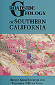
| SYLVESTER ILLUSTRATED BY ELIZABETH O’BLACK GANS 2016 Mountain Press Publishing Company Missoula, Montana ©...Roadside Geology is a registered trademark of Mountain Press Publishing Company. Library of Congress...O’Black Gans. Description: Missoula, Montana : Mountain Press Publishing Company, 2016. Series: Roadside...in the United States by Versa Press, Inc. AMP Mountain Press Qe PUBLISHING COMPANY P.O. Box 2399 +...southern California. We owe special thanks to Mountain Press editor Jenn Carey, whose patience and reasoned |


