Log InRegister
Quick Links : The Mindat ManualThe Rock H. Currier Digital LibraryMindat Newsletter [Free Download]
Home PageAbout MindatThe Mindat ManualHistory of MindatCopyright StatusWho We AreContact UsAdvertise on Mindat
Donate to MindatCorporate SponsorshipSponsor a PageSponsored PagesMindat AdvertisersAdvertise on Mindat
Learning CenterWhat is a mineral?The most common minerals on earthInformation for EducatorsMindat ArticlesThe ElementsThe Rock H. Currier Digital LibraryGeologic Time
Minerals by PropertiesMinerals by ChemistryAdvanced Locality SearchRandom MineralRandom LocalitySearch by minIDLocalities Near MeSearch ArticlesSearch GlossaryMore Search Options
Search For:
Mineral Name:
Locality Name:
Keyword(s):
 
The Mindat ManualAdd a New PhotoRate PhotosLocality Edit ReportCoordinate Completion ReportAdd Glossary Item
Mining CompaniesStatisticsUsersMineral MuseumsClubs & OrganizationsMineral Shows & EventsThe Mindat DirectoryDevice SettingsThe Mineral Quiz
Photo SearchPhoto GalleriesSearch by ColorNew Photos TodayNew Photos YesterdayMembers' Photo GalleriesPast Photo of the Day GalleryPhotography

Limonite from
He Mountain - Coon Creek, Polk County, Arkansas, USA


Locality type:Prospect
Classification
Species:'Limonite' (not an IMA approved species)
Confirmation
Validity:Believed Valid
Data
Mineral Data:Click here to view Limonite data
Locality Data:Click here to view He Mountain - Coon Creek, Polk County, Arkansas, USA
Data Identifiers
Mindat Occurrence Record ID:1378879
Long-form Identifier:1:3:1378879:1
GUID (UUID V4):b8b3e606-3eef-4e9f-86fe-08a379428535
References
Reference Search (possible matching items)
Report (issue)
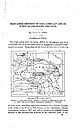
DEPOSITS OF THE CADDO GAP AND DE QUEEN QUADRANGLES, ARKANSAS. By HUGH D. MISER. INTRODUCTION. The high prices...little-exploited manganese deposits of westcentral Arkansas. These deposits are found at intervals in a belt...quadrangles, Arkansas and Oklahoma. 12 miles wide, extending west-southwestward from Pulaski County, at the...the center of the State, to Polk County, on the west border. Eecent exploitation, begun in 1915 and still...Caddo Gap and De Queen quadrangles, in western Arkansas. The location of the mountainous districts of
 
and/or  
Mindat Discussions Facebook Logo Instagram Logo Discord Logo
Mindat.org is an outreach project of the Hudson Institute of Mineralogy, a 501(c)(3) not-for-profit organization.
Copyright © mindat.org and the Hudson Institute of Mineralogy 1993-2024, except where stated. Most political location boundaries are © OpenStreetMap contributors. Mindat.org relies on the contributions of thousands of members and supporters. Founded in 2000 by Jolyon Ralph.
Privacy Policy - Terms & Conditions - Contact Us / DMCA issues - Report a bug/vulnerability Current server date and time: May 5, 2024 05:54:35
Go to top of page