 | | Report (issue) | | CONTRIBUTIONS TO THE GOLD METALLOGENY OF NORTHERN NEVADA Richard M. Tosdal editor Open-File Report 98-338-6...Contributions to the gold metallogeny of northern Nevada Preface R.M. Tbsdfl/.............................the crustal structure near the Battle Mountain-Eureka mineral trend from geophysical constraints V.J...Regional crustal structure beneath the Carlin Trend, Nevada, based on deep electrical geophysical measurements...and its relation to gold belts in north-central Nevada: Overview and progress report V.J.S. Grawc/i.. |  | | Journal (article/letter/editorial) | | Igneous and Sedimentary Rock Sources in Northern Nevada: Implications for Fluid and Metal Sources* R. M...J. S. CLINE, University of Nevada, 4505 Maryland Parkway, Las Vegas, Nevada 89104 C. MARK FANNING, Research...calcareous rocks around the Carlin trend in northeast Nevada. Petrologically similar rocks host the Getchell...the Carlin trend and from the Jerritt Canyon mining district have Pb isotope characteristics similar to...1990). In some sedimentary rock-hosted deposits in Nevada, this link has been established (Hitchborn et al |  | Theodore, T. G., Kotlyar, B. B., Singer, D. A., Berger, V. I., Abbott, E. W., Foster, A. L. (2003) Applied Geochemistry, Geology, and Mineralogy of the Northernmost Carlin Trend, Nevada. Economic Geology, 98 (2) 287-316 doi:10.2113/gsecongeo.98.2.287 | Journal (article/letter/editorial) | | and Mineralogy of the Northernmost Carlin Trend, Nevada TED G. THEODORE,† BORIS B. KOTLYAR, DONALD A. SINGER...King Midas Resources, Ltd., 3841 Amador Way, Reno, Nevada 89502 AND ANDREA L. FOSTER U.S. Geological Survey...interpretations of geochemical halos in the Carlin trend. District-scale geochemical patterns of several elements...theodore@usgs.gov 0361-0128/01/3329/287-30 $6.00 Nevada (Fig. 1). The study enhances ongoing efforts to...Getchell Area of Figs. 2–4 Ivanhoe Independence District Pinson Dee Bootstrap North Star Betze/Post Carlin |  | | Journal (article/letter/editorial) | | Accepted Manuscript Gualcamayo Mining District, Argentina: An Example of Carlin-like Au Deposits Natalia...as: N.E. Bruno, T.B. Thompson, Gualcamayo Mining District, Argentina: An Example of Carlin-like Au Deposits...apply to the journal pertain. Gualcamayo Mining District, Argentina: An Example of Carlin-like Au Deposits...Argentina Tommy B. Thompson, CREG, University of Nevada, Reno, USA Abstract In the mid-1990’s Minas Argentina...Exploration, began a reevaulation of the Gualcamayo district that included a drilling program. Low-grade gold |  | | Report (issue) | | MINERALS OF NEVADA MINERALS OF NEVADA Peer Hen By CASTOR oan eGORY.C.oFER DOCK NEVADA AND BUREAU... UNIVERSITY Reno & Las Vegas OF NEVADA PRESS GEOLOGY Nevada Bureau of Mines and Geology Special...University of Nevada Press, Reno, Nevada 89557 USA Copyright © 2004 by University of Nevada Press Photographs...otherwise noted Map of Mining Districts and significant mineral occurrences of Nevada by Nevada Bureau of Mines...Cataloging-in-Publication Data Castor, Stephen B, Minerals of Nevada / Stephen B. Castor and Gregory C. Ferdock.— Ist |  | | Report (volume) | | 147 N., R. 84 W., 4 km N of Riverdale, McLean County, N. Oak. Named for Aggie Brown Coulee, which flows...NW1/4NW1/4SW1/4SW1/4 sec. 17, T. 85 N., R. 7 W., Linn County, Iowa. A-L Peak Rhyolite Oligocene 1. New Mexico...structures in the San Mateo Mountains, Socorro County, New Mexico: New Mexico Geol. Soc. Spec. Pub. 5...Mountains, 10. sees. 33-35, T. 4 S., R. 6 W., Socorro County, N.Mex. Anapra Sandstone 1. Early Cretaceous 2...6. 7. 9. 10. at Cerro de Cristo Rey, Dofta Ana County, New Mexico, Appendix 2 in Lovejoy, E. M. P., Geology | | | Report (issue) | | MINERALS OF NEVADA MINERALS OF NEVADA STEPHEN B. CASTOR and G R EGOR Y C . F E R D OC K l NEVADA BUREAU...association with the UNIVERSITY OF NEVADA PRESS Reno & Las Vegas Nevada Bureau of Mines and Geology Special...University of Nevada Press, Reno, Nevada 89557 USA Copyright© 2004 by Uni versity of Nevada Press Photographs...Districts and si gnificant minernl occurrences of Nevada by Nevada Bureau of Mines and Geology All rights reserved...-Publ ication Dat,i Castor, Stephen B. Minerals of Nevada/ Stephen B. Castor and Gregory C. Ferdock.- rst |  | Peters, S. G., Armstrong, A. K., Harris, A. G., Oscarson, R. L., Noble, P. J. (2003) Biostratigraphy and Structure of Paleozoic Host Rocks and Their Relationshipto Carlin-Type Gold Deposits in the Jerritt Canyon Mining District, Nevada. Economic Geology, 98 (2) 317-337 doi:10.2113/gsecongeo.98.2.317 | Journal (article/letter/editorial) | | Carlin-Type Gold Deposits in the Jerritt Canyon Mining District, Nevada STEPHEN G. PETERS,† U.S. Geological Survey...University of Nevada, Reno, Reno, Nevada 89557-0138 Abstract The Jerritt Canyon mining district in the northern...northern Independence Range, northern Nevada, contains multiple, nearly horizontal, thrust masses of platform...Carlin-type gold orebodies in the Jerritt Canyon mining district were controlled by structural and host-rock...JERRITT CANYON mining district in the northern Independence Range, Elko County, Nevada, contains clusters |  | | Journal (issue) | | EUREKA! Self-Collected Minerals A Supplement to The Mineralogical Record, May-June 2022 EUREKA! U...Supplement to the Mineralogical Record, May- June 2022 EUREKA! Self-Collected Minerals A Supplement to The Mineralogical...Scovil photo. Vanadinite, 2.4 cm, from the Apache mine, Arizona. Collected by Evan Jones; Jeff Scovil photo...Miglioli photo. Fluorite, 7.4 cm, from the La Barre mine, France. Collected by Aubin Cosson; Niels Brouwer... from left: Caledonite, 1.1 cm, from the Reward mine, California. Collected by Jeff Lines; Ben DeCamp |  | | Journal (article/letter/editorial) | | Caldwell Stone Company quarry, Danville, Boyle County. Terry Huizing specimen and photo. K entucky...Commonwealth is Black Mountain in the Appalachians (Harlan County) at 4,139 feet. The lowest point is the floor of...of the Reed quarry near Grand Rivers (Livingston County) in western Kentucky, at 100 feet below sea level...small, nondiamondiferous kimberlite in Elliott County in eastern Kentucky and alnöite intrusions in Crittenden...described in Anderson (1994). The most widespread mining in Kentucky is coal. More than 7.4 billion tons |  | | Report (volume) | | Nicholas M. Ratcliffe .................... 79 Scotts Hill Member (new name) of the Cretaceous Peedee Formation...and northwesternmost Massachusetts, p. A 79 Scotts Hill Member of Peedee Formation, southeasternmost North...northwestern Nevada Johnson, M. G., 1977, Geology and mineral deposits of Pershing County, Nevada: Nevada Bur...Silver Cliff and Rosita volcanic centers, Custer County, Colorado: U.S. Geol. Survey Misc. Geol. Inv. Map...Geology of central Peloncillo Mountains, Hidalgo County, New Mexico: New Mexico Bur. Mines and Mineral |  | | Journal (issue) | | stock certificates for mines in the Cripple Creek District, Colorado, in 1898 and 1901. Sponsorship: This...Richard Jackson & Safaa Yu Dan & Dianne Kile Brian Kosnar Bryan & Kathryn Lees Ian Merkel Mining Hall of...did not escape the notice of some of the earliest mining men to work in there. Unlike the neighboring states...is basically a hardrock state where mining (and specimen mining) must typically cut through granite and...localities like the Sweet Horne mine, Breckenridge, Mount Antero, the Sunnyside mine, Creede, Cripple Creek, | 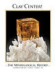 | | Journal (issue) | | Japan/ Munich, Germany Laguna Beach, California, USA tel: +1 949 494 5155 / info@kristalle.com The ...Articles The White Rock Quarry, Clay Center, Ottawa County, Ohio ...............651 by C. J. Stefano & J....from the White Rock quarry, Clay Center, Ottawa County, Ohio. Daniel Trinchillo (Fine Minerals International)...$324/three years, (Canada) $196/one year, (outside USA other than Canada) $275 for one year Subscription...(deceased) Peter L. Via (deceased) Salim Edde Lyda Hill Daniel J. Record Rob Lavinsky Wilbert A. Danner |  | Mathieu, Jordan, Turner, Elizabeth C., Kontak, Daniel J., Fayek, Mostafa, Mathur, Ryan (2018) Atypical Cu mineralisation in the Cornwallis carbonate-hosted Zn district: Storm copper deposit, Arctic Canada. Ore Geology Reviews, 99. 86-115 doi:10.1016/j.oregeorev.2018.06.009 | Journal (article/letter/editorial) | | mineralisation in the Cornwallis carbonate-hosted Zn district: Storm copper deposit, Arctic Canada Jordan Mathieu...mineralisation in the Cornwallis carbonate-hosted Zn district: Storm copper deposit, Arctic Canada, Ore Geology...mineralisation in the Cornwallis carbonate-hosted Zn district: Storm copper deposit, Arctic Canada Jordan Mathieua...Canada c Juniata College, Huntingdon, PN 16652, USA *jy_mathieu@laurentian.ca Abstract The metallogenetically...Cornwallis Zn district, in Canada’s Arctic islands, includes the past-producing Polaris mine and numerous |  | | Report (issue) | | indicate annotation of thesis title by addition of county. Capitalization of terms in revised abstracts was...particular to Mis s Edith Rich, and to the Natrona County Library, for procuring theses. Many university...WARD OWEN, 1951, Cambrian diabase flow in [Utah County], central Utah: Brigham Young Univ. M. S. thesis...Arizona, and parts of Utah, Nevada and California, (2) an embayment in western Nevada and northern California...California, and (3) land masses in northeastern Nevada and southeastern Idaho. Manyareas have evidence of post-Mississippian |  | Smith, M. T., Rhys, D., Ross, K., Lee, C., Gray, J. N. (2013) The Long Canyon Deposit: Anatomy of a New Off-Trend Sedimentary Rock-Hosted Gold Discovery in Northeastern Nevada. Economic Geology, 108 (5) 1119-1145 doi:10.2113/econgeo.108.5.1119 | Journal (article/letter/editorial) | | Sedimentary Rock-Hosted Gold Discovery in Northeastern Nevada MOIRA T. SMITH,1,† DAVID RHYS,2 KATHERINA ROSS...rock-hosted gold discovery located in northeastern Nevada, over 150 km east of the well-explored Carlin trend...this underexplored area of eastern Nevada. Introduction NORTHERN Nevada is home to some of the largest gold...known as the Carlin and Cortez (or Battle Mountain-Eureka) trends, and are characterized as sedimentary rockhosted...ores, mining and exploration activity related to sedimentary rock-hosted gold deposits in Nevada has been |  | | Report (issue) | | INTERIOR U.S. GEOLOGICAL SURVEY MINERAL SUMMARIES for NEVADA U.S. Bureau of Land Management Wilderness Study...the U.S. Government iMenlo Park, CA 94025 1990 Nevada Briefing Book U.S. Geological Survey and U.S. Bureau...BUREAU OF LAND MANAGEMENT WILDERNESS STUDY AREAS IN NEVADA 1. 2. 3. 4. 5. 6. 7. 8. 9. 10. 11. 12. 13. 14....Rock Range North Fork Little Humboldt River North Jackson Mountains North McCullough Mountains Owyhee Canyon...South Egan Range South Fork Owyhee River South Jackson Mountains South McCullough Mountains South Pahroc |  | | Book | | Map of Regions Covered in this Guidebook B | Hill & Bartholomew }® Dillon 44° Montana Se . (75)...Office of Research Snake River Section, Society of Mining Engineers Idaho Association of Geoscientists (IAPG)...Neogene-Quaternary Tectonics and Volcanism of Southern Jackson Hole, Wyoming and Southeastern Idaho 115 David...Montana: Comparison at Dillon and Bozeman Arleen A. Hill and Mervin J. Bartholomew iv 131 Chapter Three... Field Guide to the Southeast Idaho Phosphate District 269 Ray M. Petrun 17. Regional Geology and | 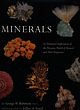 | | Book | | P L AT E 8 Chalcopyrite and Calcite. Groundhog mine, Vanadium, New Mexico. 4 x 5 cm. Thesecrystals formed...them. In the distance to my right was a conical hill of reddish-brown cinders, burning bright in the...Russia, 3.2S ct; Diamond. Locality unknown, 1.02 ct; Ruby. Thailand, 1.61 ct. Most of thesegemscontain appreciable...the diamonds clearly do not form in them. Placer mining employs water to separate gems or precious metals...easily duplicated. Spessartine in Rhyolite. Ely, Nevada. - c m crystals. Spessartine is one of the most | 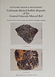 | | Report (issue) | | paralle l to host-rock bedding. Black Cloud mine, Leadville district. Sherman-type ore (bottom) in paleokarst...paleokarst breccia with recrystallized dolostone fragments (dark gray), white tabular barite. green sphalerite...veined with ferroan dolomite. rv1oose mine, North Alma district. Photographs b)' \Villiarn Sacco, Peabody...Carbonate-hosted sulfide deposits of the central Colorado mine ral belt: Introduction, general discussion, and...Johansing Leadville district: Geology and the origin of ore deposits in the Leadville district, Colorado: Part |  | | Report (volume) | | rock types 133 Cross section through the Kalavos district Cyprus showing relationship of massive sulfide...based on considerations that extend far beyond the mine itself, in some instances relating to the overall...subject, as in a scale model of the workings of a mine, to a unifying concept that explains or describes...significant tasks. GRADE-TONNAGE MODELS Estimated pre-mining tonnages and grades from over 3,900 well-explored...represents an individual deposit (or, rarely, a district), cumulated in ascending grade or tonnage. Where |  | | | | surrounded ce ne white calcite, from!iheBluebell Mine; Riondel, Digitized by the Internet Archive...misuse of mineral names such as diamond, quartz, and ruby for substances synthesized in a laboratory. These...synthetic diamond, synthetic quartz, or synthetic ruby so there is no misunderstanding. A rock is usually...dolomite, and aragonite, or rocks such as limestone, dolostone, and marble. Streak plate: Use a piece of unglazed...land surface and boasts one of the most productive mining areas in the world. The Shield’s rich deposits |  | | Report (volume) | | Cambrian formations in the Desert Range, Clark County, Nevada, by John H. Stewart and Harley Barnes_____________...Meduxnekeag Group and Spragueville Formation of Aroostook County, northeast Maine, by Louis Pavlides__-________...in the vicinity of the Aldrich Mountains, Grant County, Oreg______-____________ ________ 4. Summary of...Precambrian), central Arizona, by P. M. Blacet. Aroostook County, northeast Maine, by Louis Pavlides. Washington...Limestone. (Cinctnnatlan). County, Maine, by Louis Pavlides. tlon. Essex County, Massachusetts, by R. O |  | | Report (volume) | | Highway 49 (Skyway Road) near town of Abel, Cleburne County. Absaroka Supergroup/Volcanic Supergroup U ABRK03...volcanic field, Yellowstone National Park, Park County, Wyo. Academy Church Shale Member (Springer Formation)...W1/2NW1/4NE1/4SE1/4 sec. 1, T. 3 s., R. 2 E., Carter County. Adams Formation ADMS01 1. Holocene 2. Alaska (SE)...Quadrangle, lat 45° N., long 70°50'-55' W., Oxford County. Adamstown Member (Frederick Limestone) U ADMS06...section W of Lime Kiln in Frederick Valley, Frederick County. Named for town of Adamstown. Adobe Town Member |  | | Report (issue) | | Contents PREFACE At this writing, the base-metal mining industry in the United States is struggling to...Upper Mississippi Valley district and the Kansas-Missouri-Oklahoma Tri-State district have been shut down...the U.S. Geological Survey (the Organic Act), the Mining and Minerals Policy Act of 1970 (30 U.S.C. 21a)...Missouri district), in Middle and Upper Ordovician rocks (Upper Mississippi Valley district), and in...in Mississippian rocks (Tri-State district). The initial discoveries in all three districts were made at |
|


