 | | Report (volume) | | Geology of the Jomac Mine,White Canyon Area San Juan County, Utah GEOLOGICAL SURVEY BULLETIN This...1046-H Geology of the Jomac Mine,White Canyon Area San Juan County, Utah By ALBERT F. TRITES, Jr....production._______________________________________ Mine workings._______________________________________________...Geologic map of the Jomac area, San Juan County, Utah. 5. Geologic sections at Jomac mine. 6. Structure contour...contour maps of Jomac Hill. m Page 165 166 166 167 167 167 167 168 168 168 169 169 170 171 172 172 173 |  | | Journal (article/letter/editorial) | | 02:29 16 July 2012 ineralogy of the jom San J u a n County, Utah 240 ROCKS 81MINERALS Downloaded by... Colorado 81321 All photos by the author T he mine adlts are adjacent to a narrow bench cut into the...the flats forming the base of Browns Rim. The Jomac mine produccd most of its uranium ore in the 1950s...1998). Other secondary uranium minerds found at the mine nre metueunerite, boitwoodite, coconinoite, urunopilite...the mine. Location The Jomac mine is located on Browns Rim in thc White Canyon mining district, San |  | | Journal (article/letter/editorial) | | AMERICA 1966 COCONINOITE, A NEW URANIUM MINERAL UTAH AND ARIZONA1 Nos. 5 and 6 FROM E. J. YouNc, A... C. AssrRA,crr coconinoite, named for coconino county, Arizona, is a new uranium mineral with the probable...found in the oxidized zone of uranium deposits in utah and Arizona and occurrences have been documented...samples from utah and Arizona. The sample from the Blackwater No. 4 Mine, Apache County, Arizona, contained...Total:99.5. The sample from the Jomac Mine, White Canyon, San Juan County, Utah, contained (in weight per cent) |  | | Report (volume) | | and Ore Deposits of the White Canyon Area San Juan and Garfield Counties, Utah By ROBERT E. THADEN, ALBERT...Rock tongue____________________________________ White Rim sandstone member ____________________ ~ ___...systems___________________________________ Glen Canyon group________________________________________ Wingate...system________________________________________________ San Rafael group__________________________________________...129 129 Blue Lizard mine __________________ ~--------------------------Fry No.4 mine, by Earl J. Ostli |  | | Report (issue) | | 4 a== 12.50(3) X-ray Powder Pattern: Jomac mine, Utah, USA. 11.12 (100), 5.56 (42), 3.30 (22), 5.64...10.13 24.01 Total 100.0 99.5 100.00 (1) Jomac mine, Utah, USA; by spectrophotometry, Ca and Na by flame...to Fe~16AI2.dU02h(P04)4.16(S04)1.28(OHh 4 mine, Arizona, USA; analytical methods as for (1); after deduction...vanadium-poor and Arizona, USA). Association: Utah, USA). Gypsum, jarosite, "limonite", Colorado Plateau-type...deposits (Utah quartz, clay minerals, coalized wood (Jomac mine, Distribution: In the USA, from the |  | | Report (issue) | | CALITI ES OF UTAH by Kenneth C. Bullock UTAH GEOLOGICAL AND MINERAL SURVEY a division of the UTAH DEPARTMENT...JANUARY 1981 MINERALS AND MINERAL LOCALITIES OF UTAH by Kenneth C. Bullock Nature displays her most.... . . . . . 1 Chapter I. Mining Districts of Counties and the State of Utah. . . . . . . . . . . . .... . . . . . . . . . . . . . . . . . . . . . . 1 County Listings. . . . . . . . . . . . . . . . . . . .... . . . . . . . . . . . 1 Chapter II. Mining Districts of Utah . . . . . . . . . . . . . . . . . . . |  | | Report (issue) | | Selected Mining Districts of Utah by Carl L. Ege Headframe of Centennial Eureka mine, Tintic mining district...MISCELLANEOUS PUBLICATION 05-5 UTAH GEOLOGICAL SURVEY a division of 2005 Utah Department of Natural Resources...Resources STATE OF UTAH Jon Huntsman, Jr., Governor DEPARTMENT OF NATURAL RESOURCES Michael Styler, Executive...Executive Director UTAH GEOLOGICAL SURVEY Richard G. Allis, Director PUBLICATIONS contact Natural Resources...toll-free: 1-888-UTAH MAP website: http://mapstore.utah.gov email: geostore@utah.gov THE UTAH GEOLOGICAL SURVEY |  | | Journal (article/letter/editorial) | | Tourmaline on quartz, Cruzeiro mine, Minas Gerais, Brazil. Los Angeles County Museum of Natural History specimen...Pelt photo. MarcWApril: Beryl and calcite, La Pita mine, Maripi Boyacii, Columbia. Cal Graeber, Leonard... near Badger Creek, north of Coaldale, Fremont County, Colorado. Dave Bunk specimen, Jeff Scovil photo...(Herkimer “diamonds’’), Treasure Mountain Diamond mine, near Little Falls, New York. Uli Bahmann specimen...SepteniberlOctober: Gold, Smuggler Union mine, Telluride district, Colorado. Colorado School of Mines Museum |  | | Journal (issue) | | some of the words used to describe a lluorite mine in the San Andres Mountains of New Mexico. The author...ve~ture. The mine was determined to be the Bohrnstedt lluonte mme and was located near Sulphur Canyon in the...the San Andres Mountains. The problem was that it was within the boundaries of White Sands Missile Range...for us to reach the mine. This was accomplished and we eventually reached the mine (which included a hike...crystals covered the mine area and it appeared that no one had visited the mine since the U. S. Army |  | | Report (volume) | | ____ __ __ __________ __ ___ 125 125 History of mining and production ____ ------------------------------Geologic...belt_-----------------------------------East ·white Canyon belt____________________________________ ~[...vanadium, copper, and radium during various periods of mining in the past 50 years. Most of the deposits in Triassic...Triassic unconformity. In northeastern Arizona, eastern Utah, and western Colorado three mineral belts have been...formation, are the Monument Valley belt, the east White Canyon belt, and the Moab belt. The chief unoxidized |  | | Journal (issue) | | Northern Alliance. They also took control of the ruby mine over the past year, and tried to lease it. They...father had just returned from the new demantoid mine, and finally provided the exact locale. It is from...larger razor sharp 5/8 to 3/4 inch crystals on white matrix that was the best specimen that I have seen...price. Then I finally met a miner from the sodalite mine who provided me with locale information. The sodalite...Karak oram Highway (or a stretch from the Hazara District all the way to Cbilas. an area that takes four |  | | Book | | is a fue l for reactors to produce electricity, mining operati ons. Robert Lau f presents here a highly...structures in three dimensions for a richer Mountain Mining; Leonard Himes and Michael Jacob, appreciation...Czech Republic) and elsewhere in the Erzgebirge district. Those n1ines had been \VOrked for silver and...vvastewater during environmental reclamation at a mine that has ceased production. The following statistical...Unspecified 0 0 33, l 00 84,l 00 313,800 mining method TotaJ 493,900 2,014,800 3,455,500 4 |  | | Journal (issue) | | Collector's Notebook: Moat Mountain, Albany, Carroll County, Hew Hampshire-2000 Art Smith 9118 Concho Street...the Jersey Gardens Mall in Eliza- beth, Union County, New Jersey which he thought was a blue calcite...photographs. from gem crystal s 10 cut gems with many mining a nd locality photographs. Most of the photographs...the geology. minera logy/ crystollography. and mining of any ge mstone. but you wi ll find the bas ic...periodical for the mine ral e nthusias t and mineral history enthusiast. $24 .00 per year in USA $30.00 per year |  | | Book (volume) | | instance, a single Spodumene crystal from the Etta Mine near Keystone on the east side of the Mount Rushmore...beds, excavations, etc.Selenite roses. BRULE COUNTY AREA: in the Oacoma zone of the Pierre Fm. On Elm...gray Barite rosette up to 5 or 6 inches. CAMPBELL COUNTY MOUND CITY, W to the Missouri R., regional hillsides...gravels, etc.petrified wood, wood opal. CORSON COUNTY LITTLE EAGLE: area ridges, slopes, stream beds...Hounds in the United States CUSTER COUNTY AREA: The November Mine, 1.2 mi. SE of the Needles Eye Tunnel |  | | Book (edition) | | (Brazil). Malcolm Back (Canada), Henry L. Barwood (USA). Dmitriy Belakovskiy (Russia). Fabio Bellatreccia...(Italy), T.S. Ercit (Canada). Alexander Falster (USA). Jeffrey de Fourestier (Canada). Robert Gault (Canada)...Henderson. Jr. (USA). D.D. Hogarth (Canada). J.L. Jam bor (Canada), Anthony R. Kampf (USA). Pave! M. Kartashov...Karnp-Moller (Denmark). Akira Kato (Japan). Lance E. Keams (USA). Elisabeth Kirchner (Austria), Uwe Kolitsch (Austria)...Republic). Per Nystcn (Sweden), David O'Hanlcy (USA). Filippo Olmi (deccased) (ltaly). Werner H. Paar |  | | Journal (issue) | | stibnites from a new Nevada locality, the Murray Mine, not the old Manhattan, but he had only three specimens...clear calcites from a small pocket in the Meikle Mine, the new locality for the superb yellow barites...specimens of azurite and malachite from the Flambau Mine in Wisconsin, now completely gone, of the chalcocite...News, P.O. Box 2043, Coeur d'Alene, ID 83816-2043 USA Phone: 208-664-2448 E-mail: lream@comtch.iea.com...find of calcite in complete "balls" from the Herja Mine near Baia Mare. Evidently a large vug, or series |  | | Report (issue) | | ____________________________________ _ History of mining and production ________________ _ General description...States. FIGURE 1. Map showing location of uranium-mining districts in West-Central United States-------------------------2...outcrop of the Coconino Sandstone in the Grand Canyon area, Arizona ___ --------- ______ --------- ________...positions and shapes of sandstone pipes in the Grand Canyon area, Arizona ___________ -------------· ·---------...in 1874 at Mauch Chunk (now Jim Thorpe), Carbon County, Pa. ('Genth, 1875, p. 144B). In 1898 a deposit |  | | Report (issue) | | · as a joint program of the Manhattan Engineer District and its successor, the U. S. Atomic Energy Commission...Wallace Frederick N. Ward Alice D. Weeks Amos M. White Jesse W. Whitlow George A. Williams Irving J. Witkind...Stocking Ernest E. Thurlow Charles W. Tom R. L. White Hiram B. Wood Harry B. Young h~ CONTENTS For...___ _ Pitchblende deposits in the Central City district and adjoining areas, Gilpin and Clear Creek Counties...certain pitchblende deposits in Golden Gate Canyon, Jefferson County, Colorado, by John W. Adams and Frederick |  | | Journal (issue) | | Cooper Nottingham, England Anthony R. Kampf L.A. County Mus. of Nat. Hist. Los Angeles, CA Joseph A. Mandarino...Librarian Curtis P. Schuh Founder John Sampson White July–August Volume Thirty-three, Number Four Articles...Johnston & E. R. Swoboda Sulfur from the Perticara mine area, Pesaro-Urbino, Italy . . . . . . . . . . ...Pezzotta Famous mineral localities: The Lord Brassy mine, Tasmania . . . . . . . . . . . . . . . . . . .... John Sinkankas (1915–2002) at the Pala Properties Mine Bash, 1977. Van Pelt photo. NOTICE Died, John Sinkankas |  | | Report (volume) | | the future: Just, E. ing: Burwell, E. B., Jr., 4. Mining geology, retrospect and Index fossils: Stephenson... Landform interpretation, stereoSearch for new mining districts: Nolan, T. B., 1. pairs: Powers, W. E...described. Div. Mines, 1; Jenkins, O. P., Choctaw County, Highway 17 area: 3. Toulmin, L. D., Jr., 3. Minor:...limestone: Lamar, Shotts, R. C., 5. J. E., 11. Gold, mining districts: Pallister, Trace elements and potash...analysis: KelH. D., 5. ler, W. D., 3. Talladega County, hematiteOklahoma, potash agstone, granite magnetite |  | | Report (issue) | | Capitol Reef Area, Wayne and Garfield Counties, Utah GEOLOGICAL SURVEY PROFESSIONAL PAPER 363 Prepared...C~pitol Reef Area, Wayne and Garfield COunties, Utah By J. FRED SMITH, ]R., LYMAN C. HUFF, E. NEAL HINRICHS...upper members _____________ Wingate sandstone (Glen Canyon group) _____ Jurassic(?) system _____________________________..._____________________________ _ Kayenta formation (Glen Canyon group) _____ Jurassic and Jurassic(?) system __________________...__________________ _ Navajo sandstone (Glen Canyon group) ______ _ Jurassic system-San Rafael group _______________ |  | | Report (volume) | | are as follows: COLORADO. Mineralogy. Montrose County, uranium-vanadium deposits: Weeks, A. D., 13R....Iron, Cook County, titaniferous magnetite: Grout, F. F., 5. IRON. Minnesota, Cook County, titaniferous...and have not been searched completely. A.I.M.E., Mining Geology Geophysics Div. Ann. Mtg., Abs. Tech. Papers;...Br. Abs. American Institute of Mining and Metallurgical Engineers, Mining, Geology, and Geophysics Division...Technical Papers; Mining Branch Abstracts. New York. A.I.M.E. Trans. American Institute of Mining, Metallurgical |  | | Book | | 41)(Si3.86Al0.10 Fe0.04O10)(OH)2 from Mikhailovskii mine, Zheleznogorsk, Russia (Chukanov 2014a). IR spectra...In Fe3+-bearing Mg-poor schorl from the Limoeiro mine, Murta, Minas Gerais, Brazil, the band of OH groups...area), olmiite CaMn(HSiO4)(OH) from N’Chwaning II mine, Kalahari manganese fields, South Africa (c), and...Ca3(H2Si3O10) from Russian River basin, California, USA (d). The spectra were obtained by N.V. Chukanov....brandtite Ca2Mn(AsO4)2·2H2O from skarn (Harstigen mine, Sweden) (b), and roselite Ca2Co(AsO4)2·2H2O from | 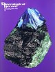 | | Journal (issue) | | Cooper Nottingham, England Anthony R. Kampf L.A. County Mus. of Nat. Hist. Los Angeles, CA Joseph A. Mandarino...Erica Van Pelt Los Angeles, CA Founder John Sampson White Editing, advertising 4631 Paseo Tubutama Tucson...W. Pinch & J. D. Grice The M eikle m ine, Elko County, N e v a d a ....................................by M. Jensen The Ross H annibal m ine, Lawrence County, South D a k o ta ...............................North Dakota and Washington, and began working as a mining geologist in 1950. During World War II he had served |
|


