 | | Journal (article/letter/editorial) | | Houston, Texas 77036 ROBERT 0. FAY Oklahoma Geological Survey Norman, Oklahoma 73019 Downloaded by [The Aga...713 15th Street NW Ardmore, Oklahoma 73401 OKLAHOMA Figure 1. Oklahoma counties. Mineral Locality...Although perhaps best known for its gypsum crystals and barite roses, Oklahoma also boasts a variety of other...minerals available from Oklahoma and think primarily of the prolific gypsum crystals that are easily...hundred years, extends into the northeast corner of Oklahoma and has produced notable specimens. Unfortunately | 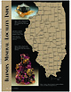 | | Journal (article/letter/editorial) | | Sphalerite and calcite, 5 cm across, Denton mine, Hardin County. Ross Lillie specimen. +!.+!+%% 34!2+ +./8 ...chalcopyrite, and sphalerite, 12.7 cm high, Hardin County. Marv Rausch specimen. 3(%,"9 -!#/50). /5 ....extreme southeast corner of the state has been a major fluorite producer, with some zinc and lead production...and barite, 6 cm high, Minerva No. 1 mine, Hardin County. Ross Lillie specimen. Figure 5 (above right).... Barite, 12.9 cm across, Denton mine, Hardin County. Ross Lillie specimen. Figure 6 (right). Fluorite |  | | Report (issue) | | eastern New Mexico and northwestern Texas and Oklahoma. The northern extension of the deposit in the...sandstones and are associated with more or less gypsum, anhydrite, dolomite, and limestone. The salt is...|McCU V MAP OF SALT BASIN IN NEW MEXICO, KANSAS, OKLAHOMA, AND TEXAS. PERMIAN SALT DEPOSITS OF SOUTH-CENTRAL...STATES. 207 appears to be but little anhydrite or gypsum interbedded in the salt measures or closely associated...thick deposits of gypsum are reported from both higher and lower horizons. In Oklahoma, Texas, and New |  | | Journal (article/letter/editorial) | | Geologic Provinces The state can be divided into four major geologic provinces. The eastern third is dominated...terrain where crystals of barite, calcite, and gypsum are found along with petrified wood and agate....Indian Queen mine ca. 1905 at Farlin, Beaverhead County. 208 ROCKS & MINERALS Downloaded by [University...mines at Butte in Silver Bow County and the Black Pine mine in Granite County have produced many fine crystal...Beaverhead County, the pegmatites of Jefferson County, and the Snowbird mine in Mineral County continue |  | | Report (issue) | | Vegas, Nev., in 1940 and the product mixed with gypsum for plaster. About 1941, Lee Boyer, an assayer...(Wilson and Roseveare, 1945,- p.* 5.-)1 Gi*eenlee- County* Undeveloped gray to black perlite^ associated...agglomerate..194&, p, 11,)' (Wood,- ; Maa?icopa!- County? Deposit of dar'k^gr'ay perlite nea-f Aquilav (Wood...- 11.-) ^ Deposits iri the western part- of fee county.- (Wilson and Rosevear'e, 1945,p/ 5.-) The following...CRocolate' Mountains/ Theiafbrirtat-ionortlnyo County was obtained from Norman and Stewar't (1951, p |  | | Report (issue) | | its widely scattered field operations has been a major source of information necessary for making the decisions...Rico, Territory of Alaska, and Indian Territory (Oklahoma) were published between 1894 and 1906. However...of the country. This information com prises a major part of the computerized National Geographic Names...the Interior, is one of the Federal Government's major earth-science and factfinding agencies. The Survey's...place, locality, or civil division (city, village, county, township, crossroad, and railroad siding) named |  | | Journal (article/letter/editorial) | | nor even under an argon lamp. "Fluorite. Teller County, Colorado." —on label. CONNECTICUT—"Perhaps you...found in Dodge County near Empire, Plainfield and Jay Bird Springs, and in Irwin County near Osierfield...believe that this will prove to be a location of major mineralogical interest. Anyone visiting the area...from the Colorado shale formation in Judith Basin County, right in the heart of Montana. This site where...are very interesting. The white one is a mass of gypsum; the yellow brown crystals are sphalerite; the |  | | Report (issue) | | 31 University of Nevada Press, Reno, Nevada 89557 USA Copyright © 2004 by University of Nevada Press Photographs... Majuba Hill Mine, Antelope district, Pershing County. N. Prenn collection. Photograph by J. Scovil....Goodsprings (Yellow Pine) Mining District, Clark County John C. Kepper 91 References 467 Contributors...and Calcite Almandine-Spessartine Annabergite Gypsum Quartz, Petersen Mountain Heterogenite Quartz...Humboldt County and the crystalline quartz collecting area on Petersen Mountain in Washoe County, permission |  | | Report (issue) | | Valley.... Small hill near Ninemile Reservoir... Major structures (diapiric folds)................ Sanpete-Sevier...50 51 51 51 55 57 Diapiric structures Continued Major structures Continued Sevier Bridge Reservoir diapiric................................................ Fairview diapiric(?) fold............................................................. 7. Photograph of gypsum bed in the Arapien Shale, being mined near Nephi...................... 9. Map showing location of major test wells in central Utah, and their spatial relation |  | | Report (issue) | | 522,000 Miscellaneous, including fluorspar, gems, gypsum, iron, lithium minerals, manganese, mica, mineral...great Chino copper deposits at Santa Rita, Grant County, were first mined in 1801, a year after they were...mine of the American Metal Company in San Miguel County. This property has become the chief producer of...developed at the Groundhog mine near Hanover, Grant County. This mine is an important factor in the New Mexico...Consolidated Copper Company, at Santa Rita, Grant County, marketed as concentrates from the mill at Hurley |  | | Report (issue) | | turquoise near Boulder City in present-day Clark County, and mined salt from deposits near St. Thomas,...covered by waters of Lake Mead in eastern Clark County. Evidence of Indian turquoise mining and processsing...was also found at Crescent Peak in southern Clark County, When this deposit was “discovered” by modern prospectors...[347] in Lincoln County, and Robinson [378] and White Pine [512] in White Pine County, tell of prospectors...Humboldt County, the Northumberland mine in Nye County, and the Gold Acres mine in Lander County. These |  | | Report (issue) | | notable production include: Chalk Mountain (Pb, Ag), Fairview (Ag, Au, Pb, Cu), Sand Springs (Ag, Au), Toy (W)...Basin (Fe) in Churchill County; Buckskin (Fe, Cu, Au, Ag) in Douglas County; Como (Ag, Au, Cu) and Yerington...Yerington (Cu, Ag, Au) In Lyon County; Broken Hills (Ag, Pb, Cu, Au, Zn), Nevada Scheelite (W, Pb, Ag...Au, Pb, Cu) in Mineral County; Quartz Mountain (Ag, Pb, Au, W) in Nye County; Ragged Top (W) and Nightingale...Nightingale (W) in Pershing County; Gooseberry (Ag, Au) in Storey County; and Galena (Zn, Pb, Ag, Cu), Olinghouse | | | Report (issue) | | 3i University of Nevada Press, Reno, Nevada 89557 USA Copyright© 2004 by Uni versity of Nevada Press Photographs... Majuba Hill Mine, Antelope district, Pershing County. N. Prenn coJlection. Photograph by J. Scovil....Goodsprings (Yellow Pine) Mining District, Clark County John C. Kepper MINERAL CATALOG 91 121 Gregory...Hurnbo ldt County and the crystalline quartz collecting area on Petersen Mounta in in Washoe County, permission...state's mining history. Mineral wealth was the major factor in the settling of Nevada. Discovenes of |  | Bare, Godfrey Tinashe, Mbayo, Jean Jacques Kalombo, Ndlovu, Sehliselo, Shemi, Alan, Chipise, Liberty (2021) Mineralogical Characterization and Acid Pretreatment of a Gold Calcine Leach Residue. Minerals, 12 (1) 10 doi:10.3390/min12010010 | Journal (article/letter/editorial) | | NaAlSi3 O8 (6.9%), and Fe3 O4 (6.4%)—were the major mineral phases in the cyanide leach residue. SEM... Canada), Barrick Goldstrike (Eureka County, NV, USA), Fairview (Barberton, South Africa), Mount Morgan...associated with As, S, silicates and talc in the Fairview calcine leach residue have been reported by Mutimutema...that predominantly have arsenopyrite and pyrite as major gold carriers. The flotation concentrates delivered...chemical analysis of the material to determine the major elements (Mg, Al, Si, Ca, Ti, V, Cr, Mn, Fe, Co |  | | Report (issue) | | RI EE 12-14 10-12 8-10 6-8 38° 2-4 0-2 GILES COUNTY SEISMIC ZONE VIRGINIA NASHVILLE EASTERN TENNESSEE...Giles County Seismic Zone Since at least 1828, earthquakes have been reported in the Giles County seismic...any known faults are seismically active. UNION County Name CHARLESTON WAYNE RANDOLPH WEBSTER BRAXTON...KALB 40°N 2006 Temperance ERIE ERIE Avonia Fairview Lake City Girard North Springfield LAKE 1993...Burton Beachwood Archbold Oak Harbor Port Clinton Gypsum Lakewood Stony Ridge Genoa Sheffield LakeBay Village |  | | Journal (article/letter/editorial) | | figure 2 (leftI: Galena. Crawford mine, Pirher, Oklahoma, Tri-State district; 6' 2 cm across; Harvard Mineralogical...lead. As a group, mines classified as MVT are also major producers of zinc, fluorite, and barite as well...crystals are also common. Smithsonite, cerussite, gypsum, and limonite were present in the oxidized zone...of the Crescent Formation, Robertson Pit, Mason County, Washington" (January/February 1988). From 1961...include hematite, limonite, pyrolusite, psilomelane, gypsum, epsomite, melanterite, copiapite, honessite, and |  | | Journal (article/letter/editorial) | | west to east along the shearzoneare, Jane,Bluff, Fairview, Empress,and Victoria. The total productionof...(Figs. I and2.) Fig. 2. N.-S. Vertical Sectionof Fairview Mine. Theargillaceous quartzite intheJane mine...British Columbiais related in direction to these two major systemsof fractures. These fracture zonesformed...and chlorite schist. An interestingoccurrenceof gypsum• is associatedwith the foot wall slateson the I...silver schistof the hanging wall portion of the Fairview mine. Sincethe gypsumoccursat least I,OOOfeet |  | | Report (volume) | | ............................................. Oklahoma.................................................Mineral resources of Oklahoma and statistics of production from 1901 to 1914: Oklahoma Geol. Survey Bull...See Bauxite and Halloysite. Asbestos. Tallapoosa County, with corundum deposits near Dudleyville; not found...commercial quantity or quality. Asphalt. Colbert County, small quantity has been shipped from near Leighton;...following localities : Bibb County, Pratts Ferry; Calhoun County, near Tampa; Clay County, T. 20 S., R. 7 E.; |  | | Journal (article/letter/editorial) | | PA 16802, USA Smithsonian Institution, PO Box 37012, MRC 119, Washington, DC 20013, USA c Harvard School...Engineering and Applied Sciences, Cambridge, MA 02138, USA b a r t i c l e i n f o Article history: Received...Mn(II)-removal beds in Pennsylvania and Tennessee, USA. Sterile and non-sterile sediments were incubated...is a significant problem for many regions in the USA and throughout the world. In Appalachia, centuries...whirl-paks. For the other four sites (De Sale 3, Fairview, Derry Ridge, PBS), thin, hard ‘‘crusts’’ that |  | | Report (volume) | | results. During the succeeding years nearly every county lost population, and the entire State, as is shown... is a large area of Juratrias, extending from Oklahoma as far north as the latitude of Wichita. North...production of the State one-half came from Crawford County. Lead and zinc are mined in the southeastern portion...civil townships, the number of townships in each county ranging from 5 in Wyandotte to 30 in Eeno and Sumner...local affairs is divided between the township and county authorities. In Kansas the only class of municipal |  | | Report (issue) | | RECONSTRUCTION OF SEASCAPE IN GLASS MOUNTAIN AREA, BREWSTER COUNTY, TEXAS, DURING MIDDLE PART (LEONARD) OF PERMIAN...related events can be made between areas. The third major division of the Permian System has been given a...Survey; R. L. Fay, W. E. Ham, and Louise Jordan, Oklahoma Geological Survey; Carlyle Gray and W. R. Wagner...University of Colorado; C. C. Branson, University of Oklahoma; R. K. DeFord, University of Texas; D. W. Boyd...and Texas-Oklahoma Panhandles, by George H. Dixon._______-_______-_--__-___-_--___ Oklahoma, by Marjorie |  | | Report (issue) | | 91 Geology and Mineral Resources of Rio Arriba County, New Mexico by E D W A R D C . B I N G L E R 1968... Production of sand and gravel from Rio Arriba County . . 4. Features of sand and gravel sources .....Rio Arriba County ...................... 4 2 . Geologic provinces in Kio Arriba County . . . . . ....Rio Arriba County, east half . . . . . . I n pocket lb. Geologic map of Rio Arriba County, west half...Arriba County . . . . . . . . . . . . . . I n pocket 3. Mineral commodities in Rio Arriba County . . . |  | | Journal (issue) | | 602-299-5274 Promotions Manager Sue Jones 1601 Fairview Dr., Suite C Carson City, NV 89701 702-883-2598...702-883-2598 Bookstore Marilee Chiriia, Manager 1601 Fairview Dr., Suite C Carson City, NV 89701 702-883-2598 Subscriptions...Foord Fluorite from the Pine Canyon deposit, Grant County, New Mexico .....................................Hanson Ilmenite expitaxial on bixbyite from Sierra County, New Mexico .....................................COVER: FLUORITE from the Pine Canyon deposit, Grant County, New Mexico. (See the article on page 47.) The |  | | Book (volume) | | chalcedony, jasper and gem petrified wood. BUFFALO COUNTY KEARNEY, area gravel bars and pits along the Platte...townagate, chalcedony, jasper, petrified wood. CASS COUNTY WEEPING WATER, SE, on rd. to Nehawka, in the Snyderville...chalcedony, jasper, fossils. CHERRY COUNTY VALENTINE, in the Sandhills county along the Niobrara R. and Minnechaduza...gem qualityagatized and opalized wood. DAWES COUNTY CHADRON, in N part of Co. and as far W as Crawford...woods, etc. DAWSON COUNTY GOTHENBURG, in sand pitspetrified palm wood. DEUEL COUNTY CHAPPELL, all regional |  | | Report (volume) | | Deposits in the Dripping Spring Quartzite Gila County, Arizona GEOLOGICAL SURVEY BULLETIN This report...Deposits in the Dripping Spring Quartzite Gila County, Arizona By HARRY C. GRANGER and ROBERT B. RAUP...deposits in the Dripping Spring quartzite, Gila County, Arizona, by Harry C. Granger and Kobert B. Raup...author, n, Title: Dripping Spring quartzite, Gila County, Arizona. (Series: U. S. Geological Survey. Bulletin...Canyon deposit___________________________________ Fairview deposit.-______________________________________ |
|


