 | | Journal (article/letter/editorial) | | Houston, Texas 77036 ROBERT 0. FAY Oklahoma Geological Survey Norman, Oklahoma 73019 Downloaded by [The Aga...713 15th Street NW Ardmore, Oklahoma 73401 OKLAHOMA Figure 1. Oklahoma counties. Mineral Locality...Although perhaps best known for its gypsum crystals and barite roses, Oklahoma also boasts a variety of other...minerals available from Oklahoma and think primarily of the prolific gypsum crystals that are easily...hundred years, extends into the northeast corner of Oklahoma and has produced notable specimens. Unfortunately |  | | Journal (article/letter/editorial) | | PERMIAN REDBEDS OF SOUTHWESTERN OKLAHOMA CHARLES N. GOULD Oklahoma City, Oklahoma INTRODUCTION The first papers...papers dealing with the redbeds of Kansas and Oklahoma were published by F. W. Cragin in 18961 and 1897...present writer published a brief description of the Oklahoma redbeds series,3 in which the greater part of...understood. At that time the present counties of Grady, Stephens. Garvin, and McClain, in which are located a considerable...(1897), No. 5, pp. 351 ff. 3 "General Geology of Oklahoma," Second Biennial Report, Department of Geology |  | | Journal (article/letter/editorial) | | VERDEN SANDSTONE OF SOUTHWESTERN OKLAHOMA' ('. J). STEPHKXSOX Tulsa, Oklahoma INTRODUCTION The Verden sandstone...working in the vicinity of Chickasha, Orady County, Oklahoma. The writer has observed this sandstone throughout... to 'I'. 15 N\. K. 12 W., all in southwestern Oklahoma. The recent areal geology map of the United States...6 Op. ell., p. 155. 626 YERDEN SANDSTONE OF OKLAHOMA 627 of the rock, and is calcile. The Verden...as marine. 1 In the Whitehorse sandstone and the Marlow shale no fossils have been observed by the writer |  | | Report (issue) | | Aquifers in Western Oklahoma By CAROL JOHNSON BECKER Prepared in cooperation with the Oklahoma Department of...SURVEY ROBERT M. HIRSH, Acting Director OKLAHOMA CITY, OKLAHOMA 1994 For additional information write...Geological Survey 202 NW 66th Street, Bldg. 7 Oklahoma City, Oklahoma 73116 Copies of this report can be purchased... RUSH SPRINGS, AND BLAINE AQUIFERS IN WESTERN OKLAHOMA By Carol Johnson Becker Abstract Aquifers are...drinking and agricultural purposes in western Oklahoma. Health concerns about consuming nitrogen and |  | | Report (issue) | | Oklahoma, A Summary of Activities of the U.S. Geological Survey, Water Resources Division, in Fiscal...GEOLOGICAL SURVEY OPEN-FILE REPORT 94-38 Oklahoma City, Oklahoma 1994 U.S. DEPARTMENT OF THE INTERIOR...NW 66th Street, Building 7 Box 25286, MS 517 Oklahoma City, OK 73116 Denver, CO 80225 CONTENTS Page.............................................. 3 Oklahoma District organization chart.....................Types of investigations and sources of funding for Oklahoma in 1991-92................................ 5 List |  | | Journal (article/letter/editorial) | | centeredupon the Cement anticline in southwestern Oklahoma has been undertooka hydrogeochemical surveyof...a smalluraniumdepositwas rocks in Oklahoma and southwestern Oklahoma, rediscovered and mined out southwest...at outcropand in the sub- sylvaniansandstonesin Oklahoma. This paperpresentsthe resultsof one detailed...-1352.50 284 U POTENTIAL, CEMENT DISTRICT, OKLAHOMA 285 tional Uranium ResourceEvaluation (NURE)...geologicalcharac- andGrady Countiesin southwestern Oklahoma(Fig. teristicsto the NURE recognitioncriteria |  | | Report (issue) | | Glorieta Sandstone and the Ogallala Formation in the Oklahoma Panhandle and Adioining Areas as Related to Underground...Glorieta Sandstone and the Ogallala Formation in the Oklahoma Panhandle and Adioining Areas as Related to Underground...in the Oklahoma Panhandle and adjoining areas. 2. Geologic sections A-A' and B-B' of the Oklahoma Panhandle...Geologic section C-C' of the Oklahoma Panhandle. 4. Hydrologic map of the Oklahoma Panhandle and adjoining...of wells showing- geologic correlations in the Oklahoma Panhandle ___ 3. Correlation chart showing geologic |  | | Report (issue) | | 14k GROUND WATER State of Oklahoma HENRY L. BELLMON, GOVERNOR Oklahoma Water Resources Board Members...Chairman JOHN R. CURRY, Antlers GUY H. JAMES, Oklahoma City GLADE KIRKPATRICK, Tulsa Vice-Chairman ...water-level data for all observation wells in Oklahoma. The first report, published in 1963, contains...related. Oklahoma Water Resources Board GROUND-WATER LEVELS IN OBSERVATION WELLS IN OKLAHOMA, 1961-62...Wood U.S. Geological Survey and M. D. Moeller Oklahoma Water Resources Board The United States Geological |  | | Journal (article/letter/editorial) | | Perini's Williams No. i in northeastern Stonewall County southwestward through Fisher,4 Scurry, and Mitchell...Continental's Brice No. i in southwestern Howard County, and from there southward through Glasscock and...counties to the Stanolind's Todd No. i in Crockett County. In reality, the cross section consists of two...Standard Oil Company of Texas. Two wells in Fisher County are common to Dickey's and Page and Adams' cross...Whitehorse group. Whitehorse is a Kansas-Oklahoma name, including the Marlow, Rush Springs, and Cloud Chief formations |  | | Report (issue) | | OKLAHOMA A SUMMARY OF ACTIVITIES OF THE U.S. GEOLOGICAL SURVEY WATER RESOURCES DIVISION FOR 1985 Compiled...by the Oklahoma District Staff U.S. GEOLOGICAL Open-File Report 85-328 Oklahoma City, Oklahoma 1985 ...Office Building 215 Dean A. McQee Avenue Oklahoma City, Oklahoma 73102 Telephone: (405) 231-4256 CONTENTS...mission and program...................... 1 2 Oklahoma District organization chart.......................................... 6 Water conditions in Oklahoma ........................................... 7 |  | | Report (issue) | | INDEX OF PUBLISHED SURFACE -WATERQUALITY DATA FOR OKLAHOMA 1946-1975 U. S. GEOLOGICAL SURVEY Open- File Report...DATA FOR OKLAHOMA 1946 -1975 compiled by Jerry D. Stoner Open-File Report 77- 204 Oklahoma City, Oklahoma... 5 Figure 2.--Map of Oklahoma showing Counties 6 Figure 3.--Map of Oklahoma showing River Basins ...alphabetical order by county 194 iii Index of Published Surface-Water-Quality Data for Oklahoma, 1946-1975...Stoner INTRODUCTION Surface-water-quality data for Oklahoma have been published by the U.S. Geological Survey |  | | Report (issue) | | RECONSTRUCTION OF SEASCAPE IN GLASS MOUNTAIN AREA, BREWSTER COUNTY, TEXAS, DURING MIDDLE PART (LEONARD) OF PERMIAN...Survey; R. L. Fay, W. E. Ham, and Louise Jordan, Oklahoma Geological Survey; Carlyle Gray and W. R. Wagner...University of Colorado; C. C. Branson, University of Oklahoma; R. K. DeFord, University of Texas; D. W. Boyd...and Texas-Oklahoma Panhandles, by George H. Dixon._______-_______-_--__-___-_--___ Oklahoma, by Marjorie...in the George's Creek basin of western Allegany County, Md. In the Allegheny region, rocks of Early Permian |  | | Report (issue) | | OKLAHOMA A Summary of Activities of the U.S. GEOLOGICAL SURVEY WATER RESOURCES DIVISION in Fiscal Years...GEOLOGICAL SURVEY Open-File Report 88-172 Oklahoma City, Oklahoma 1988 DEPARTMENT OF THE INTERIOR DONALD...Resources Division 215 Dean A. MoGee, Room 621 Oklahoma City, Oklahoma 73102 Copies of this report can be purchased...Conservancy Dist. Oklahoma Conservation Commission USQS Cooperative Matching Funds Oklahoma Dept. of Transportation...Transportation Oklahoma Water Resources Board City of Oklahoma City Grand River Dan Authority Central Oklahoma |  | | Report (issue) | | Monitoring Scheme of the Department of the Environment. Marlow, Eng. : Water Research Centre, [1984] S (510) qW292tr...En27db pt.4 AMADOR COUNTY (CALIF.) HISTORY . Mason, Jesse D. History of Amador County, California : with...of the Black Rock Wilderness study area, Graham County, Arizona. Washington : U.S. G.P.O., 1987. (200)...Cabezes Mountains Wilderness Study Area, Cochise County, Arizona. Washington : U.S. G.P.O., 1986. (200)...Winnemucca 1x2 quadrangle, Nevada, with indexing by county, commodity, mine name, mining district and selected |  | | Journal (article/letter/editorial) | | arch of the Palermo mine, North Groton, Grafton County. Rob Lawrence photo, courtesy Bob Whitmore. 242...at 15:01 05 January 2015 LOCATIONS BY COUNTY Belknap County Alton area: arsenopyrite, galena, quartz...occurrence is particularly noteworthy for Carroll County Albany, Blackberry Crossing (includes the Moose...tall, Government Gravel pit, North Conway, Carroll County. Jeff Scovil specimen and photo. Downloaded by...tall, Middle Moat Mountain, North Conway, Carroll County. Canadian Museum of Nature specimen, Jeff Scovil |  | | Journal (issue) | | "elephant country" exi ted was in outhea tern Kern County, California, in tile Moj ve-Ro amond mining di...cement, boron, rare-earth minerals, saline minerals, gypsum, and gold. The California desert mining industry...industry directly employs 16,640 people in the five-county area of Imperial, Inyo, Kern, Riverside, and San...billion) directly accounts for 12.8 jobs in tlle five-county area and 15.1 jobs in the greater Southern California...for 754,799 per 1 million production in the five-county region ( 981.2 million total) and 898,422 per 1 |  | | Journal (article/letter/editorial) | | This article was downloaded by: [University of Oklahoma Libraries] On: 30 January 2015, At: 04:33 Publisher:...N D J. M. MOORE Downloaded by [University of Oklahoma Libraries] at 04:33 30 January 2015 Geology Department...type 840 841 Downloaded by [University of Oklahoma Libraries] at 04:33 30 January 2015 SANDAMAP...central Namibia. Downloaded by [University of Oklahoma Libraries] at 04:33 30 January 2015 842 STEVEN...NOORD GOLD PROSPECT Downloaded by [University of Oklahoma Libraries] at 04:33 30 January 2015 SANDAMAP |  | | Report (volume) | | Selected Annotated Bibliography of Gypsum and Anhydrite in the United States and Puerto Rico By CHARLES...geographic occurrences, origin, technology, and uses of gypsum and anhydrite UNIT.ED STATES GOVERNMENT PRINTING...Francis, 1920comp. Selected annotated bibliography of gypsum and anhydrite in the United States and Puerto Rico...S. Geological Survey. Bulletin 1105) 1. Gypsum-Bibl. 2. Gypsum-U.S. 3. Anhydrite--Bib!. 4. Anhydrite-U...______________________________________________ Gypsum and anhydrite_____________________________________________ |  | | Report (issue) | | BIBLIOGRAPHY OF OKLAHOMA HYDROLOGY REPORTS PREPARED BY THE U.S. GEOLOGICAL SURVEY AND PRINCIPAL COOPERATING...GEOLOGICAL SURVEY Open-File Report 93-448 Oklahoma City, Oklahoma 1993 U.S. DEPARTMENT OF THE INTERIOR...Geological Survey 202 NW 66th Street, Bldg. 7 Oklahoma City, Oklahoma 73116 Copies of this report can be purchased...and Maps ..........24 Oklahoma Water Resources Board.............. 25 Oklahoma District library ........................... 3 General information on Oklahoma water resources and publications ............ |  | | Report (volume) | | GEOLOGICAL SURVEY CHARLES D, WALCOTT, DIRECTOR r GYPSUM DEPOSITS IN THE UNITED STATES BY ir- G-EORG-E...technology, and statistics of gypsum, by George I. Adams.......... Properties of gypsum and theory of formation... Character of gypsum.............................................. Varieties of gypsum ................Formation of gypsum.............................................. Deposition of gypsum................. Origin of rock gypsum............................................ Origin of gypsum seams and veins. |  | | Journal (issue) | | sapphires have been found in che Inashowen area of County Donegal during a recent mineral exploration programme...indicator minerals in the same area. Tynagh mine in County Galway, famous for its azurite specimens, has recently...Wavellite to rival the old time Irish specimens from County Cork has recently been found at the abandoned Laharran...along the coast of Ireland, Tankardscown mine in County Waterford has produced some particularly fine ...Figure I. An anglesite specimen from Tynagh mine, County Gal way showing blocky white crystal to 6 mm on | 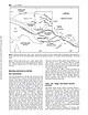 | | Journal (article/letter/editorial) | | km of early Miocene and younger strata (Exon & Marlow 1990). These rocks are widely exposed on New Ireland...Weitin Fault (Figures 2, 6a; Marlow et al. 1988). Exon & Marlow (1990) and Marlow et al. (1988) provided long-section...the island groups (Wallace et al. 1983; Exon & Marlow 1990). Basin fill consists of C5000 m of marl,...calcareous mudstone and volcanogenic sandstone (Exon & Marlow 1990). The sequence, in ascending order, includes...1979; Taylor 1979; Wallace et al. 1983; Exon & Marlow 1990). More recently, detailed observations obtained |  | | Report (issue) | | OE B 3 7bb htfi OKLAHOMA OJSULUOlCAL SURVEY Governor C. N. Haskell, State Superintendent E* D...PRELIMINARY REPORT ON THE MINERAL RESOURCES OF OKLAHOMA BY CHAS. N. GOULD L. L. HUTCHISON AND GAYLORD...Ix ' ^A nHivR5\tY ^IfOW*!*- EXCHANGE OKLAHOMA GEOLOGICAL SURVEY (V Governor C N. Hasfcell...PRELIMINARY REPORT ON THE MINERAL RESOURCES OF OKLAHOMA BY CHAS. N. GOULD L. L. HUTCHISON AND GAYLORD...Asphalt, by Chas. N. Gould . . . Gould . . Gypsum, by Chas. N. Gould 6. Salt, 7. Lead and Zinc |  | | Report (issue) | | hydrothermal deposits; (3) the uranium mineral_ 3. Marlow, Ernest E. and Writ, Robert J., Uraninite in the...the *hits Canyon. Red Canyon district of San Juan County, Utah, a persistent sandstone or conglomerate,...concentrations. In the Silver Reef district of Washington County, the oopperianranium deposits appear to be confined...deposits in the San Rafael Swell area of Emery County, Utah, contain uranium in a variety of forms, In...oxidation product of the uranium-bearing asphalt. Gypsum is almost universally associated with these deposits |  | | Report (issue) | | RIVER BASIN NEW MEXICO, COLORADO, KANSAS, AND OKLAHOMA Prepared by the U.S. Geological Survey Water...RIVER BASIN NEW MEXICO, COLORADO, KANSAS, AND OKLAHOMA CONTENTS Page Introduction .....................irrigation wells in Baca County, Colo.. ............ 5. 17 Map of Baca County, Colo., showing net changes...Formation ................ 6. 18 Map of Baca County, Colo., showing net changes in water level, in...RIVER BASIN, NEW MEXICO, COLORADO, KANSAS, AND OKLAHOMA INTRODUCTION This report on ground water in the |
|


Marlow, Stephens County, Oklahoma, USA