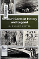
 | | Book | | org/details/missouricavesinhOOweav MISSOURI CAVES IN HISTORY AND LEGEND PROJECT SPONSORS Missouri Center for the Book...University of Missouri-Columbia SPECIAL THANKS Christine Montgomery, State Historical Society of Missouri, Columbia...the Ozarks MISSOURI HERITAGE READERS General Editor, Rebecca B. Schroeder Each Missouri Heritage Reader...social history of Missouri. OTHER BOOKS IN THE SERIES Airow Rock: The Story of a Missouri Village, by Aiithorene...A. Batterson Called to Courage: Four Women in Missouri History, by Margot Ford McMillen and Heather |  | | Report (issue) | | Agency Geology and Mining History of the Southeast Missouri Barite District and the Valles Mines, Washington...Washington, Jefferson, and St. Francois Counties, Missouri Scientific Investigations Report 2016–5173 U.S... Geology and Mining History of the Southeast Missouri Barite District and the Valles Mines, Washington...Washington, Jefferson, and St. Francois Counties, Missouri By Douglas N. Mugel Prepared in cooperation with...2017, Geology and mining history of the Southeast Missouri Barite District and the Valles Mines, Washington |  | | Report (issue) | | information iuly 18 circular 1967 STATE OF MISSOURI DIVISION OF WC HAYES DEPARTMENT GEOLOGICAL... AND AND WATER DIRECTOR RESOURCES ROLLA MISSOURI Digitized by the Internet Archive in 2023 with...fgeO OOOj err , BIBLIOGRAPHY OF THE GEOLOGY OF MISSOURI 1966 by Jerry D. Vineyard / INFORMATION CIRCULAR...CIRCULAR NO. 18 July, 1967 STATE OF MISSOURI Department of Business and Administration Division of GEOLOGICAL...Director and State Geologist Rolla, Missouri STATE OF MISSOURI Warren E. Hearnes, Governor DEPARTMENT |  | | Journal (issue) | | Woodland Cave Photo by Jeff Crews MISSOURI, THE CAVE STATE Missouri is not only known as the SHOW-ME-STATE...the Missouri River in the Ozarks. Bedrock in this region is primarily made up of soluble dolomite and...St. Louis, as well as in central Missouri near Columbia. MISSOURI DEPARTMENT OF NATURAL RESOURCES Division...planes and other areas of weakness in limestone or dolomite bedrock to create solution-enlarged openings....water. Welch Spring in Shannon County, the fifth largest spring in Missouri, contains more than one-half |  | | Report (issue) | | INVESTIGATIONS OF THE U.S. GEOLOGICAL SURVEY IN MISSOURI FISCAL YEAR 1983 Compiled by Wanietia M. Kratzer...GEOLOGICAL SURVEY Open-File Report 83-251 Rolla, Missouri 1983 UNITED STATES DEPARTMEN^1 OF THE INTERIOR...Survey 1UOO Independence Road Mail Stop 200 Rolla, Missouri 65401 Open-File Services Section sstern Distribution...stations in operation during fiscal year 1983 Missouri district projects - 8 17 Where to obtain U.S...the Missouri district 2 2. Map showing locations of Water Resources Division offices in Missouri 3. |  | | Report (issue) | | deposits of selected mines in the VIBURNUM TREND, MISSOURI ~ _. 0 0 w (!) a: ..J <{ a: ::> I~ z...DEPOSITS OF SELECTED MINES IN THE VIBURNUM TREND, MISSOURI: Mo. Dept. of Nat. Resources, Geological Survey... CONTENTS 1 introduction to the southeast missouri lead district page 3 stratigraphic and facies...deposits of selected mines in the VIBURNUM TREND, MISSOURI J ,. . ~:·~ ;i. ' 1'......,,,11o.-~ l'o.,.....The Viburnum Trend ore deposits in southeastern Missouri contain the largest reserves of lead and zinc |  | | Journal (article/letter/editorial) | | THE OZARK PLATEAU IN MISSOURI W. A. TARR University of Missouri, Columbia, Missouri ABSTRACT The streams...streams of the northern Ozark area in central Missouri are well-known examples of intrenchment. The question...is given to show that the Osage, Gasconade, and Meramec rivers intrenched themselves by downward cutting...downward-lateral cutting by the downward cutting of the Missouri River into which it empties. INTRODUCTION The streams...northwest, north, and northeast. The course of the Missouri River lies across the northern flank of this upland |  | | Journal (article/letter/editorial) | | ORDOVICIAN MONOPLACOPHORANS FROM THE OZARK UPLIFT, MISSOURI BRUCE L. STINCHCOMB AND NICHOLAS A. ANGELI ...Pershall Road, St. Louis, Missouri, 63135 and 1715 Stemwood Way, Fenton, Missouri 63026 ABSTRACT-Seven new...Lower Ordovician strata of the Ozark Uplift of Missouri; Biloboconus frizelli, Ulrichoconus bonneterrense...Bridge in the 1920s and 1930s from near Potosi Missouri. Stinchcomb and Darrough (1995) described additional...FORMATION Biloboconus frizelli n. gen., n, sp. BLACK RIVER FAUNAL INTERVAL Gayneoconus echolsi n. gen., n |  | | Report (issue) | | PROGRAMS AND ACTIVITIES OF THE MISSOURI DISTRICT, WATER RESOURCES DIVISION UNITED STATES GEOLOGICAL...and Land Survey PROGRAMS AND ACTIVITIES OF THE MISSOURI DISTRICT, WATER RESOURCES DIVISION, U.S. GEOLOGICAL...GEOLOGICAL SURVEY Open-File Report 79-1058 Rolla, Missouri July 1979 UNITED STATES DEPARTMENT OF THE INTERIOR...Division 1400 Independence Road Mail Stop 200 Rolla, Missouri 65401 CONTENTS Page Abstract 1 Introduction...1 Cooperation 1 Hydrologic-data program 4 Missouri district projects 4 Anticipated new work 50 |  | | Journal (article/letter/editorial) | | Florissant Valley, St. Louis, Missouri 63135 and 47 Pomme Ave., Arnold, Missouri 63010 ABSTRACT—The mollusk...Cambrian-Ordovician boundary in the Ozark region of Missouri, is discussed and compared with Matthevia and...one known set now resides in the Uni versity of Missouri-Rolla library. Butts (1941) illustrated and briefly...suggested, such formations of the Ozark Uplift of Missouri and Arkansas. as a univalved organism, a polyplacophoran-like...specimens, preserved as internal molds in crystalline dolomite, represent a preser vation type similar to that |  | | Report (issue) | | Survey Stanley Keller R. H. Shaver A: F. Schneider Missouri Division of Geological Survey and Water Resources...University of Missouri, Department of Geology Dietmar Schumacher University of Missouri, School of Mines...Mississippi Valley area: the Kinderhook, Osage, Meramec, and Chester Series. A two-letter designation,...from large-scale geologic maps, such as State or County geologic maps. The outcrop patterns are necessarily...(approximately middle Osage); mid-interval C(middle Meramec time- approximately early St. Louis of the midcontinent); |  | | Report (issue) | | Co. of Missouri. 99.97 99.839 99. 09 Trace. N 0.13 .00 .00 .0197 0.01 .01 .'002 MISSOURI. 1 Physical...Carboniferous system is widely distributed in Illinois, Missouri, Kansas, and other central glass-manufacturing...same district. Undeveloped sands in Arkansas, Missouri, Kansas, Wisconsin, and Iowa have been examined...necessary to import the greater portion of it from Missouri points, Ash Grove being an important center. Salt...AND METHODS OF PREPARATION OF SAND. Illinois and Missouri together furnish at present about 350,000 short |  | | Report (chapter) | | History of Mining in the Southeast Missouri Lead District and Description of Mine Processes, Regulatory...Mining Issues in Southeastern Missouri Edited by Michael J. Kleeschulte Missouri Department of Natural Resources...............................................7 Missouri Lead Study....................................................10 Early Mining in Southeastern Missouri..................................................................................10 Southeast Missouri Lead District................................ |  | | Report (issue) | | recent drilling data of the Sinsinawa River area, Grant County, Wis. : 21 p. , 2 figs. , 1 map. May 11... F. , East Shasta copper-zinc district, Shasta County, Calif.: 1 map. Sept. 16, 1953. 102 Old Mint Bldg... A brief report on the progress of the Manatee County, Fla., ground-water investigation: 11 p., 4figs...H., Photogeologic map, Clay Hills 16, San Juan County, Utah: 1 map. Jan. 9, 1953. 468 New Customhouse... V. L., and George, W. 0., Low flows on Neches River, Texas, September-October 1952, dam B reservoir |  | | Report (issue) | | abash River, Ind., and glacial Lake Whittlesey ---__..______-________..___.__-_._Souris River at Minot...Minot, N. Dak...____________ Sheyenne River, N. Dak., and glacial Lake Agassiz._________________________________...Iowa------------------------Humboldt River, Nev___________________ Shenandoah River, Va-__-----_-_-------Ozarks...s and Salt and Cuivre River basins, Missouri- _-_______-_---_--__---_----Rivers in New England________________... 19. 20. 21. 22. Page Map of the River Bar and the reversed River Agron, France, showing valley bends_ |  | | Journal (article/letter/editorial) | | page): Galena, St. Joseph Lead mine, Viburnum, Missouri, Viburnum Trend district; 6 cm on edge; James...the mines of the Viburnum Trend in southeastern Missouri accounted for 90 percent of the United States'...Beales (1967). The source of lead in southeastern Missouri is described by Doe and Delevaux (1972). M V T...ore deposits are the very coarsely crystalline dolomite of the Presquile Forma tion and the dolomitic...marcasite, calcite with crystals up to 16 cm long, and dolomite crystals are also common. Smithsonite, cerussite |  | | Report (issue) | | Concerning Lead Mining Issues in Southeastern Missouri Scientific Investigations Report 2008–5140 U...Geological Survey Cover photographs. Current River (photograph courtesy of David J. Weary, U.S. Geological...Concerning Lead Mining Issues in Southeastern Missouri Edited by Michael J. Kleeschulte Contributions...concerning lead mining issues in southeastern Missouri: U.S. Geological Survey Scientific Investigations...the Viburnum Trend Subdistrict of southeastern Missouri has occurred for more than 40 years. Additional |  | | Report (issue) | | Iowa, by Matthew J. Avcin and Donald L. Koch Missouri, by Thomas L. Thompson Arkansas, by Boyd R. Haley...Donald L. Koch__________________________________ Missouri, by Thomas L. Thompson_______________________...----------------------------------------------------Meramec Series _________________________________________...-----------------------------------------------Missouri Series _ _ _ _ _ __ _ _ _ _ _ __ _ _ __ _ _ __...Moines series is best exposed along the Des Moines River and in the many small surface mines that roughly |  | | Journal (article/letter/editorial) | | from the Upper Ordovician Viola Formation, Kansas, USA K.D. Newell and R.H. Goldstein . . . . . . . . ....suspended matter and bed sediments in the upper Loire river basin ŽFrance. P. Negrel and C. Grosbois . . . ....................... An experimental study of dolomite dissolution rates as a function of pH from y0...residence times of the unimpounded Meramec River Basin, Missouri G.C. Frederickson and R.E. Criss . ...2 and substrate weathering in a large northern river basin, Canada: carbon isotope perspectives K. Telmer |  | | Report (issue) | | and possessing so many geological features as Missouri, labors of eighteen months only, may seem to...have compelled us to omit the Reports upon the Missouri River Section, the Section from Providence to Hannibal...Reports on Economical Ge- much ology, Cooper County and the South-West, have been very abri^ed and... Justiije ous obligations to the citizens of Missouri for the sympathy and aid The everywhere bestowed...Excellency, is Sterling Price, the Governor of Missouri, for the prompt manner, in which he has rendered |  | | Report (issue) | | 15 15 15 15 15 15 15 15 16 16 16 17 17 PAGE Meramec group . Salem formation St. Louis formation St...stage 59 Burlington-Keokuk tage 59 Warsaw stage 60 Meramec epoch 60 Salem stage . 60 St. Louis and Ste. Genevieve...Springfield (fig. 1). It is entirely within Macoupin County and is bounded on the east and west, respectively...it is named after an early settler in Macoupin County. 2 It consists of two hills, the higher of which...Brink, McDonough, and Co., I 879. [4] Macoupin County: RELIEF AND DRAINAGE 5 FIG. 3.-Eastward view |  | McClung, Craig, Bair, Dorinda, Leach, David L. (1998) Bibliography pertaining to the Ozark Mississipi Valley-type metallogenic province, Missouri, Arkansas, Kansas, and Oklahoma, USA covering 1785 to February 1998; paper edition. Open-File Report Vol. 1998 (98-238) US Geological Survey doi:10.3133/ofr98238 | Report (issue) | | VALLEY-TYPE METALLOGENIC PROVINCE, MISSOURI, ARKANSAS, KANSAS, AND OKLAHOMA, USA COVERING 1785 TO FEBRUARY 1998;...smaller Northern Arkansas, Central Missouri, and Southeast Missouri barite districts. This report provides...list of the Mississippi Valley-type districts of Missouri and key words relating to mining, MVT's, base...the same operation on the water resources of the Missouri by using the Water Resources Abstracts, a CD ROM...relating to the carbonate-hosted leadzinc deposits of Missouri. Acknowledgments We would like to thank John |  | | Report (volume) | | MISSOURI GEOLOGICAL SURVEY VOLUME VI. LEAD AND ZINC DEPOSITS ( SECTION l) By ARTHUR W INSL OW ASSISTED...EXCELLENCY, DR. J. HON. WM. ,J. STONE, GOVERNOR OF MISSOURI, JEFFERSON CITY, ex officio President of the Board... CARTER, SECRETARY , LETTER OF TRANSMITTAL. MISSOURI GEOLOGIC.AL SURVEY,} JEFFERSON CITY, JULY 1,...of the Report on the Lead and Zinc Deposits of Missouri, by Mr. Arthur Winslow, assisted by Mr. James...and Mr. Robertson. The lead and zinc deposits of Missouri have proved of great and unexpected importance |  | | Report (issue) | | Cotter (?) dolomite _________________ _ St. Peter sandstone ________________ _ Joachim dolomite __________________...limestones_ Keokuk limestone ______________ _ Meramec group ____________________ _ Warsaw formation and...__ 97 Recent________________________________ 98 River alluvium_____________________ 98 Physiography__...major rivers of area __ Peculiarities of Illinois River ________________ _ 128 Ill IV CON' rENTS Page..._________ _ Application of concept to Illinois River _______ _ Structure _________________________________________ |  | | Report (issue) | | THE OZARK PLATEAUS AQUIFER SYSTEM IN PARTS OF MISSOURI, ARKANSAS, OKLAHOMA, AND KANSAS U.S, GEOLOGICAL...the Ozark Plateaus Aquifer System in Parts of Missouri, Arkansas, Oklahoma, and Kansas By J.L. IMES and...the Ozark Plateaus aquifer system in parts of Missouri, Arkansas, Oklahoma, and Kansas / by J.L. Imes...water levels in observation well in Phelps County, Missouri Graph showing effect of precipitation on water...water levels in observation well in Howell County, Missouri Maps showing: 55. Selected springs of the |
|


