 | | Journal (issue) | | February 1987 No.1 VIRGINIA MINERAL LOCALITY INDEX D. Allen Penick, Jr. This Virginia mineral locality...world-wide locality index The localities are listed by county, followed by a listing of the most prominent minerals...source of information in this Virginia index was Minerals of Virginia (1970) by R. V. Dietrich. Although...of the index. Some of the famous localities in Virginia, such Updated from Rocks and Minerals, Vol. 60...pegmatite in Amelia County and the Lynch Station locality (turquoise crystals) in Campbell County, are now closed |  | | Report (issue) | | the cover—Turquois crystals from Lynch Station, Virginia; x ca.; pho tograph by Neal Ycdlin; color plates...C. A. Michael. COLD NUGGET FROM SPOTSYLVANIA COUNTY: Longest dimension approximately 13 cm., photograph...of Virginia R. V. DIETRICH* Professor of Geology and Associate Dean of Arts & Sciences, Virginia Polytechnic...Polytechnic Institute Research Division Bulletin 47 Virginia Polytechnic Institute, Blacksburg, Va. 24061 *... © R. V. Dietrich and the Research Division of Virginia Polytechnic Institute, 1970 Printed and bound |  | | Report (issue) | | ....................4 Todd (St. Stephen Nickel) mine......................................................................10 Blakeney (Basswood Ridge) mine........................................................................11 The Ledge (Charlotte County Granite) quarry...................................................................13 Central Tower Hill occurrence..............................................................................14 Tower Hill Road occurrence................................. |  | | Journal (issue) | | R. Kampf Natural History Museum of Los Angeles County Arthur Roe Tucson, AZ Abraham Rosenzweig University... by P.J. Dunn A new stolzite occurrence: Broken Hill, Australia........................................Behnke Famous mineral localities: the Corrego Frio mine and vicinity, Minas Gerais, Brazil ...............A. Rickard Allactite from Franklin and Sterling Hill, New Jersey............................... 251 ...in from Itagu agu , Espirito S anto, Brazil. The group m easu res 6.4 cm , and is from th e collection |  | | Report (issue) | | CHAPTER VI. ECONOMICS - History of Corundum Mining in Georgia Value of the Georgia Deposits Preparation...in this publication will act as a its and the high price it Georgia It is hoped, that production. arts...A. Burdick, Manager of the Laurel Creek Corundum Mine, Pine Mountain, Rabun Co., Ga., Mr. Corn of Visage...near the village Machel in Padar; and, since then, mining has been some success. Blue sapphires are brought...hexagonal in Gellivara, Dr. J. Lawrence Smith; Emery Mine of Chester; Scientific Kesearches, p. 42. 3 |  | | Report (volume) | | KING, ELISABETH S. LOUD, MILDRED CHALLMAN MEAD, VIRGINIA M. JUSSEN and GEORGIANNA D. CONANT PART 2. INDEX...the future: Just, E. ing: Burwell, E. B., Jr., 4. Mining geology, retrospect and Index fossils: Stephenson...P., 15. California, Barstow quadrangle: Trenton group, Ordovician: Bowen, O. E., Jr. , 5. Clark, T. H... Landform interpretation, stereoSearch for new mining districts: Nolan, T. B., 1. pairs: Powers, W. E...Reading: Military Service Pub. Co. Texas, Tordilla Hill area, color: Shale nomenclature: Clark, T. H. ,6 |  | | Report (issue) | | ALTITUDES IN VERMONT, /GEOLOGY OF GRAND ISLE COUNTY, THE OLDEST CORAL REEF, P. E. TERRANES OF BETHEL...Schist ..................................... 91 V—Chlorite Schist, Royalton ...............................95 Vill—Overlying Chlorite Schist, Bethel .......................... 97 TX—Chlorite and Ankerite, Bethel.................................. 97 X—Contact, Chlorite Schist and Barnard Gneiss .................. ...as from these maps the altitude, of any mountain, hill, town, etc., which is within the limit of these |  | | Report (issue) | | appeared warranted by improvements in exploration and mining techniques and unknown future economic conditions...areas. This greatly decreases the likelihood of mining, but correspondingly increases the need to identify...Topographic and Geologic Survey was able to respond to county health officials with details down to the level...Township, Berks County, which came to the authorities’ attention as having an exceptionally high level of indoor...Skarn- and gneiss-hosted occurrences in the Chestnut Hill area . . . . . . . . . . . . . . . . . . Phase I: |  | | Journal (issue) | | . ..... 483 W. E. Wilson The Total Wreck Mine, Pima County, Arizona ............ .. ........... ......... .... ..... 507 L. Presmyk The Flux Mine, Santa Cruz County, Arizona .................................. 531 W. E. Wilson & M. Hay The Carlota Mine, Gila County, Arizona ............................. .....Wilson & E. Jones Fluorite from the Oatman District, Mohave County, Arizona ............. .... ..... 569 M...M. Hay & D. Morris The Bagdad Mine, Yavapai County, Arizona ............. .......................... | 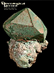 | | Journal (issue) | | R. Kampf Natural History Museum of Los Angeles County Arthur Roe Tucson, AZ Abraham Rosenzweig University...AZ 85715 602-299-5274 Articles The Jacupiranga mine, Sao Paula, Brazil ...............................and J. M. Martins The Jensen quarry, Riverside County, California .....................................Doorselaer A highly magnesian alleghanyite from Sterling Hill, New J ers ey by O. V. Petersen, J. Bollhorn and...coated with malachite, 5 cm across, from the Onganja mine, Namibia. Collection of the Sorbonne, University |  | | Report (volume) | | viii-ix. The physical geology of the Grand Canon district, by Clarence E. Button, pp. 47-166, pis. x-xxxvi...Abstract of report on geology and mining industry of Leadville, Lake County, Colorado, by S. F. Emmons, pp...of'the geology of the Comstock lode and the Wash oe district, by George F. Becker, pp. 291-330, pis. xlvi-xlvii...xviii-xxiii. Abstract of report on'geology of the Eureka district, Nevada, by Arnold Hague, pp. 237-290, pis. xxiv-xxv...ii-xxx. Abstract of a report on the mining geology of the Eureka district, Nevada, by Joseph Story Curtis |  | | Report (issue) | | INTRODUCTION. reports are those on the Mercur district, by J. E. Spurr and S. F. Emmons; the Bingham...Bingham The senior author, J3. S. Butler, began district, by J. M. Boutwell, Arthur Keith, and field work on...deposits of Utah in the S. F. Emmons; the Park City district, by J. M. FIELD .WORK AND AUTHORSHIP. summer...author, G. F. Loughlin, began work in the Tintic district in 1911 in collaboration with Waldemar Lindgren...the Leamington district, and of districts in theW asatch Range. Several of the mining districts of the |  | | Book | | P. Blake, professor of mineralogy, geology and mining the at College of California, parent to the...mineralogist of California, and pub- and sixth State Mining Bureau reports. Then beginning volume prepared...sulfides, oxides, and so on. Within each major group the minerals are presented generally according...mineral species or group of species are reported by 1-2 shows the county boundaries and county names. When possible...within a township is illustrated by Figure 1-1. county of occurrence. Map *M. Fleischer’s 1980 Glossary |  | | Report (issue) | | Geophysical studies Hydrology Economic geology Mining directory Environmental studies Engineering studies...Geochemistry of the Franklin-Creighton Gold Mine, Cherokee County, Georgia by R. B. COOK . . . . . . . . ... 15 Land lot map of the Franklin-Creighton Gold Mine Figure 1. and grid area . . . . . . . . . . . ....48 CONTENTS - Continued Page The Sandy Springs Group and Related Rocks of the Georgia PiedmontNomenclature...Sandy Springs Group . . . . . . . . . . Table 1. Stratigraphic units of the Sandy Springs Group . . Diagrammatic |  | | Report (edition) | | though some are metals and others nonmetals. JYletal mining is restricted to the iron ranges, but the nonmetals...Minneapolis. 1903. C. K. Leith. The Mesabi iron-bearing district of Minnesota: U.S.G.S. Mon. 43, 1903. J. M. Clements...Clements. The Vermilion iron-bearing district of Minnesota. U.S.G.S. Mon. 45, 1903. C. R. Van Hise and...Louis County 32 16. Map showing many irregular lakes in terminal moraine, Otter Tail County 34 17....erratic, Duluth 158 71. Boulder till, St. Louis County 159 7£. Map showing distribution of loess in |  | | Journal (volume) | | Earth, Editorial and Design by T he Brown Reference Group pie ISBN O 7489 7935 2 NO i 07 04 18 Printed in...Mexico. Eight-sided crystals from the Traversella mine, Piedmont, Italy. .&. crystals. It can also be...are often replaced by pyrite. FACT FILE PYRITE Group: Sulphides Crystal system: Cubic Habit: Cubes,...quartz rather brittle. FACT FILE ROSE QUARTZ Group: Oxides Crystal system: Trigonal Chemical formula:...CHARACTERISTICS Rose quartz is a member of the oxide group of minerals. It is an oxide of silicon, and it gets |  | | Report (edition) | | though some are metals and oth~rs nonmetals. :Metal mining is restricted to the iron ranges, but the nonmetals...polis 1903. C. K. Leith. The Mesabi iron-bearing district of Minnesota: U.S.G.S. Mon. 43, 1903. J. M. Clements~...Clements~ The Vermilion iron-bearing district of Minnesota. U.S.G.S. Mon. 45, 1903. C. R. Van Hise and...Louis County :32 16. Map showing many irregular lakes in terminal morame, Otter Tail County :34 17...erratic, Duluth 158- 71. Boulder till, St. Louis County 159' 72. Map showing distribution of loess in |  | | Book (edition) | | magnitude of South African mineral deposits and local mining operations, the Economic Geology Section of the...Grange as co-ordinator, and the South, African mining industry; statutory bodies, namely the Atomic Energy...Transport and Export Facilities, and Taxation of Mining Profits. I am greatly indebted to the above organisations...due to the Secretary for Mines, the Government Mining Engineer, the Director of the Minerals Bureau,...his full co-operation to produce a work with this high standard of printing, is gratefully acknowledged |  | | Report (volume) | | . 19 Kigluaik group................................................... Nome group ...................gravels............................................... High-level gravels and gravel-plain deposits............................... 137 137 .137 History of mining......................................................-.........".........-..... 143 Big Hurrah mine............................................. Miscellaneous.............................. General methods of mining placers................................ Classification |  | | Report (volume) | | of July 29............. 58 VIII. A, Flat-topped hill south of Whitefish Lake, Hoholitna River basin;...of recent lavas on hill west of Sixmile Lake; B, Recent lavas and earth flows on hill west of Sixmile Lake...sketch of the relations of shales and sandstones on hill 4 miles north of the camp of July 15..............described and those of the Tuluksak-Aniak placer district, which has already been surveyed. The two unexplored...accordance with its policy of keeping in touch with new mining developments in Alaska, sent a small party in charge |  | | Book | | the ClaraMine in Germany,Laurion in Greece,Broken Hill in NewSouthWalesand Langbanin Sweden.The secondtype...collaborationand support from I I Topographic map of the district from the Langesundsfjord in the west to n,nsberg..... n Topographic map of the Langesundsfjord district. Courtesy of Prokart AS, H0nefoss. 7 I. Festnings0ya...Laivik Copenhagen and reported on the minerals district, and wrote that a sample of this from the syenite...and bergmannite (mainly natrolite after group at the Mining Academy in Kongsberg. nepheline). Schumacher |  | | | | T. W. Stanton XV. — Iron Ores of the Marquette District of Michigan; by C. R. Van Hise XVI. — Illustration...Bituminous Coal Field of Pennsylvania, Ohio aud West Virginia, I. C. White, 156. Age of the Plants of the American...XXVII. by ; XXIV. — Recent Theory of the Chlorite Group and '_____ 210 by of Colloid Solutions;...at the Deep West Virginia; by W. Hallock XXX.— Mount Bob, Mount Ida, or Snake Hill; by T. W. Well, Wheeling...display of minerals was theonlyone display were ae high as those given ana genera] and g Over 150 tons and |  | | Journal (volume) | | T. W. Stanton XV. — Iron Ores of the Marquette District of Michigan; by C. R. Van Hise XVI. — Illustration...Bituminous Coal Field of Pennsylvania, Ohio aud West Virginia, I. C. White, 156. Age of the Plants of the American...XXVII. by ; XXIV. — Recent Theory of the Chlorite Group and '_____ 210 by of Colloid Solutions;...at the Deep West Virginia; by W. Hallock XXX.— Mount Bob, Mount Ida, or Snake Hill; by T. W. Well, Wheeling...display of minerals was theonlyone display were ae high as those given ana genera] and g Over 150 tons and |  | | Book | | in 1950—just a little over 20 years ago— that a group of geologists in Tulsa, Oklahoma, recognized the...Mackenzie Gordon, jr., Robert R. Hessler, Dorothy Hill, Erie G. Kauffman, Robert V. Kesling, Porter M....White. Engineering geology and rock mechanics: Mary Hill, Eugene Kojan, and David J. Varnes. Geochemistry:...Francis J. Pettijohn, and J.W. Pierce. Soils: Mary Hill, Charles E. Kellog, and Arnold C. Orvedal. Statistical...Middleton. Stratigraphy: George V. Cohee (assisted by Virginia Byers and Marjorie MacLachlan). Structural geology |  | | Book (edition) | | Stanton, Mr. R. P. Whitfield, and Professor E. T. Hill and the Tertiary, as regards the Invertebrates,...H. Scudder, Mr. Prank Leverett, Professor R. T. Hill, Professor W. Upham, Pro- fessor G. P. Wright,...)':2/*:"'°'"<^c r^ NORFOLK wales/// /FRIENDLY .>::;i-' \group ^.ra,4.5^^/,.^' \ 21 15 . f -4ni^ / /'-...2900 Colorado, 6800 Connecticut, 500 Delaware, 60 District of Columbia, 150 Florida, 100 Georgia, 600 Idaho...1700 Utah, 6100 Vermont, 1000 Virginia, 950 Washington, 1700 West Virginia, 1500 Wisconsin, 1050 Wyoming |
|


