| Locality type: | Mountain |
| Classification |
|---|
|
| Species: | Zircon |
| Formula: | Zr(SiO4) |
| Confirmation |
|---|
|
| Validity: | Believed Valid |
| Data |
|---|
|
| Mineral Data: | Click here to view Zircon data |
| Locality Data: | Click here to view Stove Mountain (Cookstove Mountain), El Paso County, Colorado, USA |
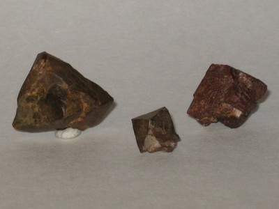
| Photo Gallery | View Gallery (2 photos) |
| Data Identifiers |
|---|
|
| Mindat Occurrence Record ID: | 34960 |
| Long-form Identifier: | 1:3:34960:8 |
| GUID (UUID V4): | f6994569-701f-4787-90b1-9865437d3776 |
| Localities for Zircon in this Region |
|---|
|
| NE Spur, Stove Mountain (Cookstove Mountain), El Paso County, Colorado, USA |
| Nearest other occurrences of Zircon |
|---|
|
|
| 2.0km (1.3 miles) | ⓘStove Mountain Mineral Locality (Cook Stove Mountain Mineral Locality), Cheyenne Mining District (St. Peters Dome Mining District), El Paso County, Colorado, USA |
| 2.1km (1.3 miles) | ⓘEureka Tunnel (1-15 pegmatite), St Peters Dome, Cheyenne Mining District (St. Peters Dome Mining District), El Paso County, Colorado, USA |
| 2.2km (1.4 miles) | ⓘCheyenne Mining District (St. Peters Dome Mining District), El Paso County, Colorado, USA |
| 2.2km (1.4 miles) | ⓘSt Peters Dome, Cheyenne Mining District (St. Peters Dome Mining District), El Paso County, Colorado, USA |
| 2.4km (1.5 miles) | ⓘEureka Shaft, Cheyenne Mining District (St. Peters Dome Mining District), El Paso County, Colorado, USA |
| 2.7km (1.7 miles) | ⓘMount Rosa, El Paso County, Colorado, USA |
| 2.9km (1.8 miles) | ⓘHelen Hunt Falls, El Paso County, Colorado, USA |
| 2.9km (1.8 miles) | ⓘNorth Cheyenne Cañon-Helen Hunt Falls area, Colorado Springs, El Paso County, Colorado, USA |
| 3.0km (1.9 miles) | ⓘRosa No. 1 trench, Mount Rosa, El Paso County, Colorado, USA |
| 7.3km (4.6 miles) | ⓘCrystal Park area, Crystal Park, El Paso County, Colorado, USA |
| References |
|---|
|
|
| Reference Search (possible matching items) |
|---|
 | | Journal (article/letter/editorial) | | was born in Missouri in 1903. We first came to Colorado in 1908, but I don’t remember much about that...several times in the next few years. When visiting Colorado, my family always stayed at the Iron Springs Chateau...those in my cabinet. In 1920, when we moved to Colorado Springs from Missouri, a friend, about my age...agates and carnelian from Austin Bluffs here in Colorado Springs. Shortly after that I met Willard Wulff...Museum of Nature and Science 2001 Colorado Boulevard Denver, Colorado 80205 Unless otherwise noted, all |  | | Journal (issue) | | Julius Weber Mamaroneck, New York COLORADO ISSUE #2 Articles Colorado locality index.............................. 323 by B. L. Muntyan What’s new in Colorado minerals? ......................................339 by M. I. Jacobson The San Juan Mountains of Colorado ..................................349 by J. A...10 cm tall, from the Yucca Hill claim, Park County, Colorado. Richard A. Kosnar specimen; photo by John...Natural History for conceiving the idea of a second Colorado issue and for helping a great deal in bringing |
|


Fairview, Stove Mountain, El Paso County, Colorado, USA