 | | Journal (issue) |
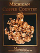
| large mass of native copper in the Quincy mine ca. 1918. (Michigan Technological University Archives, Houghton)...Donald Pearce (1941-1989) The “Copper King” The MICHIGAN COPPER COUNTRY L. W i l s o n New Mexico Bureau...t a n l e y J. D y l II Seaman Mineral Museum Michigan Technological University % 1992 T h e M in e...crystal group, 13.6 cm, from an unknown mine in the Michigan Copper Country. Richard A. Kosnar collection;...wrote the classic work on the copper deposits of Michigan in 1929. Photo by Wendell E. Wilson. TENT . |
 | | Journal (article/letter/editorial) |
| MICROMOUNTING AT THE KEWEENAW PENINSULA, MICHIGAN By PAUL B. MOORE and RICHARD M. 6EGER Depr. of Geolophysical...UNIVERSITY] at 03:21 25 August 2017 INTRODUCTION The Keweenaw Feninsula is well-known for its fine specimens...collectors with limited time, may we suggest the Hancock Mine (on Ingot St., Hancock). The dump looks terrible...chlorite minerals are the best found anywhere in the Keweenaw Peninsula. PUMPELLYITE (6Ca0.3Al 2 0 3 .7Si0 2...due to the parallel growth of xls. At the Hancock Mine, Hancock, it occurs upon xls of epidote and quartz |
 | | Book |
| Mineralogy of Michigan by E. W. Heinrich updated and revised • by George W. Robinson M By E W~ Hellnr]ch...Museum Michigan Technological University Houghton, Michigan 49931 2004 © MINERALOGY OF MICHIGAN 3 FOREWORD...FOREWORD Michigan has a long and varied geologic history that includes repeated episodes of volcanism...before the first Europeans set foot here. When Michigan became a state in 1837, one of the first actions...and we continue to learn more about them today. Michigan minerals helped to build the state and nation |
 | | Report (issue) |
| (CaBSiO4OH) vesicle filling from a basaltic Houghton County lava flow. Small specks of native copper occur...the surface and between the nodular masses. The Michigan Bicentennial symbol (back cover) incorporates...Survey Division BULLETIN 6 THE MINERALOGY OF MICHIGAN by E. Wm. Heinrich Professor of Mineralogy and...University of Michigan Ann Arhor, Michigan Lansing, Michigan 1976 STATE OF MICHIGAN WILLIAM G. Mrr...State of Michigan CL '48 s.321.6. Printed by Speaker-Hines and Thomas, Inc., Lansing, Michigan. Available |
 | | Journal (article/letter/editorial) |
| 81427 THE CLIFF MINE, discovered in 1844, is located on the Keweenaw Peninsula of Upper Michigan in the...turned the Cliff into a successful mining operation and made it the first mine on the "Keweenaw" to pay...dividends to stockholders. Throughout its history, the mine also produced spectacular specimens of crystallized...over. N ative copper was first mined on the Keweenaw Peninsula several thousand years ago by Native...controlled three mineral tracts on the northern part of Keweenaw Peninsula. After examining the copper prospect |
 | | Journal (issue) |
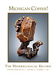
| MICHIGAN COPPER! The Mineralogical Record JANUARY-FEBRUARY 2023 ? VOLUME 54 ? NUMBER 1 ? $40 ... KRISTALLE Est.1971 Laguna Beach, California, USA • Tel: +1 949 494 5155 • Email: info@kristalle.com.......................3 by W. E. Wilson The Keweenaw County Fissure Mines.......................................13 by C. J. Stefano The Cliff Mine, Keweenaw County, Michigan................................... Stefano & P. Persson The Central Mine, Keweenaw County, Michigan................................... |
 | | Journal (article/letter/editorial) |
| in celebrating the rich mineral heritage of the Keweenaw Peninsula’s datolite by diving into this article...Dyl II, Director A. E. Seumnii Mineral Museum Michigan Technological University 170 ROCKS 81MINERALS...81MINERALS ’ .1-. . TOM ROSEMEYER 1632 Camp Bird Mine Road P.O. Box 586 Ouray, Colorado 81427 rosemeyer@ocinet...Florida] at 00:43 01 January 2015 1. Cliff mine 2. Phoenix mine 3. Centralmine 4. Central Exploration...pit 7. IronCity(Empire)mine 8. Capemine 9. Clatkmine 10. starmine 11. Keweenaw Point Historical information |
 | | Journal (article/letter/editorial) |
| recovered from a large vug in the fissure vein of the Cliff mine; the largest crystal is 2 cm across. The specimen...Probably the best arborescent silver from the Cliff mine, this specimen is 9.5 × 10.5 cm and was originally...Jaszczak photo. Figure 18. This calcite from the Cliff mine is 3.6 cm long and perched on a matrix of spongy...lava on earth (Bornhorst and Rose 1994). At the Cliff mine it thickens to more than 1,300 feet and remains...some of the veins (Butler and Burbank 1929). Cliff Mine After the failed 1844 mining venture at the Hays |
 | | Book (volume) |
| may find useful. Mr it Thorns has compiled the County List. Messrs Macfarlane & Erskine's engravings...510 Analysed (Museum Ticket). 10.*Albite after Laumontite Old Kilpatrick Greg and Lettsom, Min.Brit., :...Albite after Min. A Laumontite Lang Crag, Dumbarton Greg and Lettsom, : Laumontite : Calton Hill, Edinburgh...impression that it was the pseudo; morphs after Laumontite (Nos. 10 and 11 supra) that had been investi-...he was only in a position to suggest that the Laumontite pseudomorphs would prove to be the same substance |
 | | Book |
| Islands Juan Carlos Carracedo & Simon Day 5. The north of Ireland Paul Lyle 6. Leinster Chris Stillman...onNewMinerals,Nomenclature andClass::ication. Co. County. EMPElectronmicroprobe - an instrument usedto ...with older fluorite specimens from Weardale in County Durham being a case in point. Many of these specimens..."Cumberland", "Alston" or "Alston Moor" (Cumberland as a county no longer exists, as it was merged with Westmorland...Westmorland in the mid- I 970s to form the new county of Cumbria). The confusion appears to have occurred during |
 | | Book (edition) |
| PALAEOZOIC-STRATIGRAPHY Cambrian and early Ordovician North-west Highlands Highland Border South of Scotland...314 3 I7 320 11. PERMIAN AND TRIASSIC Hebrides North Minch Basin Sea of the Hebrides Basin lnner Hebrides...Basin Other areas Moray Firth Basin and Northern North Sea Moray Firth Basin Brent Oil Field Piper Oil...Vlll 343 344 344 345 347 34 7 North-east Scotland and the North Sea Lower Jurassic Middle Jurassic...unusually exciting was the discovery of oil in the North Sea in 1970. Widespread drilling has given us a |
 | | Book |
| and adjacent islands . . 205 Jurassic flora from north-eastern Snow Island, E. Rb-Sr total-rock and mineral...continuous the deep water of Drake Passage; to the north the des¬ mobile belt connecting South America and...of Burdwood Bank, the basin may be offset to the north but it continues at least as far as long. 49° W...of low-velocity sediments situated just to the north of the south slope of the Scotia Ridge, the sedi¬...cate a marked low in the Bouguer anomaly over the north edge of Burdwood Bank reaching a minimum of -61 |


