 | | Report (volume) | | Boulder-Pioneer wilderness study area, central Idaho, that is being considered for wilderness designation...Boulder-Pioneer Wilderness Study Area, Blaine and Custer Counties, Idaho By U.S. GEOLOGICAL SURVEY and U.S. BUREAU...Boulder-Pioneer wilderness study area, Blaine and Custer Counties, Idaho B. Aeromagnetic studies of the Boulder-Pioneer...Boulder-Pioneer wilderness study area, Blaine and Custer Counties, Idaho C. A geological and geochemical evaluation...Boulder-Pioneer wilderness study areas, Blaine and Custer Counties, Idaho D. Economic appraisal of the Boulder-Pioneer |  | | Report (volume) | | GEOLOGY AND ORE DEPOSITS OF THE WOOD RIVER REGION, IDAHO BY JOSEPH B. UMPLEBY, LEWIS G. WESTGATE AND CLYDE...D. F. HEWETT Prepared in cooperation with the Idaho Bureau of Mines and Geology Francis A. Thomson,...Lower Ordovician rocks___-____-__-_____--___--__ Phi Kappa formation______________-__-_____-______-__General...____ Granodiorite and related rocks on upper Wildhorse Creek __ Massive granodiorite________-------__-----________...Distribution and general relations_-.___..__._______. Augite andesite and basalt.___-----___-_.--________ Latite |  | | Journal (article/letter/editorial) | | r------' .--. !i i , i ' i Boundary '---~ IDAHO Bonner_j l--;~u:d{ene\, I , L~ Coeur'cI'Alene...its pyromorphite, Idaho also boasts many other mineral species. ( :\.. -~:/ Idaho <....: (_ ", I...Power i..r v. ) 't,.,. 1. r': ~ Caribou Idaho 83816-2043 , • c-vz..J. '. 2",_J'-1 '\ o, ...INDEX BRIEFLY DESCRIBES the mineral localities in Idaho; all known localities that may have produced well-crystallized...localities for minerals that were first discovered in Idaho. Unfortunately for the field collector, most of |  | | Report (volume) | | Quadrangle and the Western Part of the Idaho Falls I°x2° Quadrangle, Idaho * , , » Prepare/ in *VG}'erati(>ttaw$i...Idaffo Stat^Universitv, 'and th&Jr "ni\'ersity of Idaho U.S. GEOLOGICAL SURVEY BULLETIN~2064-rA-R Cover...south at the Mackay stock, southwest of Mackay, Idaho. The Eocene Mackay stock (center of photograph;...Quadrangle and the Western Part of the Idaho Falls I°x2° Quadrangle, Idaho Edited by Ronald G. Worl, Paul K...cooperation with the Idaho Geological Survey, Idaho State University, and the University of Idaho Volume 1 (chapters | 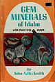 | | Book | | MINERALS^ of Idaho with field trip j& maps by John A.fl£.jkwith Gem Minerals of Idaho, designed for...for beginners and for those collectors visiting Idaho for the first time, is a guide to some of the...collecting. garnet diggings of Latah County and the Spencer Opal Mine, charge a digging fee. But most...mineral-forming forces than makes Idaho a gem hunter's para- has experienced more Idaho," a fact that dise. L... usually six to ten percent. GEM MINERALS OF IDAHO 44 pin-fire white opals are valuable and those |  | | Book (edition) | | Idaho Minerals The complete Reference and Guide to the Minerals of Idaho Lanny R. Ream 1!11, ) a...PISTOLS Idaho Minerals Idaho Minerals The Complete Reference and Guide to the Minerals of Idaho with Special...Chapters on the Coeur d'Alene Mining District, the Blackbird Mining District, and the Sawtooth Mountains...Rerun Publishing P .O. Box 2043 Coeur d'Ale ne, Idaho 83814 Copyright © 1989 by L.R. Ream Publishing...R Ream Publishing P.O. Box 2043 Coeur d'Alene, Idaho 83814 (208) 667-0453 To those collectors who are |  | | Report (issue) | | IDAHO GEOLOGICAL SURVEY Merrill Hall, Room 332 University of Idaho Moscow, Idaho 83043 (208) 8857991............ David Hawk, representative Director, Idaho Department of Lands Stanley Hamilton ............... Chairman, Department of Geology, Idaho State University Idaho National Engineering Laboratory Clayton...................................... President, Idaho Association of Professional Geologists Deborah I................................... President, Idaho Mining Association Jack Peterson ................. |  | | Report (issue) | | CRATERS OF THE MOON 30- x 60-MINUTE QUADRANGLE, IDAHO By Mel A. Kuntz 1 , Betty Skipp1, and F.J. Moye2...Geological Survey, Denver, Colorado 2Box 1145, Challis, Idaho 83226 CRATERS OF THE MOON 1:100,000 QUADRANGLE...intrusive rocks; includes some rubbly colluvium along canyon walls. Unit description modified from Scott (1982)...Butte, Horse Butte, Wildhorse Butte, (Butte County), Wildhorse Butte (Lincoln County), Mule Butte, and...tuff unit (Tiv) mapped separately west of Long Canyon, northwest of Watercress Spring, and east of the |  | | Report (volume) | | BAYHORSE REGION CUSTER COUNTY, IDAHO BY CLYDE P. ROSS Prepared in cooperation with the IDAHO BUREAU OF MINES...-________________________ Intrusive basalt and augite andesite.________________________ Biotite andesite...andesite dikes._____________________._______________ Augite syenite_________---_________-___________________-__...mines_________ Bayhorse district..______.__________--__--__-__-_--_-_.._ Good Hope mine.___________________________________...near Garden Creek._________-_-_-_____-.-__ Ramshorn mine._____.___-_______-___-.-_-__--_---__ Skylark mine________________ |  | | Report (issue) | | Geologic map of the Challis 1° x 2° quadrangle, Idaho Compiled by Frederick S. Fisher 1 , David H. Mclntyre...sedimentary and intrusive rocks.... 2 Sunnyside Mine-Marble Creek area............................ 2...Fork Mayfield Creek area............ 12 Challis-Custer Graben-East Fork-Jerry Peak area............. 18...White Cloud Peak area.... 24 Granitic rocks of Idaho batholith................................ 26 Paleozoic...2° quadrangle, Idaho Plate 2. Correlation of map units, Challis 2° quadrangle, Idaho DESCRIPTION OF |  | | Report (volume) | | Mineral Deposits of the Challis 1°x2° Quadrangle, Idaho U. S. GEOLOGICAL SURVEY BULLETIN 1658 A-S Symposium...1°x2° Quadrangle, Idaho Edited by D. H. MclNTYRE Papers presented at the Northwest Mining Association Convention...Mineral Deposits of the Challis I°x2° Quadrangle, Idaho (1983 : Spokane, Wash.) (U.S. Geological Survey...bulletin ; 1658A-S) "Papers presented at the Northwest Mining Association Convention, Spokane, Washington, Dec...3:1658A-S 1. Geology Idaho Challis Region Congresses. 2. Mines and mineral resources Idaho Challis Region Congresses |  | | Report (issue) | | Precambrian and Lower Ordovician Rocks in East-Central Idaho GEOLOGICAL SURVEY PROFESSIONAL PAPER 889 Precambrian...Rocks in East-Central Idaho Precambrian Y Sedimentary Rocks in East-Central Idaho By EDWARD T. RUPPEL ...Precambrian Z and Lower Ordovician Rocks in East-Central Idaho By EDWARD T. RUPPEL, REUBEN JAMES ROSS, JR., and...Precambrian and Lower Ordovician rocks in east-central Idaho. (Geological Survey Professional Paper 889) Includes...Precambrian Z and Lower Ordovician rocks in east-central Idaho. Supt. of Docs. no.: I 19.16:889 1. Geology, St |  | | Report (volume) | | 147 N., R. 84 W., 4 km N of Riverdale, McLean County, N. Oak. Named for Aggie Brown Coulee, which flows...NW1/4NW1/4SW1/4SW1/4 sec. 17, T. 85 N., R. 7 W., Linn County, Iowa. A-L Peak Rhyolite Oligocene 1. New Mexico...structures in the San Mateo Mountains, Socorro County, New Mexico: New Mexico Geol. Soc. Spec. Pub. 5...Rhyolite or Vicks Peak 9. Rhyolite; underlies Potato Canyon Rhyolite Type locality: NE flank of A-L Peak, N...Mountains, 10. sees. 33-35, T. 4 S., R. 6 W., Socorro County, N.Mex. Anapra Sandstone 1. Early Cretaceous 2 |  | | Report (issue) | | Pennsylvanian and Permian Systems ____ -_- __ _ Brock Canyon Formation _______________ _ Antler Peak Limestone...Range_----Breccia pipes ____ ----------------------Horse Canyon breccia pipe ____ ------Location and geologic relations--Coarse...dikes_-----Conglomerate and breccia near Horse Canyon mouth __ - - ----Development of the pipe-- - ----III...Tertiary age-Continued Breccia pipes-Continued Pipe Canyon breccia pipe__________ __ 70 Location and geologic..._ 70 Rhyolite ______ ----------------_ 70 Rocky Canyon breccia pipe__________ 71 Location and geologic |  | | Report (issue) | | the Challis Volcanics in the Twin Peaks Caldera, Idaho. USGS photograph by Frederick S. Fisher. Geology...Resource Assessment of the Challis I°x2° Quadrangle, Idaho Edited by Frederick S. Fisher and Kathleen M. Johnson...mineral resources in the Challis 7°x2° quadrangle, Idaho UNITED STATES GOVERNMENT PRINTING OFFICE, WASHINGTON...resource assessment of the Challis I°x2° Quadrangle, Idaho / edited by Frederick S. Fisher and Kathleen M....I19.16:P1525 1. Geology Idaho Challis Region. 2. Mines and mineral resources Idaho Challis Region. I. Fisher |  | | Book | | Bartholomew }® Dillon 44° Montana Se . (75) =: eye Idaho Grader& =e Dehler \ Borgo et al. ee Ketchum...once delighted volcanologists who visited Ashton, Idaho. The quarry was recently destroyed to build a housing...Jurassic Twin Creek Formation, northwest of Geneva, Idaho. (Photograph by Paul Link) Bottom Left - Aerial...of Eastern Idaho Edited by Scott S. Hughes and Glenn D. Thackray Department of Geology Idaho State University... Funding provided by Idaho State University College of Arts and Sciences Idaho State University Office |  | | Report (issue) | | description of the geology, mining history, and production of the major gold-mining districts in 21 States...relations ---------------------------History of gold mining and trends in production_ J\labama -----------...--------------Cleburne County ----------~----------------- Tallapoosa County --------------------------Alaska...------------------Cochise County -----------------------------Gila County --------------------------------Greenlee...ee County ----------------------------R[aricopa County ----------------------------R[ohave County -- |  | | Report (volume) | | Highway 49 (Skyway Road) near town of Abel, Cleburne County. Absaroka Supergroup/Volcanic Supergroup U ABRK03...volcanic field, Yellowstone National Park, Park County, Wyo. Academy Church Shale Member (Springer Formation)...W1/2NW1/4NE1/4SE1/4 sec. 1, T. 3 s., R. 2 E., Carter County. Adams Formation ADMS01 1. Holocene 2. Alaska (SE)...Quadrangle, lat 45° N., long 70°50'-55' W., Oxford County. Adamstown Member (Frederick Limestone) U ADMS06...section W of Lime Kiln in Frederick Valley, Frederick County. Named for town of Adamstown. Adobe Town Member |  | | Report (issue) | | preserved specimens was recently made from talus in a mine dump in Nevada (Kerr, 1962; Churkin and Kay, 1967)...diopsidic augite, locally as much as 10 mm in diameter, are set in a groundmass of small granular augite, plagioclase...relatively thin is in the vicinity of Trail Creek, Idaho, where more than seven graptolite zones occur in...Ordovician rocks from Silurian, whereas at Trail Creek, Idaho, the boundary falls in a small covered interval...was recently made from large slabs of slate in a mine dump in northeastern Nevada (Kerr, 1962). Most of |  | | Book (edition) | | juty a2 Sketches IDAHO Second of GEOLOGY Edition Parker, Boise, Idaho EDWARD F. RHODENBAUGH...RHODENBAUGH, M.S Sketches IDAHO of GEOLOGY Second Edition by Edward F. Rhodenbaugh, M.S. I stand upon...stand upon the summit of my years. Eo R. Boise, Idaho 1961 Printed and bound in the United States of...of America The CAXTON PRINTERS, Caldwell, Idaho 93001 Ltd. by THIS VOLUME IS AFFECTIONATELY DEDICATED...BoIs—E HIGH SCHOOL, GOODING COLLEGE, UNIVERSITY OF IDAHO, SOUTHERN BRANCH, AND BOISE JUNIOR COLLEGE Through |  | | Report (issue) | | · as a joint program of the Manhattan Engineer District and its successor, the U. S. Atomic Energy Commission...___ _ Pitchblende deposits in the Central City district and adjoining areas, Gilpin and Clear Creek Counties...certain pitchblende deposits in Golden Gate Canyon, Jefferson County, Colorado, by John W. Adams and Frederick...to pitchblende-bearing veins at Marysvale, Piute County, Utah, by George W. Walker and Frank W. Osterwald...Geology of the Los Ochos uranium deposit, Saguache County, Colorado, by R. C. Derzay _·- _______ ____ __ |  | | Report (volume) | | Bull. 1060-D, p. 193, 252-253, pl. 7. In Nemaha County, Kans., member is basal unit of Howard limestone...Aarde farm, sec. 4, T. 26 S., R. 11 E., Greenwood County. Aaron Slatet Precambrian or Paleozoic: Central...Central Railroad, sees. 5-7, T. 11 S., R. 5 E., Pope County. Named for Abbott Station. Abbyville Gabbrol Precambrian...map. Occurs in vicinity of Abbyville, Mecklenburg County. Abercrombie Formationl Middle Cambrian: Western...Abercrombie Peak, on ridge south of Dry Canyon, in Gold Hill district. Aberdeen Sandstone (in PottS |  | | Journal (article/letter/editorial) | | illis........................ Rocky Mountains of Idaho and Montana; by G. R. M ansfield... Front ranges............ Some structural features of northern Idaho [abstract] ; by Jo seph B. Umpleby....................... 97 A high temperature vein in Madison County, Missouri [abstract] ; by W. A. Tarr.............B i l l in g s l e y , A. B ., Anaconda Copper Mining Company, Portage, ington. Wash Associate Geologist...with the Wisconsin Survey in the zinc and lead district, and the two following seasons with the Illinois |  | | Report (volume) | | the Goodrich quartzite, Palmer area, Marquette County, Michigan, by R. C. Vickers. --(G) Wall-rock control...certain pitchblende deposits in Golden Gate Canyon, Jefferson County, Colorado, by John W. Adams and Frederick...uranium deposits in the Red Desert, SweBtwater County, Wyoming, by Donald G. Wyant, William N. Sharp...in oolitic limestone near I /Tayoworth, Johnson County, Wyoming, by R. R. Guilinger and P. K. Theobald...(L) Uranium and copper deposits, Coyote district, Mora County, New Mexico, by C. M. Tschanz_________. |  | | Report (issue) | | l cooperators --------------------------State, county, and local cooperators -----------Other cooperators...gional offices ----------------------Area and District offices -------------Earth Resources Observation...----------------Regional offices ----------------------District offices -----------------------Offices in other...unidentified, source. Edna Mountain area, Humboldt County, Nevada Detailed geologic and geochemical mapping...Coldrun Creek 71;2-minute quadrangle, Humboldt County, Nev., has revealed areas that contain anomalous |
|


