 | | Book (volume) | | ...........................................59 Colorado ...............................................................548 Table of Maps Page Alabama County Map ...................................................................................4 Alaska County and Stream Map ..................................Co. Mining Districts ............................................................22 Arizona County Map.........................23 Arizona – Cochise Co. Mining Districts .................................... |  | | Book (volume) | | ...........................................47 Colorado ................................................rights, so remember you were told. If in doubt, a county map will tell you who the legal owner is. Good...gemmy qualities for cutting and polishing. AUTAUGA COUNTY PRATTVILLE, N. 6 mi., and just E of the Birmingham...were well known to prehistoric Indians.) BARBOUR COUNTY BAKER HILL, SE 1 mi. : 1 in a deep ravine, as a...BIBB COUNTY GENERAL AREA: c county gravel pits along the Cahaba R.⎯gemmy minerals, petrified wood; d area |  | | Book (volume) | | ...........................................47 Colorado ................................................rights, so remember you were told. If in doubt, a county map will tell you who the legal owner is. Good...gemmy qualities for cutting and polishing. AUTAUGA COUNTY PRATTVILLE, N. 6 mi., and just E of the Birmingham...were well known to prehistoric Indians.) BARBOUR COUNTY BAKER HILL, SE 1 mi. : 1 in a deep ravine, as a...BIBB COUNTY GENERAL AREA: c county gravel pits along the Cahaba R.⎯gemmy minerals, petrified wood; d area |  | | Report (volume) | | Minerals of Colorado: A 100- Year Record By EDWIN B. ECKEL GEOLOGICAL SURVEY BULLETIN 1 1 14 A...knowledge____________________________________ Future of Colorado mineralogy______________________________________...mineral localities and metallic mineral deposits of Colorado ________________________________ In pocket III...mineral localities and metallic mineral deposits of Colorado, has not been included in this reprint. Many of...especially Fischer and others, 1946). MINERALS OF COLORADO: A 100-YEAR RECORD By EDWIN B. EcKEL ABSTRACT | 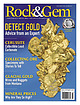 | | Journal (issue) | | -high specimen is from the DeMaria mine in Placer County, California. (Jeff Scovil Photo/Brett Keller collection)...run-of-the-mine specimens by Steve Voynick Montana Placer Mining ............................. 28 Wire gold and...mzexpos@gmail.com www.mzexpos.com Like us on facebook COLORADO MINERAL & FOSSIL SHOW SEPT. 7 - 14, 2014 ~ DENVER...Wholesale and retail show; Gem Faire Inc.; Lane County Events Center; 796 W. 13th Ave.; Fri. 12-6, Sat...4-6—FARMINGTON, NEW MEXICO: Annual show; San Juan County Gem & Mineral Society; Civic Center; 200 W. Arrington; | 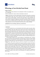 | | Journal (article/letter/editorial) | | geosciences Article Mineralogy of Non-Silicified Fossil Wood George E. Mustoe ID Geology Department, Western...Western Washington University, Bellingham, WA 98225, USA; mustoeg@wwu.edu; Tel.: +1-360-650-3582 Received:... Abstract: The best-known and most-studied petrified wood specimens are those that are mineralized with...Eh, and burial temperature. Permeability of the wood and anatomical features also plays important roles...several episodes, fossil wood may have complex mineralogy. Keywords: fossil wood; mineralogy; paleobotany; | 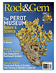 | | Journal (issue) | | specimen comes from the Eagle’s Nest mine in Placer County, California. It is currently on display in the...me think of them. “I cut slabs from fossils, petrified trees, shells, clams, pentacrinites, moss, algae...Wholesale and retail show; Gem Faire Inc.; Washington County Fairgrounds, 873 NE 34th Ave.; Fri. 12-6, Sat....Wholesale and retail show; Gem Faire Inc.; Sonoma County Fairgrounds, 1350 Bennett Valley Rd.; Fri. 12-6...and Sale; Tomoka Gem & Mineral Society; Volusia County Fairgrounds; Tommy Lawrence Bldg., State Road 44 |  | | Book (edition) | | MILEAGE L OGS. REVISED EDITION Revised Edition, COLORADO GEM TRAILS AND MINERAL GUIDE HICllAHD :--1. PEARL...an extensive ¥em and mineral collecting tour 01 Colorado, revealing the interesting places where Nature...Swallow, Publisher) 2679 South York Street Denver, Colorado 80210 - , =· - ·, BOOKS BY RICHARD M. PEARL...PEARL Exploring Rocks, Minerals, Fossils in Colorado America's Mountain: Pikes Peak and the Pikes Peak...Atlas of Colorado American Gem Trails Nature As Sculptor: A Geologic Interpretation of Colorado . Scenery |  | Collins, Donley S., Cobban, Robert R., Foord, Eugene E., Murphy, Jack A. (1989) Bibliography for update and revision of U.S.G.S. Bulletin 1114, Minerals of Colorado -- a 100 year record, by Edwin B. Eckel, Part A - Paper copy --Bibliography data file disks. Open-File Report Vol. 1989 (89-206) US Geological Survey doi:10.3133/ofr89206a | Report (issue) | | Survey Denver, Colorado Department of Geology, Denver Museum of Natural History Denver, Colorado NOTE FOR...revision of U.S.G.S. Bulletin 1114, Minerals of Colorado A 100 year record, by Edwin B. Eckel By Donley...Prepared in cooperation with Friends of Mineralogy - Colorado Chaptar, and the Denver Museum of Natural History...references dealing with the mineralogy of the state of Colorado. It is part of a more than 10 year effort to update...and revise U.S.G.S. Bulletin 1114, Minerals of Colorado: A 100 year record, by Edwin B. Eckel (1961). |  | | Report (volume) | | . 234 " y { " ,-t .. .~,:",. I " , COLORADO "or.! _ +, (~ STATE OF .~ :'(' COL~ADO /... BULLETIN 40 RADIOACTIVE MINERAL OCCURRENCES OF COLORADO AND BlaLlllGRAPHY by James L. Nelson-Moore,...Energy COLORADO GEOLOGICAL SURVEY DEPARTMENT OF NATURAL RESUURCES STATE OF COLORADO DENVER, COLORADO 1978...ete 11 st r ng of rad i aaet 1ve occurrences 1n Colorado, with a comprehensive blbi iography and bibliographic...on the Colorado Plateau sparked several periods of exploratIon that ultimately led to a mining "boom ll |  | | Book (edition) | | — _ ; COLORADO GEM TRAILS AND MINERAL GUIDE ! ■ : ' BOOKS BY RICHARD M. PEARL Colorado Gem Trails...Trails and Mineral Guide Colorado Rocks, Minerals, Fossils America’s Mountain: Pikes Peak and the Pikes...Nature As Sculptor: A Geologic Interpretation of Colorado Scenery Guide to Geologic Literature Popular Gemology...Gemology Mineral Collectors Handbook Colorado Gem Trails The Art of Gem Cutting (With Dr. H. C. Dake)...Dake) * RICHARD M. PEARL ★ COLORADO GEM TRAILS AND MINERAL GUIDE ★ SKETCH MAPS BY MIGNON WARDELL PEARL |  | | Book | | to form R°ck ■ 1 ^ Igneous Dike Rock on the bedrock. Layer after layer was accumulated; some layers...sediments. Often the layer lying directly on the bedrock has changed from gravel and is now an almost con¬...famous was the single beryl stone found in Oxford County in Maine that weighed 18 tons and was 18 feet in...Sapphires and rubies are found in North Carolina, Colorado, Idaho, Indiana, Cal¬ ifornia and Montana, but...yellow and red stones. Beryl occurs in California, Colorado, Connecticut, Georgia, Idaho, Maine, Maryland |  | | Journal (article/letter/editorial) | | containing Sweetwater agate weathering from their bedrock source in Tertiary sediments. To get to the locality...creek bed near there. RADIOACTIVE PETRIFIED WOOD To find petrified wood, take the road south from Jeffrey...directions; take your choice. You will find petrified wood mostly on the hilltops and hillsides. Most...radioactive around my neck. Some of the radioactive petrified wood fluoresces green under shortwave ultraviolet...uranium boom, the occurrence of uranium bearing petrified wood in that area deceived people into thinking |  | | Journal (issue) | | STAINLESS STEEL CABBING UNIT This machine is made in the USA for Kingsley North. Features an all stainless steel...collections. This beryl (var. albite) from Gilgit District, Pakistan, is in the collection of Marc Weill...beautiful by Bob Jones regular columns Arizona’s Petrified Forest Fossils.......... 48 Chalcedony Park is...FOSSIL SHOW �JAN. 31 - FEB. 14, 2015 ~ Tucson, AZ COLORADO MINERAL & FOSSIL SHOW - Spring WEST COAST GEM...Productions, Inc. full page template.indd 5 COLORADO MINERAL & FOSSIL SHOW - Fall WEST COAST GEM & |  | | Report (volume) | | Study Area, Garfield County, Utah, and the Escalante Canyons Tract V, Kane County, Utah U.S. GEOLOGICAL...Study Area, Garfield County, Utah, and the Escalante Canyons Tract V, Kane County, Utah By SUSAN BARTSCH-WINKLER...study area, Garfield County, Utah, and the Escalante Canyons Tract V, Kane County, Utah. (Mineral resources...and mineral resources Utah Escalante Canyon (Kane County) 3. Steep Creek Wilderness (Utah) I. Barsch-Winkler...(UT-040-061), Garfield County, Utah, and the Escalante Canyons Tract V (UT-040-077), Kane County, Utah. CONTENTS |  | | Journal (issue) | | xi. 1 ¾ x 11/s . ( 2 ½ oz.) ....... . Co"IUte• Colorado. Xld. 2 ¼ x 1 ¼ ... . .................•.... ...in Tooele Cannon, son of a Morman pioneer, the County, Utah. Here, .according to local mineral resources...the Mormon polygamists hid partially explored, a mining road has from the U. S. marshals two generations...AND MINERALS Iba, i br BLUE BARITE FROM TEXAS COUNTY, MISSOURI .:um. Geologist, Missouri Geological...BY ALBERT L KIDWELL ~ operated by the Murphy Mining Company during part of 1941 and 1942. The barite |  | | Journal (article/letter/editorial) | | mostly in small amounts. A bed near Pyriton, Clay County, Ala., was worked for copper. One was mined near...near Stone Hill in the southern part of Cleburne County at what was called Wood's copper mine and also...mine about a mile to the northwest. Much of the mining was done in the early seventies. There was a large...Martinez Lake, Yuma Co., Ariz., is a resort on the Colorado River, 37 miles north of Yuma. From the locality...Yuma, Ariz. One specimen is a dark brownish petrified wood with a rough, pale greenish crust; one face |  | | Report (issue) | | Resource Stewardship and Science Fort Collins, Colorado The National Park Service, Natural Resource...Stewardship and Science office in Fort Collins, Colorado publishes a range of reports that address natural.../588. National Park Service, Fort Collins, Colorado, USA. NPS 308/117341, October 2012 ii NPS Geologic...Inventory Report iii List of Figures Figure 1. Colorado Plateau. .......................................National Park Service is that seismic vibrations from mining activities (e.g., blasting, crushing, and hauling |  | | Report (volume) | | areas southwestern Utah and part of adjacent Mohave County, Arizona ; ch. A) Bibliography: p. 1. Mines and...areas southwestern Utah and part of adjacent Mohave County, Arizona ; 1746-A. QE75.B9 [TN24.U8] no. 1746...Survey A6 Appraisal of identified resources A6 Mining activity A6 Oil and gas A7 Results of investigation...A4 Map showing oil and gas leases and unpatented mining claims in and near the Canaan Mountain and The...The Watchman Wilderness Study Area in Washington County, near the main entrance to Zion National Park, |  | | Book (edition) | | describes sites under of the nearest town and county. and the many maps included book contain such...plane of lesser molecular cohesion in the splitting wood along the grain. Cleavage cracks across the prism...lava is petrified wood by replacement of may form in the by decay or destruction of the wood. Agate...fundamental clue to gem locations. Since hard-rock mining is too expensive for amateurs, the hobbyist ...quarries. Some gems may also be dug from agate, petrified wood, crystals easily worked soil, disintegrated |  | | Book (edition) | | MARIN COUNTY FREE LIBRARY 3 1111 00289 4184 \ I s Fifth Revised Edition A complete, state-by-state...Maryland; Professor Richard Pearl of Colorado Springs, Colorado; and Professor Jack Hanahan of Belmont... IT'S FUN TO HUNT FOR GEMS and refreshing, a petrified pool never to be disturbed by wind or tide. Few...molecular cohesion in the crystal. It is like splitting wood along the grain. Cleavage cracks across the prism...amethyst. Lava and pumice also engulf trees. The wood burns away as the rock cools, leaving a mold in |  | | Book | | conditions on th P desert . are changing rapidly; Mining claims are filed, property, once open to collectors...and is punishable under the law. Do not disturb mining machinery or buildings, posted or not, they are...Falls and Roaring Ridge 22 Buried Petrified Forest 23 Canyon View Wood 23 Jasper Hill 24 Rand Mountains...Mountains Minerals and Rhodonite 24 Bedrock Canyon 25 Golden Valley 26 Steam Well, Squaw Springs 27 Searles Lake...Areas Providence Mountains Vulcan Mine 61 Providence Wood 62 Bonanza King Mine 62 Providence 63 Mitchell Caverns |  | | Book | | appreciation is also extended to the Los Angeles County Museum of Natural History, especially to Miss...Opal, and Petrified Wood Quartz Crystalline Quartz Cryptocrystalline Quartz Opal Petrified Wood 11 Feldspar...prolific suppliers of good specimens of agate, petrified wood, and fossils, but what is not generally known...geodes, opal, amethyst, moss agate, agate, petrified wood, and fossils. The Rocky Mountain states and...specimens including metallic ore minerals, petrified wood, agate, sapphire, gold, topaz, jade, amethyst |  | | Report (volume) | | Resources of the South Warner Wilderness, Modoc County, California By WENDELL A. DUFFIELD, U.S. GEOLOGICAL...resources of the South Warner Wilderness, Modoc County, California. (Studies related tc wilderness wilderness..._ Chemical analyses of bedrock and stream-sediment samples __________ Mining claims.________________...aeromagnetic map of the South Warner Wilderness, Modoc County, California. In pocket. 2. Map showing sample localities...localities in the South Warner Wilderness, Modoc County, California. In pocket. FIGURE 1. Index map showing |  | | Report (issue) | | Spring Mountain West quadrangle, northern Mohave County, Arizona by George H. Billingsley Open-File Report...is located in northern Mohave County, Arizona about 13 km west of Colorado City, Arizona.. The quadrangle...from Hurricane, Utah, and the Navajo Trail from Colorado City, Arizona (fig. 1). Several unimproved dirt... a subplateau of the southwestern part of the Colorado Plateaus physiographic province. The Uinkaret...quadrangle is characterized by relatively flat lying bedrock strata having an average regional dip of about |
|


