 | | Journal (article/letter/editorial) | | anotlrer by the northeust-southwest-treiiiliii~ Mullen Creek-Nash Fork Shc;ir Zoiic. The older northernmost province...northeasterly-trending continentul Figure 2. Geologic map of the Colorado Front Range showing the Precambrian metamorphic...Karistrom 1978; Lanthier 1978). Farther south in Colorado, sediments accumulated in decper-water rocks formed...Survey into “Early, Middle, and Late” Eras. In Colorado we because of the subsequent folding and overthrusting...subduction zone and possibly the creation Era in Colorado and Wyoming of a volcanic island arc. Carpenter | 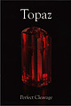 | | Report (issue) | | Denver, Colorado, USA © 2011 by Lithographie, LLC P.O. Box 11613 • Denver, CO 80211 • USA Phone 1.303...collection Robert Weldon photo Above: Topaz, 5.5 cm tall El Chalten, Santa Cruz, Argentina Scott Rudolph collection...Topaz ALFREDO PETROV & JOHN RAKOVAN 34. Colorful Colorado DAVID W. BUNK 42. Mongolian Topaz: The Gorkhi...and quartz, 5.3 cm tall Sawtooth Mountains, Boise County, Idaho shown under longwave ultraviolet light (left)...Province, Afghanistan; San Diego County, California, and Thomas Range, Utah, USA Associated Species: In topaz |  | | Book | | HfiRIN COUNTY FREE LIBRfiRY 311110G386652Q I V Russell P MacFal A COLOR TREASUF FOR COLLECTORS...to Hunting Locations ? i 9 GIVEN TO THE MARIN COUNTY LIBRARY BY MARI N L MTNF.RAT. SOCTETY DAVID...Center. Geological Survey. Federal Center. Denver. Colorado 80225. Index sheets from which the condition...may be able to buy specimens. map of Keweenaw County. Mich- Part of the U.S. Geological Survey topographic...United States are open pits, such as the enorBingham Canyon, Utah, although here some tunnels, known to miners |  | | Book | | long (Marty, 2004 ). AFRICA widely in Litchfield County, where good crystals were taken from quartz veins...region (Brunet, I 977b ). NEW YORK Amity, Orange County. At many isolated collected sites between the towns...Litchfield County. Ilmenite masses and crystals from somewhere near Washington, Litchfield County, were described...Lake Road occurrence, Faraday Township, Hastings County. In fall 1994, Dan and Shelley Lambert extracted...Madawaska [Faraday] mine near Bow Lake, Hastings County. Some of the world's finest ilmenite specimens |  | | Report (volume) | | ...................... 1. Rocks from Aroostook County..... ^..................'........... 2. Miscellaneous...1. Elliott County dike............................................... 2. Crittenden County dike...................... 86 87 90 90 92 93 93 94 95 95 Colorado.............................................................................. Rocks of Cripple Creek district..............'................... Miscellaneous.................. 1. Basalts from the Rio Grande Canyon............................ 2. Mount Taylor region |  | | Report (volume) | | crystalline rocks Maine 1. Rocks from Aroostook 'County 2. Miscellaneous rocks5 v New Hampshire 5 Vermont...Carolina Georgia Kentucky 1.. Elliott County dike 2. Crittenden County dike Tennessee Missouri Arkansas Oklahoma...Pikes Peak district Granite 5 Rocks of Cripple Creek district Miscellaneous rocks 5 3. Apishapa quadrangle...Analyses of igneous and crystalline rocks-Continued. Colorado-Continued.5 18. San Cristobal quadrangle 5 19...Basalts from the Rio Grande Canyon 5 2. Mount Taylor region 5 3. Colfax County 4. Miscellaneous rocks 5 |  | | Book (edition) | | forms a very small industry at Brandon in Suffolk County. Grindstones and Pulpstones. The production of...principally in the vicinity of Hot Springs, Garland County, are of two varieties: Arkansas stone, which is...grindings. Indiana. The .satulstones of Orange County, Ind., furnish a whetstone known as the Ilindoslan...produced are Berea and Euclid, Cuyahoga County, and Grafton, Lorain County. The Deerliek stone is produced at...at Chagrin Falls, Cuyahoga County. The Queer Creek is a hard, medium-coarse-grained Ohio sandstone, dark |
|


