 | | Book |
| columns of DSDP Sites after Initial Reports of the Deep Sea Drilling Project. Note: Leg 79 Sites 544-547...sediment cover the birth and evolution of the Atlantic Ocean Basins during the past 200 million years. Due...multichannel seismic reflection lines, numerous Deep Sea Drilling Project (DSDP) sites and petroleum...During the late 1970's, the International Phase of Ocean Drilling (IPOD), including its pre- and post-site...the offshore petroleum potential of the North Atlantic continental margins helped also to stimulate new |
 | | Book (volume) |
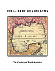
| and W. R. Bryant 13. Seismic stratigraphy of the deep Gulf of Mexico basin and adjacent margins . . ....orogenic belts rimming the Gulf of Mexico basin—the Sierra Madre Oriental in Mexico, the Ouachita orogenic...industrial organizations. To all of them I express my deep gratitude. The Bureau of Economic Geology of the...Columbus discovered the New World, most of the Atlantic coasts of both North and South America had been... Vasco Nunez de Balboa had reached the Pacific Ocean by crossing the isthmus of Panama, but the search |
 | | Book |
| Lava fountains near Aloi Crater, on the east rift zone of Kilauea volcano, in May 1969. Photo by U.S. Department...Stream Erosion 161 Mass Transfer 185 Work of the Ocean 195 Sedimentary Rocks 219 Work of the Wind 225 Work...of the Hawaiian Islands and other islands of the mid-Pacific have beckoned the traveler and charmed the...Introduction ACROSS THE FACE OF THE CENTRAL PACIFIC OCEAN, 2,000 miles from the nearest continent and 500...of a great mountain rising from the floor of the ocean. The islands in the northwestern part of the |
 | | Report (volume) |
| the depressions of 1823 and 1840 and the talus ridge of 1846 . . . . . . . . . . . . Map of the 1954.... Ground tilting at seismograph stations on the rim of Kilauea caldera ................................caldera and along the adjacent part of the east rift zone. On March 30 two strong earthquakes originated in...normal faults a few miles south of the east rift zone of Kilauea, at 19°21' N., 155° W. They were followed...rift zone south and southeast of Pahoa were recorded. Tilting of the ground surface at the rim of Kilauea |
 | | Report (volume) |
| south-southwestward tilting of the ground at the northeastern rim of Kilauea caldera indicated a sinking of...a strong earthquake originating on the east rift zone on April 22, followed by 108 aftershocks, and on...beginning of rapid northward tilting at the northeastern rim of the caldera, apparently accompanying an...operation 2 days later. The seismographs at the western rim of Kilauea caldera, and on the southeastern slope...the main earthquake. The seismograph at the northeastern rim of Kilauea caldera recorded the preliminary |
 | | Book |
| Europe, the Jurassic of the much larger Pacific rim has been studied intensively only in the past few...zonal names. Scientific interchange between Pacific-rim countries often remained minimal, and the creation..."final" breakup of Pangea. The history of the Pacific Ocean (with its ancestor, Panthalassa) and the motions...to the Jurassic, which formed the oldest extant ocean floor. Palinspastic reconstructions by geophysicists...required for the Jurassic paleogeography of the Pacific rim, because most of the current continental margins |
 | | Journal (article/letter/editorial) |
| B and G11B signatures in the shallow subduction zone forearc: Examples from Barbados, Costa Rica and...USA – (dsaffer@geosc.psu.edu) 2 Research Center Ocean Margins, Univ. Bremen, P.O.Box 330440, 28334 Bremen...boreholes and mud volcanoes indicate a contribution from deep sources. These observations include pore water freshening...one critical step toward characterizing subduction zone fluid transport. Here, we present a simple model...mudstones in subduction zones. In a generic subduction zone with a taper angle of 8º, we evaluate two end-member |
 | | Journal (issue) |
| gem-quality zincite crystals, displaying a magnificent deep red colour have been cut. One example weighing 20...closest to the diaphragm display small needles of complex morphology (Figure 3a). The more distant zones...(reductive environment) Secondary zincite crystals form complex groups, commonly on relict primary zincites, and...with diverse pyramidal terminations (Figure 7). Complex pyramidal crystals showing pronounced hemimorphism...brown. Their colour intensity varies from pale to deep and saturated. Colour distribution in the larger |
 | | Book |
| billowing clouds of steam rising as lava pours into the ocean will testify that volcanoes provide one of nature’s...four volcano world tours: the Ring of Fire, the mid-Atlantic, Africa, and the Mediterranean. Time and money...sabbatical leave. The Ring of Fire and the Pacific Ocean Volcanically speaking, this is the Earth’s busiest...a variety of volcanic landscapes, The Tarawera complex of rhyolite domes erupted spectacularly in 1886...a group of small volcanoes clustered around the rim of a caldera bay. Rabaul had a large eruption in |
 | | Book |
| between the rocky body of New England and the open Atlantic. Written plainly along the margins of these fragile...never-ending work of the sea, you can see in action the complex and interwoven processes of land and sea, climate...arise in the minds of those who stand beside the Mid- Cape Highway on Shoot Flying Hill and view the...Tertiary Swamps The Vineyard’s Greensand New England's Mid-Tertiary Life and Climate Nantucket’s Middle Tertiary...Cod’s Sandwich Moraine The Sandwich Moraine from the Mid-Cape Highway The Sandwich Moraine from the Old Kings |
| | Book |
| between the rocky body of New England and the open Atlantic. Written plainly along the margins of these fragile...never-ending work of the sea, you can see in action the complex and interwoven processes of land and sea, climate...Tertiary Swamps The Vineyard’s Greensand New England’s Mid-Tertiary Life and Climate Nantucket’s Middle Tertiary...Sandwich Moraine The Sandwich Moraine from the Mid-Cape Highway 113 The Sandwich Moraine from the...CHAPTER The X: SALT UPON Sea-Salt Industry Other Ocean xix SALT 201 202 204 Products CHAPTER XI: THESE |
 | | Report (issue) |
| correlative strata in Montana, western Wyoming, and northeastern Utah, by William J. Sando _________________...Cretaceous strand lines in northwestern Colorado and northeastern Utah, by A. D. Zapp and W. A. Cobban_ 113. Strn...___________________ _ 114. Salt anticlines and deep-seated structures in the Paradox basin, Colorado...141. The Republic graben, a major structure in northeastern VVashington, by Mortimer H. Staatz ____________________...Evidence for two stages of deformation in the western Sierra Nevada metamorphic belt, California, by Lorin D |
 | | Report (issue) |
| appropriated for electrical power production in the mid 1930s. Back: (Top) Lizard Butte near Marsing, an...magmatic, structural, and tectonic evolution of this complex geologic system. We have organized the book into...midpoint of the 1,100-km-long NevadaOregon rift zone. Strontium isotopic variations reflect crustal and...lithosphere variations along the trend of this rift zone, with the basalt area of Oregon and Washington lying...generated by the interaction of a relatively fixed deep thermal plume with a moving lithospheric plate. |
 | Rickman, H., Błęcka, M.I., Gurgurewicz, J., Jørgensen, U.G., Słaby, E., Szutowicz, S., Zalewska, N. (2019) Water in the history of Mars: An assessment. Planetary and Space Science, 166. 70-89 doi:10.1016/j.pss.2018.08.003 | Journal (article/letter/editorial) |
| formation, Martian meteorites, D/H ratios, Martian ocean, impact 31 craters SC 30 M AN U 32 1 Introduction...accretion is 55 Pourmand 2011), leading to a magma ocean that might have taken a considerable time to cool...where Jupiter stays far away from the accretion zone of the terrestrial planets. Here 69 the most important...of the asteroid belt into the terrestrial planet zone. The time at 74 which the dispersal happened is...investigated erosional scarps 214 in the Martian mid-latitudes and found exposed deposits of water ice |
 | | Book (volume) |
| Manganese and Manganiferous Iron Deposits of Northeastern Hokkaido (C04). 1 Yu Hariya, Hiroyuki Miura...MANGANESE AND MANGANIFEROUS IRON DEPOSITS OF NORTHEASTERN HOKKAIDO Yu Hariya15, Hiroyuki Miura!) and...manganese deposits of early Cretaceous age in northeastern Hokkaido, which will be visited during the Post-Conference...were found around "Yunotaki Falls", where an ore zone, approximately 150m x 70m, is distributed. The ini¬... MANGANESE AND MANGANIFEROUS IRON DEPOSITS OF NORTHEASTERN HOKKAIDO 3 Table 2. Chemical composition of |
 | | Book |
| . . . . 1.2 Northern Grauwackenzone (Greywacke Zone), Land Salzburg 1.3 Hohe Tauern, Land Salzburg ... . . . . . . . . . 4.1.1 Ilimaussaq Intrusive Complex, Kvanefjeld . . 4.1.2 Puissagtaq Area, Igaliko.... . . . . . . . 6.4.1 Saint-Hippolyte Area, Northeastern Vosges, Dpt. Haut-Rhin . . . . . . 6.4.2 Pegmatitic...Sedimentary Basins in Saxony . . . . 7.3.1 Elbtal Zone. . . . . . . . . . . . . . . . 7.4 Northwest Saxony...West Carpathians . . . . . . 14.1.1 North Gemer Zone . . . . . . . . . . . . . . . . . . . . 14.1.2 Central |
 | | Report (volume) |
| Mexico � 2. Column of preexisting ash in stream-cut ridge northwest of 16 Paricutin � 21 3. Cornfield at Chorotiro...� 7. New barranca eroded into Casita Canicjuata ridge � CONTENTS V Page FIGURE 8. Midslope in Casita...de Canicjuata 61 � 20. Head wall of landslide in deep ash from Paricutin � 61 21. Mudflows between Jaratiro...ash � 73 33. Converging rill heads at crest of ridge south of Paricutin_ _ _ _� 74 34. Parallelogram...outward and the corresponding sections of crater rim to slump. Only one of the cones, Cutzato, has an |
 | | Report (issue) |
| so inordinately fond of it that he gnawed at the rim-a testament to some that myrrhine vessels must have...GRAY 54 Elmwood-Gordonsville-Cumberland Mine Complex Of Eastern Tennessee BY ARVID PASTO 56 64 The...fake emerald." Though only generally defined by the mid to late 18th century, one fluorite find had grabbed...from Castleton in Derbyshire, England. Since the mid-18th century, this specific deposit has produced...England (page 28) are a convenient modem example: deep green when viewed under incandescent light, they |
 | | Report (issue) |
| Society of America Memoir 80 STILLWATER IGNEOUS COMPLEX, MONTANA A QUANTITATIVE MINERALOGICAL STUDY H...Edward Sampson began the study of the Stillwater complex, Montana, in 1930. The writer commenced a detailed...detailed study of the mineralogy of the complex in 1935 after several periods in the field in preceding years...Peoples would write the general geology of the complex, Howland the floor rocks and sulfide deposits,...have published a number of short papers on the complex. (Peoples, 1933; 1936; Howland, Peoples, and Sampson |
 | | Report (issue) |
| RATTE and THOMAS A. STEVEN ABSTRACT A complex pile of Tertiary volcanic rocks in the central...welded pumice breccia that is confined to the northeastern side of the Creede caldera. The source of the...welded quartz latite tuff, but a partially welded zone is present at the top of the formation, and several...have been identified near the caldera ring fracture zone. The rocks of the Creede caldera sequence show...ash-flow field near Creede surrounds a cauldron complex at least 25 miles long and 5-15 miles wide that |
 | | Report (issue) |
| photomicrograph of upper-lobes tuff in transitional zone . . . . . . . . . . . . . . . . . 17. Photograph...The Little .Jacks Tuff, in most exposures in the deep canyons of the Plateau, consists of at least four...variations that are not present in lava flows. The lowest zone consists of partially welded or nonwelded tuff that...vapor-phase crystals (Smith, 1960). The vapor-phase zone thence grades upward into vitric partially welded...Mountains are an integral part of the Idaho batholith. A deep drill hole at the edge of the western Snake River |
 | | Book |
| R. CHRISTENSEN, AND R. E. ARVIDSON Part III. B Mid-IR and Magnetic Orbital Measurements 9 10 11 Global...minerals and possibly ice and liquid in equatorial and mid latitudes and as masses of water ice making up an...2003–current Nozomi Mars Climate Orbiter Mars Polar Lander Deep Space 2 Probes Mars Odyssey Orbiter Mars Express...Polar Lander (MPL), Mars Climate Orbiter (MCO), and Deep Space 2 (DS2); the general conclusion was that the...Committee on Lunar and Planetary Exploration or COMPLEX). All of these committees rely heavily on participation |
 | | Book |
| problematical nature of the mineral. Ilfmaussaq alkaline complex, Tunugdliarfik, Greenland. SrAIF4(OH)eH20, mon...Alluaiv Mountain, Althupite Lovozero alkaline complex, Kola Peninsula, Russia. AITh(UO;)[(UO2)3(PO4)20(OH)]...Oleny Stream apatite deposit, Khibina alkaline complex, Kola Peninsula, Russia. ear Alumino-magnesiotaramite...etymology of the elements. Tsepochechnyi intrusive complex, Siberia, Russia. Oleinikov, B.V. et al. (1978):...aluminous analogue of klyuchevskite. Main Tolbachik fracture eruption, Kamchatka, Russia. Gorskaya, M.G, et |


