 | | Report (issue) |
| INTRODUCTION. The area here called the Cosna-Nowitna region extends southward from Yukon and Tanana rivers...general way the 1 Hcrron, J. S., Explorations in Alaska, 1899: War Dept., Adjt. General's Office, No. 31... 1901. 211 212 MINERAL RESOURCES OF ALASKA, 1915. Yukon-Kuskokwim divide. A pack train of seven...proceeded down the river on a raft, arriving at Ruby September 3. Topographic work was carried on by...the Yukon and Kuskokwim were mapped. Geologic mapping was extended over practically the same area. The |
 | | Report (volume) |
| Placer Deposits of Alaska By EDWARD H. COBB GEOLOGICAL SURVEY BULLETIN 1374 An inventory of the...the placer mines and prospects of Alaska, their history and geologic setting UNITED STATES GOVERNMENT...and method of presentation __ Definitions _-____ Alaska Peninsula region Aleutian Islands region ________...Anchorage district _ Redoubt district ___-_ _ Valdez Creek district __ _ Willow Creek district Yentna district...district _____________ _ ____ __________ _____ Copper River region __ _ _ _ Chistochina district Nelchina |
 | | Report (issue) |
| GEOLOGICAL SURVEY PLACER TIN DEPOSITS IN CENTRAL ALASKA By Robert M. Chapman, Robert R. Coats, and Thomas...Placer tin and gold deposits in the Morelock Creek area, by Thomas G. Payne and Robert M. Chapman ........... Mining considerations .................... Placer tin deposits in the Moran Dome area, by Robert...Investigation of reported placer tin in the Mason Creek area, by Robert M. Chapman .........................deposits .............. Placer tin deposits in the Ruby-Long area, by Robert M. Chapman. . Introduction. ... |
 | | Report (issue) |
| HAKEINGTON. SUMMARY OF MINING OPERATIONS. t A resume of the history of tin mining in Alaska up to 1914 has been...his report. Stream tin was first found on Buhner Creek, a tributary of Anikovik River, in 1900, and there...there has been some production of cassiterite. from placer operations in the York region since 1902. In...In 1911 a dredge was installed on Buck Creek which has been in operation each season since. Two dredges...River in 1914 for the recovery of both gold and cassiterite but were operated only during that and the following |
 | | Report (volume) |
| OTIS SMITH, Director Bulletin 754 THE RUBY-KUSKOKWIM REGION ALASKA BY J. B. MERTIE, JR. ' AND G. L....Local details____ ___________ Yukon River______ _________ Poorman Creek _____ Nowitna and Susulatna valleys...fish____ _ Other mining factors __________________________ Gold placers _ _ _ Ruby district _______________________________...History of mining ______________________ General character of placers________________ Ruby Creek_____...Creek_____________________________ Long Creek and tributaries _______________ Upper Sulatna River and tributaries_____________ |
 | | Report (issue) |
| RADIOACTIVE DEPOSITS IN THE RUBY-POORMAN AND NIXON FORK DISTRICTS, WEST-CENTRAL ALASKA, 1949 UNITED STATES...RADIOACTIVE DEPOSITS IN THE RUBY-POORMAN AND NIXON FORK DISTRICTS, WEST-CENTRAL ALASKA, 1949 By Max G. White...I, Calif. CONTENTS Page Chapter A. Ruby-Poorman district Abstract ............................. Introduction...Radioactivity investigations ........... Ruby, area ....................... Long area ....................... Granite............ Granite on upper Flint Creek ............... Poorman area .................. . Summary and |
 | | Report (issue) |
| MINERAL RESOURCES OF ALASKA, 1918. By G. C. MAIM-IN AXD OTHERS. PREFACE. By G. C. MARTIX. This volume...of annual bulletins l treating of the mining industry of Alaska and summarizing the results achieved during...particular district should therefore procure a copy of the complete report on that district as soon as-it...others of the series, contains an account of the mining industry, including statistics of mineral production...shall serve as" convenient reference works on the mining industry for the years which they cover. It is |
 | | Report (issue) |
| SELECTED NONMETALLI FERGUS MINERAL DEPOSITS IN CENTRAL ALASKA TO ACCOMPANY OPEN-FILE MAP 77-1680 This report...SELECTED NONMETALLI FERGUS MINERAL DEPOSITS IN CENTRAL ALASKA (To accompany Open-file Map 77-168D) By G. Donald...accompanying map have been prepared under the Regional Alaska Mineral Resource Appraisal Program (RAMRAP) to...nonmetal1iferous deposits, both lode and placer, in central Alaska. Specifically excluded are the fossil fuels (petroleum...government and private sectors, discussions with mine operators, and the firsthand knowledge of the authors |
 | | Report (issue) |
| DEPOSITS OF THE RUBY-KUSKOKWIM REGION ALASKA BY J. B. MERTIE, Jr. Mineral resources of Alaska, 1933 (Pages...-__________-___ Ruby district._______-___-____--._-_--.-__---_--__._______ Ruby area.______-_____--_..._____ 145 Long Creek and Bear Gulch..____________________ Fifth of July and Short Creeks. _____________...______________________ Greenstone Creek.._______._________._._-_._.___._ Monument Creek.______________________________...Meketchum Creek._______________________________ Trail Creek____.________________________ Flint Creek and tributaries |
 | | Report (issue) |
| NOTES ON MINING IN SEWARD PENINSULA. By PHILIP S. SMITH. INTRODUCTION. No party from the Geological...During that time he obtained some notes on the mining industry, and these, supplemented by reports in...the amount of winter mining; second, a general decrease in the number of mining operations except dredging;...development of the ancient beaches at Nome winter mining was important, for labor was cheap, the physical...sluicing in the summer) and consequently this form of mining has decreased. It is estimated that the winter |
 | | Report (issue) |
| MINING IN THE FAIRBANKS DISTRICT. By THEODORE CHAPIN. GENERAL CONDITIONS. The mineral production of...of the Fairbanks district in 1917 included placer gold, valued at $1,310,000; lode gold, valued at $47...failures would doubtless have resulted. Quartz mining showed a slight increase, which in large part was...made small outputs. On the whole the gold quartz mining was insignificant. The production of antimony in...FAIRBANKS CREEK. The Crites & Feldman mine and mill, on Moose Creek, a tributary of Fairbanks Creek, were |
 | | Book |
| os eua come] a.Batis aS i Ce. = of Alaska Ernest Wolff ALASKA Eastofof Green! Gre nwich MAP 170°...Straits 18. Yukon-Koyukuk Cordova-McCarthy 19. Fairbanks Valdez-Chitina-Whittier 20. Upper Yukon Palm...—GEOLOGICAL SURVEY. WASHINGTON, DC, MA ITOT ALASKA MAP A "sO 4 * « PSI1 TOA He REA LA Ope e...University of Alaska ERNEST WOLFF Formerly, Research Associate University of Alaska With Contributions...Formerly, Professor of English, University of Alaska Printed in the United States of America By Edwards |
 | | Report (issue) |
| BAY-CHIGNIK DISTRICT. By W. R. SMITH and ARTHUR A. BAKER. INTRODUCTION. LOCATION AND AREA. The area described...in this report lies on the southeast side of the Alaska Peninsula west of Kodiak Island and extends from...peninsula to the northeast side of Chignik Bay. This area lies between meridians 155° and 158° west and parallels...northeastern portion of the area includes a part of the Cold Bay district, which has already been described...Capps.1 Cold Bay lies on the southeast side of the Alaska Peninsula at longitude 155° 30' west and latitude |
 | | Report (issue) |
| MINERAL RESOURCES OF THE REGION TRAVERSED BY THE ALASKA RAILROAD. By STEPHEN R. CAPPS. INTRODUCTION. ...bridge across Tanana Kiver, in March, 1923, the Alaska Railroad, begun in 1915, was opened for direct...Pacific coast, and Fairbanks, in the heart of central Alaska, a distance of 468 miles (fig. 1). Rarely has ...showing location of the region traversed by the Alaska Railroad. the construction of a railroad of this...but those great navigable rivers, the Yukon, Tanana, and Koyukuk, are all connected by boat service with |
 | | Report (volume) |
| D. WALCOTT, DIRECTOR GEOGRAPHIC DICTIONARY OF ALASKA BY MARCUS BAKER SEC03ST3D EIDITIOIT PKEPAHE...established; old mining fields have been developed and new ones discovered and prospected; mining camps of that...PEEFACE. the same as names met at every turn in the mining regions of the West. The first edition of this-...Survey. CHARLES S. SLOANE, Secretary, Bureau of the Census. Maj. WILLIAM D. BEACH, General Staff, War Department...years ago determined to prepare a dictionary of Alaska geographic names and appointed a committee which |
 | | Book (edition) |
| who have been engaged in the study of our great mining regions, especially in the West, have laid the...now in the active practice of the profession of mining engi neering. J. F. K. DECEMBER, 1899. NO TEXT...125-129; Marquette district, 129-136; Menominee dis trict, 136-139; Penokee-Gogebic district, 139-143; Vermilion...Mile, Summit Co., 266, 267; Ex ample 306, Monarch District, Chart'eeCo., 268; Example 30c, Eagle River, Eagle... Tintic District, 275; Example 30gr, Hornsilver Mine, 275, 276; Example 33a, Car bonate Mine, Beaver |
 | | Report (issue) |
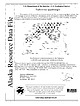
| mines, prospects and mineral occurrences throughout Alaska. 153 00 63 00 TL004 TL005 TL006 * (i|:4 TL069...Talkeetna 1:250,000-scale quadrangle, southcentral Alaska This and related reports are accessible through...110631 Anchorage, AK 99511 Location of map area in Alaska This report is preliminary and has not been...REPORT 99-139 ZUSGS science for a changing world Alaska Resource Data File TL001 Site name(s): Boedeker;...prospect north of the Hidden River, a short distance east of Swift Creek. The prospect is at an elevation |
 | | Report (volume) |
| ..........................-'.................. Alaska: 18 25 28 The Juneau gold belt, by Arthur C....Placer mining in Alaska in 1903, by Alfred H. Brooks......._....'.. The Porcupine placer mining district...'Wright........ Gold placers of the Fairbanks district, by L. M. Prindle ............ The Kotzebue placer......... Notes on the geology of the Goldfields district, by J. E. Spurr^...... Oklahoma: Reported gold..... Utah: Progress report on the Park City mining district, by J. M. Boutwell. Geological Survey publications |
 | | Report (volume) |
| on Park City mining district, Utah, by J. M. Boutwell_ 41 Placer gold mining in Alaska in 1902, by Alfred...Alfred H. Brooks 49 The Glenn Creek gold-mining district, Alaska, by Arthur J. Collier_ _ Gold and pyrite...pyrite deposits of the Dahlonega district, Georgia, by Edwin 57 C. Eckel_ _ 64 Neocene rivers of the Sierra...The Chistochina gold field, Alaska, by Walter C. Mendenhall . 76 Gold mining in central Washington, by...by J. E. 81 Spurr Gold mines of the Marysville district, Montana, by Walter Harvey 88 Weed 90 List of |
 | | Report (issue) |
| GOLD LODE MINING IN THE WILLOW CREEK DISTRICT. By STEPHEN R. CAPPS. INTRODUCTION. Gold mining in the Willow...Willow Creek district in 1917 was confined to the exploitation of the quartz lodes, from which almost...the first gold recovered from this area was gained by placer mining, the workable placers were soon exhausted...mines. Two of these mines, the Gold Bullion and the Alaska Free Gold, have been in operation for many years...produced the bulk of the output of the district. The Independence mine, which has for years been a producer |
 | | Report (volume) |
| 1-1 FAIRHAVEN GOLD PLACERS, SEWARD PENINSULA, ALASKA BY FRED H. 1V10171_= WASHINGTON GOVERNMENT PRINTING...Hannum Creek 4 Cunningham Creek 4 Collins Creek Old Glory Creek4 Nelson Gulch American Creek Pinnell...River Perry Creek Inmachuk River Kiwalik basin 4 Candle Creek Bucklaud River basin 4 Bear Creek Kugruk basin_...basin_ Dixie Creek Alder Beach 4 Source of the gold Summary 4 4 Coal General conditions Trails 4 Mail...81 4 ILLUSTRATIONS. Page. I. Outline map of Alaska, showing areas covered by blarger scale maps, Pls |
 | | Report (volume) |
| all the papers bearing on a particular subject or area; second, titles of papers, many of them abbreviated...Bulletin, vol. 44. New York. American Institute of Mining Engineers: Bulletin, nos. 61-72; Transactions,... 147-264. San Francisco, Cal. California State Mining Bureau: Bulletin, no. 64. San Francisco, Cal. California...Transactions, vol. 9, pts. 2, 3. Toronto, Ont. Canadian Mining Institute: Quarterly Bulletin, nos. 18-20; Journal... BIBLIOGRAPHY OF NORTH AMERICAN GEOLOGY, 1912. 7 Canadian Mining Journal, vol. 33. Toronto and Montreal, Canada |
 | | Report (volume) |
| listing reports_________________ Explanation of area and subject index_.______ Acknowledgments .. __...Geophysical Union.. Transactions, American Institute of Mining and Metallurgical Engineers _..._ American Journal...Colorado Mining Association publications . Economic Geology. _ . _ ___... Engineering and Mining Journal...of Sedimentary Petrology_...__._ Mines Magazine Mining Engineering ........___..._...._____ Advances in...___________________ Author index ___._____________________ Area and subject index__________________ 95 95 103 |
 | | Book (edition) |
| YEAR 1687"—DAVID T. DAY, CHIEF OF THE DIVISION OF MINING STATISTICS AND TECHNOLOGY WASHINGTON GOVERNMENT...and consump tion, or better and cheaper means of mining, extraction, and convey ance to market, may in...correspondence has been carried on with geologists, mining engineers, and other local authorities, and various...wards in thickness; mmed at Broken Arrow aud Trout creek, in Sc. Clair county. The strata in this field are...from the south prong of Canoe creek, in St. Clair county, to Ha\sop creek, in Bibb county, a distance of |
 | | Book (edition) |
| coal field Shaft house and tipple, bituminous coal mine, Spring Valley, 111 Northern Interior coal field...part of Anthracite, Colo., sheet. ... 47 Map of Alaska, showing distribution of coal and coal-bearing...structure of western field of Los 104 Angeles district 106 Section of Spindle Top oil field near Beaumont...Galveston, Tex 32. Hypothetical section in same district as Fig. 31 33. Map showing lines of sections in...42. Section across portion of oil district of southwestern of Alaska, showing areas in which oil or gas |


