| Classification |
|---|
|
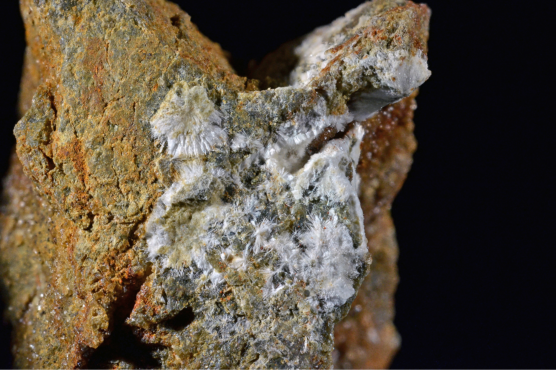
| Species: | Strontianite |
| Formula: | SrCO3 |
| Confirmation |
|---|
|
| Validity: | Confirmed |
| Confirmation Methods: | Visually Identified |
| Data |
|---|
|
| Mineral Data: | Click here to view Strontianite data |
| Locality Data: | Click here to view Hüttgraben, Spital am Pyhrn, Kirchdorf an der Krems District, Upper Austria, Austria |
| Data Identifiers |
|---|
|
| Mindat Occurrence Record ID: | 775477 |
| Long-form Identifier: | 1:3:775477:7 |
| GUID (UUID V4): | c7de9feb-1aca-4863-8d97-35ed299a9431 |
| Nearest other occurrences of Strontianite |
|---|
|
|
| 12.8km (8.0 miles) | ⓘBodenwies, Weyer, Steyr-Land District, Upper Austria, Austria |
| 21.8km (13.5 miles) | ⓘKleinreifling, Weyer, Steyr-Land District, Upper Austria, Austria |
| 23.9km (14.9 miles) | ⓘGroßauer quarry (Grossauer quarry), Reichraming, Steyr-Land District, Upper Austria, Austria |
| 27.6km (17.1 miles) | ⓘGaisberg limestone quarry, Molln, Kirchdorf an der Krems District, Upper Austria, Austria |
| 34.7km (21.5 miles) | ⓘRailway tunnel, Unterwald, Wald am Schoberpass, Leoben District, Styria, Austria |
| 36.1km (22.5 miles) | ⓘPretaller tunnel, A9 Motorway tunnels, Wald am Schoberpass, Leoben District, Styria, Austria |
| 57.6km (35.8 miles) | ⓘOberdorf (Oberdorf an der Laming), Tragöß-Sankt Katharein, Bruck-Mürzzuschlag District, Styria, Austria |
| 58.1km (36.1 miles) | ⓘWiesergut Mine (Wieser Mine), Oberdorf magnesite deposit, Oberdorf (Oberdorf an der Laming), Tragöß-Sankt Katharein, Bruck-Mürzzuschlag District, Styria, Austria |
| 58.1km (36.1 miles) | ⓘOberdorf magnesite deposit, Oberdorf (Oberdorf an der Laming), Tragöß-Sankt Katharein, Bruck-Mürzzuschlag District, Styria, Austria |
| 60.2km (37.4 miles) | ⓘRailway tunnel, Galgenberg, Leoben, Leoben District, Styria, Austria |
| References |
|---|
|
|


Hüttgraben, Spital am Pyhrn, Kirchdorf an der Krems District, Upper Austria, Austria