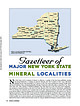
 | | Journal (article/letter/editorial) | | 2014 Figure 1. County map of New York State, prepared by William Besse. MAJOR NEW YORK STATE M I N E...E R A L LOC A L I T I E S N ew York State is rich in minerals of interest to collectors. A number of...Dana 1877, 1892). Herbert P. Whitlock published a New York State list in 1903. The most recent comprehensive...localities in the state is the book Minerals of New York State by David Jensen, published in 1978. Our...Mode of Occurrence Most mineral localities in New York can be categorized into three groups based on |  | | Journal (article/letter/editorial) | | grained m 0 .... ... . ..... Tuff Mineralogy Dolomite .... ;I.. Calcite Silicates Other symbols a...marl or carbonate (e.g. Fayetville Green Lake in New York; Brunskill, 1969). Because the origin of the varves...that these laminae are not varves. Onondaga Lake near Syracuse, New York, although not an analogue, demonstrates...to coarse-grained with carbonate intraclaStS dolomite, some units primarily quartz & may contain < 20...same as KF'LM t k calcite content is amounts of dolomite. quartz. feldspar, & clay higher same as KF'LM |  | | Journal (article/letter/editorial) | | .................... 653 Amsterdam limestone, New York................................................................................... 657 Beloit dolomite............................................................................... 670 Bonneterre dolomite............................................................................ 565 Bowling Green dolomite........................................................................... 624,679 Briarfield dolomite.............................................. |  | | Journal (article/letter/editorial) | | Pleasant, Michigan 48858 Downloaded by [University of York] at 23:09 20 February 2016 Q UESTION: Why are...oceanic islands, such as Greenland, Madagascar, and New Zealand; and from beneath the seas (e.g., on the...percentages of com- Downloaded by [University of York] at 23:09 20 February 2016 Figure I . Carbonate...Mississippian “Rock Island Sandstone” strata in Muscatine County, Iowa (from Whitney 1858). ponents) from its enclosing...concretionary masses within Middle Mississippian Fayetteville Shale strata of northwestern Arkansas: buffalo |  | | Report (issue) | | __ ........ - - - - ..... - ... - - . - ... . Fayetteville shale ..... _..................... _.................................... ~ .....•..... Boone County .....•........... _....... _... _................•••••••••• _ ••••• _ ••••••••••••••••• 66 Marion County ..................... __ . _... _.. _.. - .......Description of mines and prospects-Continued. Marion County-Continued. White Eagle _. _.............. _. ___...__ . __ ~ ....... ________ ...... ___ _ Baxter County ___________________ . ___ . _. __ . __ . _.... |  | | Journal (article/letter/editorial) | | Valley-Type Mineralization in the Southern Ozark Region, USA Christophe W. Simbo, Adriana Potra, John R. Samuelsen...Valley-Type Mineralization in the Southern Ozark Region, USA, Ore Geology Reviews (2019), doi: https://doi.org/10...Valley-Type Mineralization in the Southern Ozark Region, USA Christophe W. Simbo1, Adriana Potra1 (corresponding...Arkansas, Fayetteville, AR 72701, USA 2. Arkansas Archeological Survey, 2475 N Hatch AVE, Fayetteville, AR...Old Main 330, University of Arkansas, Fayetteville, AR 72701, USA Abstract The Pb and/or Zn deposits of |  | | Report (issue) | | of Washington County).Prairie Grove member of the Hale formation in Washington County and its apparent...east.________________ Bloyd shale in Washington County and its apparent equivalent to the south and east...the interval between the Pitkin limestone (or Fayetteville shale) and the Prairie Grove member of the Hale...apparent equivalent south and east of Washington County), and percentage distribution of sandstone. 30...Grove member of the Hale formation in Washington County and of its apparent equivalent south and east of |  | | Report (issue) | | Everton Formation, St. Peter Sandstone, and Joachim Dolomite undivided _______________ Plattin Limestone__...Moorefield Formation _______________________ Fayetteville Shale___________________________ Pitkin Limestone...Formation, and Fayetteville Shale____ 10 5. The Pitkin Limestone, combined Fayetteville Shale, Moorefield...(Haley and Hendricks, 1968); G and b, Scranton and New Blaine quadrangles (Haley, 1968); and H and c, Coal...JOACHIM DOLOMITE UNDIVIDED In northern Arkansas, the Everton Formation, predominantly dolomite with some |  | | Report (issue) | | but they also identify new features, employ an updated stratigraphy, provide new fault interpretations...BOONE FORMATION EVERTON FORMATION Dolomite MJMJJ POWELL DOLOMITE o o Chert Figure 2. Stratigraphic...shale of the Wedington Sandstone Member of the Fayetteville Shale and Pitkin Formation back tilted into...Blocks moved over middle and lower parts of the Fayetteville Shale. Bloyd Formation (Lower Pennsylvanian)...bryzoan Archimedes. The basal contact with the Fayetteville Shale is conformable. The Pitkin Limestone generally |  | McMahon, Peter B., Galloway, Joel M., Hunt, Andrew G., Belitz, Kenneth, Jurgens, Bryant C., Johnson, Tyler D. (2021) Geochemistry and age of groundwater in the Williston Basin, USA: Assessing potential effects of shale-oil production on groundwater quality. Applied Geochemistry, 125. 104833pp. doi:10.1016/j.apgeochem.2020.104833 | Journal (article/letter/editorial) | | Geochemistry and age of groundwater in the Williston Basin, USA: Assessing potential effects of shale-oil production...groundwater than similar aquifer zones in the Fayetteville (Arkansas) and Marcellus (Pennsylvania) Shale...the larger shale-oil production area. A series of county-scale studies of ground water quality were conducted...tracers and noble gases from 10 to 37. The analysis of new data is supplemented with analysis of historical...controlled by dissolution of calcite (CaCO3), dolomite (CaMg(CO3)2), gypsum (CaSO4⋅2H2O), and soluble |  | | Report (issue) | | Ordovician Series.____________________ Cotter Dolomite._______________________ Devonian and Mississippian...__________________ Batesville Sandstone.___________________ Fayetteville Shale_____________________ Pennsylvanian System......... 30. Crystallite of luzonite perched on dolomite................................ 31. Crystallites...42,43. Photographs: 42. Dolomite and jasperoid replacing M bed limestone, New Chicago No. 1 mine... 43...9. Isotopic composition of oxygen in calcite, dolomite, and quartz in relation to hydrothermal zones |  | McClung, Craig, Bair, Dorinda, Leach, David L. (1998) Bibliography pertaining to the Ozark Mississipi Valley-type metallogenic province, Missouri, Arkansas, Kansas, and Oklahoma, USA covering 1785 to February 1998; paper edition. Open-File Report Vol. 1998 (98-238) US Geological Survey doi:10.3133/ofr98238 | Report (issue) | | PROVINCE, MISSOURI, ARKANSAS, KANSAS, AND OKLAHOMA, USA COVERING 1785 TO FEBRUARY 1998; PAPER EDITION by...structures and ore relationships, Magmont Mine, New Lead Belt, Missouri, in Kisvarsanyi, G., Grant, S...regionally extensive epigenetic dolomites, Bonneterre Dolomite, SE Missouri; evidence of multiple fluids during...Doctoral, Teachers College, Columbia University, New York, NY, United States. Benn, F. W., and Cornell,...fluid inclusion study of the Jumbo lead mine, Linn County Kansas: Master's, University of Missouri at Kansas |  | | Report (volume) | | turbidite layers in sediments from Green Lake, Fayetteville, New York 3 5. Varve laminae from the central plain...laminations from sediments in Elk Lake, Clearwater County, Minnesota 4 7. Fine-grained low-magnesium calcite...Diagrammatic cross section of Green Lake, Fayetteville, New York, showing typical summer profiles of salinity...Geology , University of New Mexico , Albuquerque, NM 87106. 2 Present address: New Mexico Bureau of Mines...composed mostly of altered tuffaceous material and dolomite; dark layers are rich in organic matter. paleoclimates |  | | Journal (article/letter/editorial) | | oil or significant quantitiesof gas. In Telfair County, Georgia,a seepof petroleumhaving its origin in...Mr. Rodgersand Whitetop somh of Marion in Smyth County possess altitudesof 5,719 and 5,52o feet respectively...Unicoi formations; Ce, Erwin quartzite; Cs, Shady dolomite; d, dikes. The Unicoi formation consists of arkoses...stward to •,8ooto 2,000feetin southern Augusta County. In the vicinityof Lexingtonit is •,2oo feet andaround...Hamilton sandstone and shale • • • Marcellus shale Onondaga shale -- Oriskany (Monterey) Oriskany sandstone |  | | Report (issue) | | ....................... 19 Cannery Lane-Putnam County......................................................................22 Berkeley Springs-Morgan County......................................................................22 LeFevre Spring-Berkeley County...............................................................23 Harpers Ferry Spring-Jefferson County..................................................................23 Pipestem State Park-Summers County .............................................. |  | | Journal (article/letter/editorial) | | array of other minerals, as evidenced by this county-by-county description of localities. A R K A N S A...Some of the new mining operations are reopenings of older abandoned mines, but many new mines have been...will undoubtedly unveil new oc currences and will in all likelihood also reveal new mineral species. I...l Kidwell, Don Owens, Charles Steuart, Meredith York, and Charles Milton. Without the knowledge I have...A S \ l ^ CI— CLAY • I ' I HOT SPRING GRANT D— DOLOMITE HOWARO P i K e J —L.^NS.B.P J Di— DIAMOND — J |  | Middendorf, Mark A., Thomas, K.C., Robertson, C.E., Whitfield, J.W., Glick, E.E., Bush, W.V., Haley, B.R., McFarland, J.D. (1994) Geologic map of the Harrison 1 degree x 2 degrees quadrangle, Missouri and Arkansas. Open-File Report Vol. 1994 (94-430) US Geological Survey doi:10.3133/ofr94430 | Report (issue) | | shales. Maximum exposed thickness about 150 ft Fayetteville, Batesville, and Hindsville Formations (Upper...(Upper Mississippian Chesterian) Fayetteville Formation is a black to blue to brown, fissile, calcareous...Fortune Formation is restricted to southern Barry County in Missouri and its maximum exposed thickness is...City Dolomites (Lower Ordovician Canadian) Cotter Dolomite is generally a sequence of buff to gray, finely...finely crystalline, argillaceous to siliceous dolomite with varying amounts of chert, and gray, medium-crystalline |  | | Journal (issue) | | Squash Hollow Road, New Milford CT 06776 (860) 354-0296 Pat Hackett 1 Lakeview Road, New Milford, CT 06776...Buddington Road, Shelton CT 064812 (203) 746-2216 note new address for John Rick Sinclair, 275 South Kent Road...F.O.M.S. Spring Swap-and-Sell. Sponsored by the New Jersey Earth Science Association, The Sterling Hill...Minerals, Gems, Jewelry & Fossils Show sponsored by the New Haven Mineral Club. Amity Regional Jr. High School...Chesapeake Gem & Mineral Society. Ruhl Armory, 1035 York Rd (MD 45 just off I-695), Towson, MD. May 30-31: |  | | Journal (article/letter/editorial) | | reason for this interpretation is the presence of dolomite and geodes in the Ramp Creek Limestone. Chowns...because of the association of geodes with dolomite. This dolomite also has been explained as being the result...Gulf region (Wells, 1962). Although geodes and dolomite may suggest formation in a supratidal environment...related setting as suggested by the geodes and dolomite? For reasons discussed below, we conclude that...in lower Ramp Creek Limestone. southern Monroe County, Indiana. Note the wavy upper surface of the grainstone |  | | Book | | Rochester Shale (Silurian; Wenlock- ian) in western New York and Ontario: Journal of Sedimentary Petrology...Carbonate-shale cycles in the Middle Devonian of New York: an evaluation of models for the origin of limestones...Cambro-Ordovician Bliss Formation, G., 1986, southeastern New Mexico, U.S.A.—progradational sequences on a mixed...527-540. CiurF, R. M., 1980, Paleoenvironment of the New Albany Shale Group (Devonian-Mississippian) of Illinois:...Sedimentology No. 42: Elsevier, Amsterdam-Oxford-New York-Tokyo, 304 p. DuTTon, S. P., 1982, Pennsylvanian |  | | Book | | Rochester Shale (Silurian; Wenlock- ian) in western New York and Ontario: Journal of Sedimentary Petrology...Carbonate-shale cycles in the Middle Devonian of New York: an evaluation of models for the origin of limestones...Cambro-Ordovician Bliss Formation, G., 1986, southeastern New Mexico, U.S.A.—progradational sequences on a mixed...527-540. CiurF, R. M., 1980, Paleoenvironment of the New Albany Shale Group (Devonian-Mississippian) of Illinois:...Sedimentology No. 42: Elsevier, Amsterdam-Oxford-New York-Tokyo, 304 p. DuTTon, S. P., 1982, Pennsylvanian |  | | Catalog/List | | enlarged photograph of a piece of Obsidian, from Lake County, Oregon, which shows a Conchoidal fracture. t...confirmed letter of credit, drawn in our favor on a New York bank, for payment upon presentation of shipping...ALABASTER-See Gypsum ALBERTITE (hydrocarbon) Black masses; New Brunswick ALBITE (sodium aluminum trisilicate Xline...greenish-gray; New York ..... ... Fibrous, white; Canada and New York ............ Xline, white, in dolomite; Connecticut.... .. ........ . He:ugonite Purple xline mass; New York . ..... ... .. ..... . .. Pric� per pound .35 |  | | Journal (article/letter/editorial) | | ........................................... 501 New Mexico Strait..................................................................................... New Mexico Strait..................................................................................... New England........................................................................................... New Mexico-Arizona Strait..............................the center of the United States from Minnesota to New Mexico. For the sake of con venience, we may divide |  | | Report (issue) | | HYDROGEOLOGIC DATA FOR C ARROLL COUNTY, ARKANSAS By J.V. Brahana, Valarie A. Leidy, John Lindt, and S...Figure 1. Map showing location of Carroll County and the 16-county area of northern Arkansas...............5-minute topographic quadrangle coverage of Carroll County, Arkansas............ 4 3. Diagram showing local...Maps showing: 4. Locations of wells in Carroll County, Arkansas, for which hydrogeologic data are available...6 5. Locations of selected springs in Carroll County, Arkansas..................................... |  | | Report (volume) | | American Geographical Society: Bulletin, vol. 42. New York. American Institute of Mining Engineers: Bulletin...Transactions, vol. 40. New York. American Journal of Science, 4th series, vols. 29, 30. New Haven, Conn. American...27, 28; Journal, vol. 10. New York. American Naturalist, vol. 44. New York. American Peat Society: Journal...of Civil Engineers: Transactions, vols. 66, 67. New York. Annales de Pale"ontologie, tomes 4, 5. Paris...vol. 37, nos. 3-6, vol. 38, vol. 39, nos. 1-2. New York. Centrafblatt fur Mineralogie, Geologic und Paleontologie |
|


Fayetteville, Onondaga County, New York, USA